

BullCityWx
-
Posts
8,892 -
Joined
-
Last visited
Content Type
Profiles
Blogs
Forums
American Weather
Media Demo
Store
Gallery
Posts posted by BullCityWx
-
-
The entire state of SC is covered in Winter Ptypes
-
 1
1
-
-
18 minutes ago, ILMRoss said:
Going to put on my pessimistic hat on for a second... (I don't like making these posts so this is the only one I'm doing for this storm...)
The snow maps for the triangle are beautiful. Lovely. It's a picturesque spike that punctures straight through Wake County. I'll tell you how I'm interpreting it right now- I'm mentally taking it and shoving it 30 miles to the north. I've sat through so many of these storm threads and seen Wake County in a lovely position just to see sleet. I've been snakebitten so. many. times. We are consistently finding new ways to end up with sleet. So as I see more of these perfect snow maps the pit in my stomach just grows larger.
I'm currently put off by how skinny and shaky the modeled snow corridor is, it really leaves no margin of error. If our system ends up weaker and strung out, the snow corridor isn't simply shoved south- it will shrink with decreased lift and precipitation will struggle to get past, say, highway 1. A stronger version of our current system will likely shift the sleet line north of Wake County. Raleigh folks: we look good right now but man I don't like this tenuous balancing act.
What I'm looking and hoping for tonight is our northern shortwave somehow beefing up a little more- dropping down with a little more pep in its step- and being able to dig south more. qpf wouldn't be an issue and I think this would depress heights enough to make mixing in the triangle way less of an issue.
30 miles north you say
-
3
-
 4
4
-
-
16 minutes ago, Blue_Ridge_Escarpment said:
I feel that’s how we are sometimes though. Running with little time on the clock knowing we don’t have a timeout.
The dumbest playoff play call I’ve ever seen.
RGEM would likely be close to a foot for almost every population center in NC. What a run.
-
2
-
 1
1
-
-
5 minutes ago, PackGrad05 said:
Kat Campbell says their 3D model is showing a warm nose despite the very cold surface temps.
around Fayetteville and Clinton, yes. Not for much of anyone north of 64
-
2
-
2
-
-
12 minutes ago, msuwx said:
Nah the warm nose aloft was pretty well modeled. It was always a fine line between sleet and ZR. Asheville transition to sleet by midday.
The reason sleet prevailed in many spots (instead of ZR) is because of the very impressive surface cold layer….in terms of actual temps and depth up to at least 925mb.
I should’ve been more skeptical of freezing rain at 23 degrees as modeled by some models.
-
1
-
1
-
-
Canadian ensembles pushed their Tim hortons coffee and doughnuts to the center of the table

-
4
-
-
35 minutes ago, StantonParkHoya said:
So his thoughts are…. “We will see”? Very insightful Fish.
He said we’d hit 50 the other day.
-
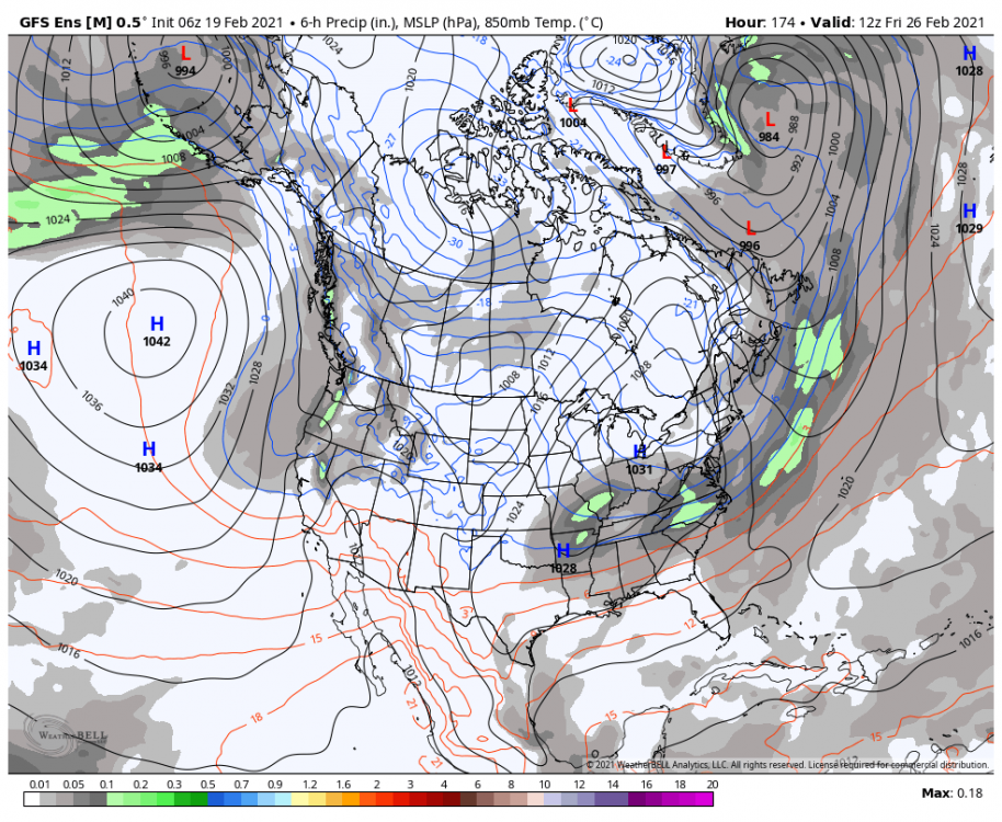
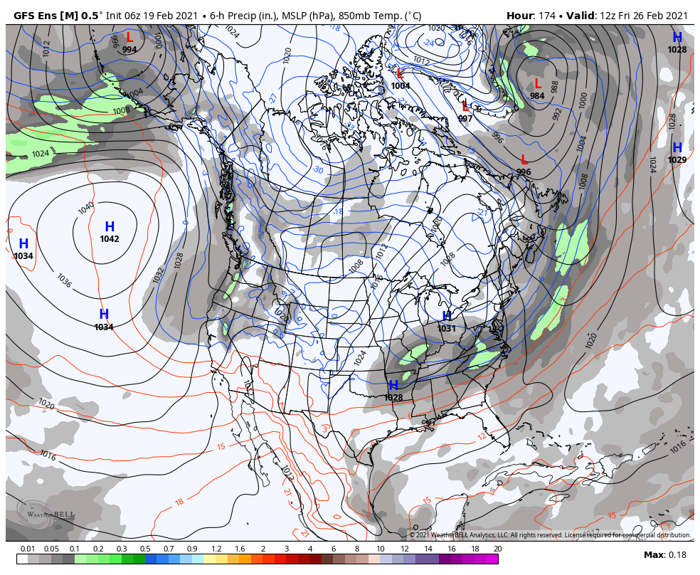
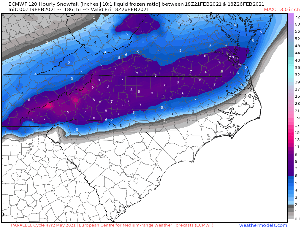
I don’t think it can be mentioned enough that the MEAN for the euro ensemble has temps in the teens on Saturday Morning with heavy snow the NW triangle and the Triad.
-
10
-
1
-
 1
1
-
-
55 minutes ago, eyewall said:
It looks like sleet saved a lot of people from a major ice event in the Piedmont.
Absolutely. We held onto sleet until 1:30.
-
Heavy snow
23/18
-
1
-
-
3 minutes ago, ILMRoss said:
i can't believe i'm going to spend another 6 days in a row overanalyzing every run of the gfs after swearing it off yesterday
Way better temps this time I'm licking my chops
I’m gonna pick up a habit if we keep this going. Lord.
-
1
-
-
30/10
-
1
-
-
I am becoming increasingly nervous for a devastating ice storm from Greensboro to Durham to Roxboro. It looks like nearly an inch of freezing rain QPF falls .
-
2
-
5
-
-
Just now, wncsnow said:
UK with its best run of the storm for mountain and foothills
.thumb.png.f95c173b98a257ac0f74b3a95e02de69.png)
Huh. Well that’s downright decent.
-
3
-
-
30 minutes ago, wncsnow said:
if you comoare to 18Z, there is more snow near Hickory to Statesville down to Shelby
(13).thumb.png.6e132e3cc2d9e6f3d40853f414bce094.png)
Also, I just noticed that WBTV moved the mostly snow line to the other side of the Catawba River. Seems like a good trend for that 321 corridor to avoid a major ZR disaster
-
2
-
-
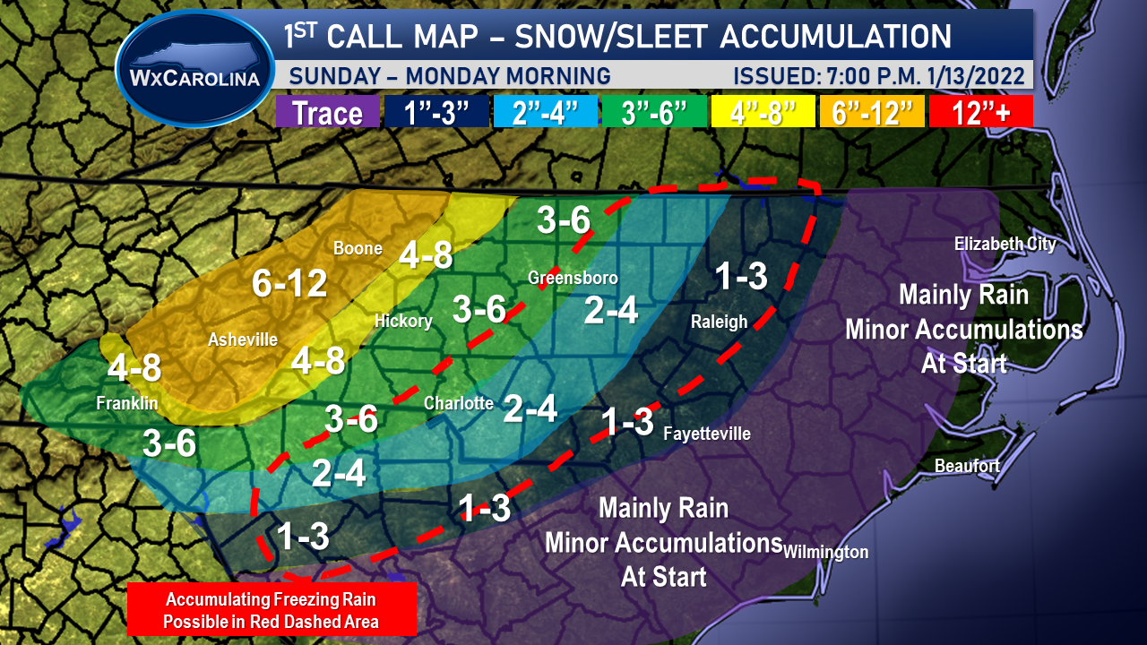
1 hour ago, WxJordan said:
I just released my first snow/sleet accumulation map this evening. Pretty much in line with most other forecast. Wouldn't be shocked for 12+ inches in mountains.
Maybe a little conservative in the foothills and western piedmont, but I really think this warm nose is going to be an issue. If the storm was a little further east, my forecast would change. But I do believe with a track this close to the coast, and with the storm strengthening, I believe we are going to have sleet issues everywhere outside the mountains.
In central locations, I kept the freezing rain area kind of large. I personally do not think it will be quiet this large, so it will probably need to be scaled down as we get closer to the event. The warm air advection shown on the models is tough.

Really think that is a super solid call
-
1
-
-
1 minute ago, NorthHillsWx said:
One thing to note- when precip arrives in the triangle it’s 24-25 degrees. Rarely and I do mean rarely do we get above freezing with precip falling and temps that low unless the SLP is directly over or west of us. I think if that setup occurred we’d struggle to get above freezing
Whatever snow QPF we can squeeze out, for once, we’re going to be efficient with it
-
5
-
-
I finally got my password right
-
19
-
1
-
12
-
1
-
-
Looks like it's snowing at the Henderson-Oxford Airport and in South Hill, VA.
-
1
-
-
Not sure where to put this but the 3K and 12K NAM have snow for the northern triangle/triad/VA border counties on Friday Afternoon.
-
6z but I didnt see it posted:
-
2
-
-
-
We had more freezing rain overnight. The fence was icy and so was my wife's car.
-
1
-
-
3 minutes ago, WinstonSalemArlington said:
Seems like sleet is mixing in in North Winston-Salem
It apparently is sleeting hard in King.
.png.b4568e536c7a061ede50b396ca93fde8.png)
(13).png.742da8d0986e3b1570b69ada1d211335.png)
January 20-22 “bring the mojo” winter storm threat
in Southeastern States
Posted
I feel okay in my part of town.