

BullCityWx
-
Posts
8,892 -
Joined
-
Last visited
Content Type
Profiles
Blogs
Forums
American Weather
Media Demo
Store
Gallery
Posts posted by BullCityWx
-
-
Last frame of the ICON, it's 20 degrees and snowing in LAKE CHARLES.
-
 2
2
-
-
Just now, CaryWx said:
If we are to get a decent storm (NC) my hunch is it will not be this weekend but mid next week as has been hinted at back-and-forth forth some time now on various modeling.
If it's a mostly snow event then you may be right. I think Friday has some real zr/ip potential.
-
1
-
-
1 minute ago, burrel2 said:
Ukmet dumps the cold on us at 144hr with a storm out west. Great look.
Well, you're starting the damn thread if it happens
-
4
-
 2
2
-
-
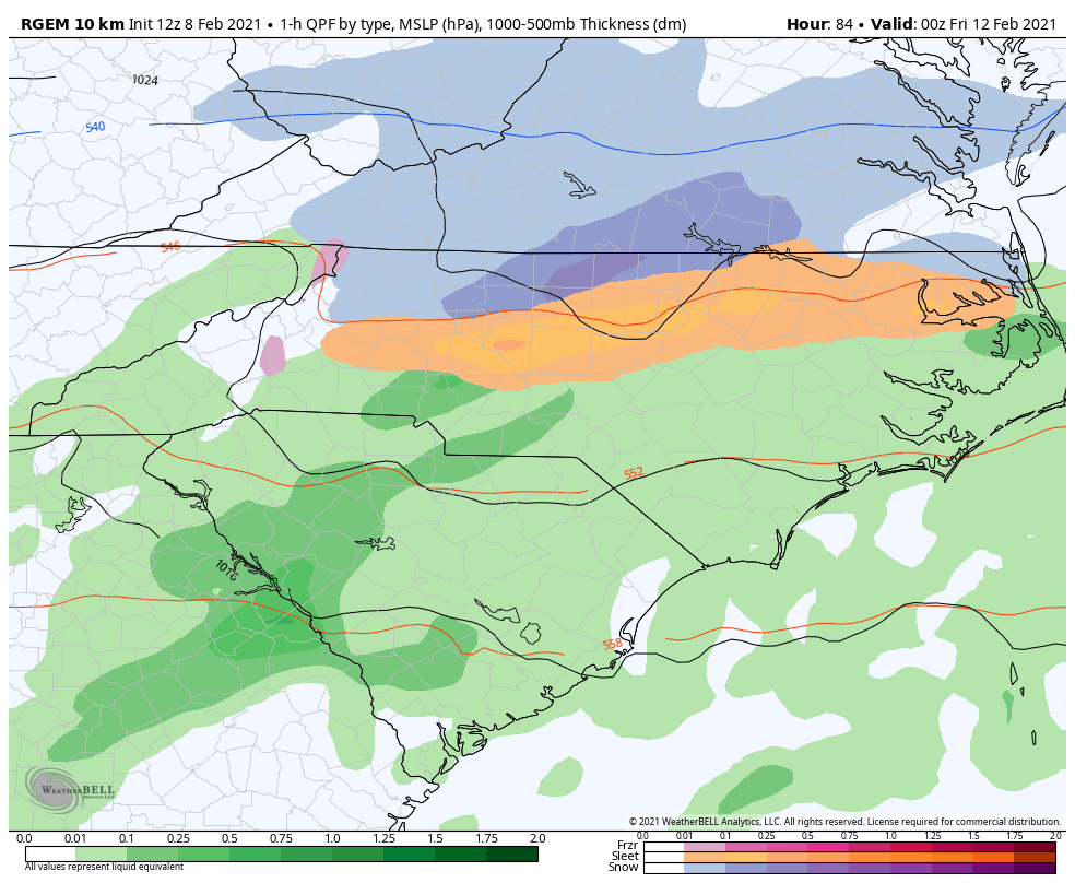
4 minutes ago, NorthHillsWx said:
Definitely the signal for a mixed precip event Friday. These CAD storms tend to trend colder as time goes on. Definitely getting interesting
Yep. If it trends hold, I'd almost expect that RGEM map with freezing rain along the edges from GSP to Johnston Co.
-
1 minute ago, WXNewton said:
Maybe short-range models will start to sniff out this dense air mass and pickup on the potential faster than the globals will.
Absolutely. I'm surprised the NAM hasnt yet. This sort of scenario is where the GEM shines.
-
1
-
-
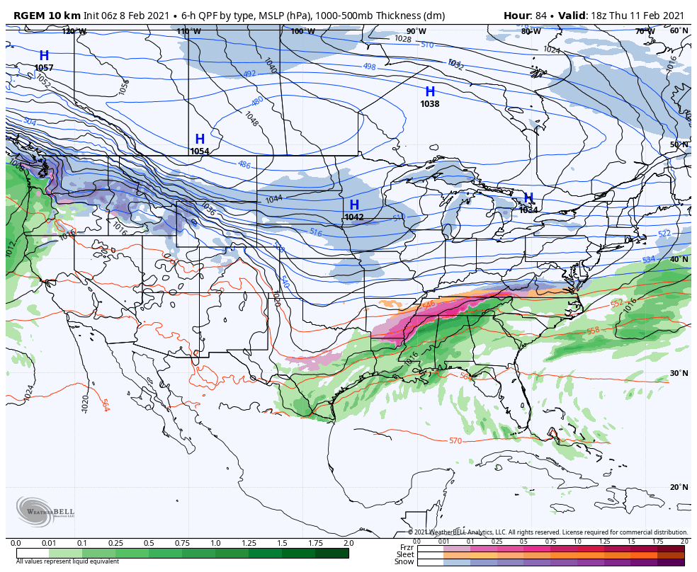
1 minute ago, BornAgain13 said:
What is taking place? Is the High trending stronger or is the storm taking a more southern track?
Well, you've got a decently strong high pressure(1036MB) centered over snow covered land plus it's close to some very cold air. It's a pretty classic look. I could see this trending colder and colder.
-
 1
1
-
-
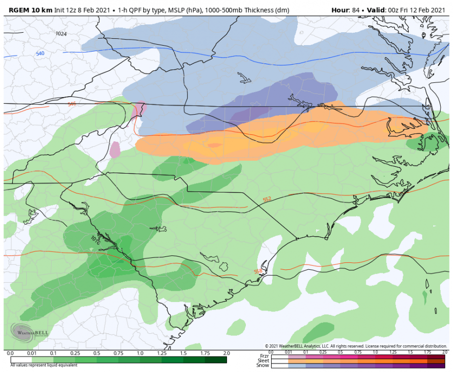
Just now, BullCityWx said:
RGEM is a huge sleet storm.
Actually wasnt far away for the border counties with VA to being all snow. Edited to show snow at Roxboro, Yanceyville, Reidsville in the last frame:
-
1
-
-
RGEM is a huge sleet storm.
-
1
-
-
13 minutes ago, NorthHillsWx said:
1034 is just barely workable. Placement would have to be perfect
1034 is more than enough for freezing rain. I’ve seen significant events with weaker highs.
-
2
-
-
-
Friday is looking like it has potential to be icy
-
Control run had an ice storm for north of 40
-
Light snow first thing this morning
-
We have a dusting of sleet.
-
3
-
-
33.5 Sleet and Rain
-
Just now, SnowWolf96 said:
Looks like West/Central NC is going to get hit pretty good. Just turned over to snow here in the Charlotte Metro.
What part of the metro?
-
Just now, Tigerchick224 said:

Up to 4” now in Travelers Rest! This was good for the soul.
.Saw a video from there and it was pouring
-
1
-
-
2 minutes ago, SnowDeac said:
Not sure how/why south Charlotte is now under a WWA. Interesting. Guess they just included the whole county.
Mecklenburg county is one zone as far as I know
-
1
-
-
Starting to see slush on the patio and deck here. Heavy sleet with some flakes mixed in.
-
1
-
-
Waiting on the bright banding near Hillsborough to get here. I have a decent enough gut feeling about it
-
21 degrees with light snow at 1PM next Sunday. That’d be nice.
-
1
-
-
Little bit of light snow next Sunday afternoon on the GFS. Not much QPF but when you have -15 850 temps, you don’t need much.
-
4 minutes ago, griteater said:
The Upstate decided to gift E Gaston and Mecklenburg counties the warm bubble with this storm
It’s been snowing in downtown Gastonia for an hour and a half now. Gastonia airport, 4 miles south into the CC band, still just rain.
-
1
-
-
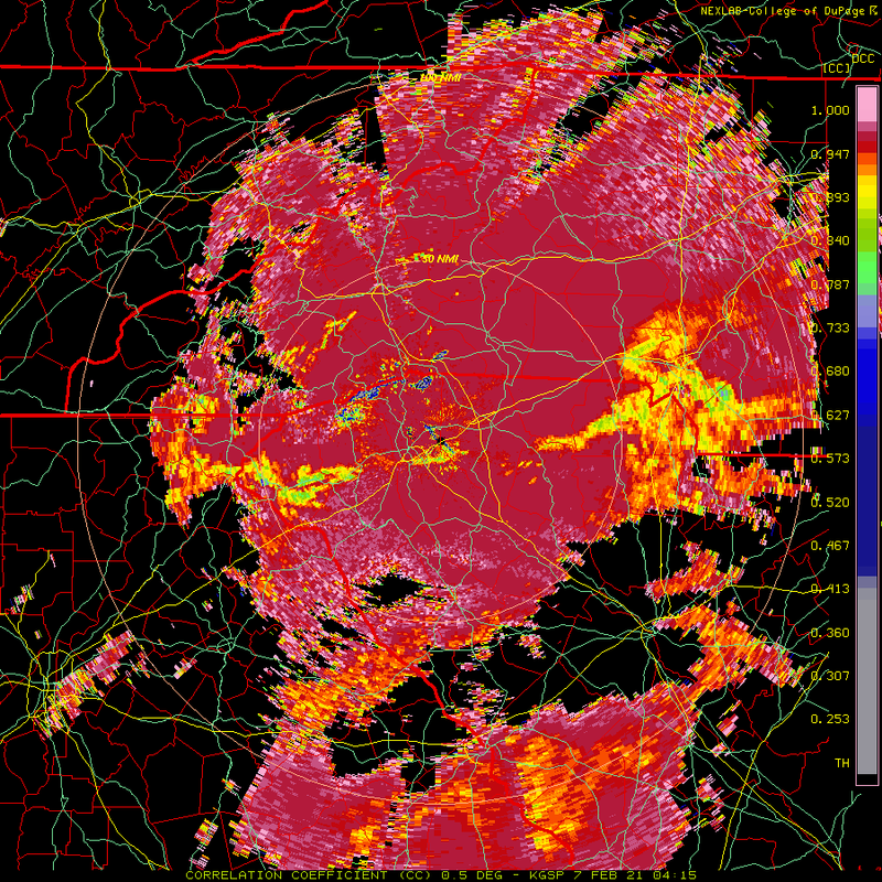
KCLT reporting -IPSN
Mid to Long Term Discussion 2021
in Southeastern States
Posted
In the immortal words of Blizzard24:
Winter uncancel.