

cyclone77
-
Posts
17,685 -
Joined
-
Last visited
Content Type
Profiles
Blogs
Forums
American Weather
Media Demo
Store
Gallery
Posts posted by cyclone77
-
-
Another 90 in the bag at MLI today, hit 88 here.
Guess the cicadas are out but I have yet to hear one.
-
Nice brief downpour just gave us almost two tenths with some thunder as well. Up to 3.65" for July now.
-
 2
2
-
-
Looks like mid-upper 90s Wed/Thu for this area. We've already had that earlier this summer so nothing too exciting there. Doesn't look like the heat will stick around very long.
-
After being above 100 since early Sunday morning Death Valley finally dipped below 100 for two hours early this morning. Cooled off to 98 degrees, and then back to 122 this afternoon.
-
 1
1
-
 2
2
-
 1
1
-
-
The majority of the DVN cwa has been bumped out of the severe drought in the latest monitor update. Even some areas down to just abnormally dry now.

-
2
-
-
-
According to the hourly obs from Furnace Creek in Death Valley CA they haven't been below 100 degrees since early Sunday morning when temps dipped to a frosty 94 degrees. Yesterday's low was 105, and today's low was 101 degrees- at least as far as the hourly readings. Spending a stretch of summer there would be as fascinating as spending some time up on Mt. Washington NH during the winter.
The ob from 3am yesterday morning is just insane. 108 degrees at 3am!
-
1
-
1
-
-
Got down to 52 here early this morning. Pretty nippy for mid July.
-
6 hours ago, SolidIcewx said:
Love how it went from 100% chance of storms at 8am to now it’s 20%


-
2
-
-
Red sky in the morning asthmatics take warning.
-
7
-
-
Looking pretty quiet again for the next 10 days or so.

-
1
-
-
Got about a quarter inch. About 3.5" for July now.
-
Had a nice little period of 40 mph gusts with the gust front a short while ago. That knocked the temp back a good 20 degrees. Now the heavy rain is moving in, and thunder is getting louder.

-
2
-
-
1 hour ago, CheeselandSkies said:
"Full" video, such as it is (all 60 glorious seconds of tornadic bliss) is up:
We've got sisters!

-
1
-
1
-
-
1 hour ago, Harry said:
Can mark a fail here again. Heaviest rains went north and storms south. .75 which I'll take though.
Guess this is payback for the epic Les event here in November..
Ma' nature always seems to remember. Probably why Minneapolis is drying out so much lately.
-
10 minutes ago, Stebo said:
Nice no one decided to post the best picture of the day here it is
He'll definitely be hanging that one on the wall.
-
2
-
-
3 hours ago, A-L-E-K said:
extended looks good, no heat, active nw flow
I admit I'm surprised at how things worked out. The way it was going in June I figured we'd be a lock for a few 100+ readings this month or August.
-
1
-
-
4 hours ago, mjwise said:
That's a crazy stat to me. We have had 1 90 so far this summer, a 90 on 6/25. Granted, we have gotten 89'ed 5 (!) times, but still, even despite being ~300 feet higher, less urbanized and at a slightly higher latitude, I wouldn't expect that contrast between two sites separated by a <2 hour drive.
Yeah there's definitely a steep gradient from northeast IL to the QC. We're only about 25 miles northeast of MLI and have 16 90+ days.
Nice soaker today between the two main rounds. Ended up with 1.77", up to 3.21" for July.

-
1
-
 1
1
-
-
5 minutes ago, hawkeye_wx said:
Cyclone has managed to get another inch of rain overnight before I've seen any.
I really hope all the heavy stuff moving in from the west doesn't suddenly crash south into the juicier air, leaving me with just a few hours of light rain. That's what I'm afraid of.
Hopefully your area does well with the WAA wing downpours and nice comma head action. Sometimes heavy comma head rains are a bit under-modelled.
-
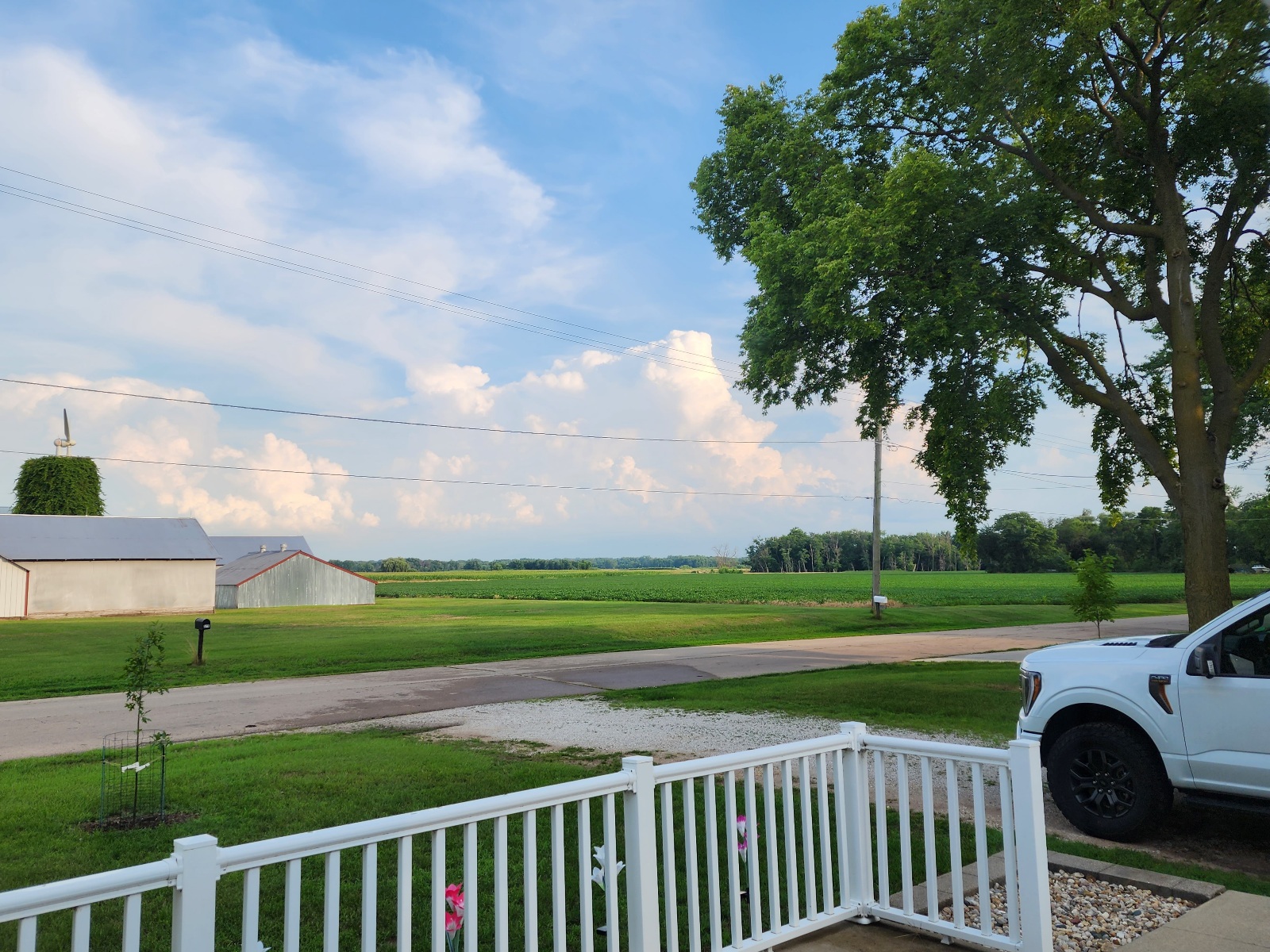
Nice thunderheads to the southeast

-
4
-
-
4 minutes ago, hawkeye_wx said:
As we get closer to the action, the HRRR is looking increasingly good for much of my area. I hope this is fairly accurate.
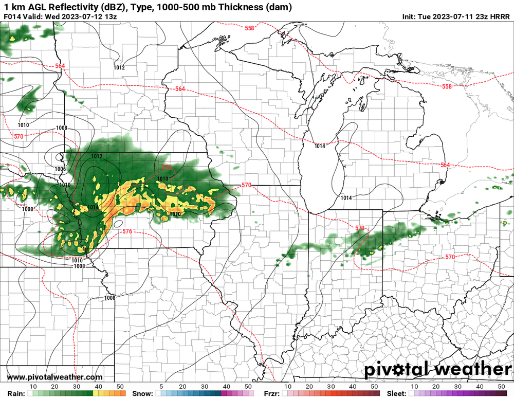
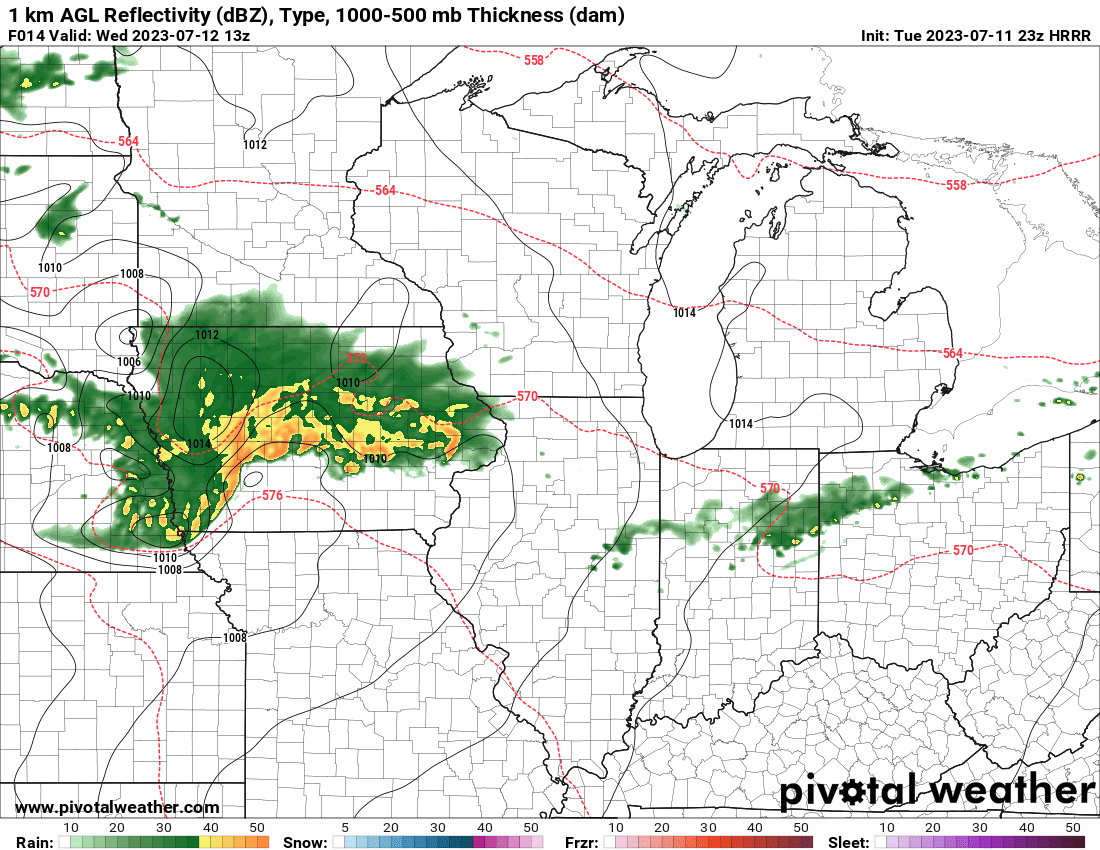
Yeah sure looks like we are go for a massive MCS moving through Iowa tomorrow morning.
-
1
-
-
Picked up 0.01" from a cell that crapped the bed on the back doorstep.
-
2
-
-
Pretty steamy out there this afternoon, as the dews have shot up into the 70s. Nice towers building all around.
-
1
-
-
Today was the 21st 90+ day at MLI for the year.

July 2023 General Discussion
in Lakes/Ohio Valley
Posted
DVN has 100 in the point for Thu at MLI, 99 on Friday.
We still haven't made a run at an 80 degree dewpoint yet, which is kind of unusual. Looking like there's a good chance we won't make it this year.