

cyclone77
-
Posts
17,669 -
Joined
-
Last visited
Content Type
Profiles
Blogs
Forums
American Weather
Media Demo
Store
Gallery
Posts posted by cyclone77
-
-
Another half inch this evening from some decaying convection/anvil rains. Up to 1.60" for the day.
-
 3
3
-
-
Nice storm with nearly continuous thunder for a good half hour. Picked up 1.06"

-
4
-
-
Down to 43 here this morning.
Below freezing up in Sparta and Black River Falls WI.
-
1
-
-
Nice little thundershower rolled through and deposited 0.21". Knocked temp back into the 50s.
-
2
-
-
4 hours ago, KokomoWX said:
This weekend I am planting 37,000 square feet of grass. I need a half inch of rain every day for about three weeks or I'm going to be doing a lot of watering. Sigh.

-
Nice slow soaker all morning that slowly added up to a final total of 0.69". I'll take it.
-
6
-
-
0.17" so far here.
-
Felt a few anvil sprinkles short while ago. Top 3 event past month.
-
1
-
 4
4
-
 1
1
-
-
3 hours ago, hawkeye_wx said:
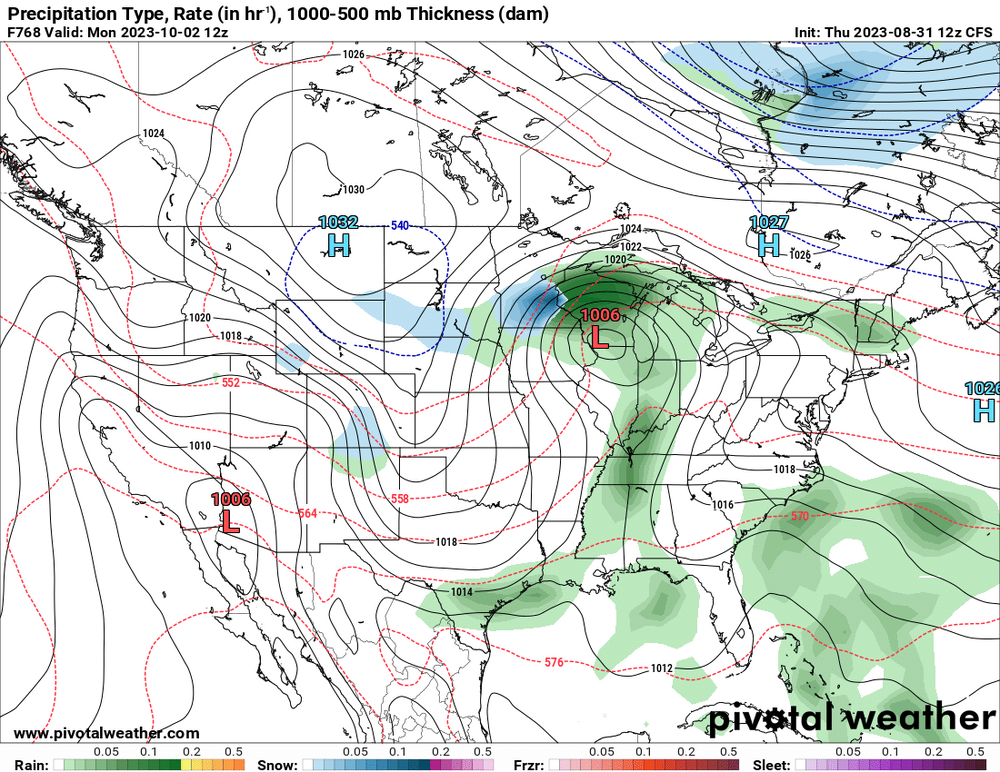
Models are struggling with this wave. The Euro has generally been one of the more bullish models, but it has been all over the place. Yesterday's 12z run mostly took Cedar Rapids out of it, but the new 00z run is the most bullish, yet, with a swath of rain through Cedar Rapids of well over an inch. The GFS and other models have also become more bullish overnight. After this wave, models are very dry into late September, so we really need this.
Yeah the models aren't handling this well to be sure. Kinda up in the air what any one location may see from this.
-
Last night's Euro a lot more generous with a swath of rain from Iowa into northern IL Monday, with widespread 0.5-1.0 inch rains. Not enough to do much to help the overall drought situation, but would still be nice to see if it comes to fruition. Temps may have a hard time getting out of the 60s Monday as well under a heavy overcast/all day rainer.
-
3
-
-
18 hours ago, hawkeye_wx said:
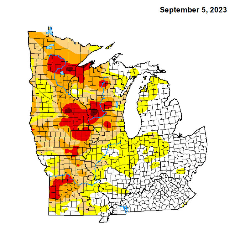
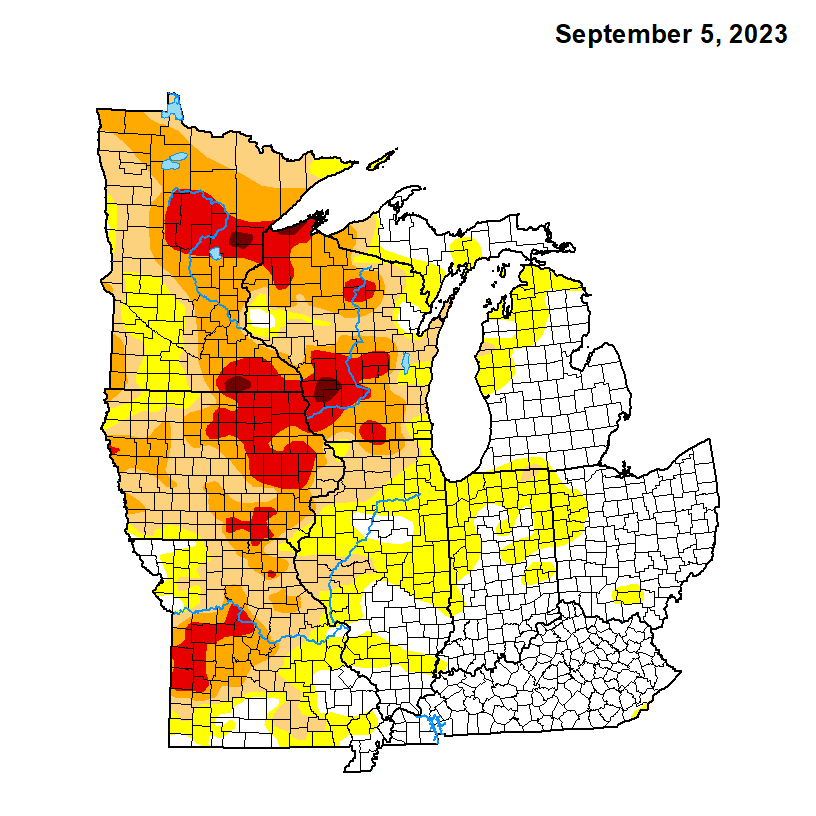
Extreme drought has expanded across east-central Iowa. A couple spots of exceptional drought have popped in se MN and sw WI.
If the new Euro is correct another few weeks of waiting for rain are in order.

-
1
-
-
The level of the Mississippi in the QC is down to just 3.5ft at the lock and dam in Rock Island. Back in May when the major flood was taking place the level peaked at over 21ft. Tremendous difference to say the least.
Don't see any more 90s on the immediate horizon. MLI has 36 for the year.
-
17 minutes ago, MNstorms said:
Looked outside as this front went by and there's 100s to 1000s of dragonflies flying about.

Looks like the radar's showing dragonfly advection.
-
Had a brief shower this morning and managed to squeeze 0.06" out of it.
-
On 9/3/2023 at 4:34 AM, Spartman said:
Got 89'd on the first Saturday night of September. It's the highest it's going to get for the month. Almost all the 90s are dropped from the upcoming week.

-
6
-
-
Soybeans and corn has really dried up the past week as we move more into Sep. Harvest season not too far away.
-
1
-
-
On 8/31/2023 at 7:16 AM, hardypalmguy said:
you're too cold this weekend. it will be way warmer. probably not as humid.
Looks like you were incorrect as expected.
-
4
-
-
Another morning in the 40s as we made it down to 49 here. AC has been getting a nice break the last several days.
-
2
-
-
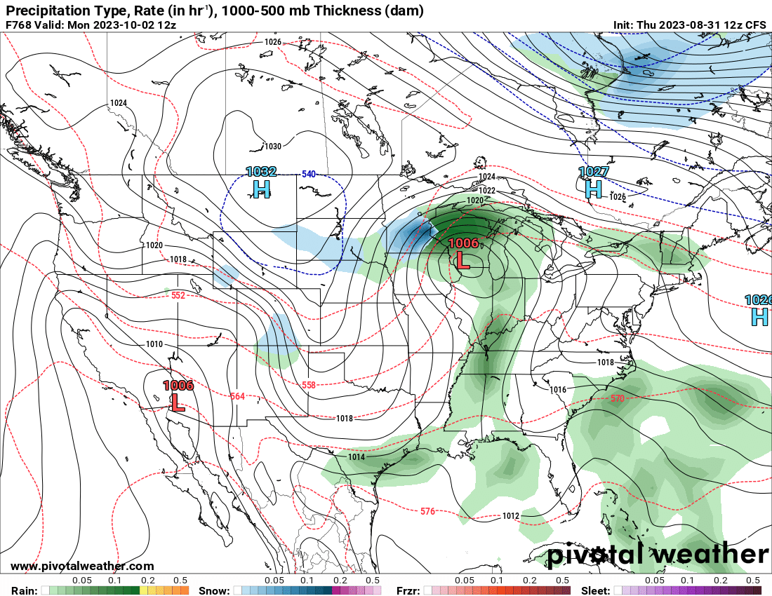
58 minutes ago, mhou said:
Just a little teaser from the lovely CFS model lol
Lock it in.
-
1
-
 3
3
-
-
MLI finishes met summer down 6.31" and now down exactly 10" for 2023 compared to average.
-
Not completely shutout on the new Euro as 0.02" is predicted to fall here.

-
1
-
-
41 here this morning. Nice early taste of Fall before a little warm spell returns this weekend/early next week. Temps won't be nearly as impressive as last week's heat wave, prob mid 90s tops for the DVN cwa.
-
50 here this morning. Likely to dip into the 40s Thu morning.
-
3 hours ago, hawkeye_wx said:
Hurricane Franklin, well off the US southeast coast, has cratered to 926 mb this evening. 72 hours ago it was 1003 mb and highly sheared.
Hopefully the one heading towards Florida doesn't do something like that.

September 2023 General Discussion
in Lakes/Ohio Valley
Posted
Extreme northwest IN getting hammered right now. Gonna be some big totals in that area.