-
Posts
8,736 -
Joined
-
Last visited
Content Type
Profiles
Blogs
Forums
American Weather
Media Demo
Store
Gallery
Everything posted by USCAPEWEATHERAF
-
"Dawn Awakening: The Apocalypse is Now"
USCAPEWEATHERAF posted a blog entry in Once a legend always a legend
"Dawn Awakening: The Apocalypse is Now", is a heart wrenching tale about the end of the world through the study of geology. Together we will experience, life, death and destruction of the world in a process known as the, "Earth Core Pulse", a theory I created on an epic energetic pulse of ultimate energy emanating from the Earth's Core throughout the faults of the Earth, and where it all starts, the Philippines, explodes into dust and heat is generated throughout the oceans as various earthquakes erupt along the fault lines of the Earth. This novel will be such an experience, that this author has never written before in his lifetime, it will be a journey through the characters that has never happened before in our lifetimes. This story will bring heartache, suspicion, suspense, heroic behavior and the ultimate giving of sacrificing one's life for the better good, for the ultimate good, in saving a person's life, putting a person's life ahead of their own safety. The ultimate sacrifice. Our hero Jack and heroine Abi, take us on an adventure, one only dreams of in the end, and today that journey begins. I cannot wait to give you this novel, because I want to surprise the world with my talents as a tremendous author with the talents of a great writer. This novel will prove that to the reader. You will want to continue to read my novels as they will be better and better, filled with tremendous action. Good luck, this might take me a full year to work on from now until Thanksgiving 2018. I will cherish this journey, because I want it to be the best out there ever. -
Will is right, the January 05 Blizzard was a "Blizzard" in its truest nature. Even on Cape Cod we had winds gusting between 75-85mph, on Nantucket the winds gusted to 86mph and the island lost power, its quite possible that Nantucket experienced Category two hurricane force wind gusts over 95mph as they couldn't confirm with their power out. The blizzard was the worst wind/snow combination I have ever experienced. The fun thing is I remember making and drooling on snow maps I made during high school classes and showed my friends what was coming for that weekend. The awesome thing is, I was right for once, and accuweather was right in hyping the storm. Man that was a fun winter, 98" of snow.
-
This winter could be a lot like the 2011-2012 winter, stay tuned for further updates.
-
- enso
- cold and warm phase
-
(and 3 more)
Tagged with:
-
Looking at the latest 12z model data, it appears that the last week of October through the Halloween holiday and into the first few weeks of November the Teleconnections will favor trough in the east and ridge in the west type pattern where sustained cold will be possible in New England north of 40N latitude. This could mean a stormy November in which cold air sinks into the Oh Valley centered in this region the trough will allow storms to come up the East Coast to the benchmark and give us precipitation perhaps in the form of snow or rain. GEFS. GFS, EURO, CMC all favor a long range pattern that is conducive for snow and cold, just how cold will be determined by a negative anomaly in the Arctic Oscillation cycle. This negative anomaly should allow a polar vortex or a vortex from the arctic circle to focus a cold air phase into the Northeastern US by November 1st. This should be a fun period folks, especially if blocking develops over the Atlantic Ocean.
-
Patriots are having their difficulties on defense, but they should still compete for an AFC conference championship this season, the Boston Celtics have reloaded this offseason and prepare for an entertaining season perhaps NBA finals appearance, the Boston Bruins have started off horribly, but expect the young guns to make this an intriguing season and congrats to the Red Sox for a great Season too bad it ended poorly.
Could this winter season bring a lot of snowfall to Cape and Islands? I would say possibly yes
-
SO the models are showing frigid air entering the northern Plains sometime in the next ten days and that cold air filters into the eastern US by day 13-16, which is the 27th and beyond of October. We could be seeing a change to much colder air eventually as winter gets closer. Most of our storms this winter will be from the Oh Valley to the Mid Atlantic coastal storm tracks, signifying that miller Bs and not Miller As will be the normalcy this winter.
-
Ok the pattern upcoming for the next two weeks is quite simple. Simply put, it remains a negative to neutral PNA, positive NAO and positive AO, this means cold air will continue to filter into the western Canada and Western US, while the eastern US and eastern Canada remain underneath a strong ridge of high pressure with southwesterly winds and warm temperatures. By the end of October, this pattern may switch to more seasonal temperatures showing a cooling trend by the beginning of November. the models show some semblance of a -AO/+PNA pattern emerging in the long range but the NAO remains positive or neutral at best. Time will tell, but we will certainly run into a winter cold snap sometime in the future, perhaps near.
-

Novel being considered for publishing
USCAPEWEATHERAF posted a blog entry in Once a legend always a legend
Hey everyone of Americanwx.com foruims, Today I inform you that my novel, 'The Dawn Awakening: Opening Segment" is being reviewed by a publishing company for potential publishing, keep me in your prayers, as we can get through the barrier of publishing. Thanks, I will have another updated blog on Thursday when they make the decision. Thanks! James Warren Nichols -
thanks
-
Man Blizzard of 2005 beats all with cold air and snow.
-

Storm Chasing in western and upstate NY, Lake Effect Snow?
USCAPEWEATHERAF commented on USCAPEWEATHERAF's blog entry in Once a legend always a legend
I will no doubt -

Storm Chasing in western and upstate NY, Lake Effect Snow?
USCAPEWEATHERAF commented on USCAPEWEATHERAF's blog entry in Once a legend always a legend
awesome, I no doubt pay attention to your forum, we guys know the most on your region so I come to your forum to watch the comments on the latest snow events -
The videos of the Blizzard of 2015 Coverage is awesome. I hate how Harvey and Mike didn't update the snow fall graphic every time news came in of the Outer Cape getting over 24", Harwich came in at 30.4" officially, but you know how banding is, I measured 32" in my front yard. I live in Harwich Center, there has to be a residual front between Harwich and Chatham.
-
So folks, should I publish my work on my own with amazon? Or should I go with another publisher?
-
Hello folks, I am writing to you guys because its fun and a bit of an exercise short story for when I try to write short stories and get published in the future. This practice short story is about a Blizzard of the Century deal where a catastrophic nor'easter meets the NE CONUS and the MW. A storm as strong as the Greenland storms in the winter time. A low as low as 925.4mb a category five hurricane pressure. What would happen if a low bombed out to 925.4mb southeast of Nantucket, MA, how much snow would fall and how would it unfold in SNE. I have a snowfall map from the Midwest Clipper and the Northeast Nor'easter coastal low. Check it out and I hope it holds everyone off until the short story is finished. Take care. James Warren Nichols
-
- snowfall map
- blizzard of the century
-
(and 1 more)
Tagged with:
-

18z GFS shows Monster Hurricane near East Coast for 99L
USCAPEWEATHERAF commented on USCAPEWEATHERAF's blog entry in Once a legend always a legend
I'm just pointing out the GFS run, no need to cry wishcasting.- 2 comments
-
A microburst potential exists on Tuesday morning as a screaming Low Level Jet with hurricane force winds possible for Cape Cod if the surface low travels over the top of the area.
-

18z GFS shows Monster Hurricane near East Coast for 99L
USCAPEWEATHERAF posted a blog entry in Once a legend always a legend
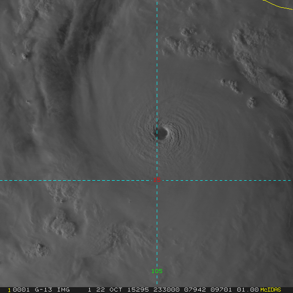
The latest afternoon run of the GFS today has brought fear into the eyes of the beholder. Shows a 937mb sitting off the SE US Coastline festering on the warmest waters of the Atlantic Ocean. Could become a category four hurricane in another five days.- 2 comments
-

Could GOM Low become a hurricane?
USCAPEWEATHERAF posted a blog entry in Once a legend always a legend
Models are not crazy about the tropics right now but we have two areas of interest growing in the Tropical Atlantic as I write this blog. First area of concern is close to home, in what we call a homegrown threat, an area of thunderstorms grew into an area of low pressure earlier this afternoon and is growing with thunderstorm activity. It developed from a leftover frontal boundary currently racing off to the Northeast over the western Atlantic Ocean. TS Emily grew from the same front yesterday and is now quickly diminishing in a midst of a shear and dry air. Just as I thought from yesterday this area needed to be monitored as the area of frontal shear caused by a front in the GOM appears to be lessening now and is near 10-20 knots instead of 30-40 knots yesterday. This shear should continue to drop according to the 18z GFS run yesterday afternoon. This small area of low pressure is already well defined on satellite imagery this evening and appears to be gaining convection. Depending upon if the convection is consistent and persistent will determine the tropical outlook on this system. Next system of interest is a tropical wave currently in the MDR battling dry air to the north of it and the ITCZ influence to the south of it. Shear is light to moderate, not enough to stop development, should become an invest tomorrow morning. Stay tuned this system could become a threat to the lesser Antilles islands in the mid term.-
- gulf of mexico
- hurricane
-
(and 1 more)
Tagged with:
-
The title is "A Wild Weekend to remember, a love story" there will be a continuation of Marie and Walter's weekend in the second short story and then a continuation of the story. James Warren Nichols, written by A couple, a love story.docx
-
- a love story
- romantic story
-
(and 1 more)
Tagged with:
-

Check out my Novel
USCAPEWEATHERAF commented on USCAPEWEATHERAF's blog entry in Once a legend always a legend
Hmmm, why aren't people flocking to a newly written novel -
Take a look at my attached novel, give some comments too. The Year 2029, Catalystic Beginning.docx

