
Trent
-
Posts
2,813 -
Joined
-
Last visited
Content Type
Profiles
Blogs
Forums
American Weather
Media Demo
Store
Gallery
Everything posted by Trent
-
It's funny how the heaviest snow is in Lorain/Medina/Summit where no advisories exist. I'd imagine things will pick up later this afternoon.
-
We'll see if the radar starts to light up this afternoon. So far, the snow has been unimpressive. We are going to struggle to meet advisory criteria unless it starts pouring snow this afternoon.
-
Winter Weather Advisory issued for 4-6" tonight and tomorrow. Tight temperature gradient today with mid 50s east side and mid 30s west and lakeshore. Looks like the leftover scraps of this storm could end up being CLE's largest snow of the season.
-
Crazy to string together 4-5 days of near full sun in Cleveland in February. As of today, CLE is even running a snowfall deficit for February. The lake enhancement at the end of the week still looks good, so it's possible CLE actually has above normal snow for February, but the synoptic misses still continue.
-
There's been a lot of consistency with the back side snows from most of the models. This is pretty much CLE's bread and butter type snowfall - getting missed by a low pressure overhead or just to the west, but getting hit with lake enhanced back side snows. NAM spits out 8" for CLE, pretty good hit.
-
No doubt this will be a big rainstorm as the low probably comes over us, but the consistency among models showing decent backlash and enhanced snows after is interesting. Lock it in, this will be CLE's biggest snow of the year, but it won't take much to do it.
-
The mid week storm should set the stage for a nice lake enhancement event as the low pulls off to the NE. After this weekend's warm up, a lot of the ice on Erie melted. Should be interesting to see how this unfolds.
-
The winter torches always over perform. Lots of places pushing 70 degrees today. CGF hit 70 and BKL probably came close. I think the forecasts this morning were only for mid 50s too. Interestingly last year on this day CLE hit -17 with many interior locations falling to around -30. For some spots, today is 100 degrees warmer than the same day last year. Incredible stuff.
-
In the end, the thaws always over perform. It still looked like deep winter when I left for work this morning and by the time I got home, only a few driveway snow piles. It's incredible how quickly it melted. With above freezing temps through Sunday, I'm sure the snow is now toast pretty much across the region.
-
I think those to the east will retain some snowpack. High dewpoints really melt snow and the dewpoints don't look to get too high this weekend compared to other winter thaws this season. The sun tomorrow could do a number in unshaded spots though. I bet a couple inches remain in the snow belt. Bare grass will certainly be common for the west side.
-
CLE nudged over 20 inches on the season today, sitting at 20.5". We'll see what the rest of the season brings, but the 30-35" range seems likely now. This place has been a synoptic wasteland, I wonder if we'll have to wait until next season before we see a decent hit?
-
Had just under two inches as the snow is about to wrap up. Realistic snowfall predictions win 90% of the time. It's a shame to waste such a perfect track on a such meager snowfall, but it is what it is. These snowfalls also make you realize how much different 2" of high ratio fluff is from 2" of dense synoptic snow.
-
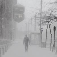
Heaviest snow would start falling in the middle of the night and peak during morning rush. Even if we only get grazed, the timing tomorrow morning would be the worst possible for commuters.
-
Think of all the times CLE has been screwed by last minute NW trends over the years. Could one of these last minute jogs NW actually be beneficial to us? Obviously the more east you are, the better. But the potential is certainly there for a high impact event. Realistically CLE will probably get 2" and those out in Geauga would get 4". Such a tricky forecast for the mets today.
-
Interestingly 10 of the SREF plume members give CLE over 6" tonight.
-
The trends yesterday looked favorable, but the models have backed off today. It'll probably end up barely whiffing most of NE Ohio, with the PA border getting something. This was basically the first legitimate synoptic storm threat for us in a year.
-
Awesome squall. Too bad it's nearly impossible to maintain these rates for 6-8 hours.
-
Very nice event this ended up being. Adding up all the pieces and parts over 60 hours gave me a tally of 7.4" of snow since Tuesday morning. Not bad for a 60 hour snow total. Granted, there's only about 3-4" of that due to settling, but a nice total nonetheless. Now if we can only reel in the Tuesday storm ...
-
Picked up 2.6" in 2 hours here. Wish I could lock in these bands til morning.
-
Wow. It was dumping snow when that band briefly moved through here. I was outside for about 5 minutes to take out the trash bins and it snowed almost a half inch. Crazy rates! Fingers crossed for the rest of the evening!
-
Story of the past 3 winters I'm still waiting for that elusive multi day NW wind event, seems almost impossible in NE Ohio anymore to get that wind flow. I do remain optimistic for some decent accumulations later today. Should at least be some nice rates, even if short lived in spots.
-
Wow. Look at that band over the lake. If that drops over land today there are going to be some serious accumulations with that. Looks like some snow starting to fire outside the band in eastern Cuyahoga and Geauga.
-
That nice band over the lake right now that is skirting extreme northern Lake County and Ashtabula is what most of the high res models had much farther south. Models had this primary band extending from about Lorain to central Geauga from about 7am to noon, so it's a good 20 miles north or so. Hopefully it sags south during the morning, but bands being modeled too far SW is pretty typical.
-
Picked up almost 3" overnight from that band that was meandering over the west side. Surprised no headlines for Cuyahoga.
-
Interestingly some of the BUF hi res models have a dominant east/west band through much of Lorain/Cuyahoga/Geauga for several hours tomorrow morning coinciding with rush hour.
