
Trent
-
Posts
2,813 -
Joined
-
Last visited
Content Type
Profiles
Blogs
Forums
American Weather
Media Demo
Store
Gallery
Everything posted by Trent
-
77 was officially reached. What a day! If it's going to be 35, overcast, and snowless for days, what's the point? We might as well have these types of days. I still think we're due for at least a widespread 3-5" snowstorm sometime in March. Maybe we can still salvage a decent lake enhancement event too, especially with how warm Lake Erie is for this time of year.
-
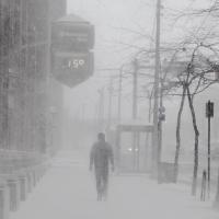
75 at CLE and 76 at BKL for the 2pm observations. These are unthinkable temperatures for Cleveland in February! No doubt that 76 is the warmest temp ever recorded downtown during Meteorological winter in Cleveland.
-
The all time warmest temperature in meteorological winter for Cleveland is 77 set on December 3, 1982. Today's 74 degrees ties for second warmest temperature recorded during met winter. 77 is probably out of reach, but I think 75 is doable. February 2017 is certainly rewriting the record books for warmth in Cleveland. We'll probably break the previous warmest Feb by over 3 degrees. No other month of the year has ever been that stand out.
-
This is now the 2nd warmest meteorological winter on record for Cleveland. We'll see where it finishes the next few days, but who would have thought back in November with all the winter outlooks that winter would have wound up this warm?!
-
I'm wondering if this February can score an average temp of 40? Plugging in projected temperatures the rest of the month gives an average temp of 40.4. For comparison, the previous record warmest February was 37.5 degrees in both 1998 and 1930. By further comparison, March 2012 beat out the previous monthly record by 1.9 degrees. It's still too early to call as midnight lows/highs/clouds can end up playing a significant role in the final temperature, nonetheless the potential is there for a monthly record to be broken by 3 degrees which would be the largest margin of any month.
-
The 6z GFS has a fantasy snowstorm on the 28th. I think this might be the first significant snow storm to pop up in the 7-10 day time frame all season!
-
Even with the chilly lake influence under full sun, it was near 56 IMBY, a far cry from yesterday's temps flirting with 70, but still impressive by February standards. It's probably a lock that this February will be the warmest on record (reversing 2015) for Cleveland. We'll see how high in the ranking meteorological winter ends up being. Cleveland is currently at 11th warmest out of 145 winters. With the forecast the rest of the week, that should easily move into top 3 warmest. But this is nothing new the past year, as the positive temp departures have been relentless. You have to wonder when the rubber band will snap back? A cruel punishment would be a very cold late April-June period that keeps us in the 40-50s. CLE still racking up snowfall deficits by the day. They'll need more than 15" to crack the 40" mark and there's nothing on the horizon.
-
71 at Cleveland Burke Lakefront today! The running 12 month average temperature for Cleveland is now 0.8 degrees above the previous warmest year which is pretty amazing. Even more impressive is that the past two year period in Cleveland is the warmest 2 year period on record. Why is that impressive? It INCLUDES the record coldest February 2015 in that calculation. Once that month falls off and is replaced by this month, the recent warmth the last two years will be off the charts.
-
I'm wondering what kind of lake breeze will kick in for the upcoming torch? Is this going to be a case where it's 65 inland and 38 by the shore?
-
Decent banding with the lake effect. Might be able to squeeze out an inch of fluff that will melt in 36 hours.
-
Let's say CLE manages to get a 6" storm this spring, gets four 1.5" events, and then gets a handful of sub 0.5" coatings ... that's a seasonal total of about 37". That's still worse than the winter of 11/12 and would be nominally better than last year. It's going to take an epic March/April just to move this winter from disaster to "could be worse".
-
I know it's way too early to think about, but I wonder if CLE will actually end up getting less snow this winter than last. So far snow cover at CLE has been abysmal: just 3 days with 3" or more on the ground and just 5 days that had 2" on the ground.
-
This is certainly turning into a much more frustrating winter than I would have thought last fall. It's been the winter of lake effect snows, but even that's been hit or miss. From about CLE and points west this winter has been an absolute dud. It's sad that this winter is only marginally snowier than last at CLE, and last winter actually had more substantial snow cover than this year. It's hard to imagine the kind of pattern we'd need just to hit normal snowfall this year. 44" more here on out seems like an impossible feat. I think it's a pretty safe bet that this will be another below normal snowfall year at CLE. This would mean 5 out of the last 6 winters had below normal snowfall at CLE. The only salvage to this winter would be a blockbuster storm in early March.
-
I was out of town yesterday and today. Talk about terrible luck.
-
It was 90% rain with a few flakes mixed in around Cleveland proper. This is the 11th consecutive day with RAIN in Cleveland! That's an astounding stat for January. The temperature has also not fallen below 36 degrees for over 10 days. Maybe we'll get a nice synoptic hit later this winter. It's hard to believe we are almost to February and there's yet to have been even a widespread 3" synoptic event across Northern Ohio.
-
I guess we'll see what happens with the lake effect. These events can really add to the seasonal totals without being major events. It still hasn't been below freezing at CLE since last Monday at 9am. We might be able to stretch that out until Thursday. Quite an impressive run. We just went through one of the warmest 7 day periods in Cleveland January history, tying 1933.
-
It was last below 32 on January 16th at 9am. Forecast doesn't have a below freezing temperature until at least next Wednesday the 25th. You know winter is turning into a disaster when you can't even dip below 32 degrees for a 10 day stretch in mid/late January.
-
Some interesting figures for the first half of meteorological winter at CLE: Since December 1st, the average temperature has been 31.98 degrees. Total precipitation has been 5.79", however only 16% (0.94") of that has fallen in the form of snow. Perfect example of cold and dry being balanced out by warm and wet.
-
I had two rounds of thunderstorms today. So far this winter has had twice as many thunderstorms as 1"+ snowfalls.
-
Who would have thought that January 2017 would actually end up being more mundane than last January?! CLE has now dipped below 50% of normal snowfall for the season and will be racking up quite the deficit in the foreseeable future.
-
What a waste of 1-2" of rain in mid January. Pattern looks pretty bleak the next 10 days. As we approach the mid point of winter, I'm starting to doubt whether snowfall will even hit average this year.
-
Had about an inch and a half before turning to freezing rain around 6:30am. The precip type radars are not doing well on picking up the rain.
-
Overnight has the potential to be the largest synoptic snowfall of the season (at least for the west side) depending on what time the changeover to freezing rain begins. Things look like they could be a mess for the morning commute. Sadly most areas will see their snow cover wiped out by the end of the day regardless.
-
Talk about nickel and dime fluff at CLE! The past 4 days saw 2.6" on 0.09" liquid. That's almost 30:1 ratios. Oddly there has been no mention of 2016 being the warmest year on record for Cleveland by the NWS or any local media outlets. Kind of strange since even the most minor warm or cool spells elicit media articles these days.
-
Compared to last winter, this year isn't doing too poorly until you realize most areas that didn't cash in on the LES bands in December are running 40-70% of their seasonal norms to date. If you are a snow enthusiast living in Euclid, this has certainly been your year! As a % of normal snowfall, they must be winning by a hefty margin. I guess our attention now turns to the ice potential later in the week. Hopefully that doesn't pan out.
