
Trent
-
Posts
2,813 -
Joined
-
Last visited
Content Type
Profiles
Blogs
Forums
American Weather
Media Demo
Store
Gallery
Everything posted by Trent
-
As always, temps over performing in this situation. I'm surprised CLE went so conservative with highs today, easily hit 50 by 5pm. I also don't know why they are going with lows in the lower 40's overnight, I'm doubtful we drop much if at all overnight: Zone forecast for Cuyahoga tonight: Rain. Lows in the lower 40s. South winds 10 to 15 mph with gusts up to 25 mph. Chance of rain near 100 percent. The airport is "finally" running a snowfall deficit for the season as of today, a whopping 0.1" below the seasonal norm. So if the clipper and lake effect this week pans out, we're still on track to have a halfway decent winter (looking at the big picture) despite one of the worst December's on record for snowfall.
-
Even the euro had over 1.5" of rain this weekend and temps getting into the low 50s. That ice will be toast, but rapidly forming again next week. I'm just hoping that winds are WNW enough next week. I don't want to see a Lake County and points NE event.
-
Tomorrow is looking like one of the most widespread rain events for the region in about 4 months. While we came just a few tenths short last year of making a top ten wettest list, it was nonetheless wet. Looks like 2015 will be more of the same.
-
CLE is being quite conservative with temperatures this weekend. Both the NAM and GFS have highs approaching 50, with CLE calling for 42. With these warm air intrusions always over performing, I'd bet on a 50 degree high. This is one time where I want to see a full on torch in January. It would be nice to have a completely ice free lake before the cold shot.
-
A quick glance at the 12z GFS looks pretty good for lake effect snow chances next week.
-
Ouch at CLE already mentioning SW winds next week regarding LES potential with the next cold shot.
-
Just a dusting to a few tenths around Cleveland proper. This was that super fluff snow, had any band got its act together, some decent accumulations would have happened quickly. I guess we now wait until next week for the next shot of snow, this weekend looks like a rainstorm. It's probably a hard stat to look up, but a ~40 day period between 1 inch snowfalls in Cleveland in the winter is extremely noteworthy.
-
CLE actually lucked out with their 0.9" this month. I only mustered 0.3" this month. CLE is still running a surplus this year and will for the next week. All in all, a record snowy November was evened out by a record snowless December. Had November and December flip flopped, we'd be cheering at the great start to winter. If mid January comes around and we're still waiting for something to pop, then I'll complain. The lake is definitely more primed than its been in quite a few Januaries for a nice lake effect event. We just need the right cold snap to get some good snows. We are fortunate we don't necessarily have to be concerned with a perfect storm track.
-
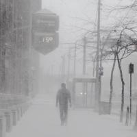
Merry Christmas. Halfway decent storm here last night. Very strong gusts, a few trees down in Lakewood and some power outages too. If no more snow falls the rest of December, this will be the least snowiest December for anyone who is younger than their 80s.
-
And now a severe thunderstorm watch on Christmas Eve and 59 degrees. Just
-
The amount of rain progged to fall with the storm keeps getting slashed as well. Some models just showing a few tenths now. All in all, CLE won't be running a snowfall deficit until New Years (assuming no snow falls til then) so it's not like this winter is necessarily off to a bad start when you look at Nov and Dec combined, even though December was/is a disaster. The one plus is that we have a wide open lake so lake effect chances are extended.
-
If I'm looking at today's Euro correctly, I see the 60 degree surface temp creeping into northern Ohio on Christmas Eve .. Ouch
-
At this point, we'd need a Christmas miracle to get snow. Nonetheless it's been interesting to watch the completely different solutions unfold with each run. Also, 2 things to continue to watch out for: CLE needs to end the month with less than 2.8" of snow to make the bottom 10 snowiest Decembers. Sadly, this looks completely doable. And CLE needs to get another 0.93" of liquid equivalent to crack another top 10 wettest year. Rain chances look pretty high on Tues and Weds, but will it be enough? This one will come down to the wire. This December has been truly abysmal weather wise, endless clouds, no snow, drizzle every couple days, and useless temperatures.
-
At least there weren't many solutions that showed a decent hit for here. LES potential looks grim now as the westward trend continues, setting up a SW flow in its wake. WHICHEVER MODEL YOU BELIEVE FORECAST IS STILL THE SAME. RAIN ON WEDNESDAY CHANGING TO A MIX OF RAIN AND SNOW WEDNESDAY EVENING THEN TO SNOW SHOWERS OVERNIGHT. BY CHRISTMAS MORNING THE 850MB TEMPS PLUNGE TO -9C AND THE LAKE EFFECT SNOW MACHINE BEGINS. BUT WITH A SOUTHWEST FLOW BUFFALO WILL GET THE BULK OF THE LAKE EFFECT SNOW.
-
I had to brush a dusting of snow off my car too earlier this evening. However it's actually switched over to a light drizzle/freezing drizzle. Regardless of where that storm hits next week, the LES machines will be firing up. Impossible to even take a stab whether we'll be fortunate to have west/northwest winds. It seems we'd want this storm to bomb out north or east of Ottawa, anything northwest of there would probably result in southwest winds locally, keeping LES out of NE Ohio.
-
We are surely paying this month for last month's near record snowfall. CLE is now an inch away from making another top 10 wettest year. Looks like it will come down to the wire. I'd hope it'd be a snowstorm that puts us over the top, but sadly a Christmas Eve rainstorm is just as likely.
-
Part 2 of the discussion. Hopefully Lake Erie cooperates this season with the occasional app runner thrown in.
-

Alaska/Western Canada obs and discussion
Trent replied to patrick7032's topic in Central/Western States
I'm thinking of flying up to Fairbanks in late October to hopefully catch the Auroras. With the trend towards el nino this fall, how will that play out for the start to the snow season up there? I was looking at some of the F6's for Fairbanks and it appears the snow generally doesn't start to accumulate until the last week of October. Ideally, I'd like to fly up there for that brief period where it's not bitterly cold, there's still some daylight, a bit of snow on the ground, yet good weather for potential Aurora viewing. Perhaps it's pie in the sky, but is October good for that, or would November be better?