
Trent
-
Posts
2,813 -
Joined
-
Last visited
Content Type
Profiles
Blogs
Forums
American Weather
Media Demo
Store
Gallery
Everything posted by Trent
-
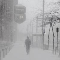
Had 10.5" when I left for work this morning. Definitely an unusual storm for Cleveland. Odd to have 10 inches of cement that instantly freezes the next day.
-
I've dropped down to 29 and it looks like the last of the precip on radar is probably a few hours off. Should avoid mixing here. Unless there's some back building of the snow or a lake flare up, this might be over by midnight.
-
This will be my largest storm since February 2011. I can't remember the date, but there were a couple decent storms that month and early March. This is also a very easy storm to measure. There's been minimal wind. I can see variations from those not clearing snow boards as compaction has surely dropped some totals by an inch or so. I cleared my board this morning and then again tonight. I'm wondering if we see some lake enhanced flare up before dawn as the winds shift?
-
The format CLE uses with the report twice a day between 7 and 9 pm causes funky reports. I wish during events like this they'd just send out continual updates to storm totals. Many of the reports would be just new snow since 9am. Many areas already had 2" by then.
-
Up to 8.5" of cement like snow. This will freeze up solid tomorrow. Sure areas to our north and west are getting slammed with temps in the teens and high ratios, but you just have to enjoy what you get. Looks like the euro wins again and the NAM and GFS were too warm. Double digits is easily reachable now. Even if we do mix, should be minimal and the accumulations we've received so far are still impressive. I'm sure CLE will come in with a low ball total, but that's par for the course. Temps IMBY have actually been dropping off now, hopefully that means the low is farther south than expected, but a quick surge into the mid 30s wouldn't be a shock considering how typical that is.
-
I'm shocked that I just measured a little over 7" outside. Radar looks great but it's a very heavy wet snow right now, ratios have to be below 10:1. We'll see how accumulations go the rest of the night, but this is nice surprise for an "un-bust". Just cleared the snowboard so we'll see how much piles up overnight.
-
Just measured 5.8" imby
-
Inch per hour rates at CLE for the past 4 consecutive hours. Oddly the snow depth didn't rise for one of those hours. KCLE 011951Z 09007KT 1/4SM SN FZFG FEW004 OVC011 M01/M02 A2991 RMK AO2 SLP136 SNINCR 1/5 P0005 T10061017 $ KCLE 011933Z 09007KT 1/2SM SN FZFG FEW006 OVC014 M01/M02 A2992 RMK AO2 P0002 T10061017 $ KCLE 011912Z 09006KT 3/4SM -SN BR FEW006 OVC016 M01/M02 A2994 RMK AO2 P0001 T10061017 $ KCLE 011851Z 09006KT 1/2SM SN FZFG FEW005 OVC013 M01/M02 A2995 RMK AO2 SLP151 SNINCR 1/4 P0004 T10061017 $ KCLE 011844Z 09007KT 1/2SM SN FZFG FEW005 OVC013 M01/M02 A2995 RMK AO2 P0003 T10061017 $ KCLE 011833Z 09006KT 3/4SM -SN BR FEW005 OVC015 M01/M02 A2996 RMK AO2 P0002 T10061017 $ KCLE 011751Z 07008KT 1/2SM -SN FZFG FEW004 OVC013 M01/M02 A3000 RMK AO2 PRESFR SLP165 60018 P0005 4/004 933005 SNINCR 1/4 T10111022 11006 21017 58037 $ KCLE 011737Z 07006KT 1/2SM -SN FZFG FEW004 OVC011 M01/M02 A3002 RMK AO2 P0004 T10111022 $ KCLE 011651Z 10006KT 1/4SM SN FZFG FEW005 OVC008 M01/M02 A3006 RMK AO2 PRESFR SLP187 SNINCR 1/3 P0004 T10111022 $ KCLE 011629Z 10004KT 1/2SM SN FZFG FEW006 OVC014 M01/M02 A3008 RMK AO2 P0001 T10111022 $ KCLE 011622Z 10004KT 1/2SM -SN FZFG VV014 M01/M02 A3009 RMK AO2 P0001 T10111022 $ KCLE 011551Z 12005KT 3/4SM -SN BR VV016 M01/M02 A3011 RMK AO2 SLP203 P0003 T10111022 $ KCLE 011546Z 12005KT 3/4SM SN BR VV016 M01/M02 A3011 RMK AO2 P0002 $ KCLE 011535Z 13005KT 1/2SM SN FZFG VV014 M01/M02 A3011 RMK AO2 P0002 T10111022 $
-
Insane rates right now. Even if we switch over to rain/mix overnight, the first half is over performing nicely.
-
Just measured 3.5" here. Flake size is huge and it's a heavy wet snowfall. So far seems better than expected.
-
Looks good. I think 6" is definitely reachable for the northern parts, especially since 2-3" has already fallen. The question is how much mixing and for how many hours tonight that will result in getting totals near the higher end. When it comes to snow, I've quickly become a pessimist over the years. It's not hard after we've been burned dozens of times over the past 5 years or so with scenarios that play out just like to today, slow trends north or slow trends south. It was on Friday that the CLE AFD was still mentioning the best snows in the extreme southern part of their CWA, that band has now easily shifted over 150 miles northward. I'm glad I never bought the hype and with every run that looked golden for us I knew that would change. If 6 or 7" of snow falls, that's an awesome storm, but seeing that there'll be twice that not too far away does sting, especially after last winter where we were fringed by every storm in a similar way.
-
Snow outside is performing as expected, if not better. Nice big fat flakes that are accumulating quickly. Radar looks pretty good for the next few hours before the dry slot starts to encroach. Temperatures are tricky and we'll have to watch where the rain/snow line starts to set up to our south and west and how quickly it advances northeastward.
-
The 6z NAM had 0.60" liquid with a brief hour of sleet mixing in The 6z GFS had 0.82" liquid with a brief changeover to rain in the middle Ratios for us riding the line between snow and slop shouldn't be too impressive. Factoring in mix potential for both models, the NAM is 4-6" and the GFS is 6-8". I'm sure some outputs are showing super high snow ratios, and thus higher totals, but I'm not buying that for areas so close to the mix line.
-
We're basically riding the line between a significant snowstorm and a major miss. It's quite possible that immediate lakeshore areas could pull off a foot and areas in Summit county struggle to get 3 or 4". Looking at the forecasted temperature gradient maps throughout the storm, the temperatures fall off quickly in a matter of miles. It's quite possible that Lorain could be at 20 degrees and parts of Northern Summit are in the mid 30s during the height of the storm. That's why every little adjustment to the low pressure track will be key. Normally I'd feel confident having the Euro on my side, but considering its performance in the NE last week, it isn't that reassuring. I think the model change from last night's 0z runs to this morning's 6z runs was the biggest drop off in snowfall totals since they first started showing a storm hit for N Ohio. The NAM cut snowfall by about 40% in just one run. The GFS dipped about 20%. The other positive thing to keep in mind is potential lake enhancement as the storm passes by. None of the models caught the snowfall from the mostly frozen lake on Thursday night into Friday morning. They are also likely going to under do it for tonight into tomorrow as well. We could see the radar light up with that "green blob" as the storm is about to end and potentially salvage any missed accumulations to dry slot/mixing issues.
-
We've seen this happen over and over again. That's why I never got excited for this storm. Model trends were once again terrible overnight. I don't think the models have produced a stable track for two runs in a row, which should have been a telling sign for the pro mets when making forecasts. I laughed last night watching local media outlets show numbers like 15" for Cleveland. Pure hype to fuel ratings. The plus side is that the Euro last night was still a major hit for the northern counties with about a foot. The NAM has dropped down to about 4-6" for the Cleveland area, with the GFS in the 6-8" range. These totals continue to decrease every 6 hours with the latest runs. Snow has started now and light accumulations of about 0.5-1.0" have occurred. It's basically nowcast time, but pessimism rules. I'm having flashbacks to Jan 4-5 last year when Cleveland couldn't even pull off an inch from that storm with winter storm warnings for 8"+ remaining in place to the bitter end.
-
The trend is not our friend. The bleeding just doesn't stop as each run inches a hair to the north. If you extrapolate each northward trend through tomorrow we definitely dry slot and get mixing issues. We'll likely get fringed again with this system, just like last winter. Not to say we can't get decent accumulations, but this has garden variety snowstorm written all over it now.
-
NAM has about 1.2" liquid at CLE and all snow. That's a healthy snowstorm, but there isn't any breathing room left. Reminds me of the trends of winter's past when everything trended NW for days including nowcasting radar returns to the NW. I'm glad I've tempered my expectations with this storm, this could easily bust into 1-3" of snow into the day tomorrow, a dry slot and some drizzle in the evening, before some wrap around snow drops another 3-4" for a total of 4-7". Here's to hoping for a slightly weaker system that's a few more miles south!
-
If you run the NAM simulated radar reflectivity, you can also see a "dry slot" trying to work it's way towards Akron. Any shift NW and that will kill snowfall totals drastically. Verbatim, the NAM is a solid hit for the northern counties of Ohio. The winds really start to crank too. I wonder if CLE will pull the trigger on a blizzard warning for lakeshore areas. And just for fun, here's the cobb output for the NAM which applies some eye candy snow ratios: http://www.meteor.iastate.edu/~ckarsten/bufkit/data/cobb_nam/nam_kcle.dat That has a zero percent chance of verifying, but fun to look at anyway.
-
Toledo and NW Ohio looks golden! There's no denying that there's been a slow NW shift with the storm each run. We are starting to run out of breathing room before mixing issues become a problem in NE Ohio. Right now the lakeshore areas should max out around 30 Sunday afternoon and fall quickly afterwards. QPF looks like a solid 1" on most models. Taking a 30% reduction and applying a straight 10:1 ratio still gives most areas 7-10" of snow. Perhaps ratios will play out much higher, but it's one of those aspects of a storm that you can easily get burned on.
-
It's really easy to get caught up in those snowfall maps posted everywhere, but those are all ratio induced. The QPF maxima is still in a band across IL, through N IN, and N OH on most models. If you take a 30% cut off some of the higher QPF totals and apply a modest 10-12:1 ratio, then storm totals of 8-10" seem reasonable.
-
The one positive to this storm compared to some of the past season's 8-12" snowstorm busts is that this is long duration light snows. Previous busted forecasts had relied on a window of 1-2" per hour rates for 4-6 hours, which is very difficult. If we can get 0.3"-0.6" per hour snows strung out over 15 hours, I can see us getting 8" or so across a widespread area. The model means still look great for us, we can afford some wobble north or south.
-
I will remain on the cautious side. How many times over the past few winters have we been tortured with model runs 48 hours out promising the largest synoptic storm in 5 years only to wind up with another run of the mill 4-6" storm? The drill goes as follows, storm pops up several days out and looks promising. Then in the 48-60 hour range the models have their most juiced up runs. The NWS and media start to hype up totals and watches go out. The next few runs drop QPF by 0.05" to 0.10", not noticeable until several runs stack up. By the start of the storm QPF is in the 0.60" range and we hope that ratios will help get totals close to 10". In the end the storm ends up being drier and less intense, ratios don't pan out and the storm total is 4-7" for most folks. I'm setting my expectations for 5" with this storm. Call me a pessimist but the vast majority of "significant" storms that are modeled like this a few days out never pan out as significant as modeled.
-
Anyone see the blurb in the AFD about the best snows on Sunday being south of the US 30 corridor? With the way the models have flipped flopped all winter there's no way you can pin down an exact snowfall swath 50 hours out. At least we have some breathing room on either side. What are the odds this ends up being a whiff to the north?
-
Nice little band of snow last night with the lake effect/enhanced flare up overnight. Looks like the traditional lake belts with some upslope probably had some nice accumulations considering the frozen lake. As for Sunday, hard to believe that the Euro, NAM, and GFS all jackpot northern Ohio with snow starting within 48 hours. It's been a LONG time since we've had one of these types of bowling ball snow set ups for these parts. Don't want to jinx it, but these tend to have less mixing worries for lakeshore counties.
-
I haven't bought the airport's snow totals the last few days as they haven't looked right at all. The normal observer must be out of town. I'm a few miles north and have 4" on the ground.
