

jpeters3
-
Posts
736 -
Joined
-
Last visited
Content Type
Profiles
Blogs
Forums
American Weather
Media Demo
Store
Gallery
Posts posted by jpeters3
-
-
Just now, Bob's Burgers said:

Yep. There she blows.
-
 1
1
-
-
-
Confirmed, wedge on his feed.
-
Just now, Bob's Burgers said:
Link?
-
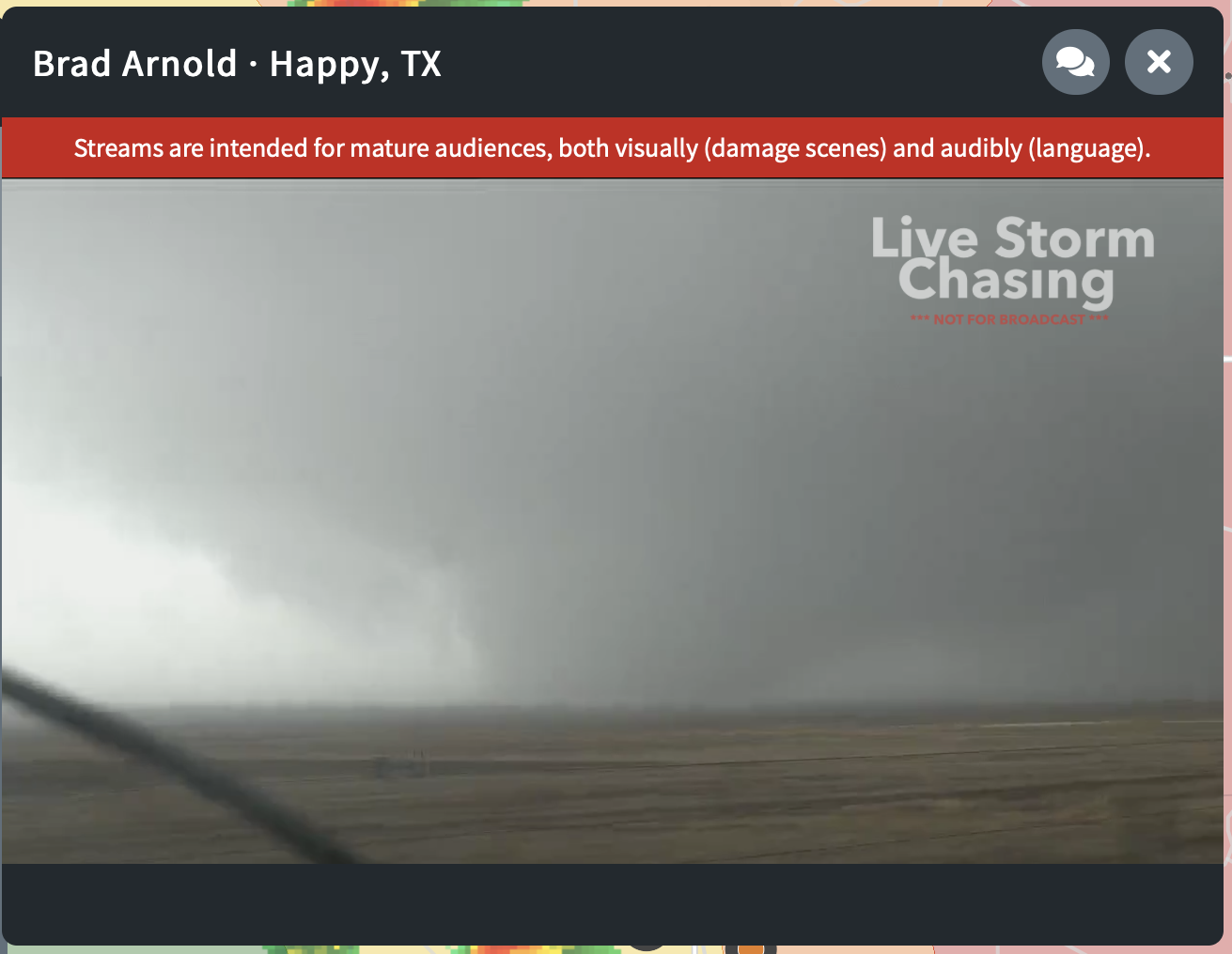
looks like Brad Arnold almost just got hit by a wedge...
Hard to tell from his vantage, but very large cone tornado passed right near him. -
Just now, Floydbuster said:
Why have three recons turned around in 24 hrs? What in the world??
Just now, StormChaser4Life said:Seriously....why?!
Evil exists.
-
 1
1
-
-
1 minute ago, Windspeed said:
Some left the party too fast. lol... Eta is still reaching for peak.
Still here

-
Eye sonde 928 mb at 17 kts. So ~925-927 sounds about right.
-
2
-
-
Just now, JasonOH said:
That north eyewall didn't have a surface report though. We only know the last report was at 929mb before it cut out.
Ahhh, got it.
-
Wait, 929 mb at 75 kt??? Something smells fishy here. Methinks they didn't hit the center.
-
Just now, the ghost of leroy said:
call me a traditionalist but gilbert and allen kinda slay what comes after...just based on looks...
Gilbert at peak.

-
2
-
-
I guess there is a reason why they cap the rate of T increase. Who would have known...
-
1
-
-
Well the actual Dvorak numbers weren't that high. Everyone was ejaculating all over the raw Ts.
-
 1
1
-
-
I guess this means trump will win the election
-
9
-
 10
10
-
2
-
-
I'm not even mad, I'm kind of impressed.
-
1
-
-
Just now, the ghost of leroy said:
biggest call of jpeters career...how will it end up?
Gets letter in the mail a few days later. <FIRED>
-
7
-
-
Nice comparison:
-
Just now, the ghost of leroy said:
i love how hard you're going.

-
Highest Raw T on Patricia was 8.3
-
FWIW, highest raw T on Goni was 8.0. We are at 8.4 on eta right now.
-
5
-
-
i maintain 882/170 kt
-
2
-
1
-
-
Raw T to 8.2
-
1
-
-
I'll be the first to say it - there is nothing different about this satellite presentation than that of Wilma/Patricia. Perfect pinhole eye surrounded by thick moat of -85 < C cloud tops.
-
5
-
-
revising to 880, 170 kt.
-
1
-
March 17-18 Severe Weather Event
in Southeastern States
Posted
I think the main question is storm mode. CAMS seem to be trending toward a classic southeastern US "grunge fest" with widespread nonsupercellular convection in the warm sector, and a QLCS along the front. This could therefore pan out like 5-20-19 in the plains, with an impressive environment but a lack of tornadic supercells.