Allsnow
-
Posts
26,462 -
Joined
-
Last visited
Content Type
Profiles
Blogs
Forums
American Weather
Media Demo
Store
Gallery
Everything posted by Allsnow
-

December 2020 General Discussions & Observations Thread
Allsnow replied to bluewave's topic in New York City Metro
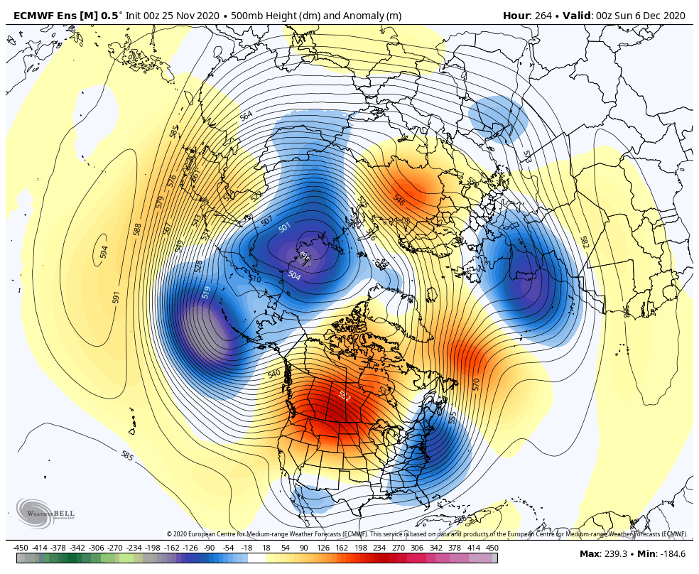
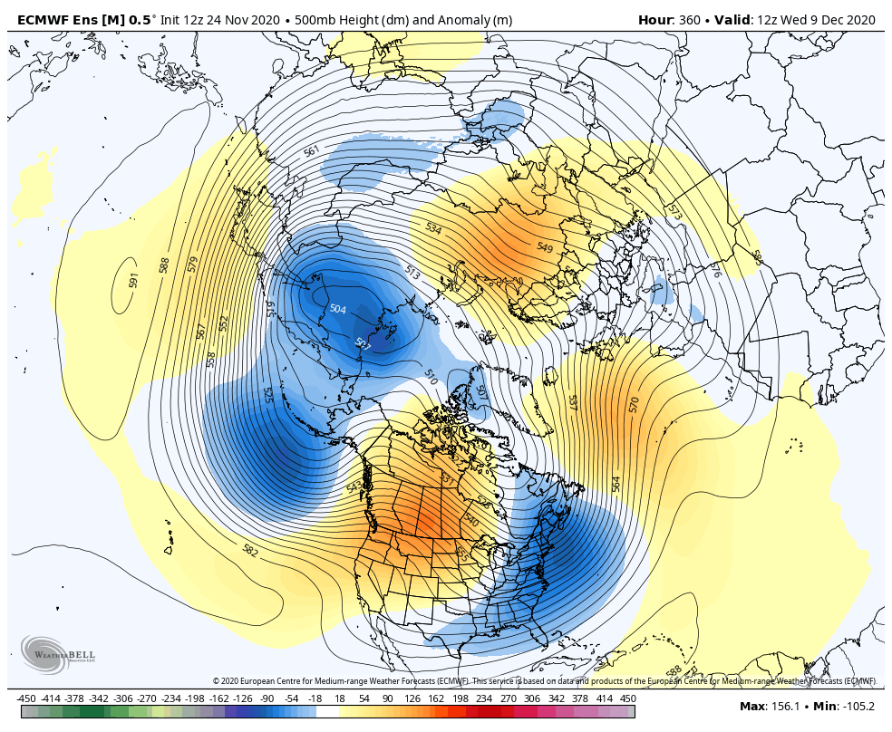
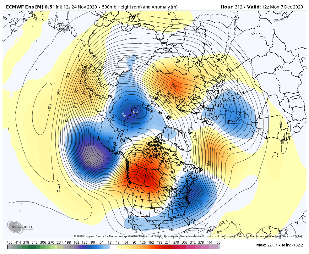
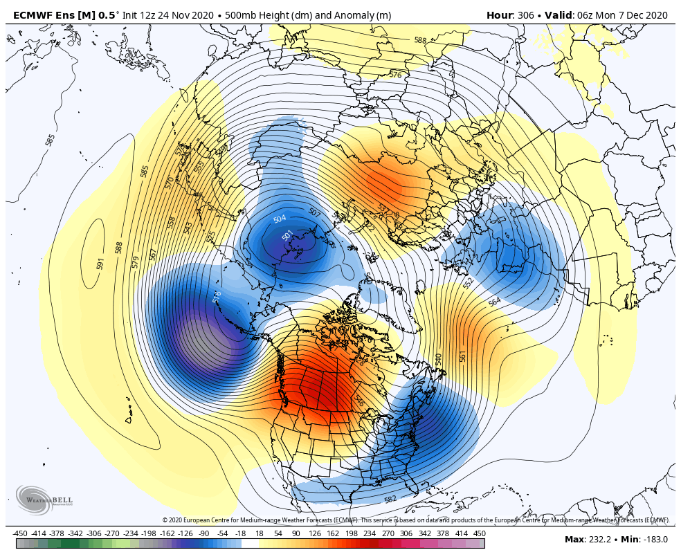
This is what I mean with the ridge moving west and establishing a cross Polar flow/-epo. All the ensembles don’t roll the ridge over which would pump the southeast ridge. -
December 2020 General Discussions & Observations Thread
Allsnow replied to bluewave's topic in New York City Metro
-
December 2020 General Discussions & Observations Thread
Allsnow replied to bluewave's topic in New York City Metro
-
December 2020 General Discussions & Observations Thread
Allsnow replied to bluewave's topic in New York City Metro
I think our best shot of snow will be as the pna ridge starts to retrograde west into Ak. This will allow colder air to enter the eastern US. With a active southern jet and colder air in Canada we will have our chances. I welcome this pattern change as it’s diff then anything we have seen in the last two years. -
I think our best shot is when the pna ridge starts to move west. It will allow colder air into Canada and the southeast ridge will still be a bay, at least at first.
-
You’re definitely correct. It’s starting the fade the Aleutian low as hgts back into Ak. That could be good (see GEFS geps) or its a bit muted like the eps. Just need to see if it goes further west into the Aleutians which would be standard Niña. This might be a response from the mjo getting into p5/6
-
December 2020 General Discussions & Observations Thread
Allsnow replied to bluewave's topic in New York City Metro
Could make the end of December and January colder if it continues into the colder phases. -
December 2020 General Discussions & Observations Thread
Allsnow replied to bluewave's topic in New York City Metro
-
December 2020 General Discussions & Observations Thread
Allsnow replied to bluewave's topic in New York City Metro
Drool worthy look to start December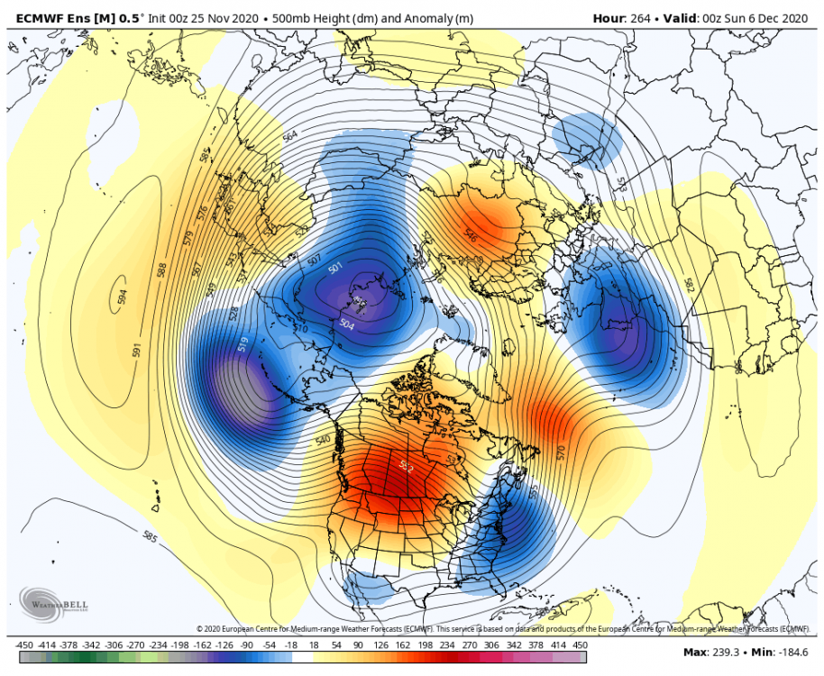
-
December 2020 General Discussions & Observations Thread
Allsnow replied to bluewave's topic in New York City Metro
The first one off the pna spike will definitely go west of us. After the 1 week of December I believe are chances of a snowstorm will be higher. The one around the 5/6th is our first chance. -
December 2020 General Discussions & Observations Thread
Allsnow replied to bluewave's topic in New York City Metro
-
December 2020 General Discussions & Observations Thread
Allsnow replied to bluewave's topic in New York City Metro
-
Yeah. Definitely. Ventrice thinks it might be from a Siberian ssw?
-
December 2020 General Discussions & Observations Thread
Allsnow replied to bluewave's topic in New York City Metro
-
December 2020 General Discussions & Observations Thread
Allsnow replied to bluewave's topic in New York City Metro
-
-
-
Crazy. It only took two years of waiting. What is causing this look? Warm pool off the west coast? Mjo in cod?
-
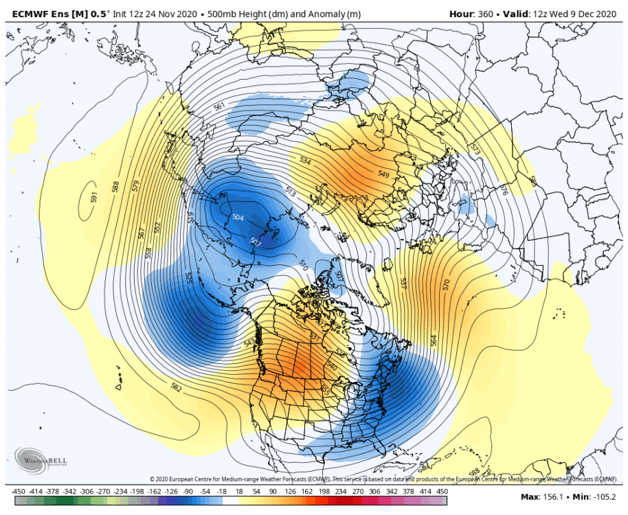
@Isotherm what do you think is causing this niño response? Mjo with weak convection in P7? Or the warm pool off the west coast? Aleutian low/++pna/-nao is textbook niño December
-
-
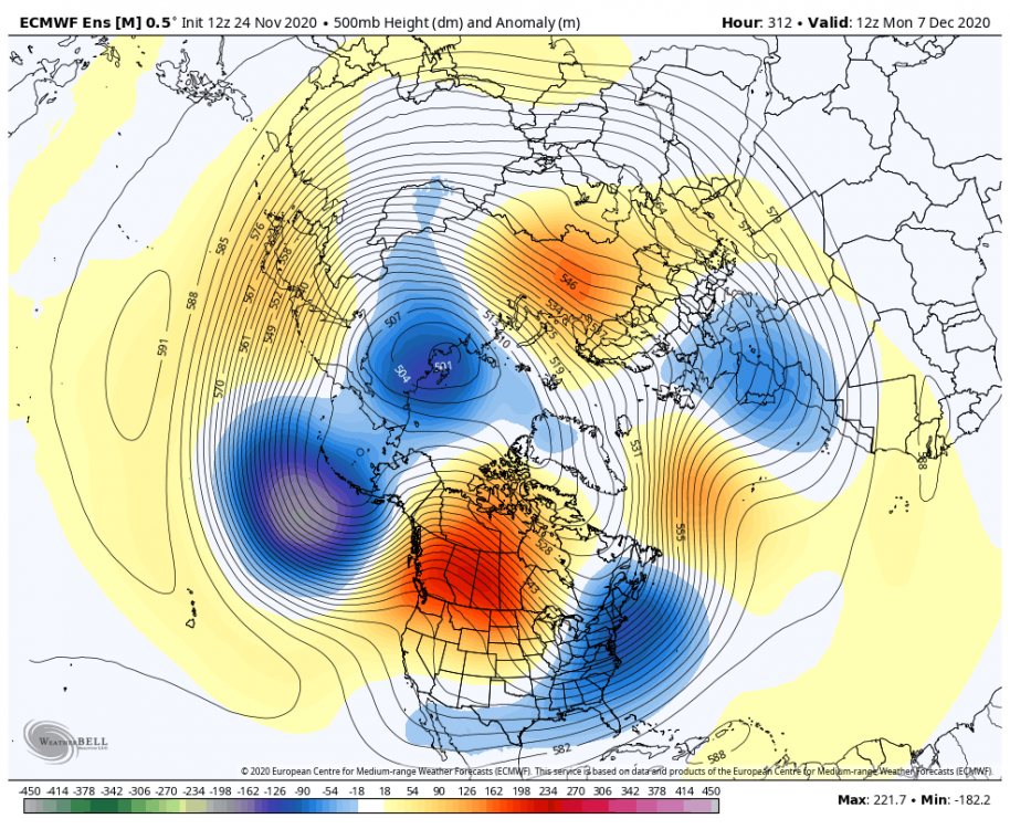
Just keeps getting better.
-
Wow.
-
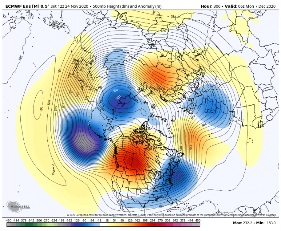
Eps doing the same
-
Yeah, looks like we start to cool Canada at the end of the run. That’s a pretty abrupt change on the weeklies for the first half of December. Last Friday it pretty much a Niña pattern for the month of December