
CoolHandMike
-
Posts
1,645 -
Joined
-
Last visited
Content Type
Profiles
Blogs
Forums
American Weather
Media Demo
Store
Gallery
Everything posted by CoolHandMike
-
 Miss being local to you, Lady Di. Nice to see you still posting here.
- 487 replies
-
- 1
-

-
- hurricane
- flooding potential
- (and 2 more)
-
Rates picking back up near me.
-
Perents checked in. Just heavy rain, they were out wrangling horses (i really wish they would retire already). Pastures are flooded. They are out by Lincoln U so this would have been to their NW.
- 487 replies
-
- 1
-

-
- hurricane
- flooding potential
- (and 2 more)
-
Parents are in Oxford. Waiting to hear back from them...
-
LOL what is that? Looks like a Homermobile storm chaser.
- 487 replies
-
- 3
-

-
-
- hurricane
- flooding potential
- (and 2 more)
-
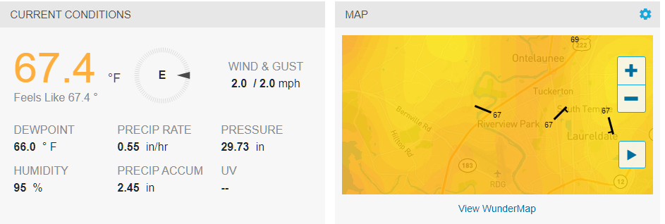
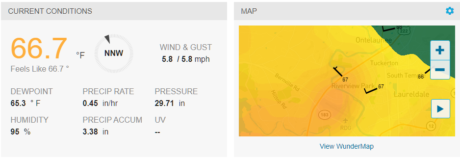
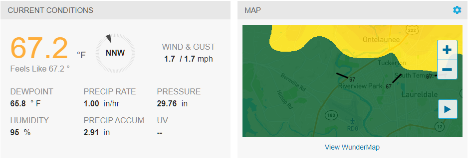
1"/hour for the last hour. Rates should back down a little bit now. Almost 3" for the day.
- 487 replies
-
- 1
-
-
- hurricane
- flooding potential
- (and 2 more)
-
Oh yeah. I've been low-key checking what my drive home would look like, so far it's almost up around 2 hours with several crashes and red zones on Google maps. Just hit .8"/hr rates here.
-
I'm totally heading out for a Garage Beer™ at 5pm if this heavy rain holds up. Over .5"/hour rates here again.
-
Just broached .5"/hr rates here. Up to 1.74" on the day. It's coming.
-
Oh yeah. We're on a bit of a hill top with excellent drainage, but there will definitely be some water rescues at the normal spots this evening I think. Oh, and schools let out early, so there's that.
-
This. I really wish we had even a smaller regional one at Reading, it would fill in the gap nicely.
-
Low level clouds are really moving right now from east to west. Starting to notice a bit of a breeze picking up. Temp down to 67.8°F and pressure has been dropping precipitously for the past 1.5 hours.
-
Temp down to 67 here. Lovely way to start September. I read that Blue Marsh has been lowering the reservoir to help alleviate flooding; I live near the Skook and I'm thinking about taking a drive to see how it's looking. We've only received about an inch though so shouldn't be too bad. In other news, @Hurricane Agnes, the stew is making the house smell crazy good right now.
-
Interesting stuff already apparent on the velocity radar out in western Berks. A still image doesn't really do it justice, and there's a lot of noise, but check it out:
-
Was waiting for that. I'll be glued to the radar all afternoon now. Not really a bad thing
-
.2" in the bucket thus far this morning. Beef stew going in the crockpot for tonight's dinner in celebration of it not being August anymore. FWIW, we had 34 days at or above 90°F for JJA according to my PWS. 7.56" for August and 15.39" total. Collected a lot of useful data; maybe later today or this weekend I'll put together another temp/DP comparison for different stations around our region.

-
Yeah that's no for me. I'd be half-way into my 1.5 hour drive right now going through some of those heavy returns around West Chester. Dodging semi's and idiot, half-awake drivers in heavy rain is not my idea of fun. Thankfully my site sup understands completely. Oh, there's a Fall thread up? YES. See ya all there!
-
Gonna wake up in 6 hours and make the call for whether or not I drive to SNJ for work. Risking going in and not being able to get home if the majority of this falls around evening rush, but I don't want to sit at home all day while it sprinkles either. What to do, what to do...
-
WU says the rates really pick up in the afternoon but as much as an inch might have already fallen by then. Tomorrow's evening rush is going to be a mess.
-
Well dang, we broke 90 again for a little longer, reached 91.2°F right at 4pm. Ok August, you get one more day. Then you're done. September, I'm looking at you--let's keep it in the 80's for now, ok? OK???

-
Clouds gave way and we just peaked at 90.1°F just ten minutes ago, back down to 89 now. Glad work got cut short today!
-
I already told my supervisor at work that if this happens Wednesday into Thursday that I'll be working from home on Thursday. No way I'm driving to SNJ and back amidst all of that.
- 487 replies
-
- 1
-

-
- hurricane
- flooding potential
- (and 2 more)
-
Work got cut short today so I'm back home. Drove through lots of misty fog going south through Exton around 5am. On my way back around 7, the sun broke through right as I got on the turnpike north of Exton but it then clouded up pretty quick as I got towards Reading. Kinda hoping it stays this way all day.
-
Timmer's stream seems to have gone down. Probably due to cell tower outages. Hopefully.