

coastalplainsnowman
-
Posts
986 -
Joined
-
Last visited
Content Type
Profiles
Blogs
Forums
American Weather
Media Demo
Store
Gallery
Everything posted by coastalplainsnowman
-
OBS and nowcast mainly midnight - Noon Thursday Feb 11
coastalplainsnowman replied to wdrag's topic in New York City Metro
Coming down pretty nicely here. I never learned how to eyeball light vs. med. vs. heavy, but I'll call this the low end of moderate. -
Obs and nowcast Super Bowl Sunday 4A-6P Feb 7, 2021
coastalplainsnowman replied to wdrag's topic in New York City Metro
Not sure how much we got here - I'll leave it to the spotters, but I'm guessing between 6 and 8. A few thoughts: - A lot of lifetime snow enthusiasts were created today. Between the "hunkered down for the Super Bowl" mood, and the postcard-like snow, this sort of storm is probably the reason most of us are here. - The evening sun and bluish sky while it was still snowing (and accumulating) was a first. I don't know if there's such a thing as a "snowbow", but I thought I was about to find out. - Usually, regardless of the storm, I feel like the snow never accumulates like I expect it to. Today was the opposite. Much of the time the snow looked light, yet it was accumulating before my eyes. - To Walt and everyone else who started talking about this last Sunday, great job with your reasoned, thorough, enjoyable discussions. They are much better than I deserve to get for free, that's for sure. I only wish I'd asked for your predictions for SB 55. Have a great night all. -
Obs and nowcast Super Bowl Sunday 4A-6P Feb 7, 2021
coastalplainsnowman replied to wdrag's topic in New York City Metro
Hey there SW Suffolk. We are right on the battle line at the moment. Literally each time I look up from my book the precip type is different but def trending snowier as cautiously expected. Intensity is up for sure now. -
Obs and nowcast Super Bowl Sunday 4A-6P Feb 7, 2021
coastalplainsnowman replied to wdrag's topic in New York City Metro
Super light precip in SE Nassau by Sunrise. Mostly liquid with occasional wandering fat flake. Little intrusion of ‘green’ depicted well on snow/rain radar. Just an obs - I know we just started. -
I attribute it more to a combination of satisfaction and fatigue from last week's storm.. I know I feel it myself. 4-8, 3-6, heck 2-3 - if it was the first snow of the season, or if last week hadn't happened, it'd be busier here.
-
Looking at the Upton's forecast and the Probabilistic Winter Weather Forecasts page, its interesting to see that there's almost no difference between the expected forecast and the 90% chance (high end) forecast, whereas the 10% chance (low end) forecast has most locations at zero, and only Montauk and Westhampton seeing 2". I always figured, not knowing any better that the 10 and 90% forecasts would typically reflect some sort of bell curve distribution, and while they are not always like that, this one struck me as unusual. Would be really interested in what skew means. From a layman's standpoint I assume it means that lot of things need to fall into place for this to pan out, but then why wouldn't the expected forecast number be lower? Would appreciate any insight. Thanks.
-
I'm sure, but you're not supposed to say that out loud here On LI we always have that rain threat in the back of our minds, keeping us from truly enjoying the runup to the big events until they are halfway done. Even on this latest storm you can see how it is gonna do its darndest to get that four letter word into the picture.
-
Anyone else find it interesting that despite the phenomenal seasonal snowfall totals we've had around here, even including 1995/1996, that we haven't cracked this list? Maybe because a lot of our recent great seasons have occurred without exceptional cold, and it's harder to thread the needle twice in a week in such conditions? Edit: I'll get back in my lane now lol
-
Hi Don, all, I have only my memory to go by , but I believe that February 8 and February 11 1994 (a Tuesday / Friday) had back to back 8"+ snowfall, at least for Nassau. This is my best recollection of significant back to back snowstorms going back to at least the mid 80s. It might not meet the 10" followed by 6", but if it's not, it probably just missed.
-
I just read that people are in an uproar because yesterday's 'livestreamed' viewing of the Staten Island groundhog, Chuck, was actually pre-recorded, apparently on an earlier day, since keen observers noted that there was no snow on the ground. Well now that's just ridiculous and unscientific! Remember that this is the same public that gets upset when a snow forecast is off by a few inches.
-
Hi thanks for the response. Your point re thunderstorms is exactly right. Naturally there's more interest in snow given the usually longer term impact when it falls, but that doesn't make it any easier to pinpoint. Anyhow, looking forward to the next potential this coming weekend. Thanks again.
-
Stating the obvious, but looking at a map like the above makes it so clear what the models and the mets have cut out for them trying to forecast a storm like this, when you see how that 4-6 runs up the coast in NJ, meanwhile 30 miles to the NE across the Atlantic, the south shore of Nassau is at 12+. To be able to predict anything close to that as has been done, is impressive. Then look at how that r/s line lined up beneath LI in Nassau, nudging north onto land in Suffolk as you go east. That thing's been predicted by many here for three or four days. Even going back to wdrag creating the original thread a week ago! I know you guys set the bar high for yourselves, but that's pretty cool. We take for granted like it's common knowledge that this storm would form off the coast as it did, where it did, when it did, right on schedule. You all have a thankless job. Ok, that's all. As always, always a blast following these storms here.
- 1,925 replies
-
- 2
-

-
- heavy snow
- wind damage
- (and 1 more)
-
It's funny how most of us think on here. When I say something like what you said above to my family, they respond to the effect of "I don't understand. The people who get buried are the ones who get screwed."
- 2,424 replies
-
- 1
-
-
- heavy snow
- ice pellets
- (and 3 more)
-
For the long islanders, I know there a lot of folks here who like Joe Cioffi, myself included. I think he was posting here at one point (maybe is still posting here?) He's got LI at "at least 6-12" to the west, "at least 4-6" east. https://www.meteorologistjoecioffi.com/winter-storm-watch-long-island-sunday-night-into-tuesday-at-least-6-to-12-inches-forecast/
-
layman's question - is there any sort of measurement which depicts the variance among the members, in which a smaller number would indicate better agreement?
-
Agreed. Since the 2000s there have many times where LI was forecast to jackpot, and somehow the jackpot turned out to be north central/even north east jersey over into NY. LI did great too in these scenarios too (especially to folks with the 80s as a frame of reference), but still. Only exception I'd add is that magical north central suffolk area that has often rivaled those spots.
- 2,424 replies
-
- 3
-
-
- heavy snow
- ice pellets
- (and 3 more)
-
Yup. At least from 1979-1993 there wasn't the temptation to stay glued to the situation 24x7 (other than TWC, which even as a kid you knew that once you watched for 20 minutes straight there would be nothing new to hear for a few hours, so might as well go play outside.) As a kid/teen if I had the 24x7 access we have now I might not have graduated elementary, junior high, or high school on time, or held down a job during the winter months lol. Imagine working in a shopping mall and heading down to the TV department in the department store to catch the weatherman at 7:45PM sharp to see if there were any updates. In hindsight, I think that might have been a problem. 1970-1999 Long Island had about six (six!) total storms of a foot or more. The 2000-2016 was the reward for those of us who suffered before that.
-
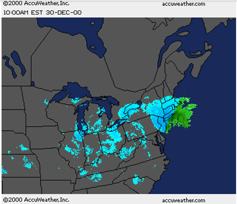
I'm real late to the party here, but I remember tracking this storm, begging the r/s line to stay away, and taking screenshots of the radar from the accuweather site. I took about 20 of these. Here's how dang close it got to me in SE Nassau:
-
Be careful putting stuff like this in writing until 2020 is in the rearview window please..
-
I found the above info here, just kind of stumbled across it https://www.timeanddate.com/astronomy/planets/great-conjunction. There may be more info there.. The whole topic is making me want to pickup astronomy/telescope hobby..
-
Personally, I'm looking forward to the 'great conjunction', when Jupiter will pass directly in front of Saturn. That will occur next on February 16, 7541 (seriously.) I'm hoping that if I diet and exercise I can be around to see it happen. By the way, if you're busy that day or if it is cloudy (does Accuweather's long range go out this far?), it happens again later that year on June 17th, 7541.
-
I see that this @#$% storm hitting on Christmas eve is going to bring with it temps in the #@$#% upper 50s/low 60s. What a surprise. This will be only the 10th straight year that the NYC area will hit least the upper 50s in the week before Christmas. Heck, in most of this timeframe the high for the week was in the 60s, even 70s in at least one of the years.
-
Sheesh, I went to bed cautiously optimistic about a nice classic 21st century LI snow - close to but on the safe size of the "rainger zone" (just coined that phrase now) only to see that things have de-escalated quickly for these parts. For the bulk of the 21st century LI managed to thread the needle and time and time again pull out these awesome snowstorms - nothing short of a freaking delightful phenomenon which never got old for those of us who grew up in the snow-starved 80s. Last few years though, the 80s seem to be rearing their ugly head with these 'rain for the coast' deals.
-
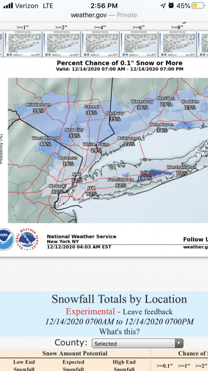
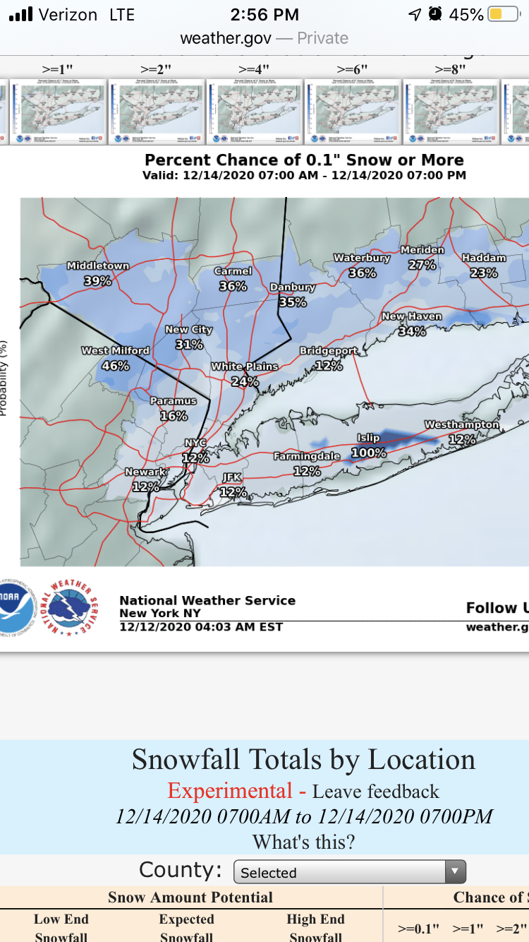
Hey what’s with Islip getting some sort of special treatment for Monday’s snow?