rochesterdave
-
Posts
6,707 -
Joined
-
Last visited
Content Type
Profiles
Blogs
Forums
American Weather
Media Demo
Store
Gallery
Posts posted by rochesterdave
-
-
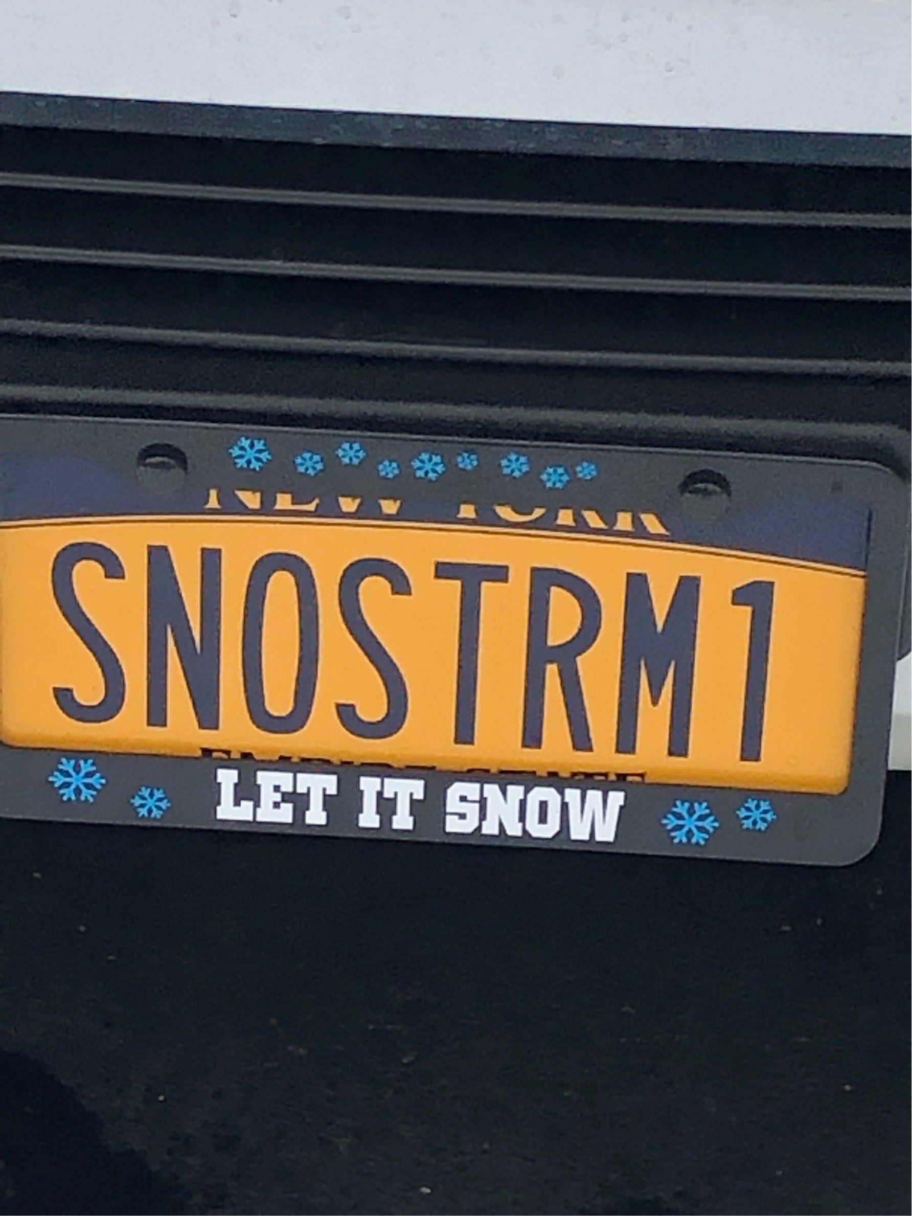
Here’s a shot in the arm for you ninnies
-
 1
1
-
 2
2
-
-
13 minutes ago, 96blizz said:
No I just am not enjoying the snow the way I used to. Full transparency is I loved to drink IPAs in the snow. I quit drinking nearly a year ago and it’s just not the same. That may sound sad but it’s my truth!
The good news is I’ve lost 30 pounds, am completely ripped and can dunk a basketball again on a 10’ rim at 6’1” and 42 years old.
And I’m as white as they come. Actually, whiter.
You were in your glory just a couple weeks ago. You don’t need IPA’s to enjoy snow (although it helps).
-
 1
1
-
-
3 minutes ago, Syrmax said:
3.5" overnight. This puts me over the 70" total. Closing in on last year's 78". Gonna be difficult as nothing looks to be on horizon but rain/snow mixes next 2 weeks.
Your constant negativity is really getting old
-
2
-
1
-
-
Almost 3” in Pittsford. Another winner. Trees are just caked.
-
6
-
-
Gorgeous snowfall. 31.5 and everything is pasted. Should be a beautiful morning. Gonna go for a JEB soon
")
-
3
-
-
I guess it’s down to me and Wolfie hoping on winter.
-
1
-
-
50 minutes ago, wolfie09 said:
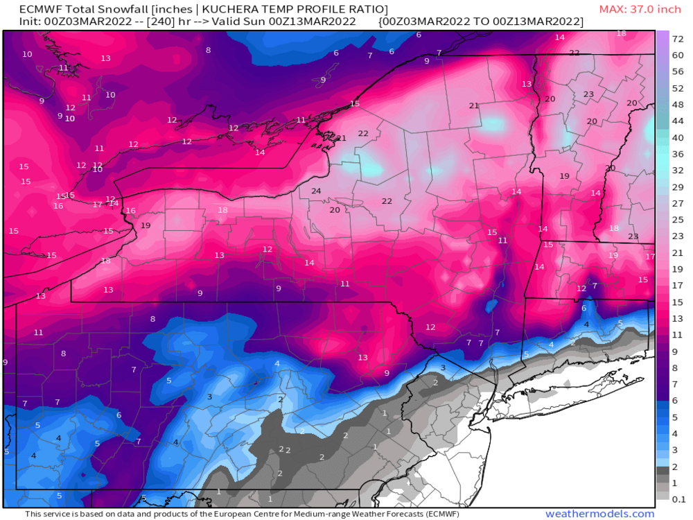
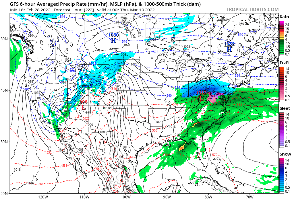
Lower forecast confidence for the closure of the weekend and the
first part of the new work week as the system from the weekend
departs interior Canada and heads into its maritimes placing a
stalled frontal boundary somewhere across the region. A new surface
low will ride northward along the boundary reaching the area
sometime between Sunday night and Monday morning. Model
discrepancies with this system include the location of the stalled
boundary and the timing of arrival of the new low. The location of
the stalled front plays a major dilemma with regards to
precipitation type. If the front stalls over the region, like the
GFS and Canadian suggest, the scenario for mostly rain Sunday night
through Monday with a switch over to snow late Monday night will be
favored. Additionally, more moisture will be available with this
system, which will make for QPF amounts to range from a half inch to
and inch. If this scenario becomes valid, flooding will definitely
become of concern. Whereas the outlier with this case, the ECMWF has
the boundary stalling further south of the region, filtering in the
cold air in faster and supports an all snow scenario.
Buf going the warm route. Shoot
-
1
-
-
11 minutes ago, Thinksnow18 said:
I’m late to the game but have been following the models all day…winter far from over on both models…in fact it might dig its heels in deeper
Yeah. I bet we get a big one out of this. The timing looks good for my ski trip on the 13th.
-
1
-
-
11 minutes ago, 96blizz said:
Sadly I am becoming less of a snow weenie. Especially once March hits.
I attribute this to quitting drinking. I look forward to the snow less now.
I suppose the net sum is quite positive but it’s nostalgically sad…
That is sad. I bet your love for it returns. Your location is prime for March events. WAY TOO SOON to think it’s Spring.
-
1
-
-
Just now, BuffaloWeather said:
Lets get a massive rare March LES event.
I envision you repacking away your shorts. A tear in your eye.
-
3
-
-
-
11 minutes ago, BuffaloWeather said:
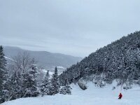
Heading up to Lake Placid again this weekend, this time with the boyz for some skiing on whiteface and hiking another peak. Looks like perfect conditions on Friday/Saturday up there. Sunny and 20-30 degrees with tons of fresh powder.

Awesome! Where are you staying?
-
1 minute ago, BuffaloWeather said:
GEFS are pretty snowy after this weekend.
The LR has just been awful. Maybe I get lucky, again!
-
10 minutes ago, DeltaT13 said:
Is this a typo? Rochester was warmer than Buffalo and Syracuse?
He meant colder
-
3
-
1
-
-
17 hours ago, DeltaT13 said:
This winter is a solid B for me, teetering on a B+. I have held at least a trace of snow on the ground everyday since January 3rd, with more than 1 inch on the ground for 56 days. Greater than 2 inches on the ground continuously since January 16th. So as a snowpack guy this is about as good as it gets. I chased a decent lake event in Buffalo and a couple real nice synoptic events here in KROC, one of them with absolutely insane rates, so I can't complain. Anyway, looks like the show is more or less over as we hit meteorological spring. We are hitting the peak acceleration of the day length sine wave now as the days are getting longer very quickly and the sun angle sky rockets. Thanks for the memories 2022!
I’m grateful for your record keeping. It verifies my gut feelings. Snow on the ground since January 3! That’s awesome. I think the Rochester record is 85 days.
-
1
-
-
36 minutes ago, BuffaloWeather said:
Rochester being 3.6 degrees warmer than Syracuse and 3.4 degs warmer than Buffalo is quite odd. I've said for awhile the ROC thermometer has run low while Buf/Syr have run warm. The truth is probably somewhere in the middle.
I’m telling you guys, it was straight up hardcore winter here. I totally buy it.
-
34 minutes ago, BuffaloWeather said:
Feb Stats:
BUF: +2.1
ROC: -1.3
WAT: +0.2
SYR: +2.3
BING: +0.7It wasn’t our imagination
-
9 hours ago, Blue Moon said:
Does anyone have any theories about why seasonal snowfall east of Lake Ontario has been well below average the past several seasons?
I believe global warming is a factor, but this stark change makes me think something else is influencing this. I believe the Pacific has really contributed to the deficit in our region. We have been lucky to get the polar jet in a favorable position to advect cold air from W-E over the Lake. For example, we had below average temps. for most of January but still finished well below normal in snowfall. I was hoping we would get a good dose of LES last month because the 13C temp. difference was favorable.
Still very new to this area so I appreciate the perspective from you all.
I mean the storm track and jet haven’t been favorable. You guys need storms to track to James Bay on Hudson Bay and sit and swirl which brings cold air in from the west. Lately, most of our storms have been progressive, they pop some cold air from the north and scoot out.
When I lived in Oswego in 91-93, they likewise had very little snow. But just inland did much better. I was super disappointed. I basically chose SUNY Oswego because of snow and in the end it felt like Rochester got more snow. -
1 hour ago, Leelee said:
B winter for me in Amherst. Compared to the last and first 2 winters I lived here with little snow, it was nice having a steady snowpack for 6 weeks finally. I wish a good LES event would have happened up here, but that requires a lot of ingredients falling in place.
I'd say Buffalo Metro and the airport is an A with the amount of big snows they got this season.
The further south of the city you go would be like a C to an F since this was an awful NW lake effect year.
It was truly an odd microclimate winter. The Tug is at a huge deficit, as is the southern tier and the Adirondacks. The Niagara frontier did well. Buf and Roc are near climo. Syracuse was terrible.
-
3
-
-
-
17 minutes ago, DeltaT13 said:
This winter is a solid B for me, teetering on a B+. I have held at least a trace of snow on the ground everyday since January 3rd, with more than 1 inch on the ground for 56 days. Greater than 2 inches on the ground continuously since January 16th. So as a snowpack guy this is about as good as it gets. I chased a decent lake event in Buffalo and a couple real nice synoptic events here in KROC, one of them with absolutely insane rates, so I can't complain. Anyway, looks like the show is more or less over as we hit meteorological spring. We are hitting the peak acceleration of the day length sine wave now as the days are getting longer very quickly and the sun angle sky rockets. Thanks for the memories 2022!
After the last 3 winters I’m looking at a B+. If March is a total bust I could see downgrading to a B or even B-.
Im not ready to say it’s over but things don’t look great. Not horrible either. -
3 minutes ago, BGM Blizzard said:
Holding out some hope for one last big dump, but doesn't look promising. What a dogs**t winter otherwise. Hopefully ROC eastward will rebound next year.
Roc had a great winter. But point taken.
-
-
17 minutes ago, MJO812 said:
For my area down here , yes but no for your area but even over there doesn't look good . You guys can get lake effect snow which is a treat.
I’ve got two more ski vacations planned if you can believe that. One at Snow Ridge for around the 12th and Holiday Valley on the 19th. Looking rather touch and go.
Spring skiing is fine- I just hope the base holds. 2-3 cutters will be problematic to say the least…lol.Hoping on my near famous luck to shine through one more time
-
1
-

Upstate/Eastern New York-Pattern Change Vs Tughill Curse?
in Upstate New York/Pennsylvania
Posted
We are entering a potentially epic pattern. PV looks to potentially break off. I’m seeing strong signals for a big Miller A. It might cut but really, the GFS was spitting out unbelievable numbers until the 6z run.
you’ve been like this for most of the winter. I know you’ve had a tough run.