rochesterdave
-
Posts
6,707 -
Joined
-
Last visited
Content Type
Profiles
Blogs
Forums
American Weather
Media Demo
Store
Gallery
Posts posted by rochesterdave
-
-
2 minutes ago, vortmax said:
Says 4am this morning. Same wording from yesterday or something?
It does sound like two different people. Lol. Disco was newer I think
-
Just now, vortmax said:
Someone different must be writing the HWO:
.DAYS TWO THROUGH SEVEN...Thursday through Tuesday.

The potential exists for widespread accumulating snow Friday night
through Saturday night. Several inches of snow will be possible.
It’s old
-
2 minutes ago, wolfie09 said:
Sweet track on the rgem..
.thumb.png.687e5f6192d9073760d67f2608cf8ddf.png)
.thumb.png.72af267466238dfd98c538edd4ee4884.png)
That’s a monster
-
Hope we get something close to this 6z madness.
-
 1
1
-
-
1 minute ago, CNY_WX said:
No, you don’t!
You can spare a few miles. Lol
-
 2
2
-
-
Pretty good look. We need a tick west though.
-
 1
1
-
-
1 minute ago, wolfie09 said:
So does COD
It's that "dynamical ratio" lol
.png.dc15998d9a94047da1788f6d2b9ea23a.png)
The individuals looked so-so to me. But you’re right. This looks good.
-
I’ve been singing their praises all winter but man…I think they are wrong here. I think this has big potential. It’s gonna be fast and furious. Easily a warning event- maybe more.
-
I’ve never read a more dismissive disco ever. NWS has spoken and there is no storm. I’m dumbfounded. I guess they went with the ICON.
-
2
-
1
-
-
2 minutes ago, BuffaloWeather said:
Overall for the region, ahead of the cold frontal passage Friday
evening, temperatures will warm up into the upper 30s and low 40s,
which will cause initial precipitation to start off as rain. Then as
the front sweeps overhead Friday night into Saturday, temperatures
will cool, causing rain to switch over to snow, with a couple of
inches of snowfall accumulations expected region wide Friday night.
While the surface low originating from the Gulf of Mexico looks to
stay far to the south and east of the region, and mainly looks to be
a snow event for far eastern NY and VT, the eastern portions of the
region (eastern Genesee Valley to the North Country) could see some
additional accumulating snows. Then Saturday afternoon, wrap around
moisture and well defined CAA will support lake enhanced snows east-
southeast of both lakes, before becoming purely lake effect by
Saturday night. Additionally, as the surface low pulls away from the
region, winds will become gusty.
WTF is this?
-
4
-
-
GFS op has got a good handle on this. Hope the operational is better than the GEFS again.

-
6z GEFS look pretty anemic

-
-
If the Canadian is an extrapolated RGEM then it should be a big hitter.
-
1 minute ago, BuffaloWeather said:

Poor Delta. Lol
-
1
-
-
GFS is still a big storm. Just ticked east. Maybe leaves room for those final shifts west?
-
1
-
-
GFS starts more progressive.
-
23 minutes ago, TugHillMatt said:
Lol...well, would you look at that. The Nam is north and west and looks like crap. Much farther south than at 18Z though, so that's a positive. Haha

Yuck. Certainly possible.
-
1
-
-
5 minutes ago, PerintonMan said:
Silver lining: they're not all blasting out to Nova Scotia and we're still in the game.
Average this and the Euro and we're in business.
My concern has always been too amped. This is a pretty robust set-up.
-
1
-
-
On 3/2/2022 at 3:15 PM, rochesterdave said:
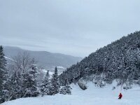
Yeah. I bet we get a big one out of this. The timing looks good for my ski trip on the 13th.
Not bad. Lol
-
1
-
-
37 minutes ago, vortmax said:
Getting stoked. This could be huge-a. Would love to see the coveted Christmas color watch/warning.
I’m getting excited too
-
1
-
-
3 minutes ago, wolfie09 said:
.thumb.png.472897bf5b8b8267b96c74df45fcf2f4.png)
.thumb.png.c556e03b756090fb4eaf33d98d62b9c7.png)
Yep. Deeper and west Nice
-
1
-
-
9 minutes ago, DeltaT13 said:
I'm stressed out man! I would have rather just had a boring ass weekend with no weather to worry about as this is the last real trip of the year.
I’ve been in your exact shoes! You’d rather just a little snow and predictable weather. It’s anxiety inducing to be sure. I’ll be in Brantingham and could easily face the same dilemma in a few runs…
-
1 minute ago, DeltaT13 said:
This is the scenario where I bail on Vermont and stay in NY. What a damn conundrum I'm in with this one. Oy vey.
It’s not even that far off. Lol
-
1
-
.png.5558f8fb4eb2dd28da3f81de83ed7ac3.png)
.png.aa8e2fe99fdae4576347fbb0483f04a5.png)
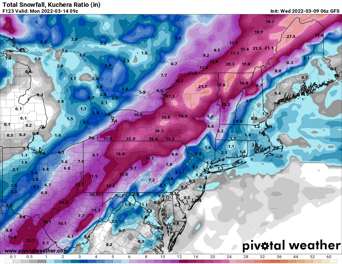
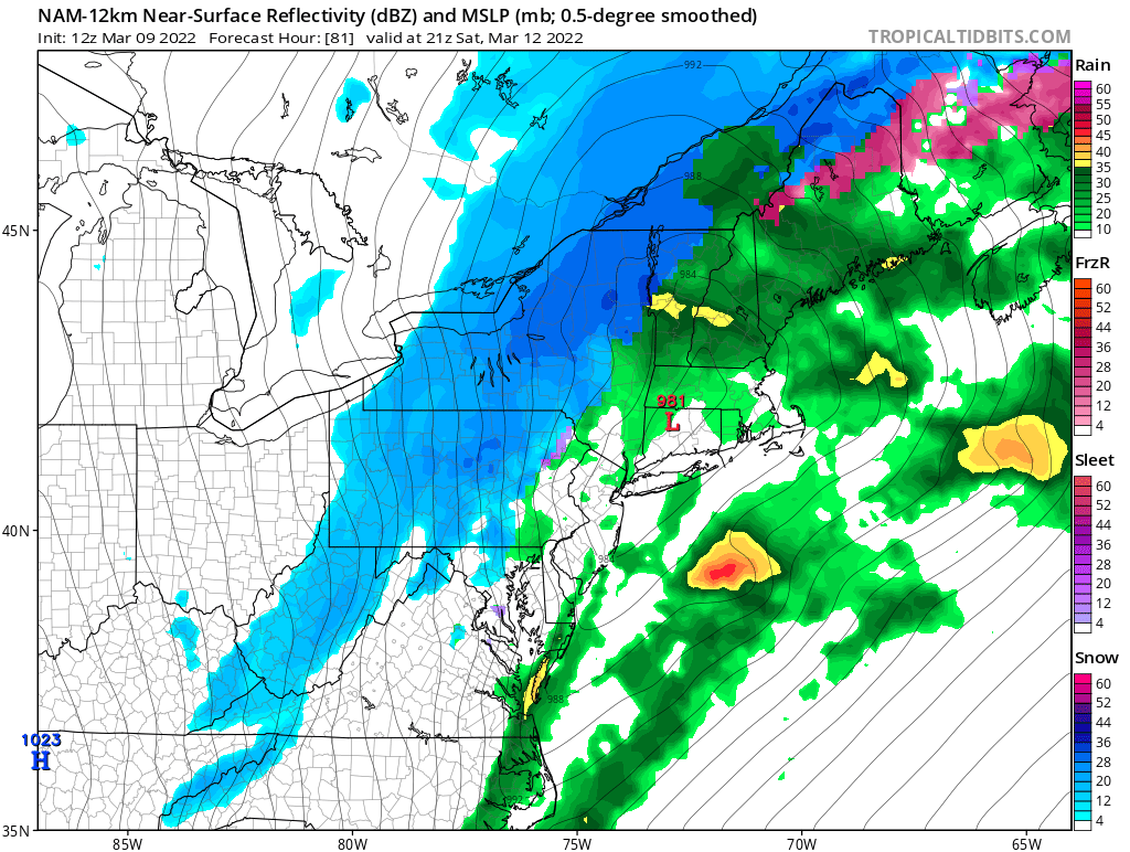
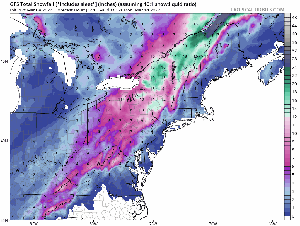
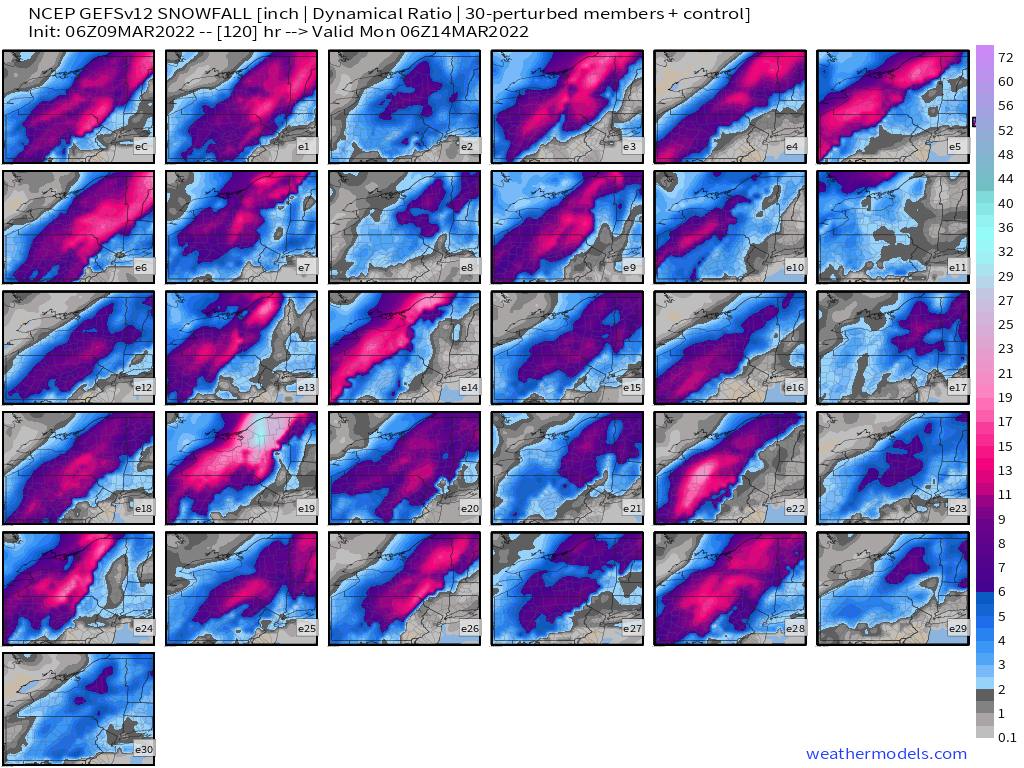
.png.fab9dedca6f94d586d3cd5a44c0cf8ab.png)
.png.6d5d3a8d2579282a3ca55d19a01322bf.png)
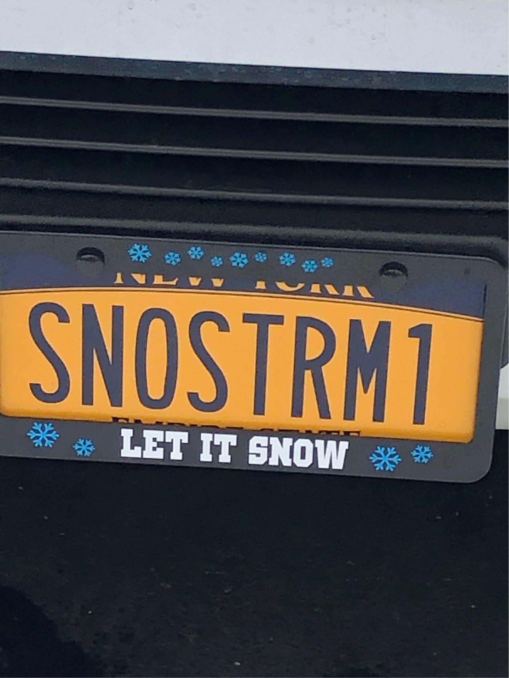
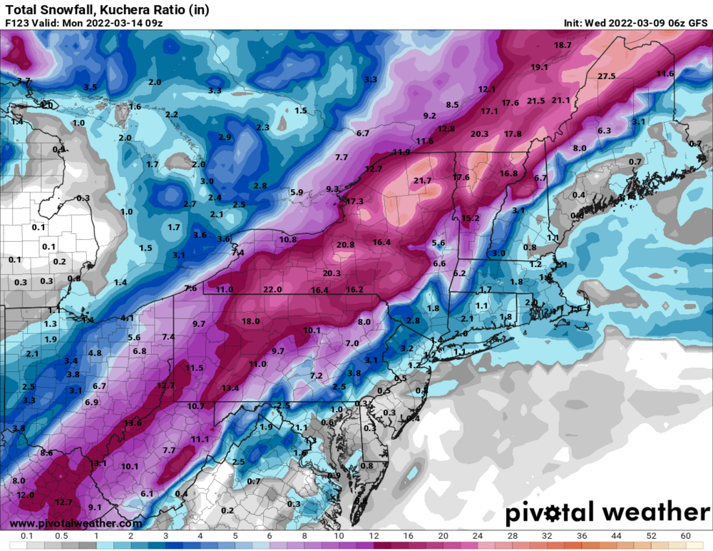
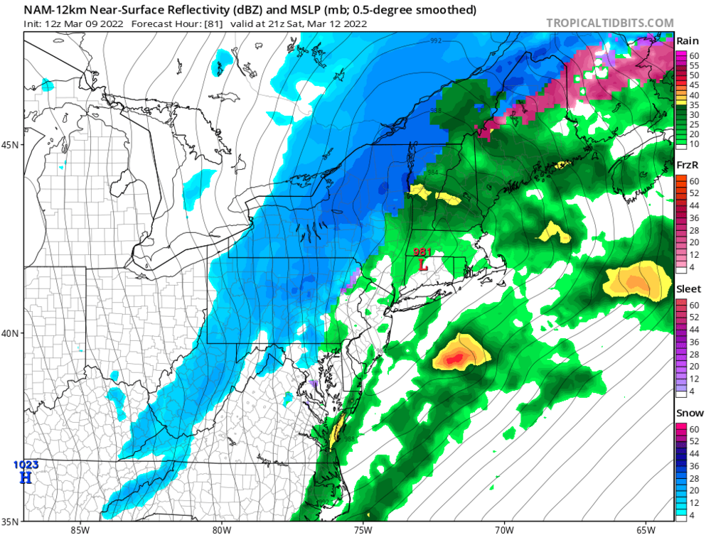
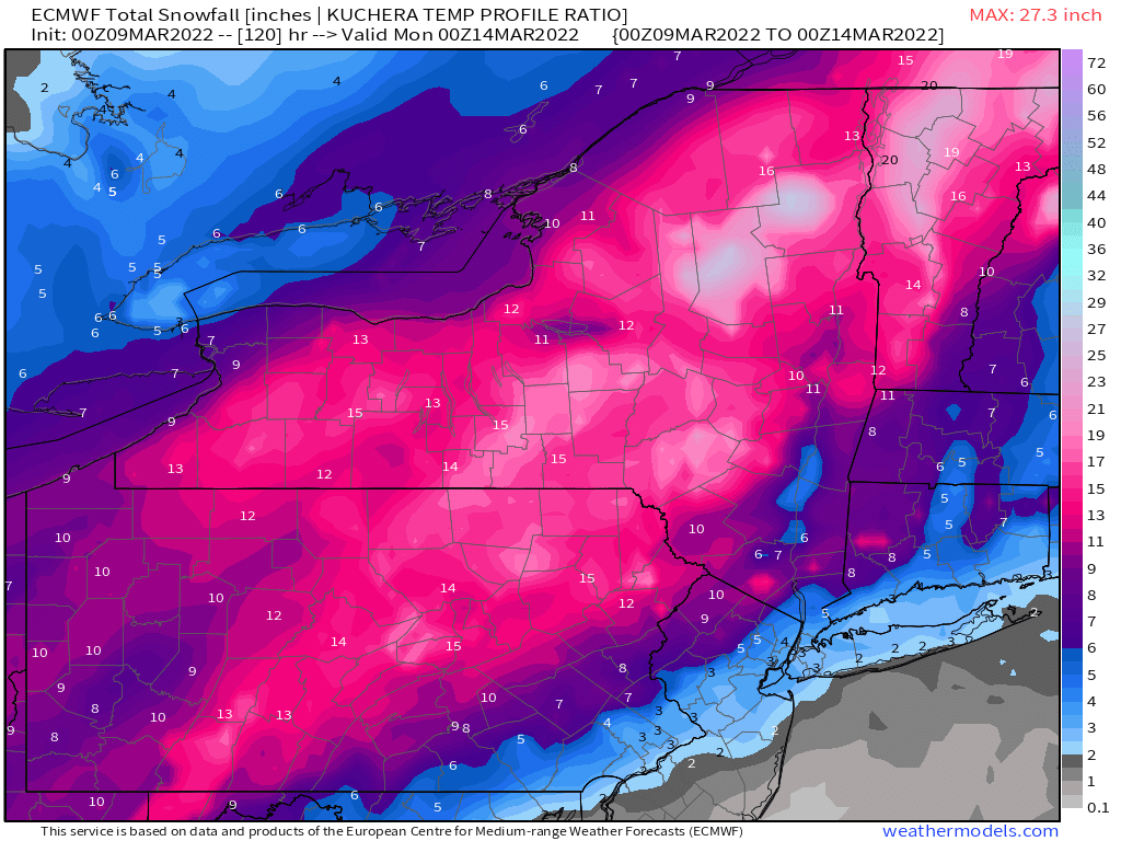
Potential large EC storm/Heavy LES March 11-13th
in Upstate New York/Pennsylvania
Posted
Dying