rochesterdave
-
Posts
6,707 -
Joined
-
Last visited
Content Type
Profiles
Blogs
Forums
American Weather
Media Demo
Store
Gallery
Posts posted by rochesterdave
-
-
Go damned Jamestown.
-
 3
3
-
-
What Buf was warning us about. A sickening trend. But you can’t discount it.
-
14 minutes ago, TugHillMatt said:
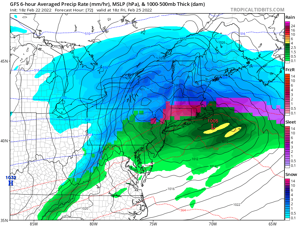
Yikes... 12Z Nams are bringing the mix well north. Hate seeing those doing that, as they are often good with those warm layers.
If the primary hangs on to Rochester- all bets are off. The mix line would go to Watertown.
-
So we go from mixing worries to suppression worries in one run? This is exciting! Lol
-
2
-
-
6 minutes ago, BuffaloWeather said:
No 85 and sunny until November

You’ve got at least another 6 weeks to wait buster.
-
1
-
-
GFS pulled back a bit but still solid.

-
 2
2
-
-
Just now, PerintonMan said:
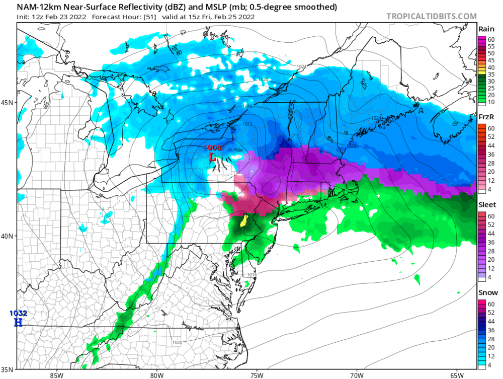
If that expansive precip shield and lake enhancement verifies, I would absolutely take it.
Yeah. I kind of like this look. Not gonna break records but I think it might be a solid mid sized storm.
-
1
-
-
Meso GFS says FU
-
2
-
-
2 minutes ago, TugHillMatt said:
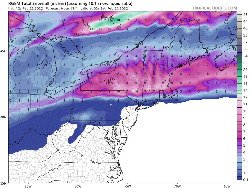
Where do you get these awesome maps from?
Looks like they're thinking some lake snows with a WNW wind based on those maps.
They have you right near the sweet spot! Where system qpf meets LES qpf maxima. Looks good to me. Now we hope we don’t get a rogue warm layer.
-
2
-
-
27 minutes ago, 96blizz said:

High end?
-
5 minutes ago, wolfie09 said:
Definitely Dave but it's the frame before that, that gets a little dicey for CNY.. But it's not the worst thing in the world lol


Yeah. And like Buf said, you really almost always have to add some to that. Close…
-
3
-
-
Nice look to me…

-
2
-
-
4 minutes ago, TugHillMatt said:
...to Syracuse. How many times have we seen this play out!?
Freaking constantly!
-
1
-
-
Move that mix line north 50 miles and it’s over the lake….we’ll see
-
1 minute ago, TugHillMatt said:
I've said that with several different systems this winter and the NAM... and it's done well. I thought, "There's no way" and then...it happens. The HP isn't really locked in place.
Yeah. It has done well. Even in longer range. Can’t discount it
-
I guess it’s possible. I don’t see it this far north. Not with this HP
-
9 minutes ago, Thinksnow18 said:
Ahhh but it does show quite a bit of enhancement which I believe will play out, and really the Euro is in its own at this point
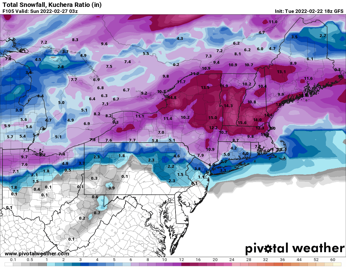
I think this is the wildcard. Anywhere from Buffalo to western Syracuse could see a few extra inches of fluff. I’m expecting it tbh.
-
1
-
-
Euro really doesn’t like this storm for WNY. It’ll be fun to see which is right- GFS VS EURO
-
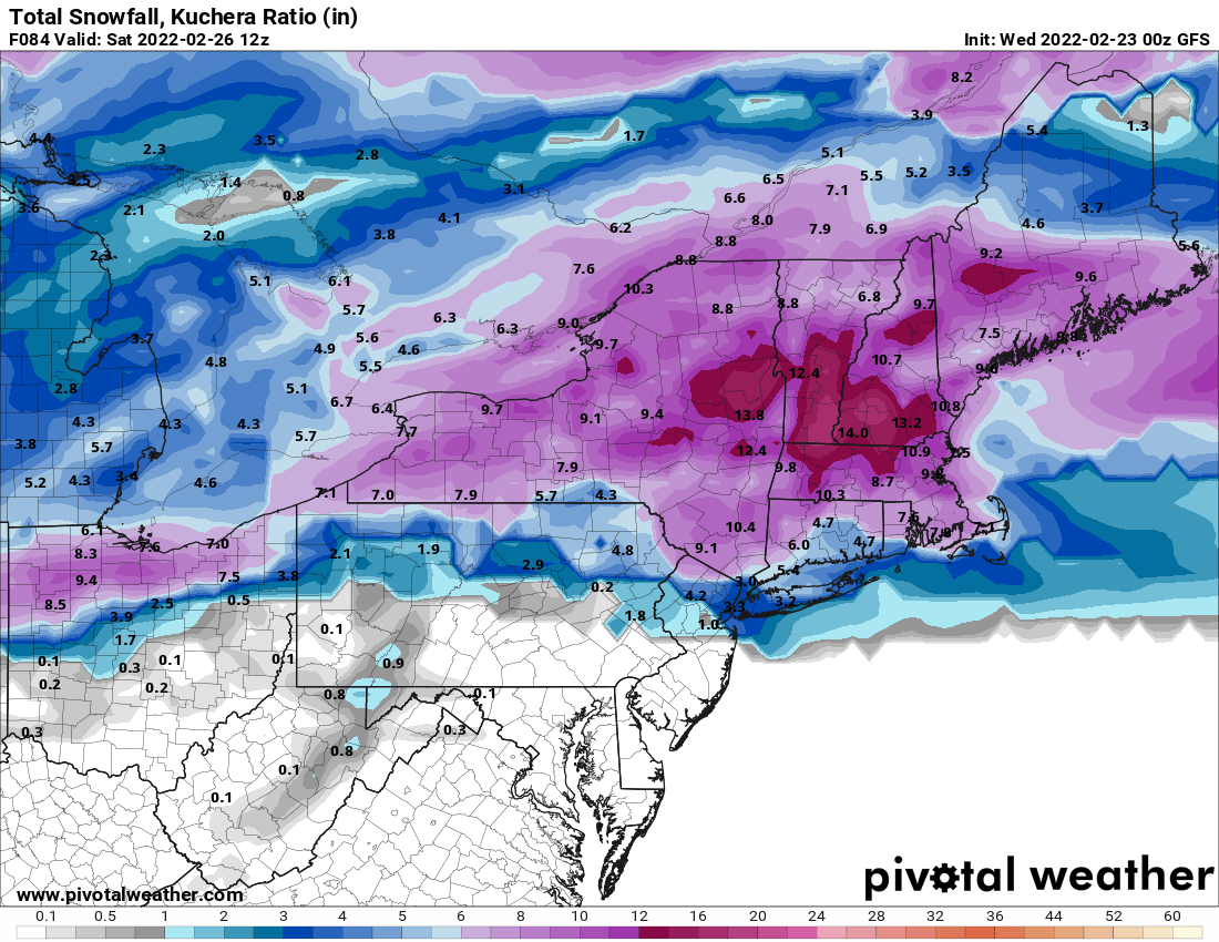
It’s a nice run. I feel pretty optimistic that a lot of us see low end warning amounts.

-
1
-
-
9 minutes ago, BuffaloWeather said:
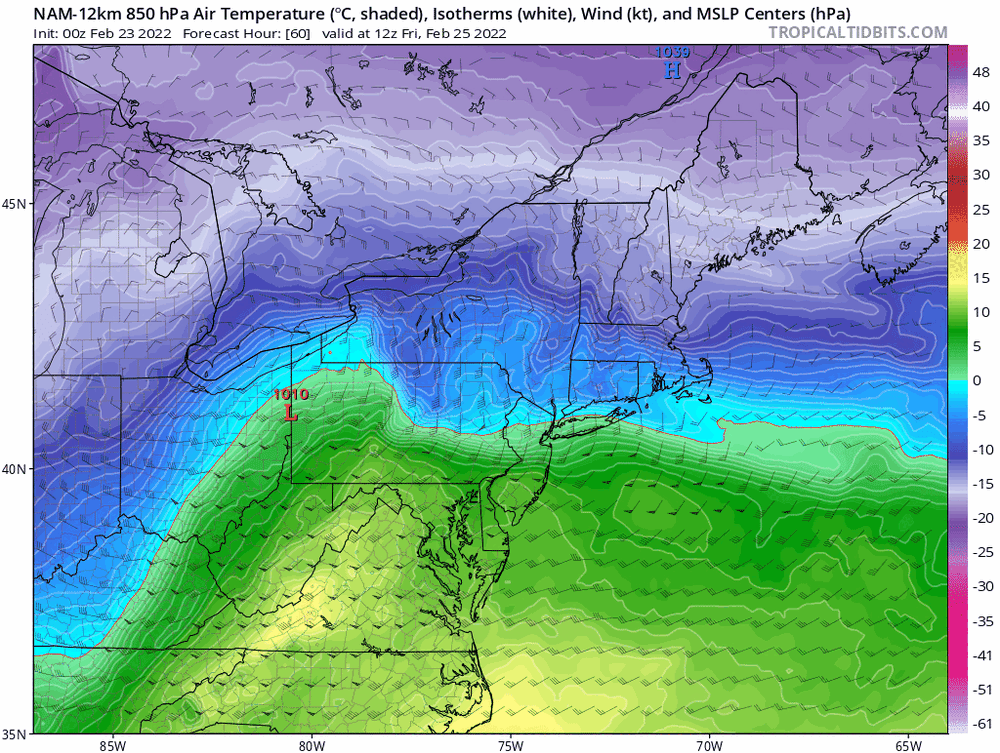
Those maps are never accurate with the warm air above surface. You can take those maps and move the sleet line 50-75 miles north. Its happened with every event this year. That's unless the secondary takes over quicker which would limit the warm air intrusion with primary.
That still leaves most of us safe. Why so worried? I agree with you about 25-50 miles with the 850
-
1
-
-
Weak sauce. Lol. I’m not giving up. We’ve got time to trend juicier. No reason this can go juicier.
-
1
-
-
1 minute ago, BuffaloWeather said:
Weak Miller B with thermal issues, this thing has lots of issues, going low on totals for WNY. Like this storm better for areas N/NW of Boston for Jackpot. For our area I like it better for central NY into Adirondacks.
Definitely a possibility. Still early. LP track is somewhat favorable for WNY. But the other issues might bend the balance. I’ll still take 4-8?
-
Keying on some enhancement which I believe is the variable needed to make this a solid event along the thruway (Buf-Roc).

-
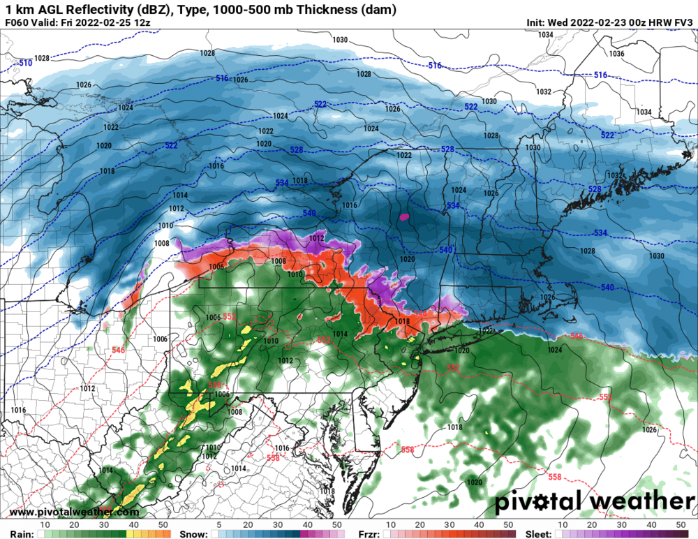
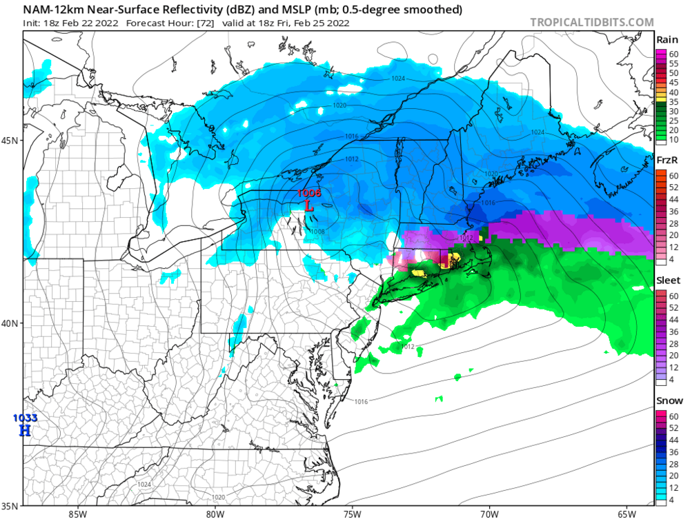
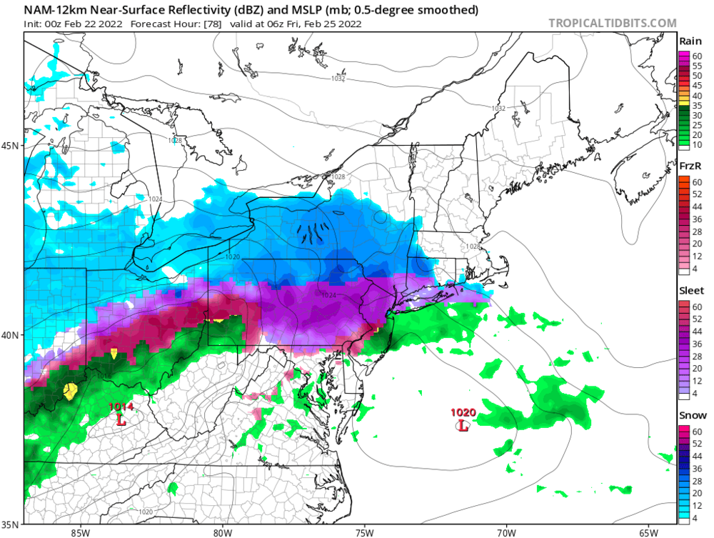
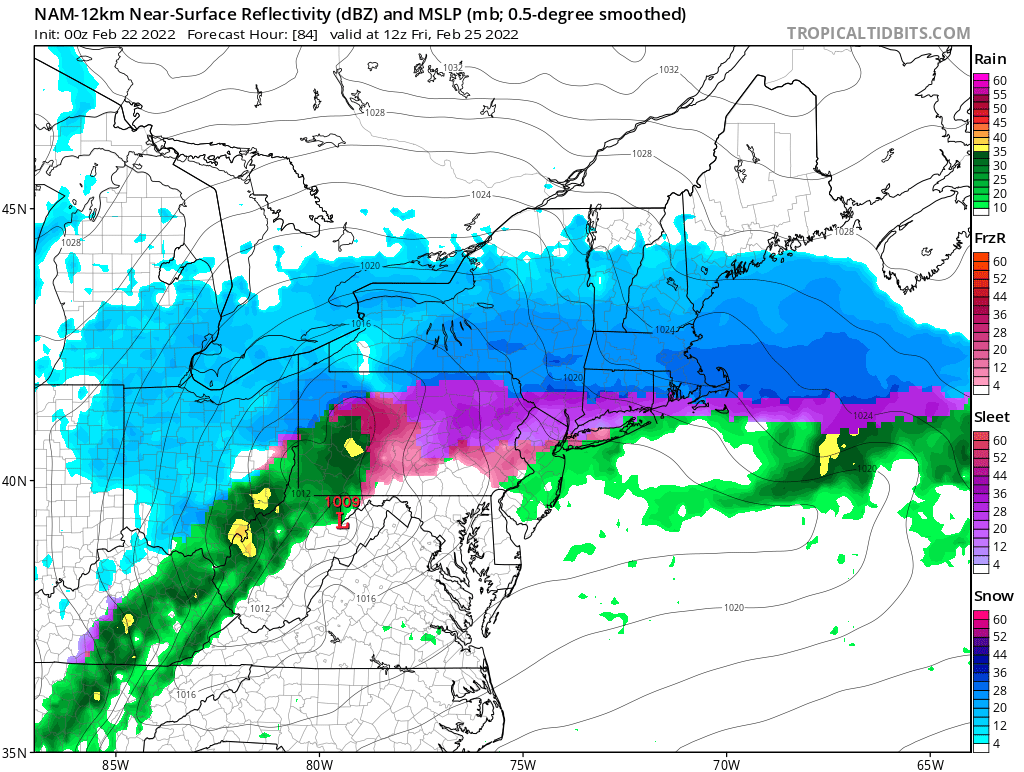
NAM offering up a long duration southern solution. Looks reasonable.


Potential of Widespread Snow/ Mixed Precipitation 2/25
in Upstate New York/Pennsylvania
Posted
It could just be a couple wild runs but you can’t discount the NAM. It would still be a front thump of 4” or so followed by a couple after the taint but you can say goodbye to any shot at 10” or 12”