rochesterdave
-
Posts
6,707 -
Joined
-
Last visited
Content Type
Profiles
Blogs
Forums
American Weather
Media Demo
Store
Gallery
Posts posted by rochesterdave
-
-
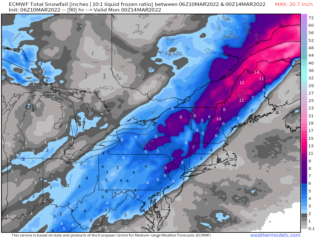
SREF plumes still look decent for Syracuse but pretty sad for Roc. 6-10 for Syracuse. 3-5 Roc.
I can’t remember the last time NAM products were the least amped -
6z EURO Pretty lame but it gives western areas a little love.
-
 1
1
-
-
Gotta say, the ICON went to crap on this storm like 24 hours ago. I know it’s not a great model but it can sniff some crap
-
1
-
-
Just now, vortmax said:
Ok, I'm hugging the RGEM for dear life.
GFS is still ok too
-
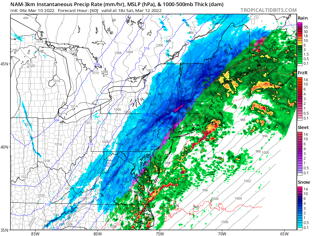
NAM 3k basically is a downstate thing. Gotta watch this for the trend. This one stings.

-
Just now, SnowLover22 said:
Hopefully the east trend continues. I am going to be going skiing on Saturday. While fresh snow at Bristol would be nice, do not want to drive in the snow.
Wrong board
-
 4
4
-
-
Pretty bad. Hope it’s a fluke. A one off
-
At least the SE shifts have stopped
-
Drives it right into New England.

-
 2
2
-
-
NAM coming in HOT!!!!
-
1
-
-
26 minutes ago, BuffaloWeather said:
.SHORT TERM /FRIDAY THROUGH SATURDAY NIGHT/...
...Accumulating snow likely Friday night and Saturday...

Deep upper level PV anomaly dropping southeast from Central Canada,
along with some sheared out upper level jet energy from the Desert
Southwest may provide just enough moisture/forcing to activate the
tight mid level baroclinic zone in place to squeeze out a little bit
of light snow or flurries Friday morning. However, this activity
will have little if any impact for the local area.

The more substantial snow will arrive Friday night and continue
through the day Saturday. As both disturbances within the northern
and southern stream approach the area, they will eventually phasing
as they get closer to the eastern seaboard. This will allow for a
developing surface wave to rapidly intensify as it moves northward
from the mid Atlantic states Friday night into New England on
Saturday.

Associated precipitation should start off as light rain perhaps as
early as late Friday afternoon with temperatures still in the upper
30s and 40s. That will change quickly Friday evening as a sharp cold
front moves through. Much colder air will pour into the region
switching the rain over to snow very quickly. There continues to
remain uncertainty to how the overall system evolves and this will
play a large role in how fast the cold air arrives and changes the
precipitation over to snow, but it does seems likely at this
juncture that most of the area will change over to snow before
Saturday morning. Snow will then continue Saturday with increasing
snowfall rates, especially for areas where some lake enhancement
occurs. A high impact event for the area seems more and more likely
with the potential for significant snowfall amounts, so will
continue to highlight this storm in the HWO product.

On the back side of this system, lake effect snow within a
increasing northwest flow will bring additional snowfall amounts to
the southeast of the lakes and higher terrain Saturday night.

Winds will become quite gusty later Saturday and Saturday night and
could bring additional impacts along with the snow.
What the hell is going on over there? Lol
-
3
-
-
18z Runs are pretty key at this point. Make or break? If the SE trudge continues I think we can write off the Buf-Roc sector for warning amounts.
-
1 minute ago, BuffaloWeather said:
You can't use the best model and NAM in same sentence.

NAM has been great. It really has.
-
4
-
-
3 minutes ago, Leelee said:
That's what meteorologists are trained to do, sometimes using their knowledge to override models altogether.
I wish Buf had given us their rationale for this am’s disco. They saw this SE shift before the models did. And I’m wondering how..
-
29 minutes ago, wolfie09 said:
Still plenty of spread..
.thumb.png.d0a605efac0c386fb21ccfe67665df91.png)
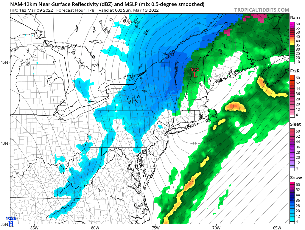
78 hours and a couple hundred miles of spread. It’s never easy. Lol. Buffalo or Albany jackpot? At least it ain’t going to freaking JT
-
2
-
-
25 minutes ago, wolfie09 said:
Still plenty of spread..
Few great hits in there!
-
1
-
-
3 minutes ago, wolfie09 said:

NYC now getting more than ROC.
-
Temps should be fine for most of us.
-
 1
1
-
-
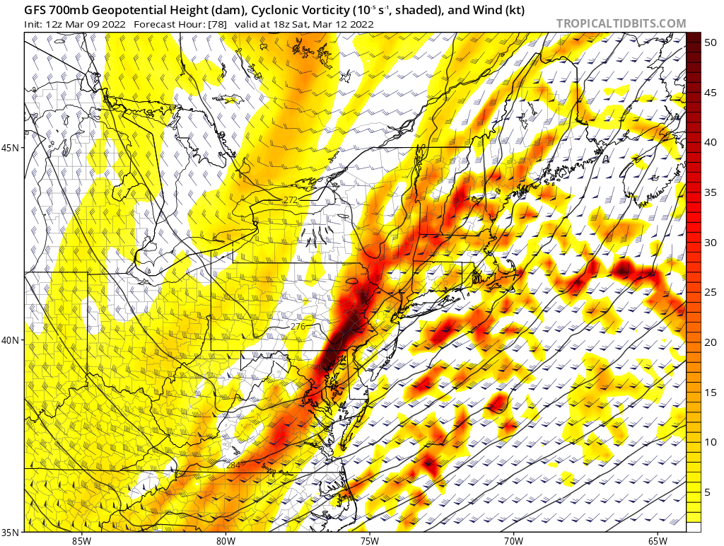
The 700 comes very close to closing off. Still a possibility this comes in stronger and a BIT west.

-
Just now, TugHillMatt said:
I appreciate it. I really hope so. We've had such big shifts within the short range this winter, that I'm a bit nervous.
I take it this is more the typical storm that gives Syracuse its average.
Currently great track for Syracuse. It really is. I’m very confident you see warning amounts.
-
2
-
 1
1
-
-
2 minutes ago, TugHillMatt said:
After this past winter, we ain't sharin anything with you.
I get that. I really do. This one should be yours.
-
1
-
-
1 minute ago, DeltaT13 said:
At least one person on this forum is feeling ok with this trend, but I do feel guilty.
Hahaha. I’ve been wondering about your plans. That disco must of been music to your ears.
-
Canadian looking robust. Early.
-
Slip sliding away for western areas. As Vortmax said, it’s all about the phase.
-
1
-
.png.977d9878a4213dbb9582266910c93030.png)


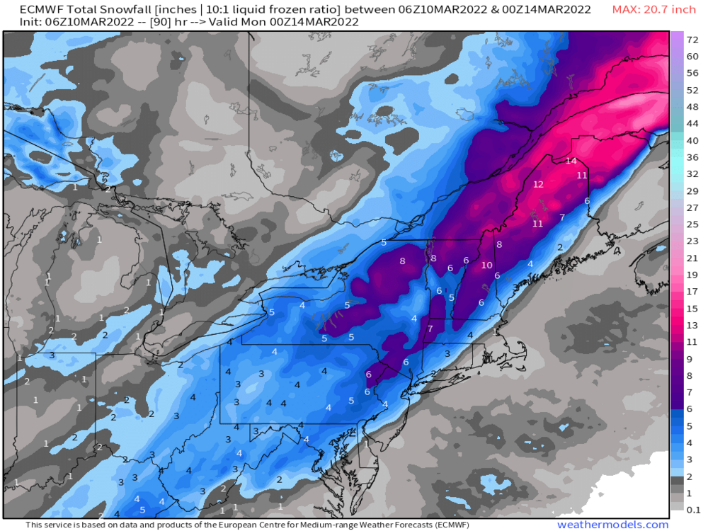
Potential large EC storm/Heavy LES March 11-13th
in Upstate New York/Pennsylvania
Posted
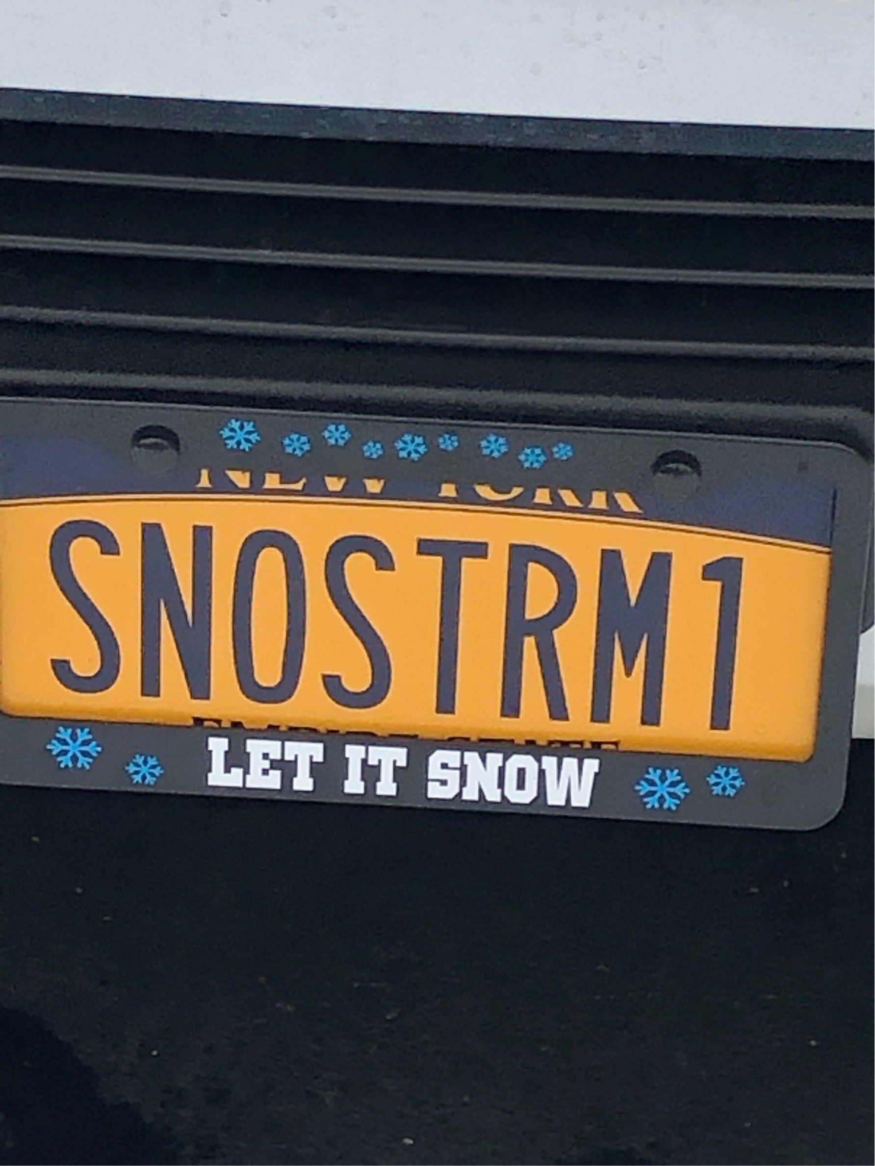
Should be perfect for him