-
Posts
3,398 -
Joined
-
Last visited
Content Type
Profiles
Blogs
Forums
American Weather
Media Demo
Store
Gallery
Everything posted by DopplerWx
-
here is an image to save, from the 12z gfs for charlotte lol.
-
it is about to transfer offshore sc. just like 06z.
-
fv3 looks very similar to the gfs at 96hr.
-
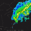
TT fv3 sim radar
-
fv3 a bit south with our lp out to 66.
-
going ahead and making my reservation for sunday in the sanitarium.
-
hoping we can get it to keep trending cooler over the next 3 days.
-
now that is the kiss of death, will never forget when he popped in the jan 2017 thread and fired the warning shot.
-
agree but soundings have improved over the past 6 runs or so. still expecting the nam to show that warm nose about 36hrs out once we are all nice and excited.
-
backside is juicy too, man if these soundings verified for kclt, what a monster storm it would be.
-
charlotte sounding at 96 w/ heavy precip. we like to live dangerously.
-
at 96, oh mama. beautiful look.
-
dps a bit better and the snow line is maybe a tick south.
-
icon still showing initial snow in clt thru sunday morning before changing to rain for areas even to asheville.
-
yea looking at soundings on the 6z gfs clt looks all snow thru 96 then a warm nose pops up at 102 turning us to sleet. encouraging that the warmer gfs shows a nice front end thumping. if we can get the nam thermals to verify we would be in even better shape.
-
6z gfs has clt right on the rain snow line and in turn spit out these ridiculous numbers. i don't buy it though, i think we see a lot more sleet and a lot more rain than snow.
-
and then the low jumps over myrtle and the obx and areas outside the mtns go to rain
-
yea sounding looks much better at kclt this run. all snow thru 96.
-
looks like a snow sounding thru 102 at clt. maybe a bit colder this run?
-
its identical at 84.
-
if the gfs is correct w/ the lp location then the warm nose would def mess with you guys. sounding in the midst of the precip shows it.
-
yep, i have my umbrella ready for the rain and a streetlight ready to squint into looking for the stray snowflake that mixes in.
-
how are temps for clt on the euro? initial start as snow before a changeover to rain?
-
at 120 with good precip our sounding is razor thin, maybe all snow but likely some sleet mixing. but if we are talking razor thin margins this far out i know which way it will likely trend.
-
yea thru 126 you're soundings look all snow pretty comfortably.


