WxUSAF
-
Posts
28,314 -
Joined
-
Last visited
Content Type
Profiles
Blogs
Forums
American Weather
Media Demo
Store
Gallery
Everything posted by WxUSAF
-
Weirdly (?) euro AI keeps drifting east even as the traditional guidance is starting to line up with the details.
-
If I was rich I’d totally get a mesonet station installed on my palatial estate. Somewhere between the pool and the botanical garden.
-
Super cool. Thanks to @Eskimo Joeand @wxmeddler for inviting me! Nice consolation prize for being furloughed.
- 427 replies
-
- 14
-

-
Ooohhh jackpot! Up over 0.25”!
-
What happened with GGEM? Planned outage?
-
Going to be *maybe* 0.2”
-
https://twitter.com/burgwx/status/1975729785394635218?s=46&t=JYOHM881b6groqc0-RqtxA
-
Big jump on the euro suite
-
Euro almost completely skunks Baltimore and a stripe of central MD to NoVA
-
6z euro was close to the area. Much farther north than 0z. 12z gfs soaks the eastern parts of the area, but brutal gradient for DC and points west.
-
Getting major “prepare for disappointment” vibes for tonight based on newest guidance
-
Also might have a handful of model runs D5+ that impact us
-
lol what a joke. I’ve tuned out his coach speak for 5+ years, but gimme a damn break. Who’s the audience for this nonsense?
-
Meanwhile, GGEM shifted way east
-
Maybe I just hadn’t noticed yet, but overnight runs jumped on this coastal low giving us rain this weekend. Looking back, 18z Saturday Euro AI was the first run to pull it west enough for rain in the metro areas, but overnight 0z runs are really the first showing rain on the physics-based models.
-
I’m intrigued

-
Yeah he has to go. And Orr too. The level of talent on paper is too high for this pathetic performance.
-
What a wasted failed season
-

Central PA Fall Discussions and Obs
WxUSAF replied to ChescoWx's topic in Upstate New York/Pennsylvania
What an embarrassing loss. Just totally exposed as frauds. -
Pathetic
-
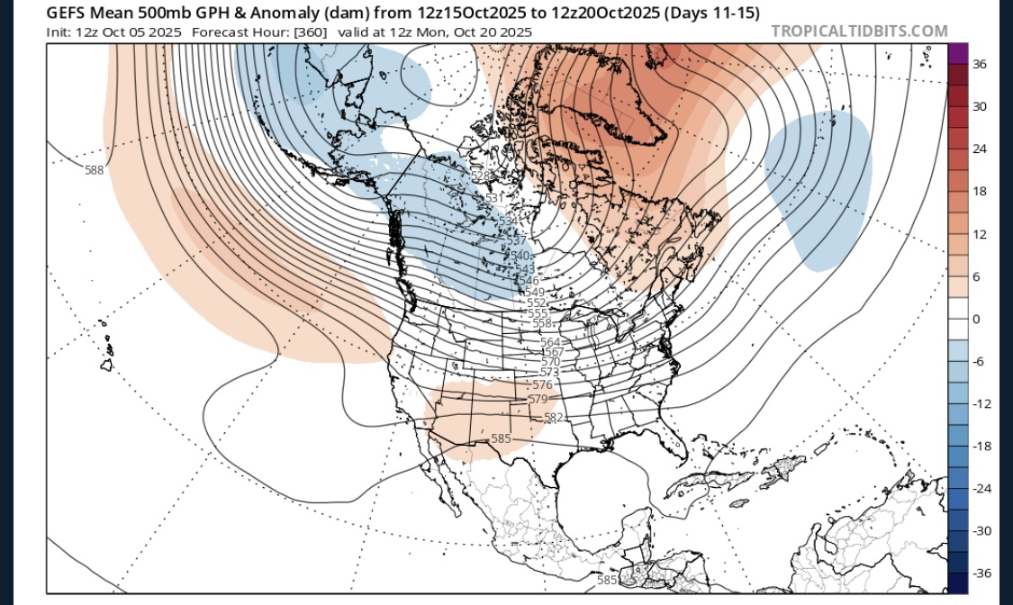
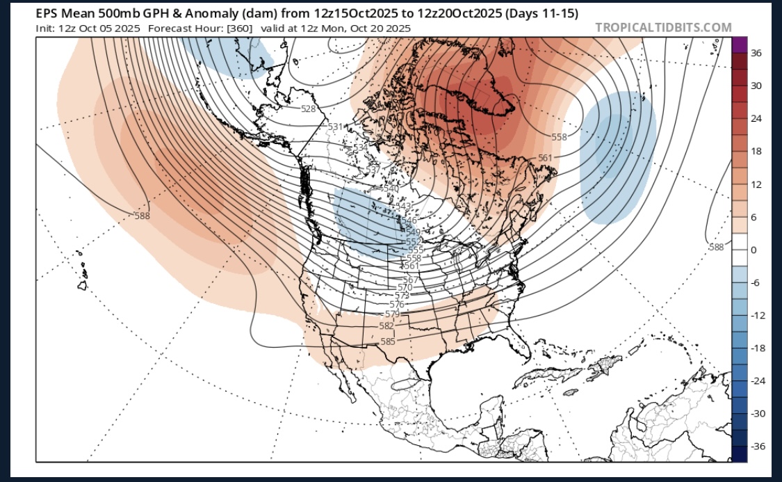
Ensembles all build a respectable -NAO D10+. Right now only GEPS shows an eastern trough response concurrently, but maybe EPS and GEFS move that way?
-
Ask him a climate change question about declining snow totals
-
3 straight mornings in the 40s, which shouldn’t be very remarkable for October.