WxUSAF
-
Posts
28,636 -
Joined
-
Last visited
Content Type
Profiles
Blogs
Forums
American Weather
Media Demo
Store
Gallery
Everything posted by WxUSAF
-
My temp also dropped back real quick. Wind picking up also
-
You’re right under that band. Getting good flakes?
-
Temp has actually increased about a degree in the last hour
-
Tiny snowflakes.
-
Current wet bulb temperature is 32.4
-
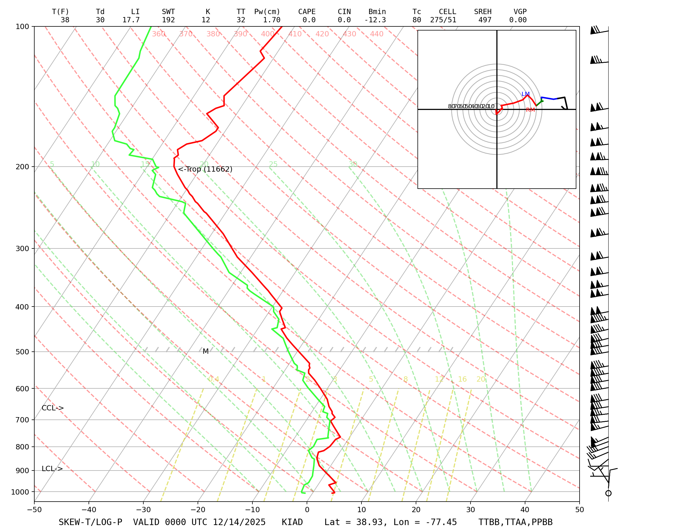
KIAD sounding. Freezing level just below 900mb. Biggest difference I see from the 18z 3k NAM prediction of the 0z sounding is the dews are lower. Boundary layer temps maybe a smidge colder as well.
-
Tomer doesn’t weeniecast. That’s impressive.
-
Harford and Cecil probably deserved warnings…
-
High of 41 and just starting to tick back down
-
Looks like the Canadian mesos
-
I’m going to be insufferable if I’m furloughed and we get a Nina torch February
-
Is it even a snow event if you don’t get NAM’d 12 hours before start?
-
I am
-
NBM looks good to me
-
Hello beautiful
-
CWG bumped up a little
-
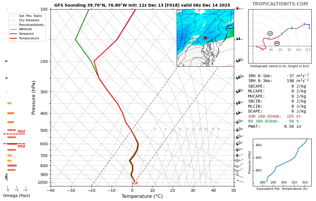
Here's the 3k NAM sounding right as precip is about to start in DC. Above freezing part of the column is *extremely* shallow. Like 975mb or lower? And even that part of the column has a wet bulb of 32-33. At worst, that's probably like a few minutes of sprinkles and as soon as there are any rates at all, it's snow.

-
Let's goooo clouds. Keep the temps as low as possible.
-
3" seems like a decent floor right now based guidance. Was thinking more 2-2.5" yesterday. 4" might be a stretch, but possible.
-
Nice sounding in the band as it starts cranking around 1am in @mappyland
-
Some personal MBY stats. Biggest December snowfall since 2009 is 3.3", which happened in both 2017 and 2020. Think I got a puncher's chance to top that.
-
Yeah I think that’ll make sense
-
I’m surprised Mt Holly hasn’t upgraded to warnings. They have 4-6” for a lot of their area.
-
0z euro has Christmas Eve snow
-
LWX probably weighing watches or warnings for Cecil and Harford?