WxUSAF
-
Posts
28,700 -
Joined
-
Last visited
Content Type
Profiles
Blogs
Forums
American Weather
Media Demo
Store
Gallery
Everything posted by WxUSAF
-

2022 Atlantic Hurricane Season Tracking Thread
WxUSAF replied to WxWatcher007's topic in Mid Atlantic
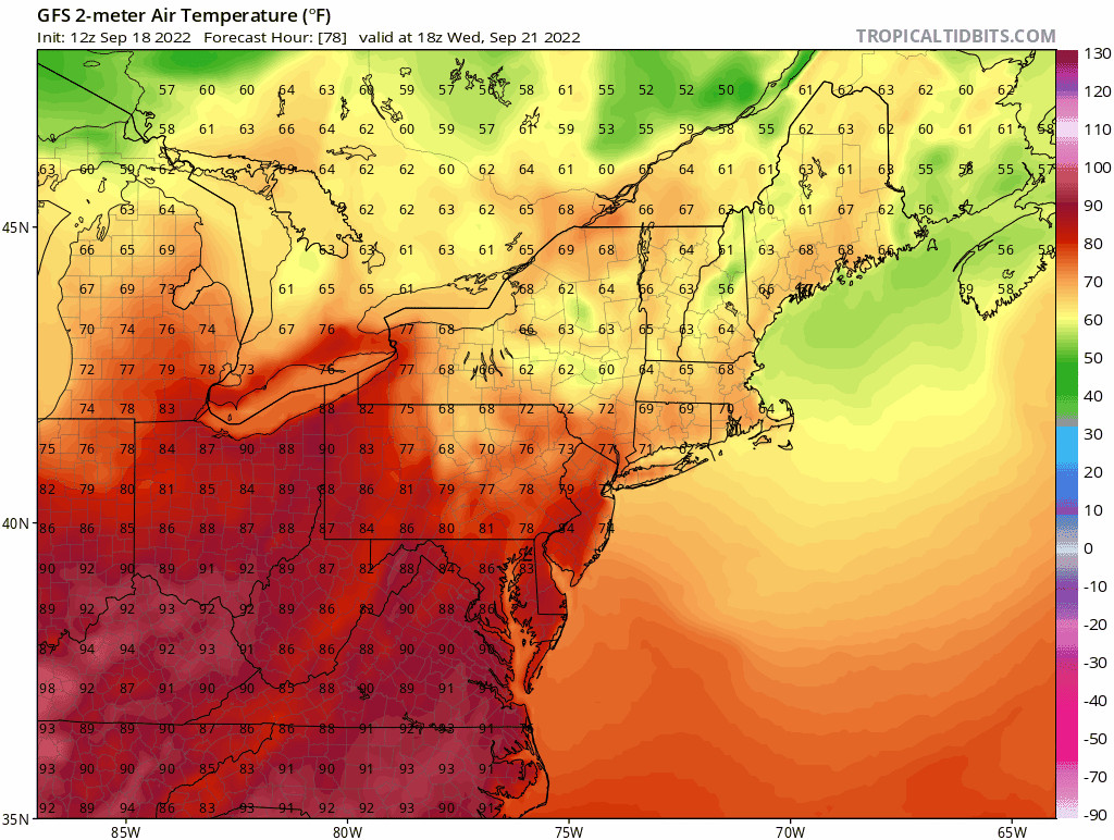
Looks like 2 primary groups for future Hermine/Ian tracks in the GEFS. Quicker moving track cuts east across Florida and moves up the coast, but mostly offshore. Second group is slower and gets into the Gulf where it then moves onto the north Gulf shore and then maybe eventually impacts us like that Op. -
2022 Atlantic Hurricane Season Tracking Thread
WxUSAF replied to WxWatcher007's topic in Mid Atlantic
-
I’m good as long as I don’t post it on Facebook
-
Start time for my mother in law’s surprise outdoor 70th birthday party
-
Great CAD signature on the happy hour GFS
-
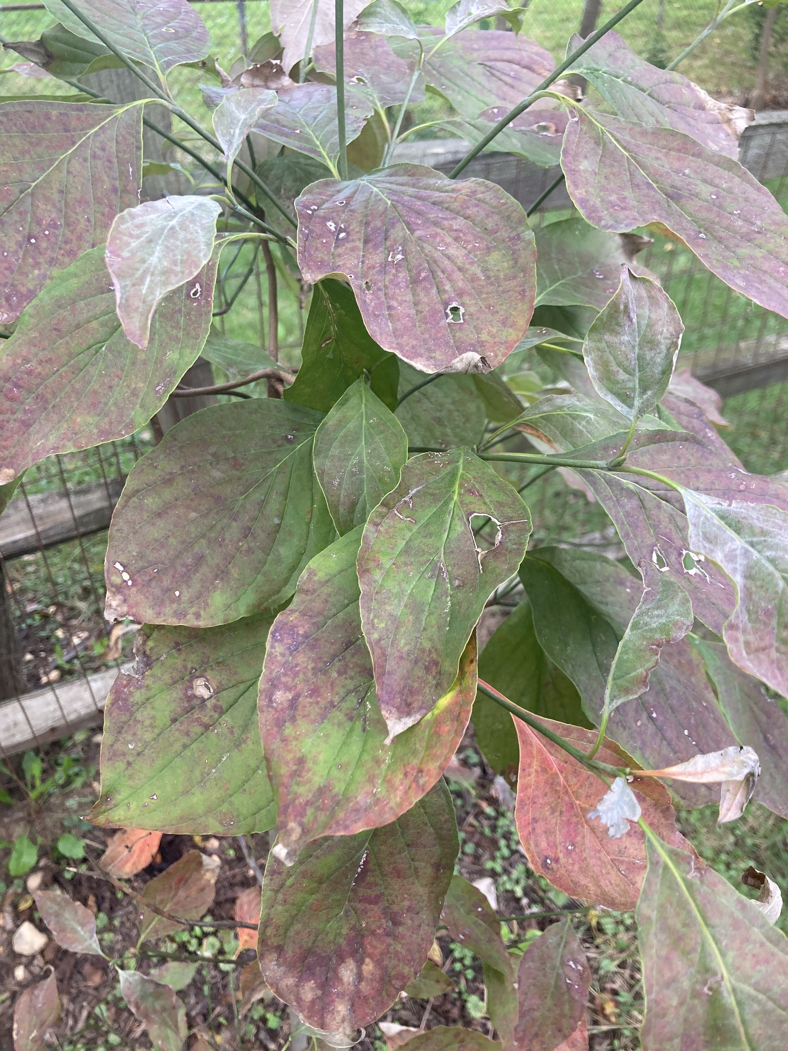
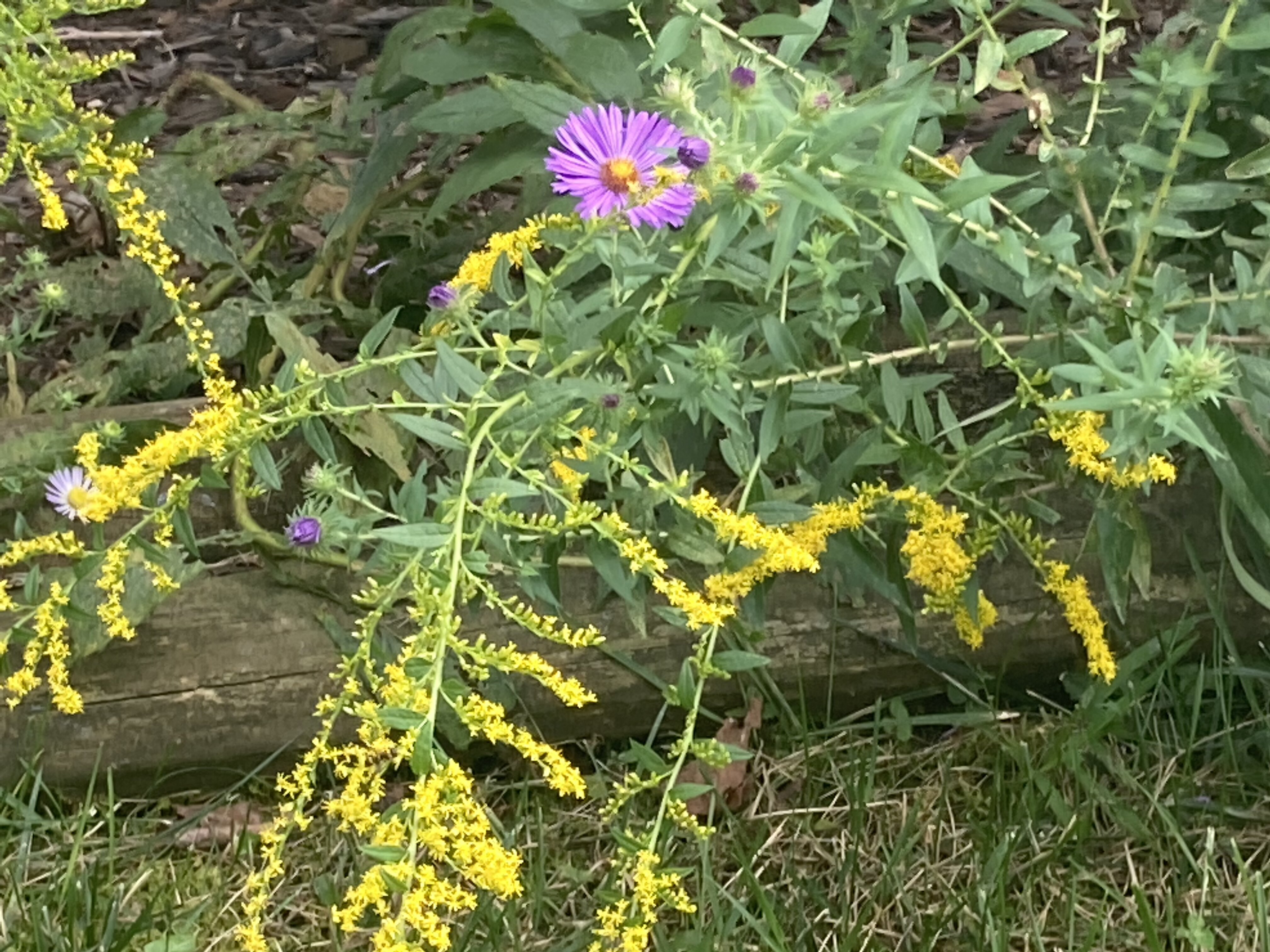
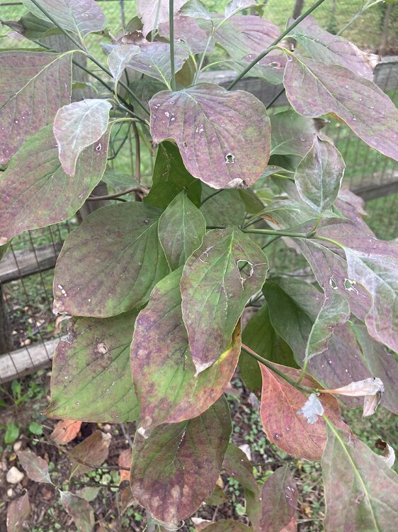
Goldenrods are blooming and many tree species are starting to show some color. Cool air coming in this weekend should help as well.

-
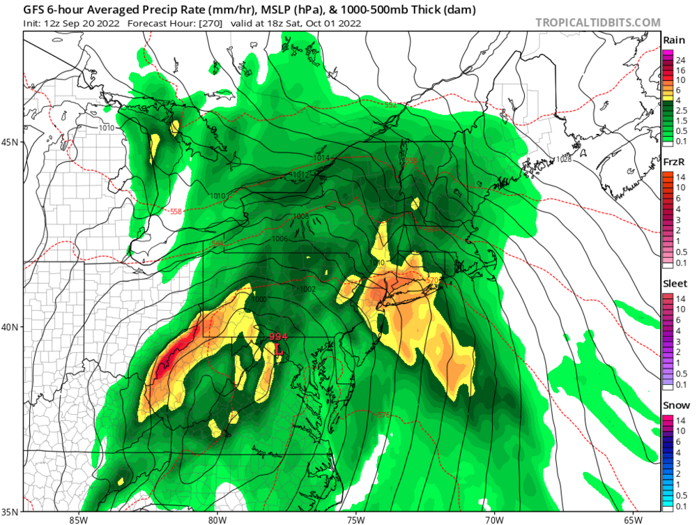
Cold Canadian high moving in, big storm brewing in the Gulf at 240hrs on the Euro. Get your snowblowers ready
-
He aggravated his injury and was mostly on the bench
-
9th inning comeback win for the O’s is a nice small consolation for Baltimore sports fans today
-
Quite possible. Prevent defense successfully prevents the defensive team from winning again.
-
What an epic collapse
-
I hate “prevent” defense
-
Fall coming in like...

- 573 replies
-
- 11
-

-

-

-

-
Next Saturday could be the first 40s temp at BWI since May 11.
-
Kill them all!
-
Parade of cool Canadian high pressure areas starting next Thursday on the Euro and GFS
- 573 replies
-
- 12
-
-
Low of 52
-
Weather watching is starting to get interesting for late next week. Seems like our first legit fall cold front will be a key player in deciding where Fiona tracks. At the moment looks like next Friday or Saturday or both could have highs in the upper 60s/low 70s with upper 40s/low 50s for lows. How fast the front moves south and it’s orientation will guide Fiona OTS or possibly under the ridge more and become a landfall risk.
-
Looks like we’re getting some smoke aloft this morning as @George BM mentioned yesterday.
-
Low of 57. Overnight ensembles started to hint at a “cool”down after next weeks heat and there are some indications the warmest temps may stay south of us next Tuesday-Thursday.
-
That cold front at the end of the 18z GFS
-
Cold novembers and torch Decembers seems to be the pattern for the last decade
-
Nearly 1.5” in my plastic rain gauge
-
7”/hr precip rate and a power flicker