EastCoast NPZ
-
Posts
9,817 -
Joined
-
Last visited
Content Type
Profiles
Blogs
Forums
American Weather
Media Demo
Store
Gallery
Everything posted by EastCoast NPZ
-
Bermuda
-
Happy 4th of July to everyone, and Happy Birthday, America! ...oh, wait, wrong holiday. It was hot and there were fireworks, so I just assumed... Happy New Year, everyone!
-
12-22-22: 2.5" 1-14-23: 0.5" 1-24-23: 2.0" Total: 5.0"
-
We just need to move to the polar vortex. What is that address?
-
Was just going to post the exact same thing. Lol. How's the house coming?
-
@Maestrobjwa I'll add an option 5 to Terp's list above, and it's the easiest of the options: 5. Make a 3 hour drive to Davis or Deep Creek.
-
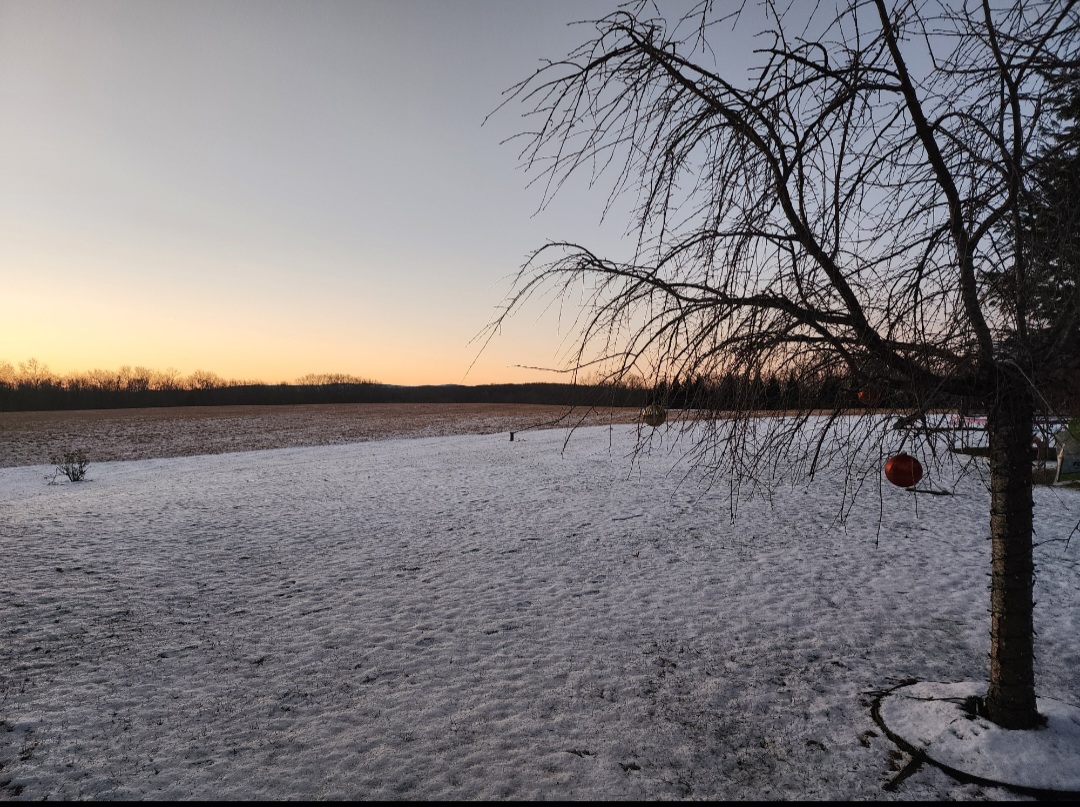
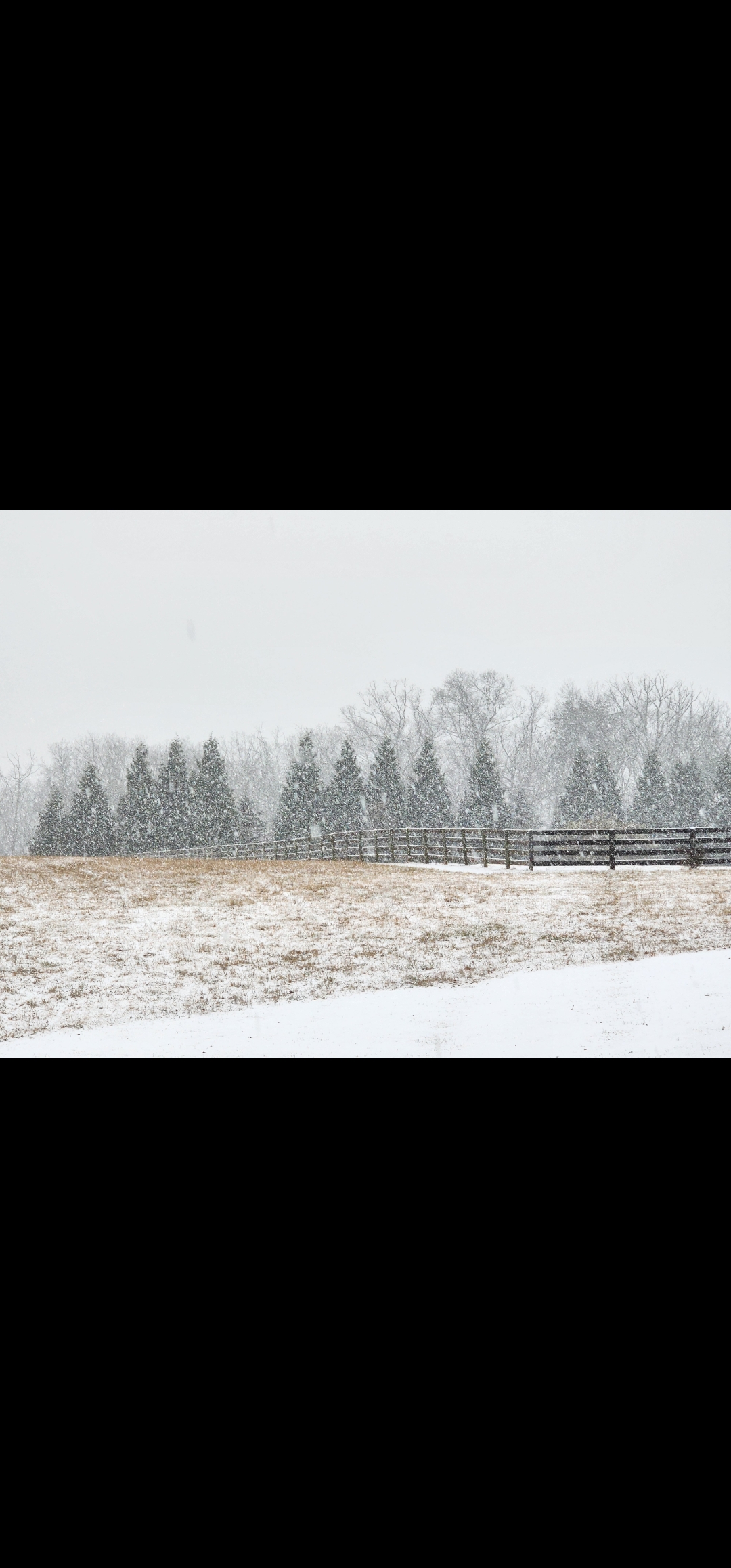
Not quite the stuff of my dreams, but we did have a White Christmas out here. Barely, but I'll take it.


- 300 replies
-
- 15
-

-

December 22-23, 2022: Warm Rain to Arctic Chill
EastCoast NPZ replied to WxUSAF's topic in Mid Atlantic
Gorgeous -
December 22-23, 2022: Warm Rain to Arctic Chill
EastCoast NPZ replied to WxUSAF's topic in Mid Atlantic
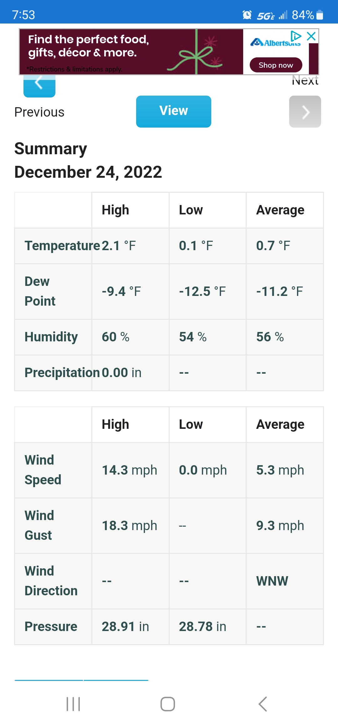
Low of .1F. Almost got there! Merry Christmas, everyone!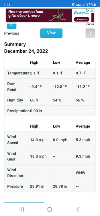
-
December 22-23, 2022: Warm Rain to Arctic Chill
EastCoast NPZ replied to WxUSAF's topic in Mid Atlantic
Great night to be on the mountain coaster! -
December 22-23, 2022: Warm Rain to Arctic Chill
EastCoast NPZ replied to WxUSAF's topic in Mid Atlantic
Down to 14F here. -
December 22-23, 2022: Warm Rain to Arctic Chill
EastCoast NPZ replied to WxUSAF's topic in Mid Atlantic
Temp down to 20F. -
December 22-23, 2022: Warm Rain to Arctic Chill
EastCoast NPZ replied to WxUSAF's topic in Mid Atlantic
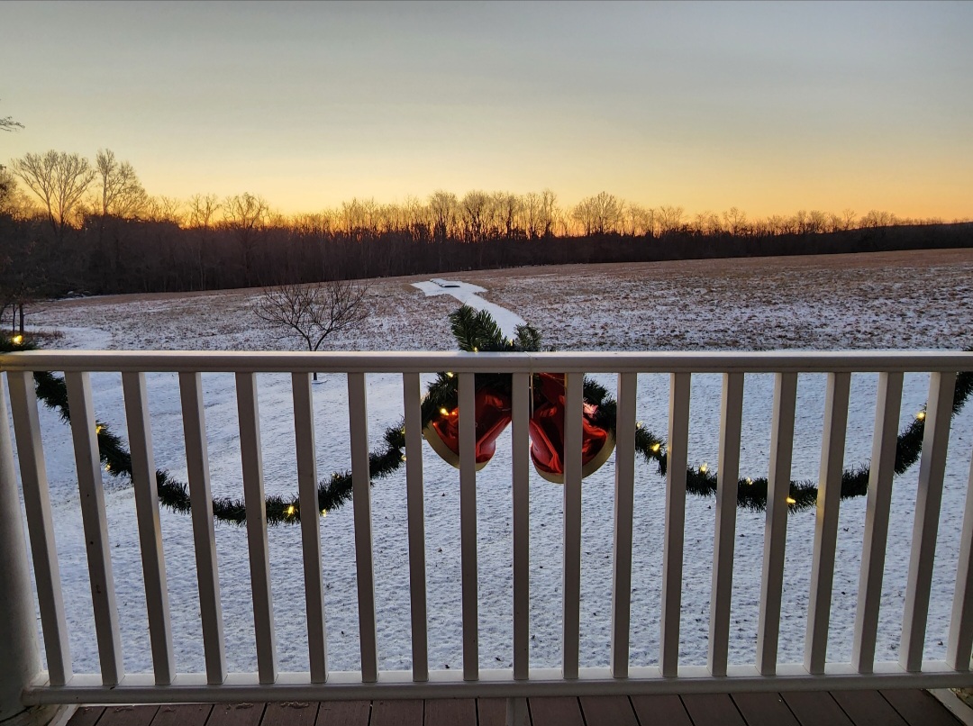
White Christmas. -
December 22-23, 2022: Warm Rain to Arctic Chill
EastCoast NPZ replied to WxUSAF's topic in Mid Atlantic
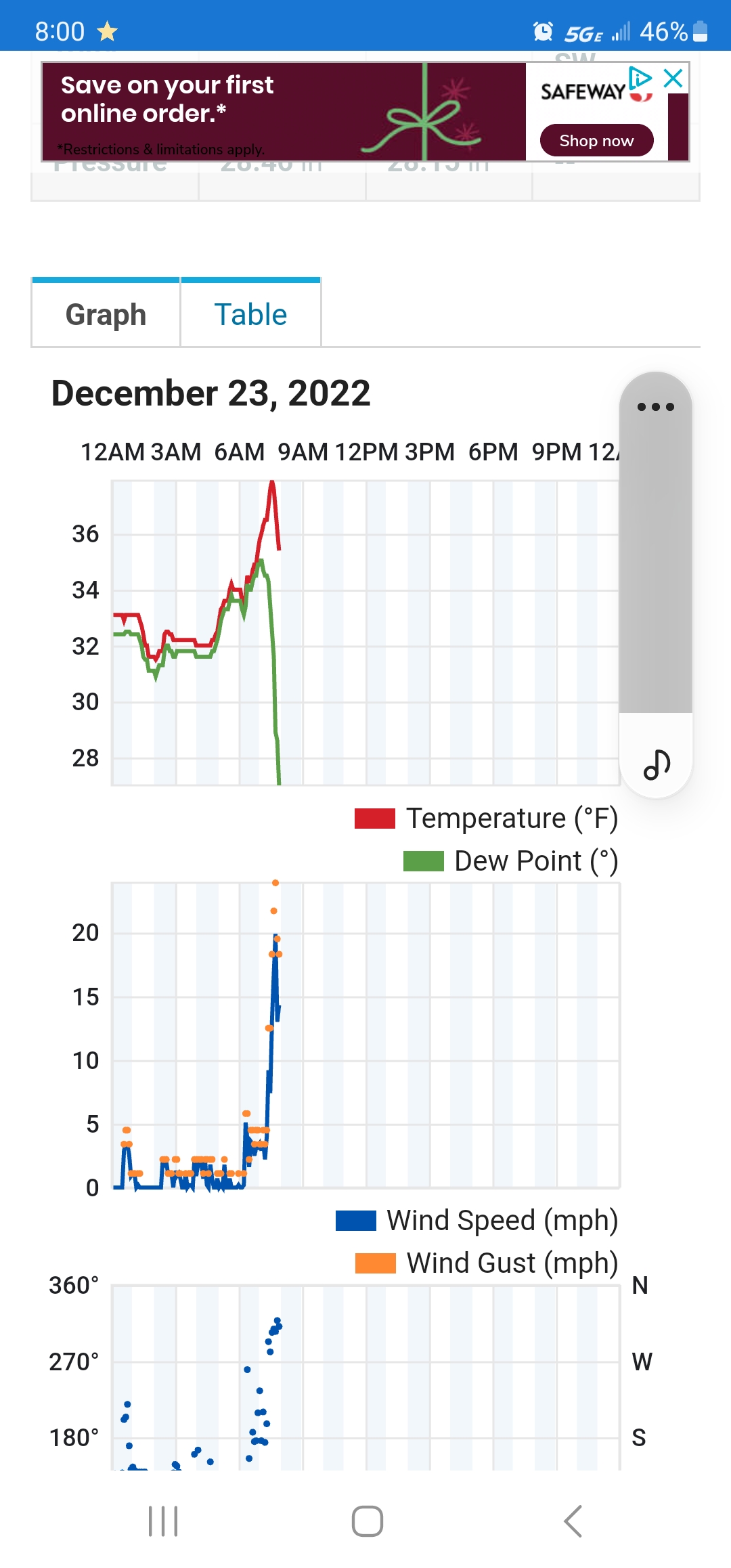
Getting nuked with the anafrontal. Scattered flurries and temp down to 28F. -
December 22-23, 2022: Warm Rain to Arctic Chill
EastCoast NPZ replied to WxUSAF's topic in Mid Atlantic
Front just came through.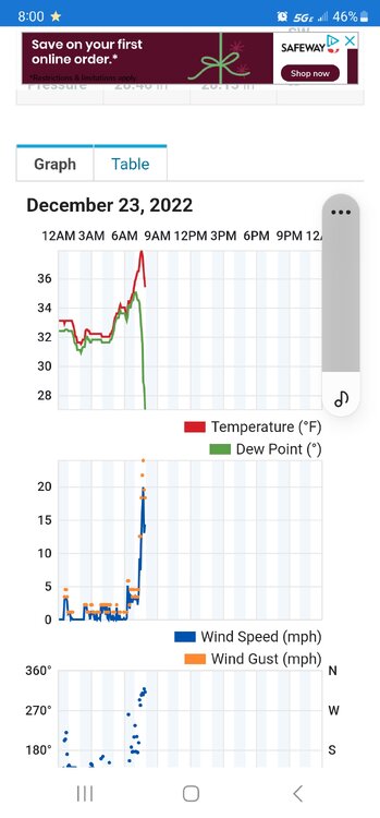
-
December 22-23, 2022: Warm Rain to Arctic Chill
EastCoast NPZ replied to WxUSAF's topic in Mid Atlantic
That would be ideal. -
December 22-23, 2022: Warm Rain to Arctic Chill
EastCoast NPZ replied to WxUSAF's topic in Mid Atlantic
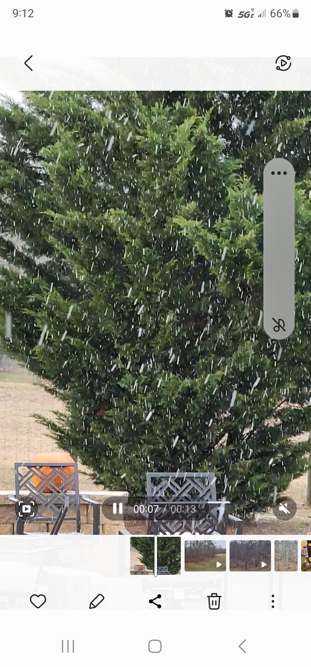
Flipped over to sleet here after a few minutes with tennis ball-sized flakes. I'll call it 2.5". Nice surprise. Now, we pray it can survive the rain until the front gets here. -
December 22-23, 2022: Warm Rain to Arctic Chill
EastCoast NPZ replied to WxUSAF's topic in Mid Atlantic
Snow has picked back up. It's reached sledding depth. Just gorgeous right now. God let this continue! 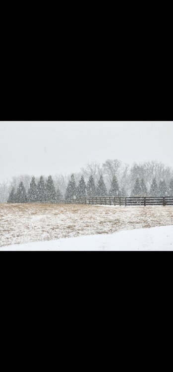
-
December 22-23, 2022: Warm Rain to Arctic Chill
EastCoast NPZ replied to WxUSAF's topic in Mid Atlantic
1". Beautiful outside.
-
December 22-23, 2022: Warm Rain to Arctic Chill
EastCoast NPZ replied to WxUSAF's topic in Mid Atlantic
If either of those verify, I'll do naked snow angels in the snow. And be the jolliest asshole this side of the nut house. -
December 22-23, 2022: Warm Rain to Arctic Chill
EastCoast NPZ replied to WxUSAF's topic in Mid Atlantic
Warm rain, frozen mud, and shredded Christmas decorations scattered over the property. Hooray. -
December 22-23, 2022: Warm Rain to Arctic Chill
EastCoast NPZ replied to WxUSAF's topic in Mid Atlantic
These maps are lol. The very rare anafrontals that ever work out for anyone only workout for areas east of the Blue Ridge. -
December 22-23, 2022: Warm Rain to Arctic Chill
EastCoast NPZ replied to WxUSAF's topic in Mid Atlantic
100% chance we get only a brief flizzard. -
Epic pattern realized! Now wait for the reload!
-
Flizzard!