Tyler Penland
-
Posts
2,504 -
Joined
-
Last visited
Content Type
Profiles
Blogs
Forums
American Weather
Media Demo
Store
Gallery
Everything posted by Tyler Penland
-

2024-2025 Fall/Winter Mountain Thread
Tyler Penland replied to Buckethead's topic in Southeastern States
Nope only had 8" here from that one. Right at 16" in '18. Which means I have had one at half. Actually forgot we made it to 8 in the 22 storm. -
2024-2025 Fall/Winter Mountain Thread
Tyler Penland replied to Buckethead's topic in Southeastern States
6 years ago today. Haven't seen an event with half this total since. I've had 2 winters not even see a season total this high.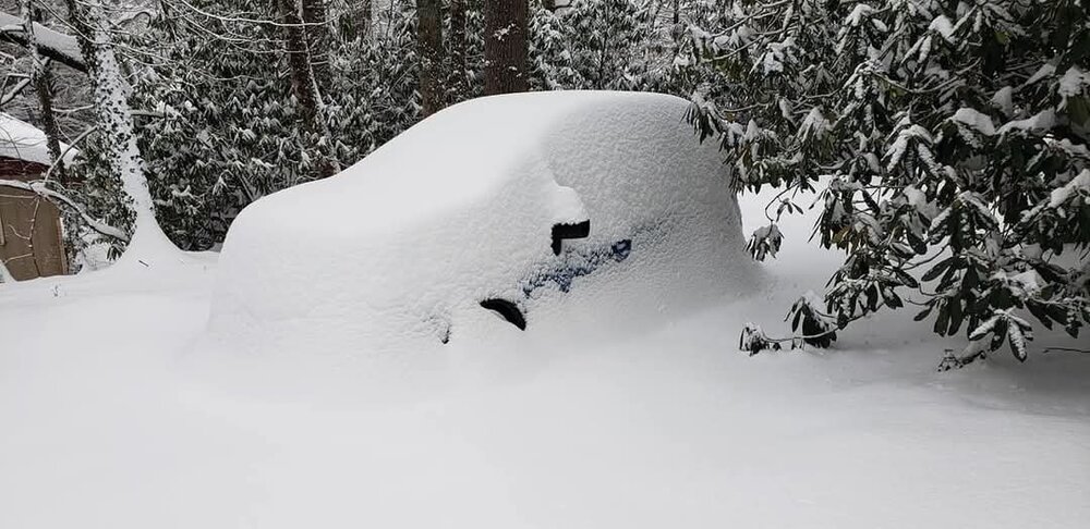
-
2024-2025 Fall/Winter Mountain Thread
Tyler Penland replied to Buckethead's topic in Southeastern States
Still a warm up, rain, cold, repeat pattern though. Trending in the right direction just need it to keep going. Next Wed/Thu is interesting. -
2024-2025 Fall/Winter Mountain Thread
Tyler Penland replied to Buckethead's topic in Southeastern States
Wednesday night looking interesting with the frontal passage. NAM has an almost convective look to it. I hope so, I'm off Thursday so I can actually enjoy it lol. Haven't had a snowy day off yet. -
2024-2025 Fall/Winter Mountain Thread
Tyler Penland replied to Buckethead's topic in Southeastern States
We definitely got downsloped this time. Not surprising, we do better here with a more northerly component. 1.5" though. -
2024-2025 Fall/Winter Mountain Thread
Tyler Penland replied to Buckethead's topic in Southeastern States
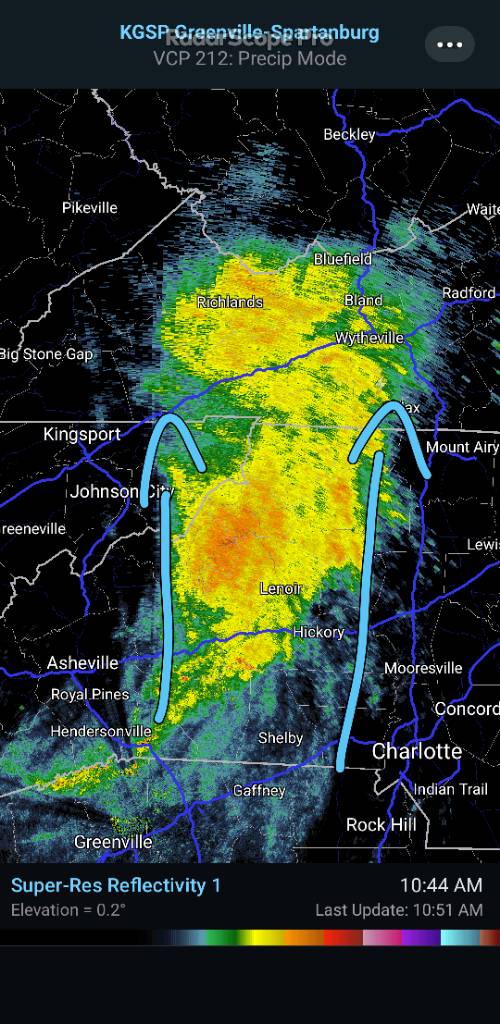
Not sure what MRX is doing but they have us at a 20% chance of snow overnight. They completely missed last night and this morning, though. Moisture plume looks decent out around Bowling Green. -
2024-2025 Fall/Winter Mountain Thread
Tyler Penland replied to Buckethead's topic in Southeastern States
Hasn't stopped here yet. This was the scene when I got to the store this morning.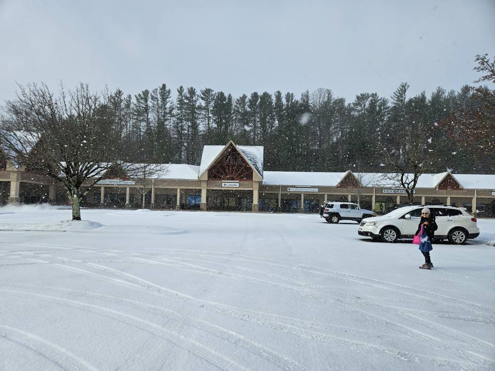
-
2024-2025 Fall/Winter Mountain Thread
Tyler Penland replied to Buckethead's topic in Southeastern States
No additional accumulation overnight but it started absolutely ripping here about 20 minutes ago. -
2024-2025 Fall/Winter Mountain Thread
Tyler Penland replied to Buckethead's topic in Southeastern States
Solid half inch or more so far. Roads around Boone are a mess. -
2024-2025 Fall/Winter Mountain Thread
Tyler Penland replied to Buckethead's topic in Southeastern States
Had a little dusting this morning. Actually flurried/flizzarded on and off most of the morning in Blowing Rock. Nice day. Wind is rocking now. -
Mid to Long Range Discussion ~ 2024
Tyler Penland replied to buckeyefan1's topic in Southeastern States
So for some reason they've decided this isn't the case for the time being. Park Service announced the other day that it is closed to all recreation when the gates are shut due to potential for downed trees and unstable ground. I think its a bit of an overreaction but that's what they've decided to do for now. Honestly a little tired of how easily public lands are getting closed since the pandemic. But yeah, most businesses saw at least a 70-80% drop in sales in October. We would love the tourism. -
2024-2025 Fall/Winter Mountain Thread
Tyler Penland replied to Buckethead's topic in Southeastern States
Long range still looking good. 12z GFS/Euro both very cold in the extended. Lots of small NW flow events sprinkled in. Fingers crossed for a big dog around the 5-12th. -
2024-2025 Fall/Winter Mountain Thread
Tyler Penland replied to Buckethead's topic in Southeastern States
3.5"! Very nice event for late November. I've successfully beat the total of winter of 22/23 before December 1st. -
2024-2025 Fall/Winter Mountain Thread
Tyler Penland replied to Buckethead's topic in Southeastern States
Up to an inch already and 28°. Dead calm here in the holler. Beautiful night. -
2024-2025 Fall/Winter Mountain Thread
Tyler Penland replied to Buckethead's topic in Southeastern States
Yep really picking up. Maybe a half inch already. Ole "no snow Foscoe" not living up to it's name this time. -
2024-2025 Fall/Winter Mountain Thread
Tyler Penland replied to Buckethead's topic in Southeastern States
Solid shower rolling through Boone at the moment. -
2024-2025 Fall/Winter Mountain Thread
Tyler Penland replied to Buckethead's topic in Southeastern States
Flurries have started here in Foscoe! -
2024-2025 Fall/Winter Mountain Thread
Tyler Penland replied to Buckethead's topic in Southeastern States
Well the rain today went well. 0.00" so far. Short range stuff looks nice with the ULL, though. -
2024-2025 Fall/Winter Mountain Thread
Tyler Penland replied to Buckethead's topic in Southeastern States
Been stuck at 35 since about midnight. Honestly kinda enjoying it with how dry and warm we've been. -
2024-2025 Fall/Winter Mountain Thread
Tyler Penland replied to Buckethead's topic in Southeastern States
Really liking the look of the models heading towards next weekend. GFS has been consistent with a big trough dipping down behind whatever happens with that tropical system. -
2024-2025 Fall/Winter Mountain Thread
Tyler Penland replied to Buckethead's topic in Southeastern States
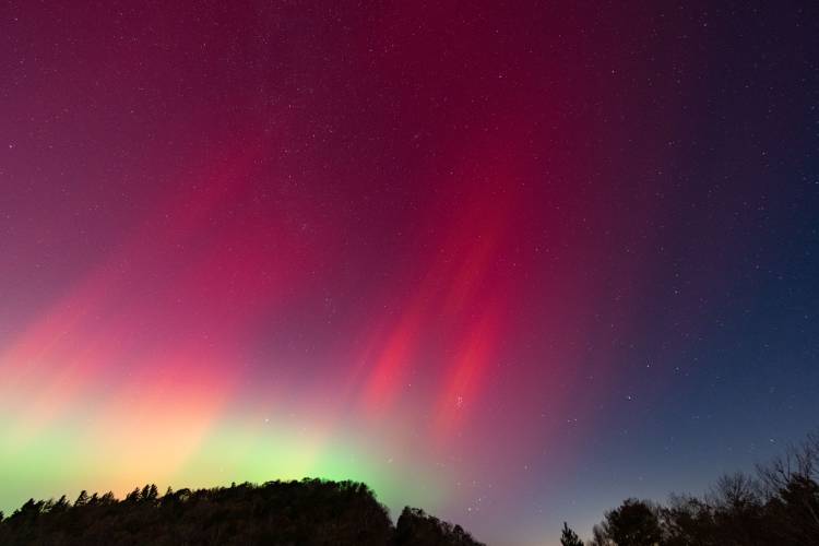
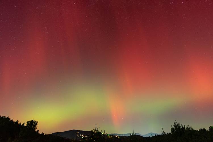
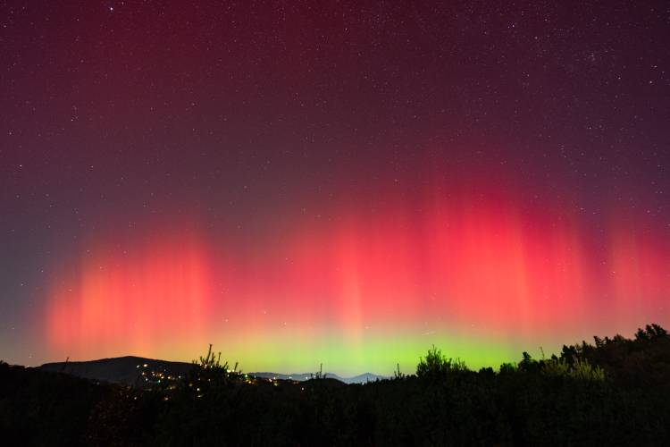
I've got a ton of images to go through but what a show. Very chilly spending 3 hours up in the breeze.
-
2024-2025 Fall/Winter Mountain Thread
Tyler Penland replied to Buckethead's topic in Southeastern States
42.4 in Foscoe this morning. Hello fall!! -
2024-2025 Fall/Winter Mountain Thread
Tyler Penland replied to Buckethead's topic in Southeastern States
Final 4 day tally of 28.68" of rain right here on the upper Watauga headwaters. 3 day of 27.08". The gauge on the Watauga failed after the river reached 1940 levels. 39,000cfs. Every major highway has a washout or landslide. I'm stuck here in Foscoe til they fix some roads. -
Just getting trained on now in the NW mountains.

-
Watauga isn't climbing as fast as I expected. Linville is approaching 2004 levels with last update at 17,000cfs