

Tyler Penland
-
Posts
2,387 -
Joined
-
Last visited
Content Type
Profiles
Blogs
Forums
American Weather
Media Demo
Store
Gallery
Posts posted by Tyler Penland
-
-
Well the rain today went well. 0.00" so far.
Short range stuff looks nice with the ULL, though.-
 2
2
-
-
Been stuck at 35 since about midnight.
Honestly kinda enjoying it with how dry and warm we've been.-
3
-
-
Really liking the look of the models heading towards next weekend. GFS has been consistent with a big trough dipping down behind whatever happens with that tropical system.
-
3
-
-
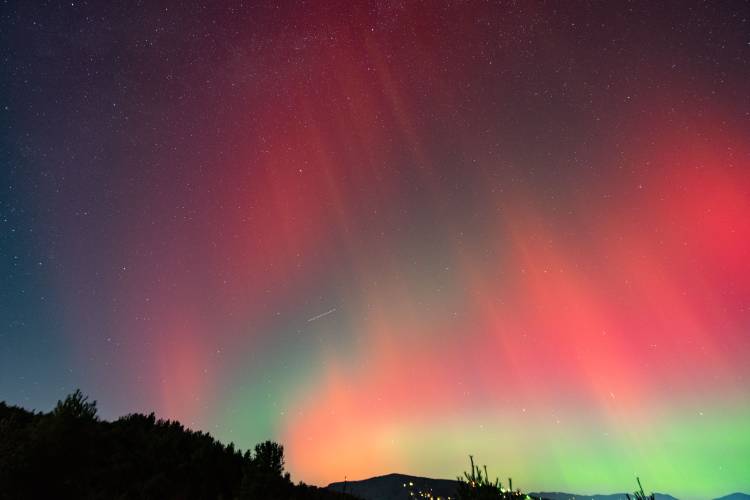
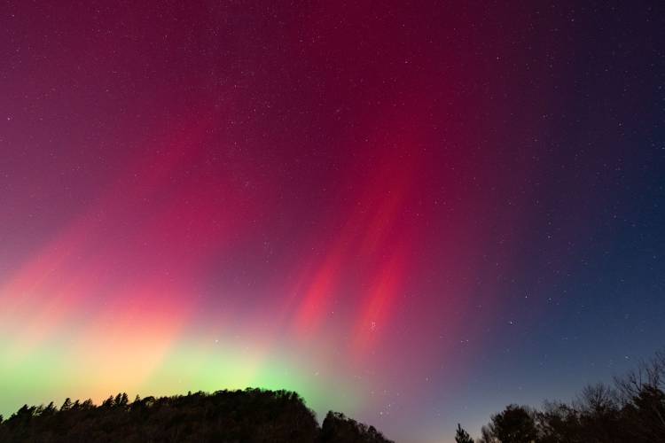
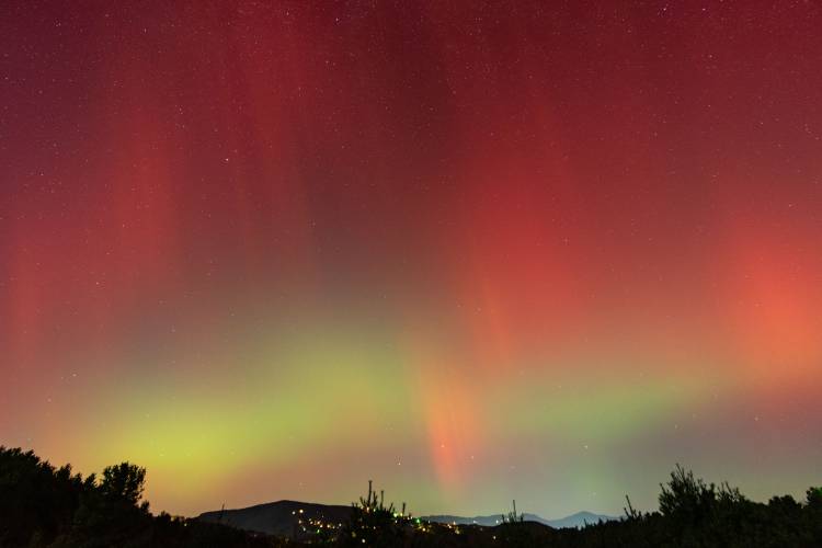
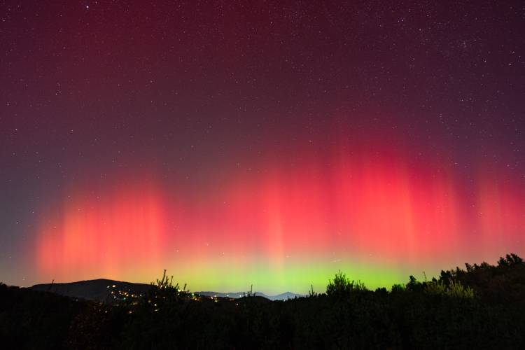
I've got a ton of images to go through but what a show. Very chilly spending 3 hours up in the breeze.
-
9
-
-
42.4 in Foscoe this morning.
Hello fall!!-
4
-
-
Final 4 day tally of 28.68" of rain right here on the upper Watauga headwaters. 3 day of 27.08".
The gauge on the Watauga failed after the river reached 1940 levels. 39,000cfs.
Every major highway has a washout or landslide. I'm stuck here in Foscoe til they fix some roads.-
3
-
-
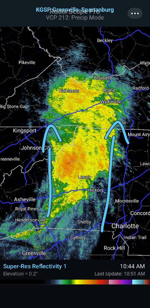
Just getting trained on now in the NW mountains.

-
Watauga isn't climbing as fast as I expected.Any update on river levels? Anything break all time records yet
Linville is approaching 2004 levels with last update at 17,000cfs -
Just lost power. Getting scraped by this eyewall. Cell service is spotty. Over two feet of rain with 7 more inches since midnight.
Easily the scariest weather I've ever been in. -
Really really picking up here now. Somehow still have power even though it sounds like a war zone with transformers blowing.
I live in a hole so most of the wind is going over my head but sounds like a jet most of the time. -
Looks to me like she's moving due north right now. HRRR/NAM had been showing this all day.
-
1
-
-
Winds are picking up here. Finished yesterday at 10.6" with another 2.4" since midnight (actually slowed down a bit). Storm total since Wednesday morning now up to 18.9". 20.5 going back to Tuesday.
Linville broke 10,000CFS and the Watauga is over 11,000.-
3
-
-
Foscoe. I'm fascinated. We don't usually get hit this hard over here.Where exactly Tyler? Just curious
Winds picking up already. -
I'm about 10 miles south of Boone in NC and am up to a 3 day total of just over 17".
1.61 Tue
5.89 Wed
9.5" Thu and still falling fast.
Never seen rain rates like this last so long. Should easily break 2 feet for the week. All this water has gotta go somewhere.-
1
-
 1
1
-
-
Over 17" 3 day total now.
Accidentally reset my station event readout so having to do math now lol-
2
-
 1
1
-
-
Guys this is absolutely ridiculous.
15.33" since Tuesday afternoon, 13.7" of that just yesterday and today. 8.07" since midnight. I have never seen it rain this hard for this long. Rates never drop off despite what radar says. My gutters stopped keeping up a long time ago.-
2
-
1
-
-
Linville River already over 7ft.
We picked up an additional 2.14" since midnight which brings me to 7.9" since yesterday morning and 9.5" since Tuesday afternoon.
-
2
-
-
20 minutes ago, Met1985 said:
Damn man! That is crazy! Great job capturing that!
Thanks! It was my first tornado! Never thought I'd see my first one up here on the mountain, though.
Just crossed 3" since 9:30PM. 2 day total up to 6.51" now.
-
4
-
-
1 minute ago, calculus1 said:
Can you post the link?
Here ya go. Let me know if this doesn't work.
Up to 2.4" of rain in the last hour and still dumping. Rain rate maxed at 4.56"/hr. I didn't even know it could fall that fast.
-
1
-
 4
4
-
-
9 minutes ago, wncsnow said:
I saw your video that was wicked. Same cell came over mby.
Another one right now.
Rain rate just topped 3"/hr, we're up to 1.18" in the last 45 minutes.
Holy $##$ just topped 4"/hr.
-
Saw a tornado over Blowing Rock today. Absolutely INSANE.
Also up to 4.16" of rain since yesterday afternoon and over 2" just today with a LONG way to go.
-
4
-
1
-
-
1.6" here from that line in a little over an hour.
-
2
-
-
6z ICON would be a disaster for the entire southern Apps from Alabama to West Virginia. Crazy rainfall amounts from the interaction and brings the center straight up through WNC.
-
1
-
-
Pattern setting up like it's going to send whatever tropical stuff this way.
-
1
-
2024-2025 Fall/Winter Mountain Thread
in Southeastern States
Posted
Flurries have started here in Foscoe!