

Tyler Penland
-
Posts
2,387 -
Joined
-
Last visited
Content Type
Profiles
Blogs
Forums
American Weather
Media Demo
Store
Gallery
Posts posted by Tyler Penland
-
-
Just got home from GA. Looks like we hit 5 this morning. Currently 2.5" of powder so I'm guessing it was closer to 3 before compaction this morning. Brings me to 16.8" for the season with a handful of traces to boot.
-
 4
4
-
-
Getting some flurries all the way down in GA this afternoon.
-
2
-
-
Well 18z suite didn't go our way for mid week.
I'm down in GA til Monday evening, y'all enjoy the NWF.-
1
-
-
Models just inching north. Last few runs of the gfs just slightly weakening the high. Interesting few days ahead.
The NW trend is inevitable.-
6
-
-
3km NAM out to 60. Could be interesting for sure.
-
1
-
-
5 hours ago, strongwxnc said:I feel like yall are going to be in it for a while in the mountains. The next week + look great for systems and NW events.
Just wish it wasn't rain on the last big ski weekend of the year. Awful for local businesses that are already down. Lots of "local" (Charlotte, Winston/Greensboro) folks won't come up with rain in the forecast.
Beech and Sugar are both down about 25% this year from what I've heard despite the great weather.That said, I'll be VERY surprised if we aren't looking at a decent thump next Tue-Thu. If this Sundays low could get going a little quicker it could kick some moisture back as well.
-
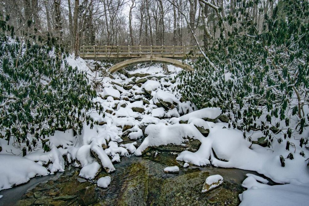
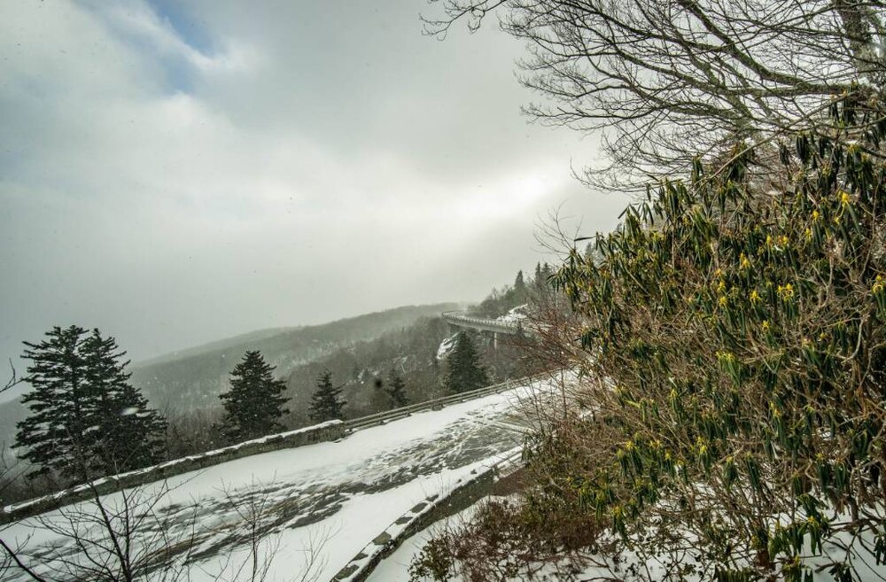
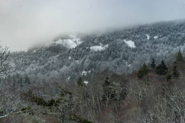
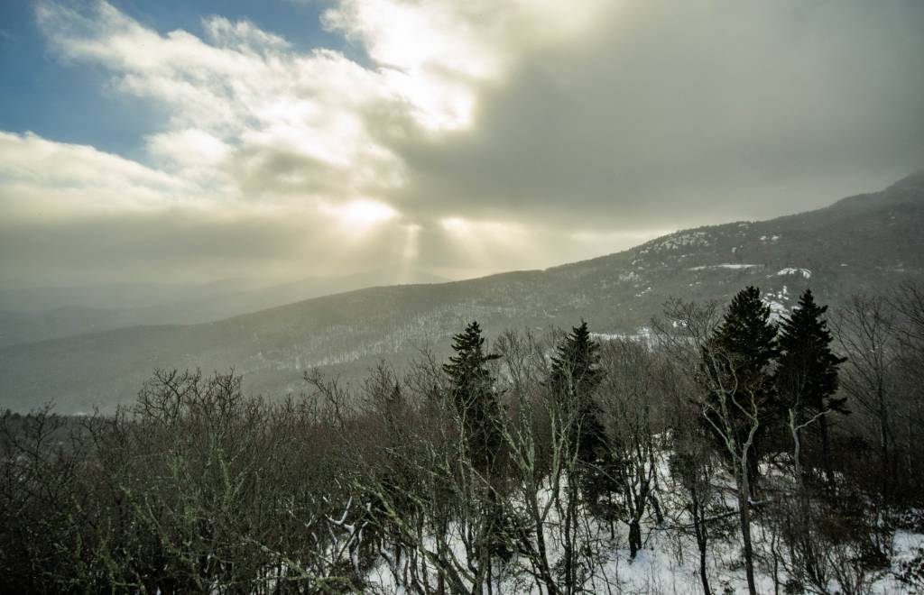
Spent the afternoon hiking the Parkway from Beacon Heights to near Rough Ridge. Wind was absolutely brutal. Snow was 10+" deep on the Tanawa at Wilson Creek. Drifts up to my knees in spots.

-
7
-
-
Wound up with a drift on my board so had to measure around the yard. Average of 5.5". Solid event and still coming down.
-
5
-
-
Up to 3.5" and back to some snow, but not heavy just yet. Probably more in the rest of the county we usually get down sloped by Grandfather a bit in these situations.
-
2
-
-
Almost 3" and been hammering for a bit. Y'all can have the sleet, our roads are bad enough.
-
3
-
-
Snow started about 11:30 in Blowing Rock. Only about a half inch so far here at the house but it's coming down decent. 24º
-
55 minutes ago, Met1985 said:
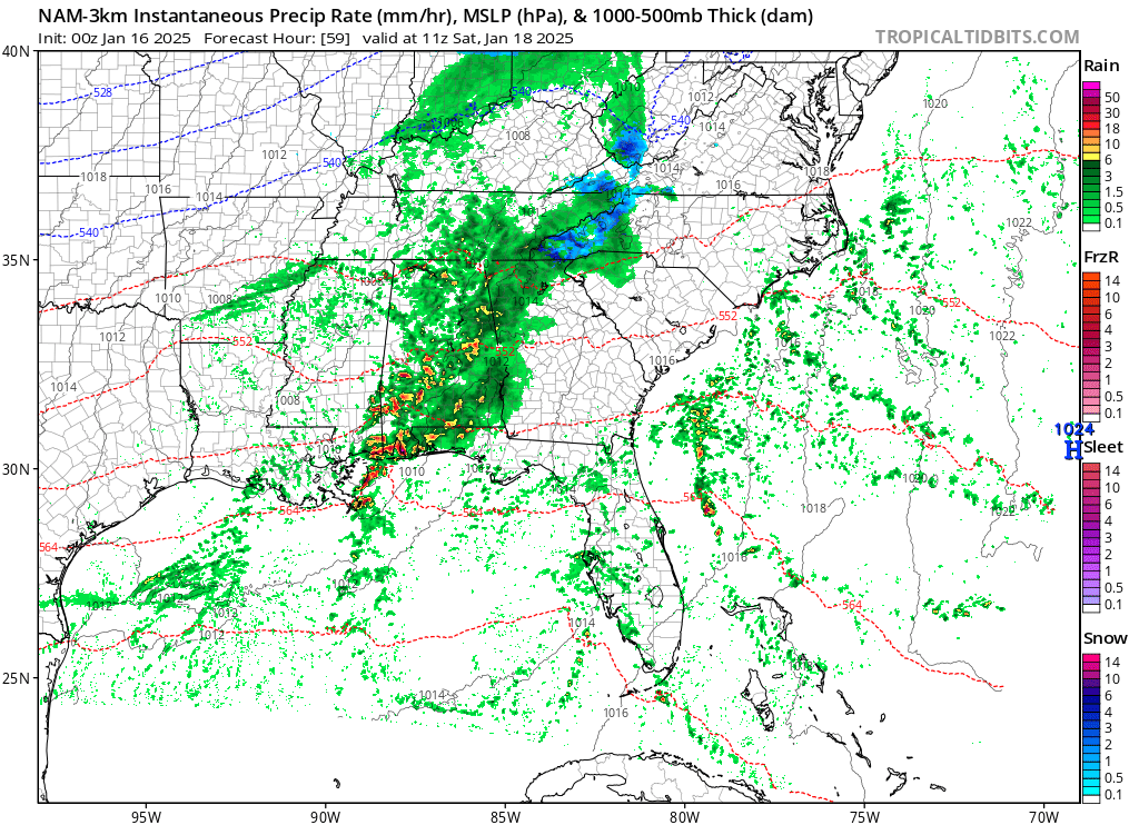
Basically we are in a now cast situation. We are about 12 hours from the start of this storm. The storm is a beast in Texas and looks very healthy.
If I had a nickel for every gulf storm that the globals understate northern precip amounts on I'd have a lot of nickels.
-
4
-
 2
2
-
-
We've managed to get to 25 so far after a low of 9. Actually feels really nice in the sunshine.
MRX went straight to a warning for 3-5".-
1
-
-
3 minutes ago, acc fan said:
Still no products from Blacksburg office. Anyone have an idea why this may be?
They like to do this. Wait til the last minute. They've completely botched more than one event since I moved up here in 2015, too. Just keep watching the models, things are looking better and better for us (NW shifts for the win).
I'm wondering when FFC/GSP is gonna pull their warning trigger, too. Less than 24 hours now.
-
2
-
-
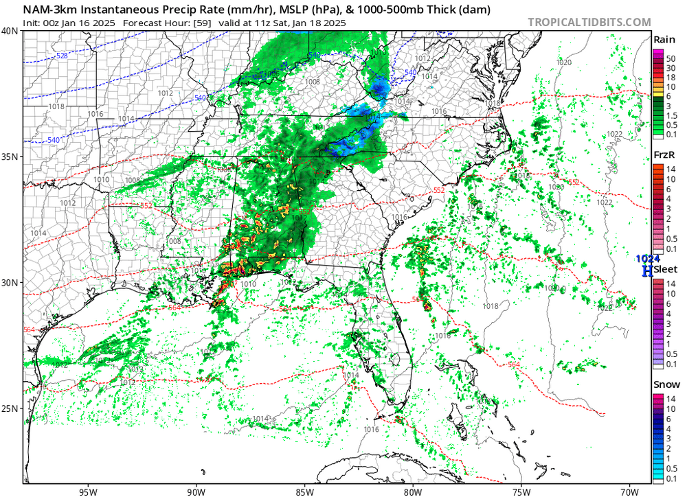
I don't think lack of precip is gonna be an issue for most (remember globals are going to underestimate that every single time) but the warm nose on the NAM is very concerning to me. It doesn't miss on those much.
-
2
-
-
I'm in Asheville but wife said 25 with a glaze at the house.
Haven't been able to get my station to recognize the wifi since Helene.-
1
-
-
Fair.It's the light stuff that accumulates fast.
Not even picked up a glaze that I can see yet. Temp says 28. Feels like a heat wave.
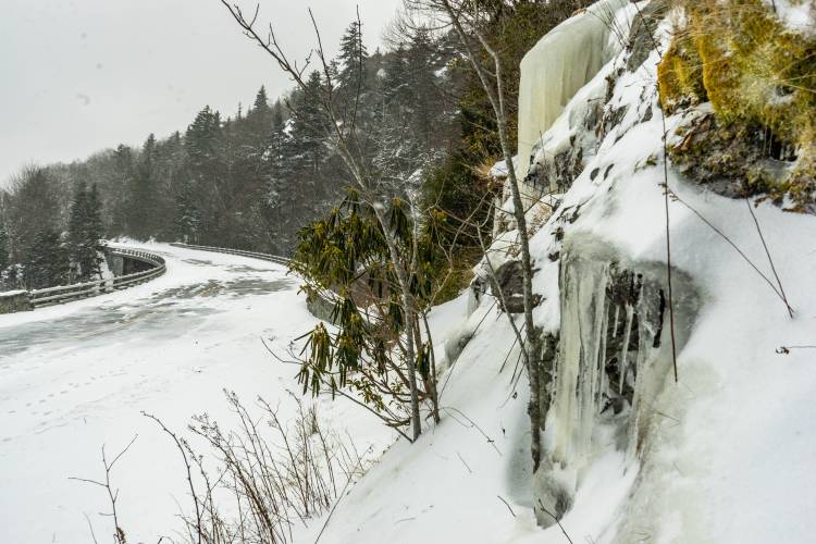
One thing I noted is that after we go briefly above freezing in the morning we are looking at a 7-10 day stretch below freezing here. Reminiscent of the 2018 freeze out. Should be some nice frozen waterfalls soon.-
2
-
1
-
-
Over to ZR in Blowing Rock now. Very light stuff fortunately.
-
2
-
-
31 according to the truck and a sleet/graupel/snow kinda thing here in Blowing Rock.
-
3
-
-
That's a lot of precip over central TN that wasn't supposed to be there last night.
-
4
-
-
Absolutely hammered for a bit. 1.5" now.
Kicking and crawling our season total up to 7.8".-
6
-
-
Just hit 1".
-
4
-
-
22 with light flurries/diamond dust here this morning. Very pretty.
-
2
-
-
Glancing at the Euro soundings verbatim it is very, very close to staying all snow in the mountains on Monday. I would imagine the warm nose wins (it almost always does) but it is very close.
-
2
-


2024-2025 Fall/Winter Mountain Thread
in Southeastern States
Posted
Currently 6.0/2.1 here. Bit chilly.