GrandmasterB
-
Posts
805 -
Joined
-
Last visited
Content Type
Profiles
Blogs
Forums
American Weather
Media Demo
Store
Gallery
Everything posted by GrandmasterB
-

Central PA Winter 25/26 Discussion and Obs
GrandmasterB replied to MAG5035's topic in Upstate New York/Pennsylvania
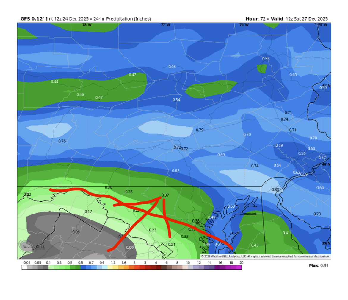
12Z GFS slightly colder outcome for everyone and a little more precip for the southern crew. -
Central PA Winter 25/26 Discussion and Obs
GrandmasterB replied to MAG5035's topic in Upstate New York/Pennsylvania
Someone posted in the MA forum that a known tendency of the Euro is to show freezing rain that should be a sleet profile. That would explain the difference between the GFS’s sleet output and the Euro which is almost entirely frz rain. Should be interesting regardless of how this transpires. …And Merry Christmas everyone!! -
Central PA Winter 25/26 Discussion and Obs
GrandmasterB replied to MAG5035's topic in Upstate New York/Pennsylvania
Canadian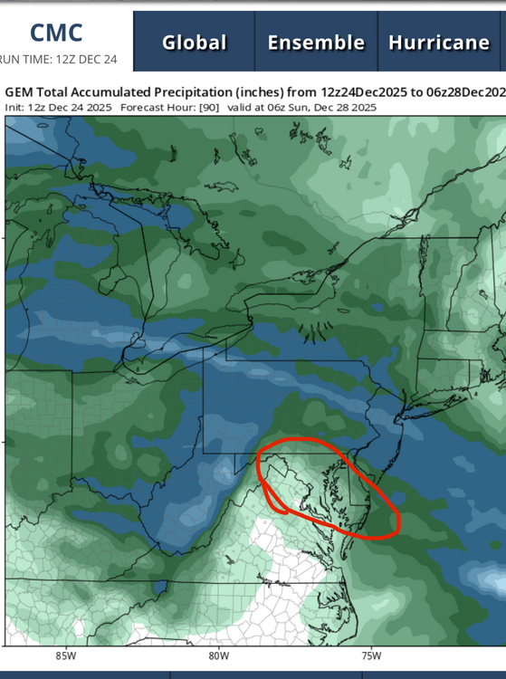
-
Central PA Winter 25/26 Discussion and Obs
GrandmasterB replied to MAG5035's topic in Upstate New York/Pennsylvania
This is what I was nervous about before the 12Z runs and both the GFS and more so the Canadian both moved this sharp cutoff northeast:
-
Central PA Winter 25/26 Discussion and Obs
GrandmasterB replied to MAG5035's topic in Upstate New York/Pennsylvania
I’ve been tentative about getting invested in this Friday thing. I don’t remember seeing a set-up quite like this one. Pros IMO, temps don’t appear to be an issue. I’m an ice guy (prefer snow of course) but it beats rain or mostly cloudy. So whatever falls will be frozen. Tracking something is great. Cons. Sharp cutoff of precip just across the MD line. Being in the south of this forum, I’ve been burned by the north trend once already this year. Some small trends northeast in modeling over the last 24 hours with probably more to come. Might get the rug pull. In any event, I’m hoping we all get the goods! (outside of Voyager I guess). Thanks everyone for contributing to this forum. Part of the fun for me is hitting refresh here so please keep it up! -
Central PA Winter 25/26 Discussion and Obs
GrandmasterB replied to MAG5035's topic in Upstate New York/Pennsylvania
Just under 4” on the ground here, quite cold, plus on and off snow showers. Doesn’t get a whole lot better for mid-December! -
Central PA Winter 25/26 Discussion and Obs
GrandmasterB replied to MAG5035's topic in Upstate New York/Pennsylvania
18Z NAM beefed up again vs. 12Z. I’m sure Blizz has those sweet, sweet maps. -
Central PA Winter 25/26 Discussion and Obs
GrandmasterB replied to MAG5035's topic in Upstate New York/Pennsylvania
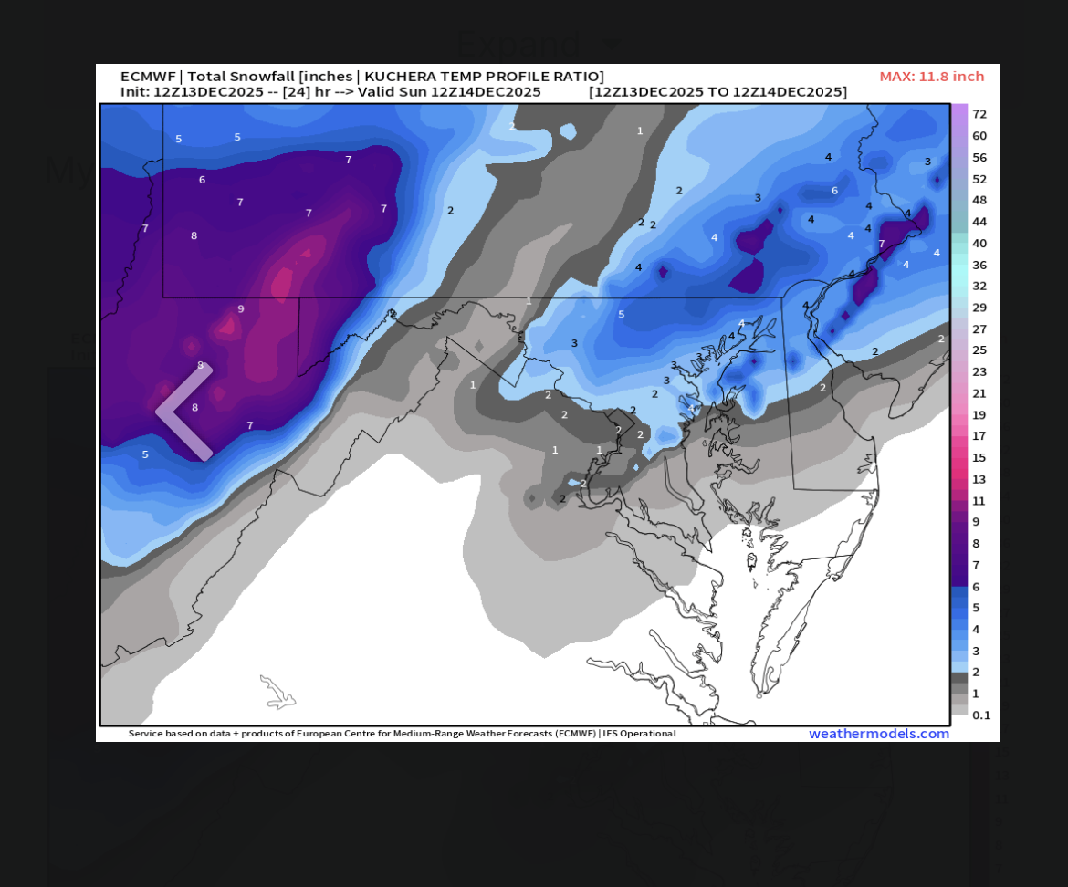
Euro Kuchie stolen from the MA. Another small bump up in totals. what’s warning criteria down here in York and Lanco? 4-6?
-
Central PA Winter 25/26 Discussion and Obs
GrandmasterB replied to MAG5035's topic in Upstate New York/Pennsylvania
Seems like it’s been a little while since we had an event trending better and better right up until go time. Ya love to see it! -
Central PA Fall Discussions and Obs
GrandmasterB replied to ChescoWx's topic in Upstate New York/Pennsylvania
Cool cool cool
-
Central PA Fall Discussions and Obs
GrandmasterB replied to ChescoWx's topic in Upstate New York/Pennsylvania
All good! It’s really a blend of models in the forecast and the GFS was way too aggressive on snow for the southern parts of York/Lanco. It didn’t help that the Euro bled north run after run. I don’t think the Euro or GFS performed all that well for this event from just 72 hours out. I just hope we get paid back with a north trend when we need it! -
Central PA Fall Discussions and Obs
GrandmasterB replied to ChescoWx's topic in Upstate New York/Pennsylvania
I was the one who commented about the NAM and yeah Canderson would have measured 0.0 if this was right: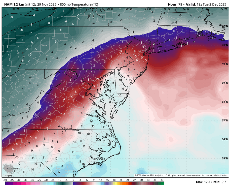
-
Central PA Fall Discussions and Obs
GrandmasterB replied to ChescoWx's topic in Upstate New York/Pennsylvania
I’ll get out of bed for sure, but if it’s rain I’m heading right back -
Central PA Fall Discussions and Obs
GrandmasterB replied to ChescoWx's topic in Upstate New York/Pennsylvania
Nowcasting is not what it used to be, but in this situation it may come into play given how tight the gradient is forecast to be between a trace and 4”. We have seen models underestimate WAA, but we’ve also seen them underestimate evaporative cooling. Will be interesting to see play out and hopefully everyone gets a nice snow tomorrow. -
Central PA Fall Discussions and Obs
GrandmasterB replied to ChescoWx's topic in Upstate New York/Pennsylvania
Ukie has measurable down to the MD line. My goal for this system (IMBY) is two inches. Seems plausible at this time.
-
Central PA Fall Discussions and Obs
GrandmasterB replied to ChescoWx's topic in Upstate New York/Pennsylvania
I’m not putting a lot of weight on the 78 hour NAM thermals. Could certainly end up being right, but it’s not close to the euro output. -
Central PA Fall Discussions and Obs
GrandmasterB replied to ChescoWx's topic in Upstate New York/Pennsylvania
12Z GFS colder on the front end and overall better for us southerners. True central smoked. Noticeable move to the Euro. -
Central PA Fall Discussions and Obs
GrandmasterB replied to ChescoWx's topic in Upstate New York/Pennsylvania
Agreed. A little snowier for the Sunday one and less snowy for the mid-week threat, but hard to complain for early December. -
Central PA Fall Discussions and Obs
GrandmasterB replied to ChescoWx's topic in Upstate New York/Pennsylvania
Well that escalated quickly! It’s certainty nice to have something to track. Thanks Blizz as always for the maps. -
Central PA Fall Discussions and Obs
GrandmasterB replied to ChescoWx's topic in Upstate New York/Pennsylvania
Now that the models run at the correct times I guess I’m back in. This (snow chasing) hobby is a lot of investment and often times disappointing, but I couldn’t quit it even if I tried. Here’s to another season riding it out with everyone. I hope it’s a cold and snowy one for all of us! -
Radar for Lancaster county looking not great.
-
Pro tip: if you check models tonight or tomorrow for possible flakes on Saturday then you’re really only going 5 months without checking models for snow.
-
Central PA Winter 2024/2025
GrandmasterB replied to Voyager's topic in Upstate New York/Pennsylvania
A highlight of the season ITT! -
For context MU is a great met up here, but typically very conservative.
-
Central PA Winter 2024/2025
GrandmasterB replied to Voyager's topic in Upstate New York/Pennsylvania
Thanks for posting up here. MU is excellent and typically conservative so to see him aggressive on this set-up and echoing your thoughts is interesting.