JoshM
-
Posts
3,398 -
Joined
-
Last visited
Content Type
Profiles
Blogs
Forums
American Weather
Media Demo
Store
Gallery
Everything posted by JoshM
-
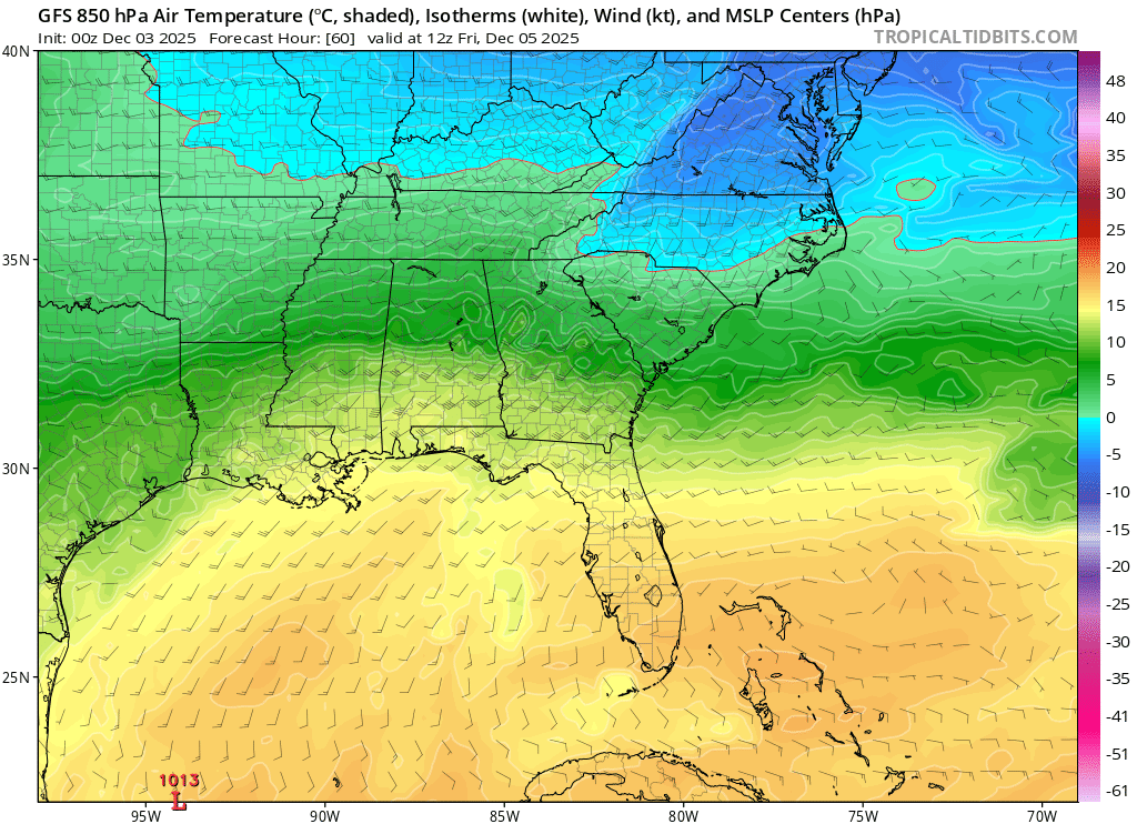
The 850s make me happy... I'll worry about surface later

-

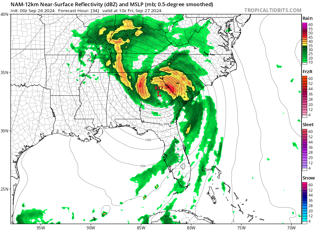
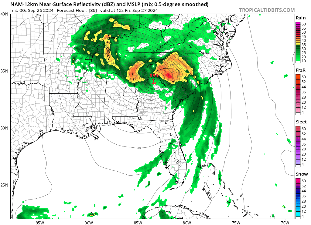
February 19-20 Major Winter Storm Threat
JoshM replied to NorthHillsWx's topic in Southeastern States
I had to get another carton of smokes. -
Little bit of ZR, too
-
Happy hour BOOM!!! Very nice wedge!

-
For my area it'd the boom of power transformers!
-
this one is at least believable... look at that I-85 line!
-
-
-
Now that's some pipe busting weather! Oh, and it has 20mph+ wind gusts as well (50mph+ in mountains)

-
The way the weather has been this year, nothing would surprise me!
-
Ready for the cool weather, hope we can get a frost in around the Piedmont before Halloween. I like Halloween better when it's cool.
-
These storms usually have some surprise at the 11th hour. Hurricane Floyd always pops into my head for my area. Thought it was gonna be a Hugo redux and we got nothing (even had blue skies that day). School was closed that day.
-
High res nam has some gusts to 90 in asheville and 70 in gastonia. even some sustained TS force winds west of charlotte
-
0z NAM decent jog east with some bands

-
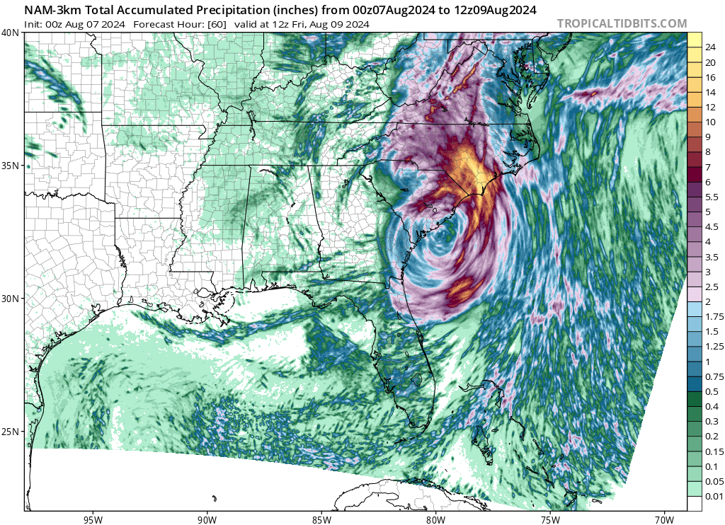
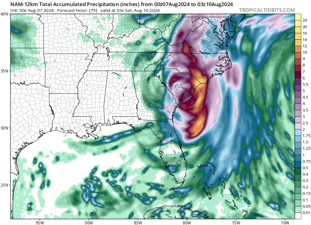
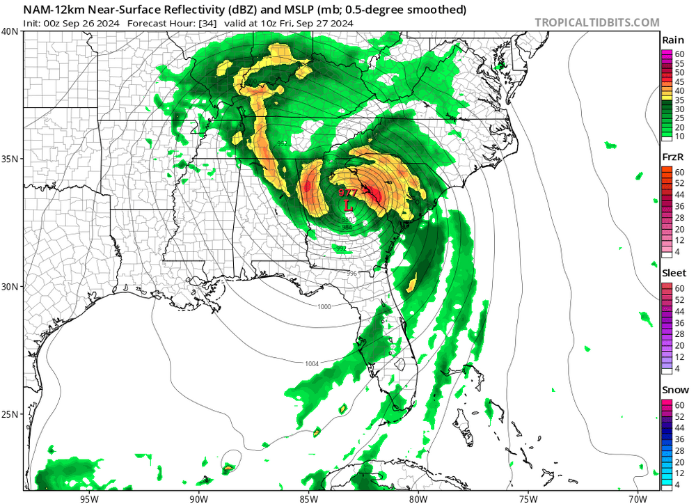
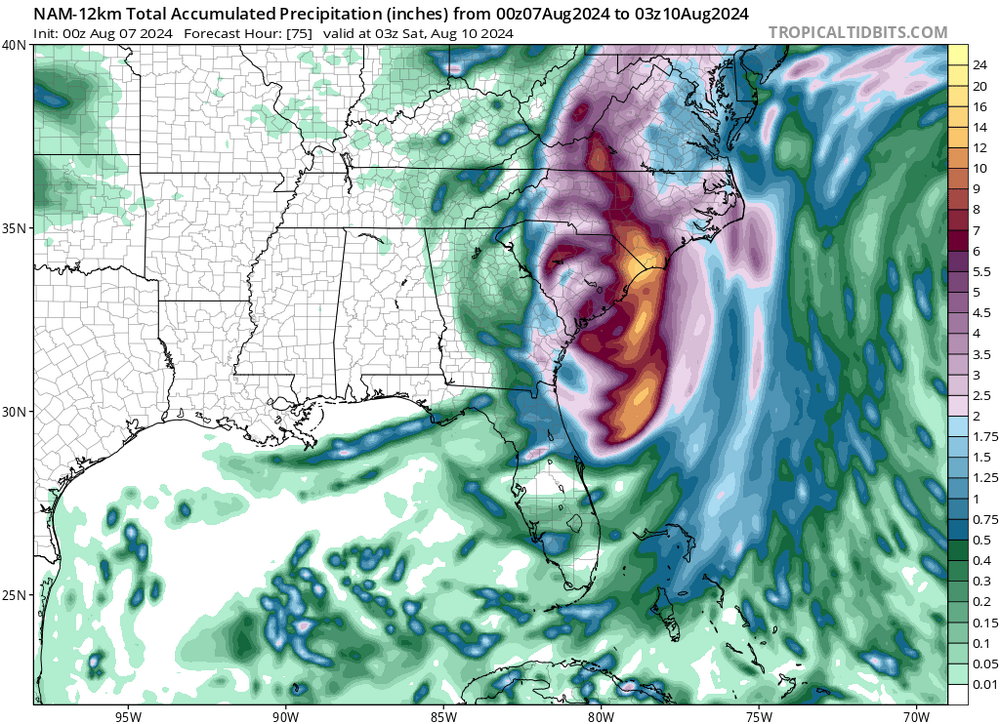
Hurricane Debby - flooding rain threat region wide
JoshM replied to olafminesaw's topic in Southeastern States
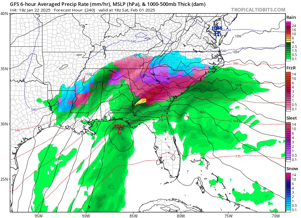
FWIW, 0z NAM made a decent shift west with the precip.
-
I don't think we'd even score in a nuclear winter.
-
Ya, we need to go to Mexico!
-
I've ran out of stupid/sarcastic comments and gifs, and for that reason...
-
Ya, back in my day, before the interstate the storms didn’t know where to go
-
It's been many moons since I've seen a storm stick around from fantasy land this long.
-
Hey, I'm like a dog. I go for the fake throw every time!
-
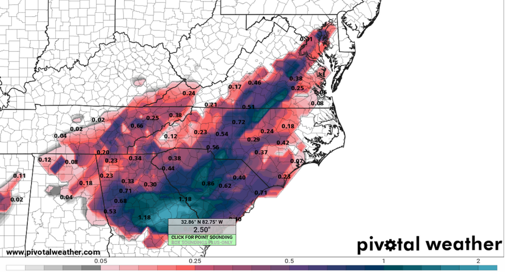
Is it even possible to get that much ZR with a transient high?
-
18z GFS has 1.5" of ZR at KCLT
-
Ill give the GFS credit, it won't let go of this fantasy storm.
-
We should rename this forum the Carolina Panthers forum. We start with high hopes, get shit on right away, never score, and punt a lot.