weatherwiz
-
Posts
81,150 -
Joined
-
Last visited
Content Type
Profiles
Blogs
Forums
American Weather
Media Demo
Store
Gallery
Everything posted by weatherwiz
-
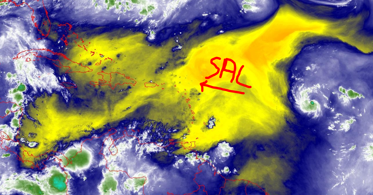
Yeah RIP Erin. If Erin starts to organize and try to strengthening its just going to begin ingesting this air deeper into the circulation. Not too mention Erin is still hauling westwards

-
None. It's done, over, caput, zero chance.
-
Southwest CT probably gets the most rain with storms today
-
I guess sea-breeze boundary is something to watch for tomorrow. The HRRR has been dreadful this summer in terms of convection but I think it is onto something.
-
If anything the best chance for stuff is like late tomorrow afternoon/evening and overnight. 12z HRRR is pretty active late afternoon/early evening (looks like RRFS will be too). Regardless though should be a rapid weakening of activity with east extent.
-
yup...something to certainly watch for them and as you've stated a few times they have been a real magnet these past few years. Something which could also end up heavily influencing the weather pattern here for the last week of August.
-
I'm with Kevin, I don't see all that much Thursday, probably northwest and mostly northwest of our region...back more into NY like around Albany and into VT. Probably be a lot of isolated or scattered stuff, nothing widespread.
-
I wouldn't worry too much about where the storm is relative to guidance right now (too far north, south, etc). Erin is still in the initial phases of development and organization and there is going to be a lot of wobbling going on. Once Erin gets closer to hurricane state with a more well-defined center. Anyways rather minute because does it really matter if it starts recurving at 60W or 70W...the pattern over the East its going to get scooped OTS but yes Atlantic Canada can't be ruled out. This is 0.000000000000000001% for East Coast.
-
A heat wave and heat advisory are not in the same. You don’t need high dews or heat index for a heat wave
-
True, but it is still doable, just messy.
-
Working outside today and not sure if it's because I am just getting over whatever I was sick with but these temps are bothering me WAYYYYY more than when I was sitting out here when it was 98/73+. Bring back the dews
-
I think a big part of that is tied into that trough digging into southeast Canada. Seems to really do a number on that riding. If the GFS is too aggressive with that degree of troughing that could open the door for a stronger ridge
-
The only positive about lower dews with heat is dog poop dries faster so it's easier to pick up. Since the dog has been on prednisone since the winter and will be long-term, he is extremely gassy with very soft poop that explodes when you pick it up, so the low dews allows it to dry quickly. Other than this, no other benefit to low dews.
-
sent you a PM about school. I'd say go for it
-
I have to do the thread for the free league. Unfortunately, I won't be doing the pay league this year. It's become exceedingly difficult to find interest. I've tried opening up to outside the board and having those in it reach out to friends...it helped somewhat but not enough and then it gets difficult tracking/getting money. With starting grad school in two weeks plus still working full time I need to limit "headaches" where I can. Maybe next year can bring it back.
-
Farmers Almanac calling for a cold/snowy East is akin to Cowboys fans thinking they're perennial Super Bowl contenders.
-
Unfortunately that is true.
-
There is always that super low percentage it happens but like you said, there is a very specific and clear pattern to get these up the coasts. There is a reason why they are infrequent and the return rate is in the years. I get looking the extended range SLP or snow maps or whatever is fun but having an understanding of the current pattern in place and how the pattern will evolve will give you tremendous insight as to what you can expect will unfold in the extended range (there are exceptions of course).
-
Some people forget or don't understand that weather forecasting is way more than just looking at the solution of a model output.
-
I just don't get it. Why would you want to shed yourself in that light?
-
hey nothing to complain at there
-
Could you imagine
-
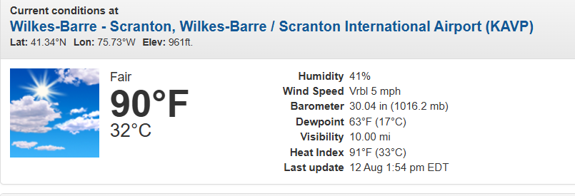
Well AVP has a shot at 90 tomorrow but probably end up 88-89
-
I clicked his profile...and he even lives in and is from NE PA...that makes this even more ridiculous. He must be a Flyers fan