weatherwiz
-
Posts
81,148 -
Joined
-
Last visited
Content Type
Profiles
Blogs
Forums
American Weather
Media Demo
Store
Gallery
Everything posted by weatherwiz
-
Checking out some soundings on the 0z NAM and don't see the funky profile in the lowest km anymore...so its much steeper with the llvl lapse rates. Hell this even looks better in terms of tornado risk, especially early on when storms are discrete and organizing into a line.
-
It will be interesting to see how tomorrow pans out. I don't think we're looking at widespread severe weather but maybe we see something along the line of a concentrated swath of wind damage reports focused where any bowing segments occur. Even with poor mid-level lapse rates, I think if we had better and stronger shortwave forcing that could yield greater potential for a swath of wind damage across the region. The greatest severe weather potential may also be early on, which would favor far western sections as activity develops. LFC heights aren't too bad, so if parcels can get to the LFC easily the initial storms could be potent with risk for a tornado. But I could see this evolving more into a torrential rain/gusty wind on the leading edge ordeal very quickly. Probably Berkshire County, Litchfield County, Fairfield County into western Hartford/Hamden/Hampshire counties for best severe potential...which matches up well with where the slight risk is.
-
?
-
One big difference tomorrow between the NAM and GFS is the difference in lapse rate in the lowest km. This could be the difference in getting damaging wind gusts that are more scattered/concentrated versus localized.
-
If my gustnado doesn't count a waterspout doesn't count
-
What will hold tornado potential back tomorrow is storm mode. That's a large helicity field across the region with some decent turning in the lower levels.
-
Could be some nasty storms tomorrow for sure if we get enough heating.
-
Kind of what I'm thinking but until we actually get a center to pop this is all kind of minute anyways but these shifts south with the wave are noteworthy. I wonder if the modeled size being so small is a factor in this too
-
GFS was really insistent on the remnants bringing heavy rain/flash flooding into AZ/NM and western TX...oops
-
Still early in the run but 12z GFS WAYYYY south with the invest moving across the southern Tropical Atlantic...that is a sizable shift south
-
Yeah at this juncture I have doubts as well, however, just enough in place to keep me a bit intrigued. Once this is able to develop and organize and where we see the center we'll have a substantially better idea of what to expect long-term.
-
One big change to notice as well is how much farther south this is being modeled. Pretty substantial really. If that front doesn't capture the system there would be a path towards the coast.
-
Summer is over...sad. But I am ready for football and hockey and hopefully Red Sox playoff baseball.
-
I hope you don't mind Ray but I may just post some "random" information here off and on which may not precisely be trying to prove a point, moreso just an illustration open for interpretation. With that said, I was just looking into the PDO and found it Interesting how 4 of the 7 most -PDO July's have occurred since 2022. Coincidentally, you just mentioned the PDO and its extreme negative state above too!
-
Could certainly be some upslope enhancement up in NNE. Also wouldn't rule out the potential for a tornado or two within the valley.
-
Friday should actually see some gusty thunderstorms and some hailers...particularly along and north of the Mass Pike. Northeast Mass into southern/eastern NH could be favored.
-
The wave was designated with medium probabilities but was lowered as it never really became organized and is moving into a more hostile environment. It's listed with 0% because the 8 AM update lowered it from either 10% to 0%...that's why it was still listed.
-
Both updates from Colorado State and NOAA a few weeks back maintained an above average season and didn't decrease anything from their previous update. I was a little shocked by this but there must be confidence from the experts the second half will get busy. Caribbean and Gulf could really be something to watch. Waters there (as per what's been the norm lately) are running above average and have largely been undisturbed and we're still a bit away from peak climo for SSTs. We'll also start getting more fronts to progress into the deep South (and stronger fronts).
-
That's pretty wild the GFS has nothing in its run...obviously some waves here and there but the overall background is not not conducive for anything outside of some brief development. Have to see if things begin to change more quickly as we near peak.
-
Must have been auto correct lol. Must have typed wrong, didn’t check, and it autocorrected
-
More like past the first round lol
-
I hope they did a field sobriety and drug test on the pilot

-
I have not seen many yellow jackets over the last few years. Went to Red Robin for dinner and sat outside and had one fly around our food but that legit may have been the first I saw this year
-
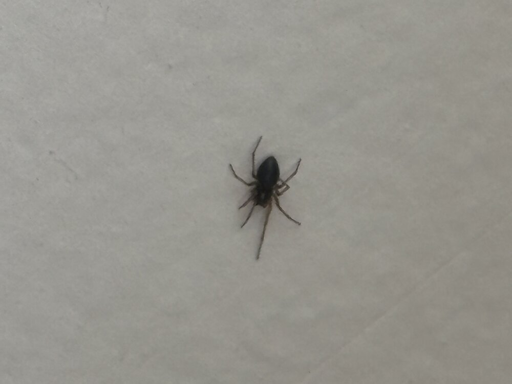
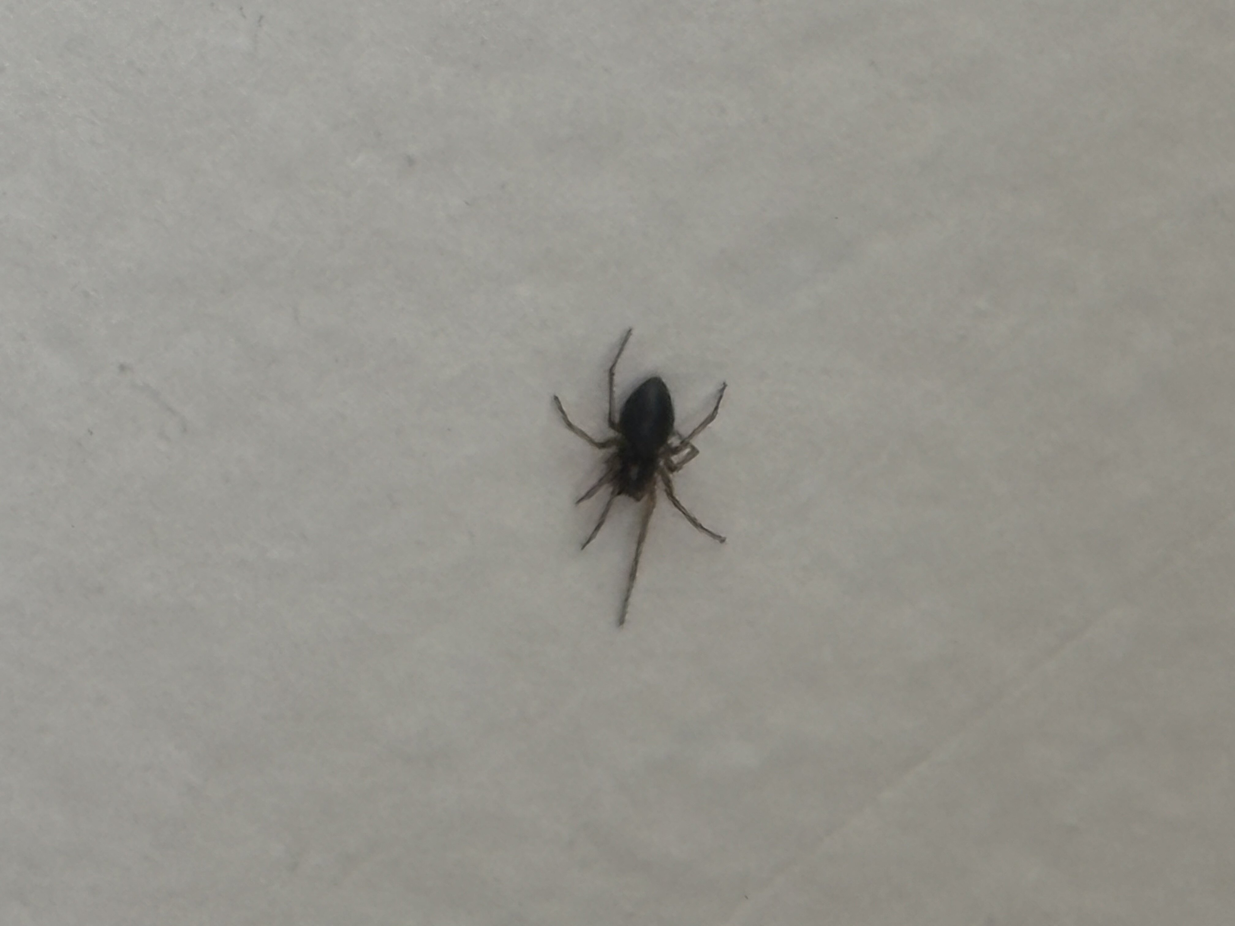
Just had a big spider race across the bed…came out from under the blankets. That sucker was flying. Now I’m all freaked out there might be another. Not even sure what kind it was…didn’t have my glasses on. Hoping it wasn’t a wolf spider
-
What the heck is this thing? It’s on my wall. I hope that isn’t a tick. It’s not a spider, not enough legs.