

weatherwiz
-
Posts
79,820 -
Joined
-
Last visited
Content Type
Profiles
Blogs
Forums
American Weather
Media Demo
Store
Gallery
Everything posted by weatherwiz
-

It was a Flop... February 2024 Disco. Thread
weatherwiz replied to Prismshine Productions's topic in New England
Did the 5 ppd people's posts reset yet? I am curious on the answer to this -
It was a Flop... February 2024 Disco. Thread
weatherwiz replied to Prismshine Productions's topic in New England
NAM tries to sneak in some precip on the Cape early Thursday AM with that offshore low -
It was a Flop... February 2024 Disco. Thread
weatherwiz replied to Prismshine Productions's topic in New England
Ultimately, the correlation between ENSO and seasonal snowfall here is not very strong. And when I say that, I mean it is not strong enough to just make a definitive statement. While snowfall can be correlated to certain patterns a bit more strongly, at the end of the day, it is all about how the pieces are moving and evolving within the pattern and how that pattern may be evolving. When a pattern regime sets in, two things can happen: 1) If that pattern sucks, then you're in for a long stretch 2) If the pattern sets up perfectly, you're going to cash in and this is what happens during our prolific stretches. We can get big winters in EL Nino, La Nina, weak events, moderate events, strong events, we can get crap winters in any of these as well. We can get good snows with a +NAO and we can get them with a -NAO. The most important thing above all, is what is happening within the pattern, not necessarily the pattern itself. -
It was a Flop... February 2024 Disco. Thread
weatherwiz replied to Prismshine Productions's topic in New England
I'll throw in an answer to that. I think some like to use one season or one example as a reason for justification. Just like 10-15 years ago there was the stigma that weak La Nina's were the king because of 1995-1996. -
It was a Flop... February 2024 Disco. Thread
weatherwiz replied to Prismshine Productions's topic in New England
Since I saw it was mentioned again a few pages back, Can someone please explain to me where the stigma comes from that a strong EL Nino guarantees a crap winter in terms of snowfall. And yes, some have guaranteed that because every now and then you have people crawl out from under the bed saying, "I know it was going to suck because of strong EL Nino". -
It's definitely much more favorable up your way. These scenarios of lows developing along an advancing front don't work out too often down this way, unless the low development happens to be south of our area.
-
An approaching cold front with a developing wave along it. Looks like enough cold air may remain wedged to yield potential for accumulating snow across the interior high terrain with a chilly rain elsewhere.
-
It was a Flop... February 2024 Disco. Thread
weatherwiz replied to Prismshine Productions's topic in New England
Yeah not a fun day. Went outside just to go shopping and it wasn't fun. If it wasn't windy it wouldn't have been bad. -
It was a Flop... February 2024 Disco. Thread
weatherwiz replied to Prismshine Productions's topic in New England
No, models did not fail anything. This has been said 1,234,564,349,349,046,903,529,034,695,239,528,585,258,457,474,868,389,393 on the board over the years but just because a pattern looks good DOES NOT MEAN IT WILL PRODUCE. If people stopped looking and using the piece of no good garbage trash snow maps and tossing the around like they have any merit, weight, or indicate anything maybe this wouldn't be a problem. Going around saying models suck or models failed because the 384 hour snow maps didn't verify is pure unscientific trash. This also have been sated 1,234,568,635,444,556,900,201,4567,000,0939 times over the years but when looking long-range it goes like this 1) Identify the pattern 2) Identify moving pieces within the pattern and how they will evolve when inside the window of a threat. But all this crap keeps going over some people's heads because they look at the piece of garbage snow maps and then the horses have left the gate and they didn't even take their morning poop. -
It was a Flop... February 2024 Disco. Thread
weatherwiz replied to Prismshine Productions's topic in New England
Looks pretty interesting around the Sacramento Valley area in California tomorrow. Could be some nasty supercells (for CA standards). -
It was a Flop... February 2024 Disco. Thread
weatherwiz replied to Prismshine Productions's topic in New England
-
It was a Flop... February 2024 Disco. Thread
weatherwiz replied to Prismshine Productions's topic in New England
I hope we get sustained 70's and 80's in April/May with humidity so it stays warm at night and I can sit outside and watch Bruins playoff games with just a jersey on. -
It was a Flop... February 2024 Disco. Thread
weatherwiz replied to Prismshine Productions's topic in New England
sounds like voodoo -
It was a Flop... February 2024 Disco. Thread
weatherwiz replied to Prismshine Productions's topic in New England
After all the work looking at ENSO for the upcoming winter dating back to last summer, I have not looked into where we are headed this summer and beyond. I've seen the thread on the main side indicating La Nina so maybe that's where we're headed. It would be nice if we could get a stretch of ENSO neutral years. I'm really starting to get back into our climatologies and ENSO state but I think sometimes there is too much emphasis on hoping for or wanting a particular ENSO state. Yeah sure certain states may elicit higher probabilities but I don't think there is anything ground breaking enough yielding a high correlation. Weak EL Nino's tend to favor increased potential for above-average snow here, but you can certainly get ratters too. -
It was a Flop... February 2024 Disco. Thread
weatherwiz replied to Prismshine Productions's topic in New England
Look on the bright side...it's not unrealistic that we could get some 60's or 70's next month and could even tickle 80's to 90 in two months. Sustained, no but at least a few days, sure. -
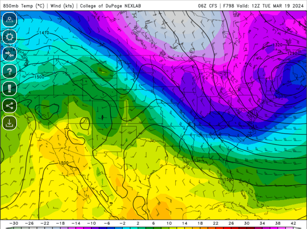
If anything, this is probably an event for the interior higher elevations.
-
verification will probably be +12C at 850
-
It was a Flop... February 2024 Disco. Thread
weatherwiz replied to Prismshine Productions's topic in New England
I think they do to some degree but I don't think models are great with this or radiational cooling. MOS/NBM can struggle greatly with these two, especially radiational cooling. MOS/NBM can easily end up being several degrees too warm in these situations. Too me at least, forecasting low temperatures can be extremely challenging at times and way more difficult than forecasting high temperatures. The best bet would be assessing forecast soundings, particularly bufkit where you're able to do do enhanced assessment. -
How fitting
-
Wow time is flying, likely expedited by the heavy tracking with the storm for the 13th but we're now down to 76 days!!! In fact, two months from today, the 384 hour GFS will run out into May 1st...WILD
-
It was a Flop... February 2024 Disco. Thread
weatherwiz replied to Prismshine Productions's topic in New England
I do love corn. Though the corn probably attracts giant spiders there -
It was a Flop... February 2024 Disco. Thread
weatherwiz replied to Prismshine Productions's topic in New England
Just give me 90-95 with dewpoints 70-80 and a large EML advecting in from the Southwest to coincide with a strong impulse at 500mb racing across the Great Lakes enlarging our hodographs with morning convection along the warm front producing golf ball sized hail then supercells develop 1-2 PM followed a derecho plowing through between 5-7 PM and getting to view the descending sun glowing beautifully off the 60K cloud tops -
It was a Flop... February 2024 Disco. Thread
weatherwiz replied to Prismshine Productions's topic in New England
This is a great post, it is short, sweet, and I think portrays perfectly how the idea of climate change should be viewed. While I do believe human activities have escalated the rate warming during this Earth's warming cycle, I can't stand how every major weather catastrophe gets blamed on climate change. When I view climate change and try to understand how human induced activities have contributed, I stick to the basics of what we know about weather. Your example there makes perfect sense. We know that CO2 and H20 are heat trapping gasses and we know these gasses are not good absorbers of shortwave radiation and we know they are excellent absorbers of longwave radiation. Given this understanding alone, it is very easy to see how an increase in both would result in warmer overnight temperatures. -
It was a Flop... February 2024 Disco. Thread
weatherwiz replied to Prismshine Productions's topic in New England
I mean even the NAM is well mixed on bufkit and showing gusts over 50 mph. NAM actually looked a bit more mixed than the GFS. That's a pretty steep lapse rate in the lowest few km -
It was a Flop... February 2024 Disco. Thread
weatherwiz replied to Prismshine Productions's topic in New England
Im shocked no wind advisory for N CT


