weatherwiz
-
Posts
79,817 -
Joined
-
Last visited
Content Type
Profiles
Blogs
Forums
American Weather
Media Demo
Store
Gallery
Everything posted by weatherwiz
-
I wonder if NWS offices there have their own in-house models.
-
How the hell does one forecast for Anchorage (or Alaska) in general?
-
Best Halloween ever

-
I don't think anyone will be radiating at night mid-week.
-
An unfortunate reality we just have to get used too.
-
what he means is these were ignited by people
-
That's alot of wood...trying to rebuild Abe Lincoln's log cabin?
-
Just goes to show that timing can mean everything and even hold more weight than the overall pattern itself. This is why I've become less enthused with wetting my lips over D6-10 or D10+ EPS or ensemble H5 looks. It's one thing to get a "nice looking pattern" - which what does that even mean? but its a whole other ballgame getting the timing of all the pieces to work out.
-
that general thunder area from SPC has to be an error. Thought maybe there was some elevated instability with the warm front but I see nada. But I wouldn't be shocked to see a well defined batch of heavier rain up north...that is some serious WAA and that nose of the jet should help (maybe that yields the risk for some thunder).
-
These clouds look super cool...waves in the sky
-
It's a smart move. Declaring state of emergency allows the state to get any assistance/aid quickly in the event it is needed.
-
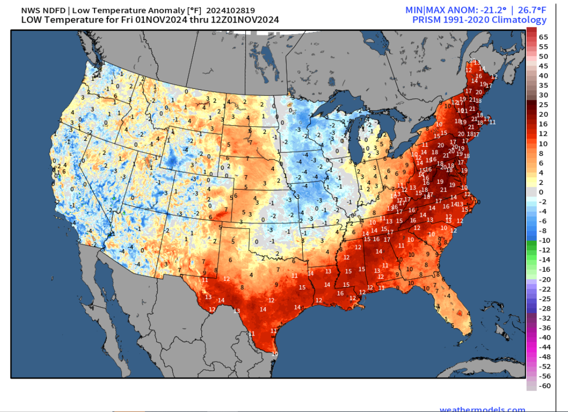
Some places in the Midwest are looking at departures for both highs/lows of about +25 to +30 Tuesday/Wednesday We'll be closing out October with like +15 to +20.
-
Surprisingly, yes. One of these winters we're going to cash in big. I mean the backlog is going back 3-4 years now. I'm still waiting for those "D10 EPS looks good" patterns to produce from 3 years ago.
-
Would be interested in those stats as well and I 100% agree with you. I can't image us being dry very long in that sort of regime. The one exception I can think of is if we have an anomalous Southeast ridge with HP off the Southeast coast (que La Nina). Obviously in the summer this would be good for showers/thunderstorms but given the lack of instability during the winter that wouldn't be the case.
-
Maybe a below-average precip winter won't be the worst thing. I mean we have had some horrible luck with some of the above-average precip winter's lately not equating to above-average snow (at least for the region as a whole). With the regime we're in above-average precip seems to be coinciding with warmer winter patterns...below-average would probably indicate colder pattern and then we cash in with whatever precip maker we get. Disclaimer: This is somewhat of a tongue-in-check post but somewhat serious too.
-
I don't think so. I think that area is climatologically favorable October/early November.
-
Need to start getting some strong systems into the PAC NW (which the long-range GFS shows). This could certainly help ripple the pattern up a bit across the CONUS.
-
Nobody is going to be able to give out chocolate...it's all going to melt.
-
I may even go out trick-or-treating if its like this.
-
ehhh only takes one to get things moving/changing. I recall some winters over the past few decades where the pattern was crap and then things changed quickly with a couple recurving typhoons. This isn't an area I really know much about but I know @Ginx snewx has talked about this many times over the years and sniffed out some of these changes from recurving typhoons.
-
I just revert to some Bob Ross videos if I want my color fix.
-
I think the whole obsession with colors is very weird but the colors look pretty meh to me. Some trees are more vibrant but for the most part they look like someone left skittles in their pocket for too long and the colors started to fade from body warmth.
-
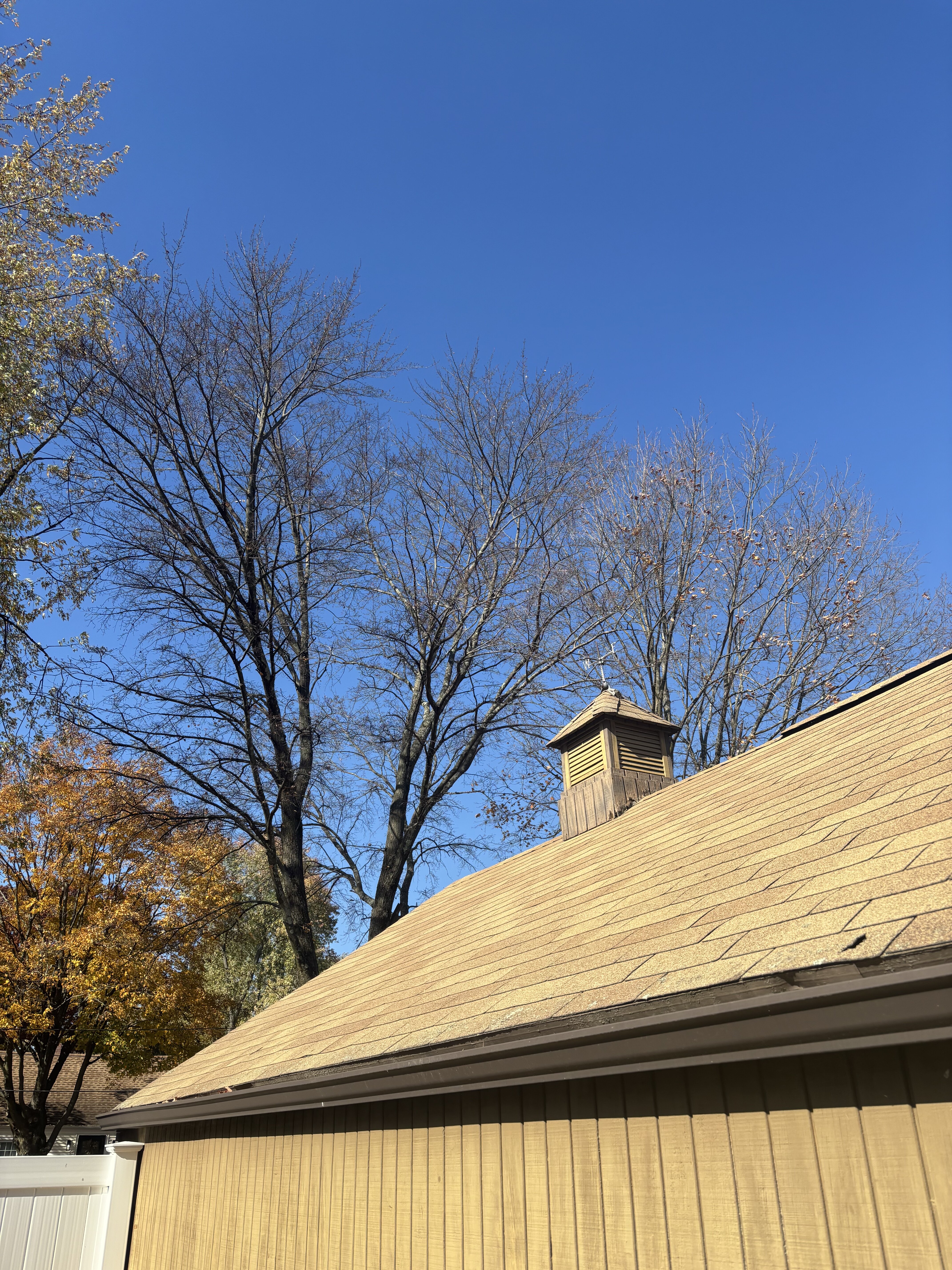
I can’t believe these trees are bare already. I swore they were still quite full even just a few days ago

-
Yup...great point and thanks for adding that in as I was just talking about diurnally. This has been mentioned many times by various posters, but as you know, at least for our region, our degree of warming is greatest with overnight departures and its easy to see and understand why that is from a chemistry and thermodynamic perspective.
-
The northward shift is very real. Was talking about this with someone the other day but you look at accounts of how winter's were, even as far south as Washington DC several hundred years ago compared to now...it's insane. Sure there were accounts of some very warm winters there and such but the frequency now is much greater than it was back then.