CT Rain
-
Posts
26,253 -
Joined
-
Last visited
Content Type
Profiles
Blogs
Forums
American Weather
Media Demo
Store
Gallery
Everything posted by CT Rain
-

December 5-6, 2020 Storm Observations and Nowcast
CT Rain replied to Baroclinic Zone's topic in New England
Yeah that's a triple bunner right there. I think it definitely shows how areas even in low elevations can go to town where best lift/banding sets up. -
December 5-6, 2020 Storm Observations and Nowcast
CT Rain replied to Baroclinic Zone's topic in New England
Meanwhile the new NAM has almost 1.2" of QPF between 10 a.m. and 1 p.m. for Hartford (the HRRR has ~0.4"). So that's a big difference.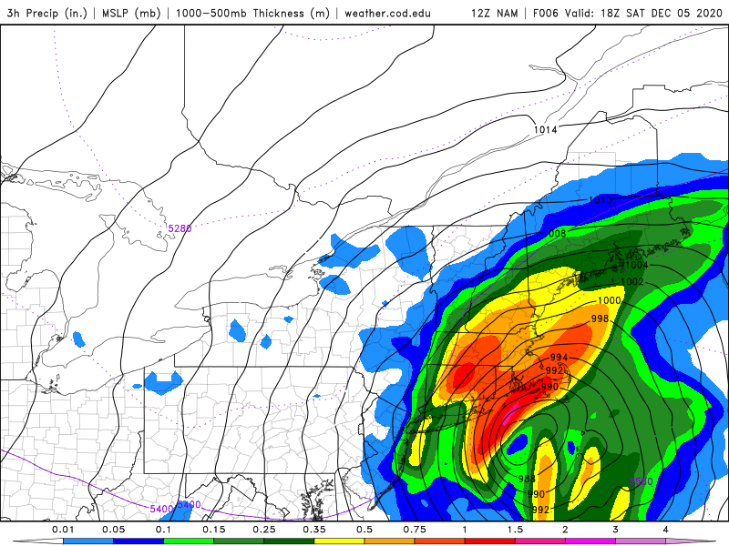
-
December 5-6, 2020 Storm Observations and Nowcast
CT Rain replied to Baroclinic Zone's topic in New England
Yeah the 12z HRRR doesn't do much with mid level banding back this way. Would be a toaster bath her locally. -
December 5-6, 2020 Storm Observations and Nowcast
CT Rain replied to Baroclinic Zone's topic in New England
Snowing through all of Litchfield county now.... and even as far south as Wolcott above 1kft. -
Dec 5/6th major coastal/ west Atlantic cyclogenesis ...?
CT Rain replied to Typhoon Tip's topic in New England
Snowing now at 1kft in Litchfield County. Still on the fence here in the valley - can definitely see monster rates arguing for a couple hour isothermal thump. Can also see myself crying at cat paws at noon lol -
Dec 5/6th major coastal/ west Atlantic cyclogenesis ...?
CT Rain replied to Typhoon Tip's topic in New England
That is amazing haha -
Dec 5/6th major coastal/ west Atlantic cyclogenesis ...?
CT Rain replied to Typhoon Tip's topic in New England
Yup. May be my favorite of all time. -
Dec 5/6th major coastal/ west Atlantic cyclogenesis ...?
CT Rain replied to Typhoon Tip's topic in New England
Sounds like Kevin in Feb 13. -
Dec 5/6th major coastal/ west Atlantic cyclogenesis ...?
CT Rain replied to Typhoon Tip's topic in New England
Yeah I could see a lot of areas getting 3-6" there. But who knows. -
Dec 5/6th major coastal/ west Atlantic cyclogenesis ...?
CT Rain replied to Typhoon Tip's topic in New England
That's the OKX forecast. Probably one of the more substantial differences I've had with them in a while.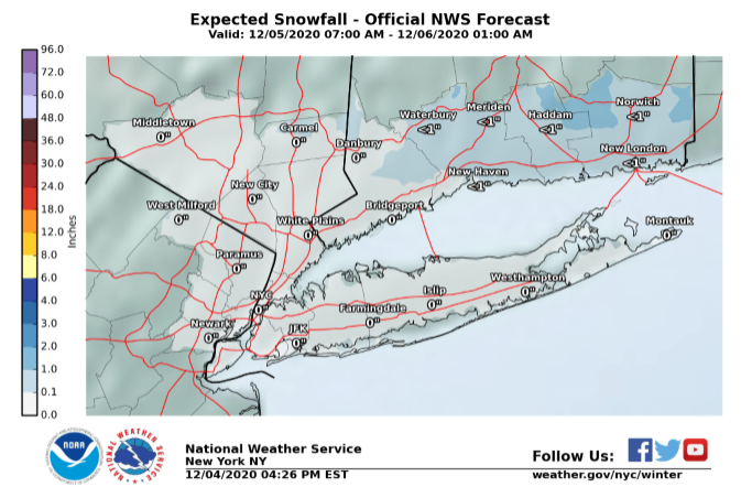
-
Dec 5/6th major coastal/ west Atlantic cyclogenesis ...?
CT Rain replied to Typhoon Tip's topic in New England
OKX has <1 their entire area pretty much. Hopefully I'm seeing something they're not. -
Dec 5/6th major coastal/ west Atlantic cyclogenesis ...?
CT Rain replied to Typhoon Tip's topic in New England
We MAUL in the DGZ. I struggled for your area Ginx. -
Dec 5/6th major coastal/ west Atlantic cyclogenesis ...?
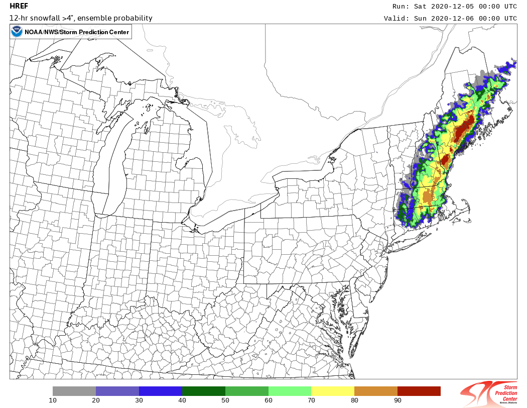
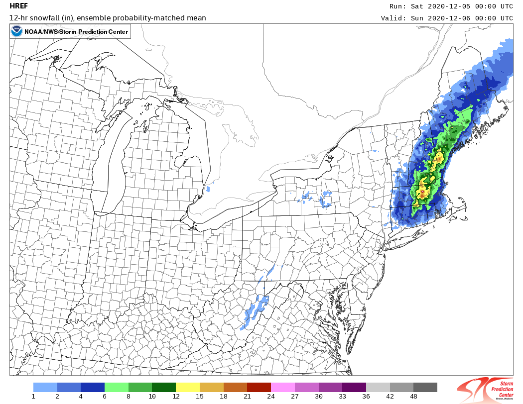
CT Rain replied to Typhoon Tip's topic in New England
Some HREF love through 00z.
.thumb.png.34f90174ecfb5f5de85bd5dc92c622a0.png)
.thumb.png.de49adcdd0d06dd50b235db4ff096213.png)

-
Dec 5/6th major coastal/ west Atlantic cyclogenesis ...?
CT Rain replied to Typhoon Tip's topic in New England
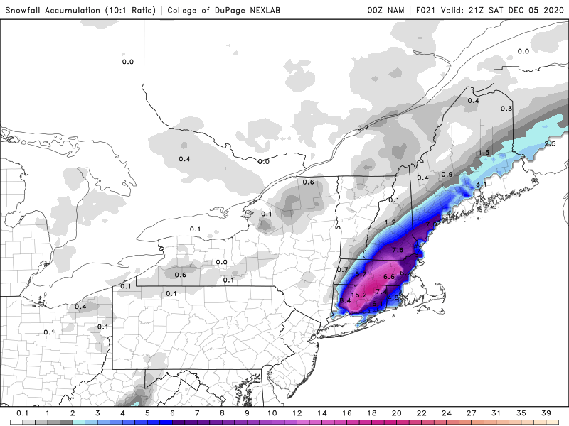
Yeah sort of riding the QPF gradient here on the models but that's where the best mid level/dgz sig is. Pretty good look. Guess we'll have to watch for a shift to NW winds at BDL and a downslope special for ineednsow at the BDL crew. -
Dec 5/6th major coastal/ west Atlantic cyclogenesis ...?
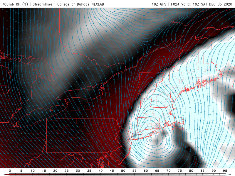
CT Rain replied to Typhoon Tip's topic in New England
I feel like it still looks good on the NAM back this way. Real nice 700mb front/TROWAL action through central CT. -
Dec 5/6th major coastal/ west Atlantic cyclogenesis ...?
CT Rain replied to Typhoon Tip's topic in New England
-
Dec 5/6th major coastal/ west Atlantic cyclogenesis ...?
CT Rain replied to Typhoon Tip's topic in New England
BDL screw job lol -
Dec 5/6th major coastal/ west Atlantic cyclogenesis ...?
CT Rain replied to Typhoon Tip's topic in New England
I do like that I have 1-3 and 3-6 over Hartford lol -
Dec 5/6th major coastal/ west Atlantic cyclogenesis ...?
CT Rain replied to Typhoon Tip's topic in New England
Sort of out on a limb here but here's our forecast. Wish me luck. -
Dec 5/6th major coastal/ west Atlantic cyclogenesis ...?
CT Rain replied to Typhoon Tip's topic in New England
I have to say... just a classic look for a crusher here even around Hartford. The antecedent airmass is totall garbage but that kind of mid level lock track, TROWAL, and good DGZ makes me think this could really overperform even in the valley. Glad we're the most bullish of the TV stations but I do worry this could be even more impactful and the power outage potential around here is quite high.
-
Dec 5/6th major coastal/ west Atlantic cyclogenesis ...?
CT Rain replied to Typhoon Tip's topic in New England
18z HRRR... yikes. That's a crusher back here. -
Dec 5/6th major coastal/ west Atlantic cyclogenesis ...?
CT Rain replied to Typhoon Tip's topic in New England
Definitely a bit torn. Putrid airmass is going to hurt... but the mid level track and strong lift/DGZ signal definitely has me bullish. Can definitely see 6-12 for Woody and even 3-6 for BDL. Soundings flip to isothermal paste pretty quickly. Also a bit worried some mid level magic gets into NW CT too. -
Dec 5/6th major coastal/ west Atlantic cyclogenesis ...?
CT Rain replied to Typhoon Tip's topic in New England
Probably just no pants. -
Dec 5/6th major coastal/ west Atlantic cyclogenesis ...?
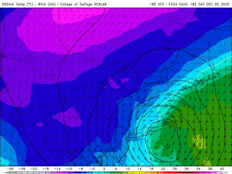
CT Rain replied to Typhoon Tip's topic in New England
Also... really nice DGZ/omega signal on the NAM and GFS here locally. Pretty bullish. Thinking 3-6" valley and 6-12 hills... especially NE. -
Dec 5/6th major coastal/ west Atlantic cyclogenesis ...?
CT Rain replied to Typhoon Tip's topic in New England
Mid level magic for me on the Euro. QPF Queens be damned. Euro 2m temps are a little warm so still some elevation dependence but do think there's a decent power outage threat around here in NE CT.


.png.33337e719dbd2aab020332c000547cb3.png)
.png.c98fc06074bcb2525c11f57cd84452c2.png)