

CT Rain
-
Posts
26,272 -
Joined
-
Last visited
Content Type
Profiles
Blogs
Forums
American Weather
Media Demo
Store
Gallery
Everything posted by CT Rain
-

Active mid December with multiple event potential
CT Rain replied to Typhoon Tip's topic in New England
HREF through 12z Thursday.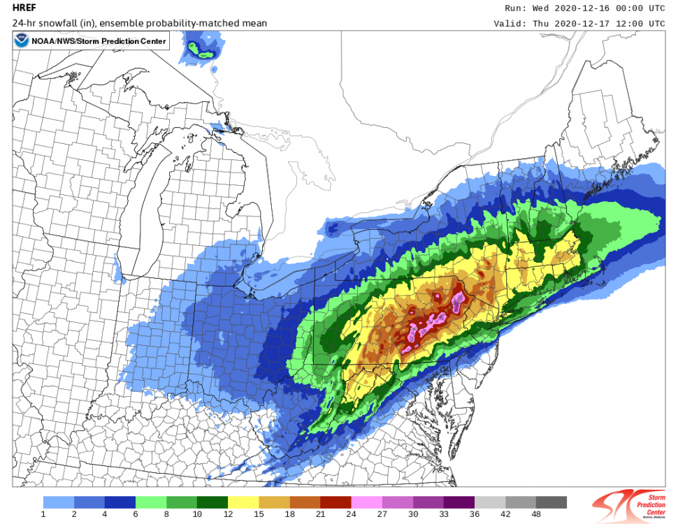
-
Active mid December with multiple event potential
CT Rain replied to Typhoon Tip's topic in New England
Tolland County lowest in SNE? Ouch. -
Active mid December with multiple event potential
CT Rain replied to Typhoon Tip's topic in New England
I strongly approve of the 700mb low track on the GFS.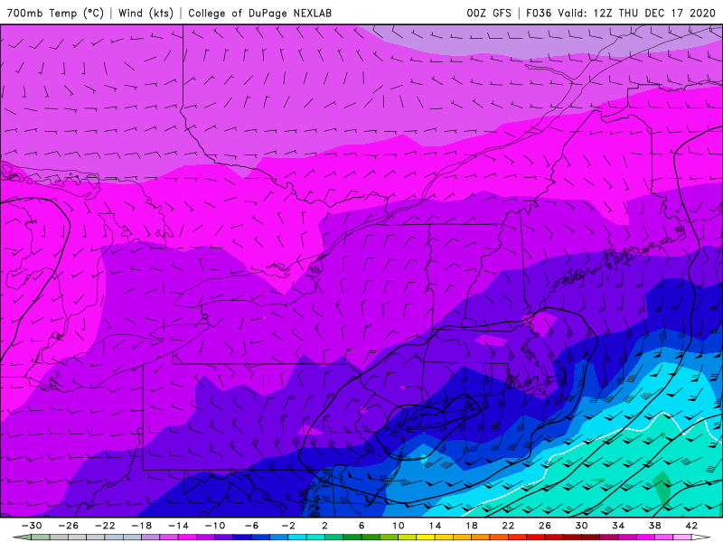
-
Active mid December with multiple event potential
CT Rain replied to Typhoon Tip's topic in New England
We take that. The NAM is pretty similar. -
Active mid December with multiple event potential
CT Rain replied to Typhoon Tip's topic in New England
Pornographic NAM run IMBY -
Active mid December with multiple event potential
CT Rain replied to Typhoon Tip's topic in New England
lol -
Active mid December with multiple event potential
CT Rain replied to Typhoon Tip's topic in New England
We've reached peak "north trend" New England forum. -
Active mid December with multiple event potential
CT Rain replied to Typhoon Tip's topic in New England
I wouldn't read into that much lol -
Active mid December with multiple event potential
CT Rain replied to Typhoon Tip's topic in New England
I've only seen the mean on wxbell - wish they had more products available. -
Active mid December with multiple event potential
CT Rain replied to Typhoon Tip's topic in New England
Is it easily available online? -
Active mid December with multiple event potential
CT Rain replied to Typhoon Tip's topic in New England
What a disaster -
Active mid December with multiple event potential
CT Rain replied to Typhoon Tip's topic in New England
Thinking about a generic 8-16" statewide right now. Just not enough confidence to pin down best banding. -
Active mid December with multiple event potential
CT Rain replied to Typhoon Tip's topic in New England
-
Active mid December with multiple event potential
CT Rain replied to Typhoon Tip's topic in New England
I feel like the synoptics on the GFS were pretty similar but the evolution of the WCB and associated QPF was way different. Probably wrong. But I do think shearing out the shortwave and letting convection go wild can do some weird things. The NAM, on the other hand, just does the classic huge jump NW with the southern stream. -
Active mid December with multiple event potential
CT Rain replied to Typhoon Tip's topic in New England
Nice call. The southern stream shortwaves always like to come in amped and NW. I guess my biggest concern was always that this thing would get shredded and weaken some as it moved east to prevent the big totals in SNE. -
Active mid December with multiple event potential
CT Rain replied to Typhoon Tip's topic in New England
Maybe I’ll just double my paltry 6”-12” forecast and call it a day. -
Active mid December with multiple event potential
CT Rain replied to Typhoon Tip's topic in New England
That’s a nice ukie look -
Active mid December with multiple event potential
CT Rain replied to Typhoon Tip's topic in New England
Yup -
Active mid December with multiple event potential
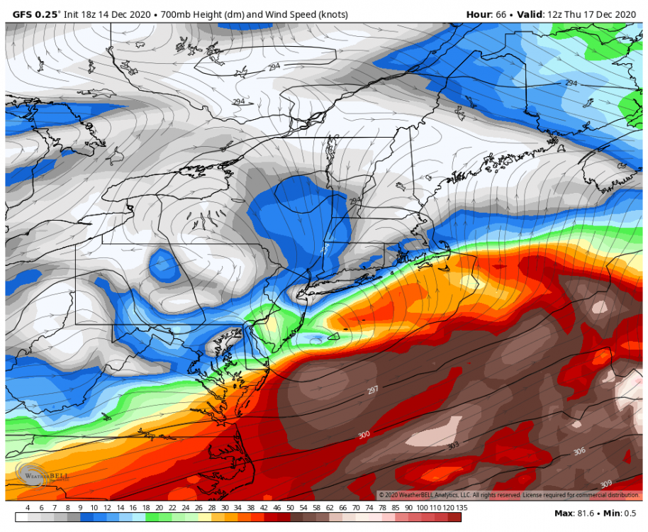
CT Rain replied to Typhoon Tip's topic in New England
You can see why the GFS sh*ts the bed with the storm in SNE. 700mb low and warm conveyorbelt just falls apart. Not sure it's right but definitely a caution flag IMO.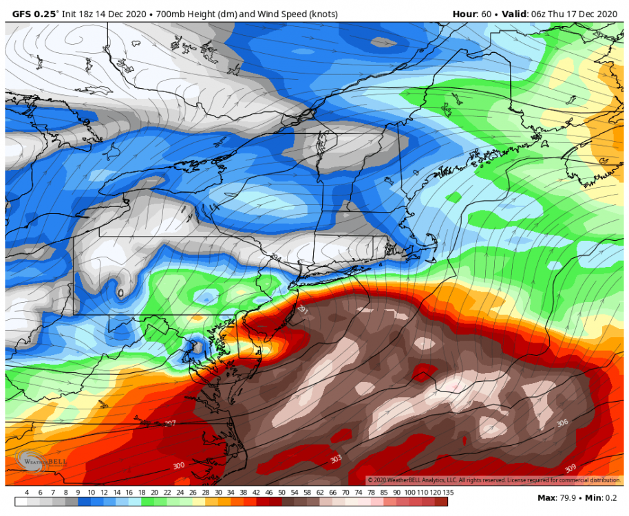
-
Active mid December with multiple event potential
CT Rain replied to Typhoon Tip's topic in New England
My biggest concern with the GFS is just how everything falls apart as it comes NE. Probably too much but I think a Euro/GFS blend makes sense. -
Active mid December with multiple event potential
CT Rain replied to Typhoon Tip's topic in New England
Storm really falls apart on the GFS once it gets into SNE. That s/w goes into the shredder. -
Active mid December with multiple event potential
CT Rain replied to Typhoon Tip's topic in New England
I mean it's possible. Some hellacious fronto. -
Active mid December with multiple event potential
CT Rain replied to Typhoon Tip's topic in New England
12km NAM is beautiful for the QPF Queens. I do think it's overdone with such a wide swath of that kind of liquid? Seems fairly progressive and not that classic ML lows closing off and pivoting right under us? -
Active mid December with multiple event potential
CT Rain replied to Typhoon Tip's topic in New England
Beast mode on the NAM. Pretty wild look there. -
Active mid December with multiple event potential
CT Rain replied to Typhoon Tip's topic in New England
I wonder if the s/w sort of damping out/getting sheared opens the door for non-hydrostatic stuff to start taking over with convection offshore. We'll have less and less forcing from DCVA as that s/w weakens over SNE but may see convection start running the show over the Gulf Stream and messing with the WCB and other stuff.


