CT Rain
-
Posts
26,253 -
Joined
-
Last visited
Content Type
Profiles
Blogs
Forums
American Weather
Media Demo
Store
Gallery
Everything posted by CT Rain
-
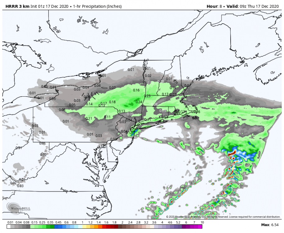
Yeah I agree. They were putting up some huge ASOS precip numbers. They had 2.80" total liquid so a 14:1 ratio. Not like the fluff bomb in NH. KBGM 162353Z AUTO 09009KT 1/2SM SN FZFG VV007 M07/M09 A3004 RMK AO2 TWR VIS 3/4 SLP199 P0011 60028 T10721089 11056 21083 58023 RVRNO KBGM 170553Z AUTO 1/4SM +SN FZFG VV002 M09/M11 A2985 RMK AO2 TWR VIS 3/4 SLP136 P0040 60120 T10891106 11072 21089 58023 RVRNO KBGM 171153Z AUTO 02011KT 3/4SM BR VV013 M09/M11 A2990 RMK AO2 SFC VIS 1 SNEMM SLP153 P0007 60131 70279 T10891106 11089 21094 51008 PWINO FZRANO RVRNO $
-
I mean it's possible the DGZ wasn't deep but there was sufficient lift there for it to puke dendrites. Obviously a deeper DGZ will help but it's not necessary. Also looks conditionally unstable above the DGZ in both which is definitely good.
-
For sure. Pretty unusual to see that strong of a veering wind profile (WAA) that high up. Really maximized that omega plus the conditionally unstable layer above as you mentioned.
-
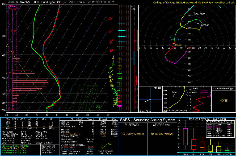
Here's a NAM sounding over Brian's fanny from this morning. Don't get a better DGZ signal than this.
-
They look like gravity waves to me.
-
A bit around 3 a.m. Most was just ugly snowflakes.
-
Storm total 10.5". Measured twice 12:00 a.m. 5.0" of snow (0.39" liquid) 10:00 a.m. 5.5" of snow (0.94" liquid) The overnight dry slot and sleet killed us with ratios.
-
The 60120 too!
-
We were pretty close to that in Feb 2013.
-
And given how much that is probably dendritic fluff that should. be easy 6"/hour rates.
-
KBGM 170553Z AUTO 1/4SM +SN FZFG VV002 M09/M11 A2985 RMK AO2 TWR VIS 3/4 SLP136 P0040 60120 T10891106 11072 21089 58023 RVRNO Holy f*ck!!!
-
The dry slot will fill in some. Cloud tops are coolling and there's plenty of goodies over NJ/E PA that will pivot east as the storm slides east.
-
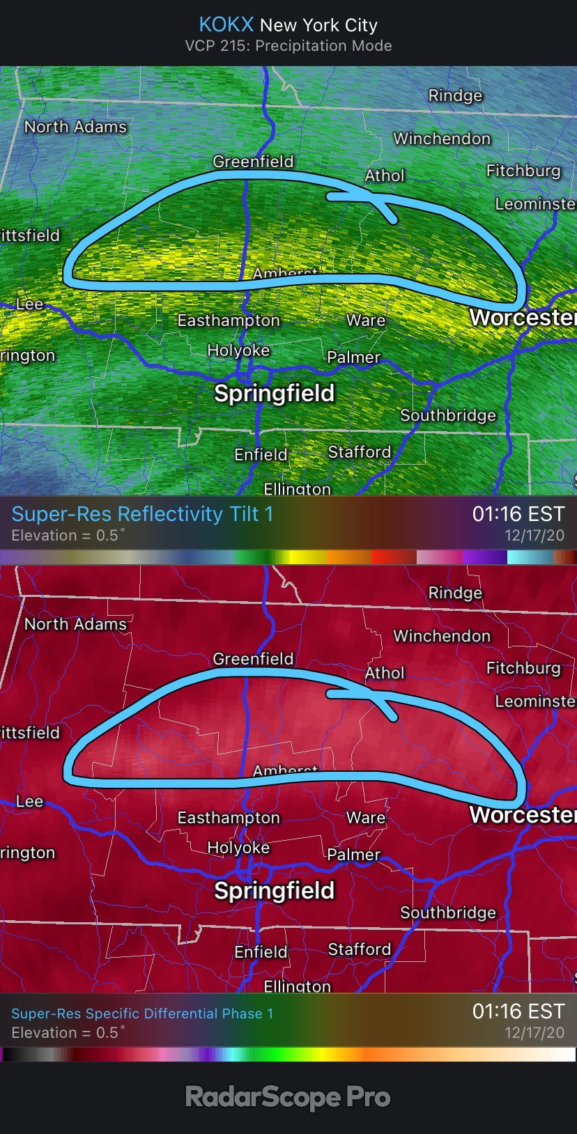
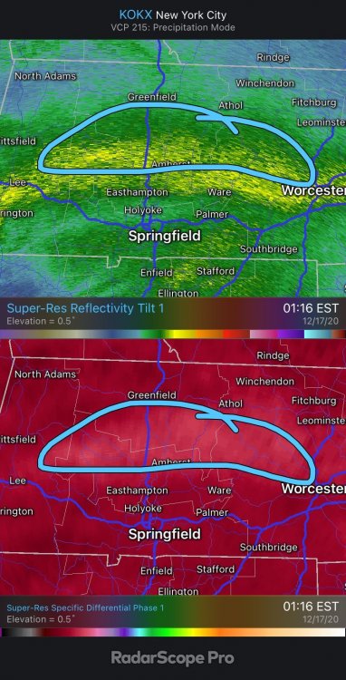
KDP is through the roof off OKX showing a tremendous amount of dendrites up in the snow growth layer across C/W Mass. Beautiful signature.
-
Yup. Not one of their shining moments.
-
When you expected snowfall matches up with the 90th percentile forecast you release too.... that's normally a bad sign.
-
The HRRR loves the mid level warming. I'm going to toss that sleet prediction south of the Pike.
-
Puking here. As of midnight I had 5.0" on the snow board with 0.38" liquid equivalent. KHFD 170453Z 02013KT 1/4SM +SN FZFG VV004 M05/M07 A3004 RMK AO2 SLP171 P0004 T10501067 410281067 KBDL 170451Z 02019KT 1/4SM R06/2000V2800FT +SN FZFG VV004 M06/M08 A3005 RMK AO2 TWR VIS 1/2 PRESFR SLP180 SNINCR 2/5 DRSN P0005 T10611078 410391083
-
Just covered itself in sh*t
-
RIP my mentions
-
Yeah it's dangerous to set your low bound at 12" with the 700mb low overhead or north of you!
-
It was
-
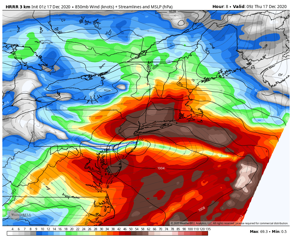
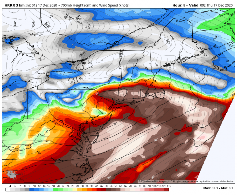
As the mid level magic shifts toward Albany we're going to get low level stuff off the fire hose 850 jet. You can see the best 700mb frontogenesis forecing up toward Albany and S CT but SNE should see a lot of low level stuff continuing. 850s cool to near -10C for a while so we'll still get snow growth - just not dendrites. Will pile up eventually but sort of an ugly look on radar for a bit I think especially south.

-
IR loop shows a lot of warming cloud tops over NJ and E PA. That's all low level junk on the 850mb jet over S NJ and such. May have some crap ratios for a while southern areas.
-
The radar does look great
-

Active mid December with multiple event potential
CT Rain replied to Typhoon Tip's topic in New England
GFS definitely hitting the ML goodies through the Berkshires back into NE PA