CT Rain
-
Posts
26,251 -
Joined
-
Last visited
Content Type
Profiles
Blogs
Forums
American Weather
Media Demo
Store
Gallery
Everything posted by CT Rain
-
50/50 NAM/Euro blend probably makes sense right now.
-
You're not angering anyone you're just taking the time to look at output that might as well been created by Kevin after 3 zimas and a box of colored pencils. You do you though!
-
Yeah Euro cooled a bit but no change in QPF. We take.
-
Probably drop for southern 1/3 to 8-12 and keep 12-18 inland.
-
8" for Kevin and 18" for you? Yikes.
-
From 6z to 12z the NAM is certainly juicier with QPF but no real change in the sleet penetration. So overall a plus I guess.
-
It's worse.
-
Nam is perilously close to a ton of sleet for most of CT/RI/SE Mass.
-
I was thinking that too. Seems possible.
-
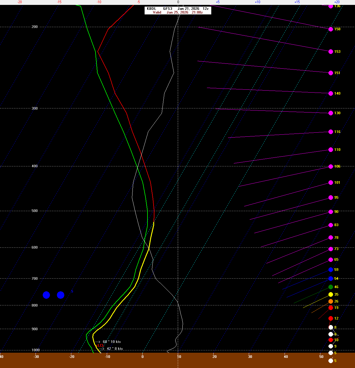
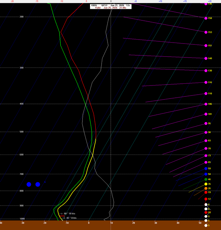
It's too dependent on surface temps when once you're below 31 or 32F they don't make any difference at all. The key is to figure out how efficiently snowflakes are produced (maximized around -15C) and the favored crystal type which impacts the density of the snowfall (ratio). For any real skill you have to look at where lift is maximized and at what temperature and also the depth of the DGZ (-12c to -18c). Kuchera would do OK if you're right around 32F because it would skew numbers down in that case not due to bad snow growth but due to melting/compacting.
-
I have 10-18" for the state. Just post the straight QPF and adjust as necessary in your head based on expected ratio. They're just not good.
-
Can we stop with the stupid Kuchera maps?
-
And it's normally right
-
NAM is sort of a torch lol
-

January 2026 regional war/obs/disco thread
CT Rain replied to Baroclinic Zone's topic in New England
Just uploaded a new youtube video after some of the 12z guidance. You may find it a bit interesting - or not lol https://www.youtube.com/watch?v=tb_0phGpeCs -
Love kissing the DGZ on the ground.
-
It's a real mess. PHI put out a map and then annotated on it to expect less due to mixing. Like huh?
-
The NWS forecasts have sort of been a mess. Watch text not matching maps, maps changing quickly, etc. Seems like it's NBM gone awry.
-
Woody slots around midnight lol
-
That's a deep DGZ lol
-
January 2026 regional war/obs/disco thread
CT Rain replied to Baroclinic Zone's topic in New England
What's best about this is we'd get Scott to stop whining! -
January 2026 regional war/obs/disco thread
CT Rain replied to Baroclinic Zone's topic in New England
Pretty good trends overnight IMO. Seems like potential for a decent event Sunday/Monday. Don't think the upper end is too high here but could be a nice moderate kinda event? -
January 2026 regional war/obs/disco thread
CT Rain replied to Baroclinic Zone's topic in New England
-
Yeah it'll be a blast. Seems like Aspen is in a bit better shape than some of the other resorts in CO. Hoping for a surprise with one of the systems moving off the Pacific this week.
-
Killington was surprisingly good Thursday/Friday. Some ice and definitely fast but they recovered nicely from Monday's ice. Lift lines were fine too. Heading to Aspen in a week... ugh. What a disaster out in the Rockies this year.