CT Rain
-
Posts
26,257 -
Joined
-
Last visited
Content Type
Profiles
Blogs
Forums
American Weather
Media Demo
Store
Gallery
Everything posted by CT Rain
-
 Yeah could be impressive. Wave action on a southerly wind always creates more issues than you’d expect with a given tide level.
 -
A nice setup for the south coast with OES... even as far west at SE CT.
-
A few opportunities too. Convection along the warm front, better low level lapse rates after the warm fropa with a bit of warming, and then possible violence on the cold front. Pretty interesting setup.
-
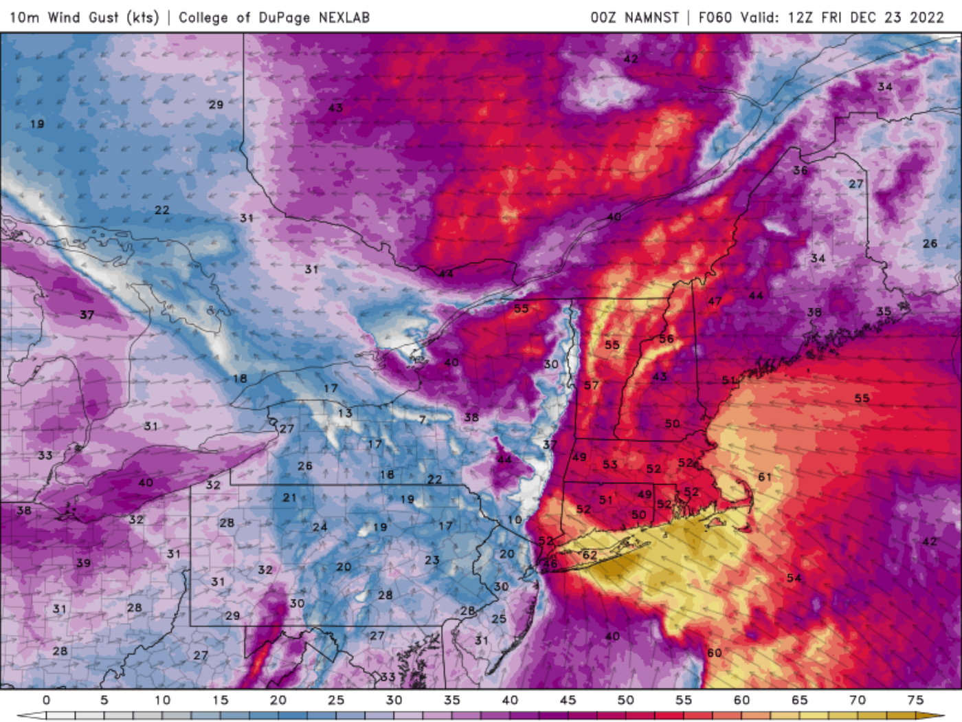
NAM/HRRR definitely have trended toward a more impressive wind event in SNE. It may rock in some towns tomorrow AM.
-
The NAM is quite lame as has been mentioned.
-
Maybe disaster averted for NNE? Looks like some snow on the front and back end and dew points struggle past 45F.
-
These are about as impressive as you'll see. Also... 60 knots at top of the mixed layer out of the NW as the storm passes. GFS may be too well mixed (and NAM too inverted) - but throw in some convection this definitely is worth watching.
-
I get it. In 17 years here I've never had anyone tell me or even implicitly pressure me to change the forecast. In fact more often than not if the forecast changes for the worse (tornadoes, more snow, higher winds) it's met with groans and annoyance by everyone in the newsroom as it means more work, longer days, etc. It's sort of funny but it's actually the opposite of what most people probably think goes on.
-
Pattern doesn't look great.
-
Yeah the other models were hinting at this earlier but the NAM is definitely pretty lame.
-
Sucks to not even have a nice upslope event after the rain.
-
Yeah pretty ugly setup for Christmas week. Doubt i'll be able to salvage even decent conditions at Stowe a week later when I'm there for New Years.
-
GFS MOS has 39knots sustained later Friday and Saturday for BDR.
-
Yeah agreed for sure. And also nice when places report 12z snow depth. Can get a nice gauge there.
-
Biggest issue is when stations measure only at 12z and you had a snow to rain situation the day prior.
-
Hopefully the picnic tables do OK
-
Mt Snow was exceptional today. Powder stashes all day. One of the better days I’ve had there- even hit the trees off Olympic on the North Face a few times. Guessing about 2ft fresh there.
-
That's a weird evolution lol
-
Preliminarily ... a medium impact partial Miller B, Friday
CT Rain replied to Typhoon Tip's topic in New England
Yeah and the snow should be done prior to daybreak. Rt 9 can be a mess if there's an accident or a tractor trailer stuck but I'm sure it will be fine. Looking forward to it. -
Wow sweet. I'll be at Mount Snow by 9a or so. Can't wait.
-
Preliminarily ... a medium impact partial Miller B, Friday
CT Rain replied to Typhoon Tip's topic in New England
Still puking in S VT. My drive up tomorrow AM won't be fun on Rt 9 lol -
Anyone hit up S VT today?