CT Rain
-
Posts
26,257 -
Joined
-
Last visited
Content Type
Profiles
Blogs
Forums
American Weather
Media Demo
Store
Gallery
Everything posted by CT Rain
-
 Yeah the BDL record is on April 27th, 1962 (94 to 41) The 2 day temperature swing is 1/27-1/28/1994. (53 to -10)
 -
BDR is down to 11F which makes their diurnal temperature range 46F. The record is 48F. Central Park tied their record of 48F this evening. Wild.
-
Can't wait for a thread about 50s and rain.
-
How'd the resorts make out?
-
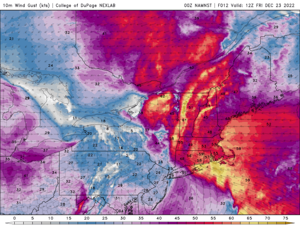
It verified. JFK gusted to 50 knots.
-
Obs aren't impressive around Philly now which should be doing a bit better based on the model soundings near the cold front.
-
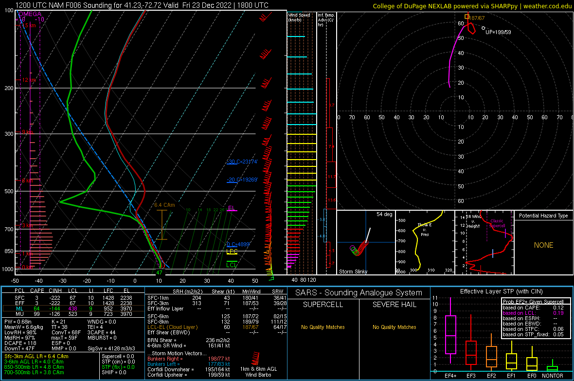
The cold fropa could be very nasty. Sounding is for New Haven.
.png.e454be751d11b8a1438d23267f4a27c3.png)
-
50 knots MHT and 55 knots HIE
-
HFD gusted to 50 knots at 554a.
-
Yeah it’s roaring here in West Hartford.
-
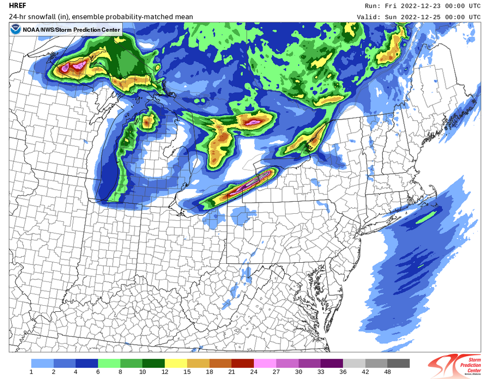
HREF with a nice little Sound Effect Snowstorm for SE CT and S RI
-
Looks like around daybreak with the warm front and then near cold fropa. But in the warm sector mixing looks pretty good so could be pretty gusty then as well.
-
In Hartford? 50+ wouldn't surprise me.
-
00z models definitely increased the wind threat here in CT some. Pretty nasty looking signal tomorrow. Also, a bit more concerned about the coastal flooding with less of a lull modeled around high tide tomorrow morning.
-
3km NAM really loves the convection along the warm front.
-
It's weird.
-
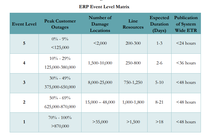
No. The numbers are hard coded into their matrix. So a Level 4 event is by definition 125-380k outages. It's not hype it's completely reasonable.
-
If I was them I'd do the same. 125k is not a crazy outage number for CT. They have to file the "Level 4" with PURA before the storm and they had a really hard time as it is getting crews in from outside because this storm was so expansive. Seems like a reasonable worst case scenario to me.
-
No. It's CT. But it's also a bad headline. They're predicting a Level 4 event which would mean 125k-380k without power.
-
Yeah for sure they're overshooting. Most likely scenario is widespread advisory and scattered outages but there is definitely some potential for some higher end stuff with convection.
-
Yeah I have 50-60 mph gusts. Saying widespread outages as that's what Eversource is saying and to prepare people for the holidays. I do think there's the chance for some bigger gusts in/around convection but that can always be tough to accomplish.
-
I'm neither excited nor going big.
-
Probably not going to lose much pack up north but rapid temp drop is going to turn it to a glacier. Maybe a bit better end of the week as temperatures warm a bit and the snow softens some?
-
Could see 1-2" of Sound Effect Snow SE CT and South County RI
-
I don't get the "wind forecasts always underperform" thing. I feel like most of our forecasts verify fairly well at the ASOS stations. If you're looking at the HRRR/Euro or whatever raw model output though and taking that as a forecast you're going to be disappointed.