-
Posts
3,292 -
Joined
-
Last visited
Content Type
Profiles
Blogs
Forums
American Weather
Media Demo
Store
Gallery
Everything posted by RCNYILWX
-
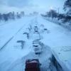
4/2-4/3 Significant Late-Season Snowstorm (WI/MI)
RCNYILWX replied to Geoboy645's topic in Lakes/Ohio Valley
Today locally is what every day was like in April 2018. Glad we don't have a cold pattern locking in. -

2024 Short/Medium Range Severe Weather Discussion
RCNYILWX replied to Chicago Storm's topic in Lakes/Ohio Valley
Re. the SPC outlooks yesterday, took a hindsight look at yesterday's 12z HREF plus the Nadocast Twitter feed. A good case can be made that SPC should have issued a 10% hatched tor in the general vicinity of the area affected by strong tornadoes, by the 1630z or 20z update. Plenty of boxes were checked environment wise in the HREF mean fields, plus some of the neighborhood and paintball UH probs. The 24-hour STP based calibrated tornado probs had a spot of 10% right near one of the strong tornado tracks. Since they had a slight with 5% tornado probs, it wasn't an egregiously underdone forecast. 8/24/16 is a much better example of that when doing hindsight assessment of the day's SPC mesoanalysis fields. Sent from my SM-G998U using Tapatalk -

2024 Short/Medium Range Severe Weather Discussion
RCNYILWX replied to Chicago Storm's topic in Lakes/Ohio Valley
NAM'med, as they say. If I had the power to get two changes in NCEP modeling done tomorrow, I'd discontinue the NAM and only have 24 hours of publicly available CAM data (and RAP data). -
Had quarter sized hail here in southeast/south central Naperville. Lots of smaller hail with several stones around to just under under quarter size.
-
Doing a deeper dive at the office now using ECMWF ERA5 reanalysis maps to look at antecedent conditions prior to some notable cool season events. This one definitely has questionable moisture with Gulf currently scoured out. 2017 not a bad comp w.r.t. Td over the GoM within this range of the event, though it had a better sfc pattern for more rapid moisture advection with the primary CO low a good deal stronger and a much stronger surface high (1035 mb) off the east coast. Some other notable cool season events, November 17th, March 15, 2016, March 27, 1991 to name a few, had much better source region moisture present. What Tuesday does have is exceptionally steep mid-level lapse rates as you mentioned with cold -15 to -20 C h5 temps. Seeing how February 8th performed with relatively questionable moisture quality, the cold mid-level temps/steep mid-level LRs could help compensate for the potentially middling moisture quality. We're concerned here that if the sun breaks out at all on Tuesday, Td could mix out substantially especially with northward extent. Perhaps a narrow zone near the warm frontal zone is best bet where you can pool the moisture with a longer residence time and pump up the 3CAPE to the 50+ threshold. Still thinking southern LOT CWA and points south with this in mind.
-
00z Euro if anything upped the ante a bit, assuming we can trust its dew points. Liking the south third of LOT and points south where the near or over 50 J/kg 0-3 km CAPE is progged. Also of note, the Bunkers right moving vectors are less crazy than you'd think they'd be for a cold season setup, so anything prior to sunset should be chaseable without having to speed as much.
-
Had SN/borderline +SN in Naperville earlier this evening with large flakes. This is more reminiscent of a late March or early April event than late February. Edit: Measured an average of 1.2" on flat surfaces here at around 8:30pm. With a heavier band overhead now, may take one more measurement.
-

Winter 2023/24 Medium/Long Range Discussion
RCNYILWX replied to Chicago Storm's topic in Lakes/Ohio Valley
I guess a better way to put it is that it was a noteworthy turnaround, but relative to the all out torch the year before, plus the fact the month still finished at normal, made it stand out less. Certainly not unusual to have widely varying conditions throughout the month of February in a typical winter. Sent from my SM-G998U using Tapatalk -

Winter 2023/24 Medium/Long Range Discussion
RCNYILWX replied to Chicago Storm's topic in Lakes/Ohio Valley
Unremarkable locally with 3 days in the 60s and 4 days in the 50s, but enough to wipe out the negative anomalies from the cold and snowy first half of the month. The warmth was more extreme east of here. Sent from my SM-G998U using Tapatalk -

Winter 2023/24 Medium/Long Range Discussion
RCNYILWX replied to Chicago Storm's topic in Lakes/Ohio Valley
Definitely doesn't look as warm going by dprog/DT -

Winter 2023/24 Medium/Long Range Discussion
RCNYILWX replied to Chicago Storm's topic in Lakes/Ohio Valley
Late February 2017. It was the 3rd warmest February on record for Chicago. 1998, a super Niño, is second warmest. -

Winter 2023/24 Medium/Long Range Discussion
RCNYILWX replied to Chicago Storm's topic in Lakes/Ohio Valley
Just surprised at how things turned so strongly away from more sustained blocking and many other LR forecasters much more well versed than me were banking on that. So the pattern did change, but only short-lived and it was completely luck driven to get in on the swaths of snow with the few clippers after the initial southern stream system got suppressed south. It shows again that strong Niños are a losing battle. Plus I think the past few winters the eastern US has been prone to these ridge amplifications apparently related to the anomalous ocean and air mass warmth in the western Pacific (maybe some CC linkage there). The warmth to end the month and start March does certainly look higher end and may have some threat for severe wx but guessing we don't get into a March 2012-lite situation. While the weekly guidance has certainly been unreliable, the recent stratospheric warming would tend to support the return of more blocky regime they've been showing toward or during mid March, right when most won't want it of course. As far as Chicago getting any measurable snow on the board for February, it seems unlikely but the only potential window would be a well timed wave while the cold air is around next weekend. -
From what I've been told by a former coworker at OKX, the CPK conservancy folks do a better job than the security guards that used to do it. But they're still not trained observers like FAA contract observers and probably still lower quality than good long-running COOP sites and diligent CoCoRaHS observers. If I were to guess, they too often or mostly adhere only to the 6-hour board clearing and don't take intermediate measurements when the situation (melting and/or sublimation of fallen snow) requires it.
-

Refresher snow & obs between ~midnight and Noon Sat Feb 17 2024
RCNYILWX replied to wdrag's topic in New York City Metro
There's a 0.5" in Hopewell TWP and 0.48" in Franklin TWP. -

Refresher snow & obs between ~midnight and Noon Sat Feb 17 2024
RCNYILWX replied to wdrag's topic in New York City Metro
The nice thing about that page is it uses the WPC forecast ratios so if those are decent, the mean, PMM, and max products will do a better job in hinting at the potential. Going by the CoCoRaHS precip amounts, liquid equivalent was generally in the 0.35 to 0.5" range in the heart of the band, so the ratios really went nuts at 20-30:1+. JFK had 6.1" on 0.32" liquid (nearly 20:1) and the NYS Mesonet on SI had 0.35". -

Refresher snow & obs between ~midnight and Noon Sat Feb 17 2024
RCNYILWX replied to wdrag's topic in New York City Metro
Amounts like what occurred are essentially impossible to predict but the existence of the strong banding signatures are handled better by today's modeling. This was strong mid-level f-gen, good jet dynamics, and the combined robust lift being well aligned with a very deep and saturated DGZ. You could find guidance that showed on planar view and cross sections the strong f-gen circulation, good RH, and slantwise instability, the issue is the exact location and the ratios under banding of that nature. I think the HRRR did an excellent job with the depiction of the band on simulated reflectivity. When you see something like that, you just kind of have to throw out the verbatim snow outputs and assume a very narrow corridor of much higher ratios that could result in totals like what occurred even with QPF probably not being terribly far off, and even that would lbe too low and the gradient sharper than you could possibly forecast. The OKX AFD yesterday was excellent in hinting at what took place. Worth a read. -
Any speculation as to why the near term guidance almost uniformly did so poorly in at least hinting in the QPF output the response to the strong h7 f-gen? From only cursory glances within past few days, it looked like all the QPF was focused along the lower level fgen axis and then subsidence north of it. In reality, you had the subsidence north of the h7 "death band", so still a sharp cutoff but shifted farther north. It's certainly not uncommon for the models to struggle with the location and magnitude of response to fgen circulations in the QPF fields, but usually you do see hints at least. Sent from my SM-G998U using Tapatalk
-

2/13 Significant/Major Winter Storm Discussion & Observations
RCNYILWX replied to Northof78's topic in New York City Metro
Yup, concern there is the 00z HREF has the juiced 12z members included in the mean on the SPC page. With the new DESI interface, I think you can subtract out the -12 hour members if you think they're going to be less representative than usual. Sent from my SM-G998U using Tapatalk -

2/13 Significant/Major Winter Storm Discussion & Observations
RCNYILWX replied to Northof78's topic in New York City Metro
I think straight to warning for some locations just north of the city and a rare near term watch for the city and at least the northern LI zones might be a prudent course of action since there's another model cycle to look at and make a decision on where to go warning and where to go advisory for the highest population zones. Might be better than going straight to advisory and having to upgrade to a warning in places. -
You nailed it, I think with that stretch alone we got a higher end stretch of wintet than expected. Obviously for those who didn't benefit it's been a exceptionally lean winter. For whatever amount of background climate warming you want to add to potential seasonal outcomes, betting on a objectively good winter for winter enthusiasts in a strong El Niño is a losing bet. 09-10 as a moderate to strong El Niño was essentially a unicorn for the areas that had BN temps and AN snow, including here in the Chicago area. 02-03 was a moderate Niño that gave eastern portions of the sub-forum a solid winter, though it was cool and dry out here. Sent from my SM-G998U using Tapatalk
-

Winter 2023/24 Medium/Long Range Discussion
RCNYILWX replied to Chicago Storm's topic in Lakes/Ohio Valley
It looks like a pattern conducive to clippers but they're never sure things in any given areas. As an example, December 2017 had a good clipper pattern by recent standards but it mostly benefitted Wisconsin and Michigan. I noted the challenge forecasting clippers accurately at longer lead times in the long term AFD the past few days. Sent from my SM-G998U using Tapatalk -

Winter 2023/24 Medium/Long Range Discussion
RCNYILWX replied to Chicago Storm's topic in Lakes/Ohio Valley
The early next week system gives some vibes of a potential northwest trender and a stronger system farther west. Just as a point of reference, the loading pattern looks somewhat reminiscent of GHD II, with a prominent ridge spike out west and positive height anomalies (good height rises) to the east. There's been a decided trend the last few cycles of the GEFS of a stronger primary with better clustering near and west of the ensemble SLP mean. Taking the 12z operational GFS, you'd want to slow down the main southern stream wave, which could allow for phasing with the northern stream short-wave to occur farther west. [Edit: This isn't strictly a Chicagoland centric perspective. As things stand now with the 12z cycle there's enough support for a moderate event in portions of the subforum that have had very little snow this winter.] -
We didn't bet against the warmth here for that reason. I think the biggest difference vs. expectations has been the precipitation being above average due to December and January being active. That might be due to the influence of the -PDO causing more periods of La Niña like conditions with a -PNA. Without that, we probably don't have the very active stretch in January and no shot of getting near normal snow at our climate sites (ORD and RFD), which is still doable because of the solidly above normal snowfall January.
-
Widespread 1' plus totals in a single event are pretty rare at this general latitude. Outside of the mountain areas, they're more common in the upper Midwest/northern Plains and the east coast. I'd say however it was reached rates wise, big dog type totals make for a memorable storm, and particularly intense rates add to the historical nature of the event. GHD II happening just 4 years after GHD I may have at the time made it stand out slightly less in this area. But when you look at the big picture, it was fluky to have another true big dog event in such a short timespan. Prior to those storms, you have to go back to the 99 blizzard for an event with the large expanse of big dog totals.


