iluvsnow
-
Posts
361 -
Joined
-
Last visited
Content Type
Profiles
Blogs
Forums
American Weather
Media Demo
Store
Gallery
Everything posted by iluvsnow
-
Where are we in total global sea ice? How is this in relationship to the past?
-
I saw that Almanac forecast too...misread it...thought it said itchy and flaky...and wondered if it meant a warm winter with lots of fleas
-
So sorry Brian....just tragic!
-
For we in Ohio....its looking more and more likely it will be at least July before we see our first 90 degree reading. Last half of June looking to be below normal. I'll take it.
-
Wish we could share all this rain further west. Ohio has had a pretty Garden of Eden type start to summer.
-
EE...you will need everything from sunscreen to umbrella's and heat packs. Spring time in Ohio....gotta love it. Have a great time!
-
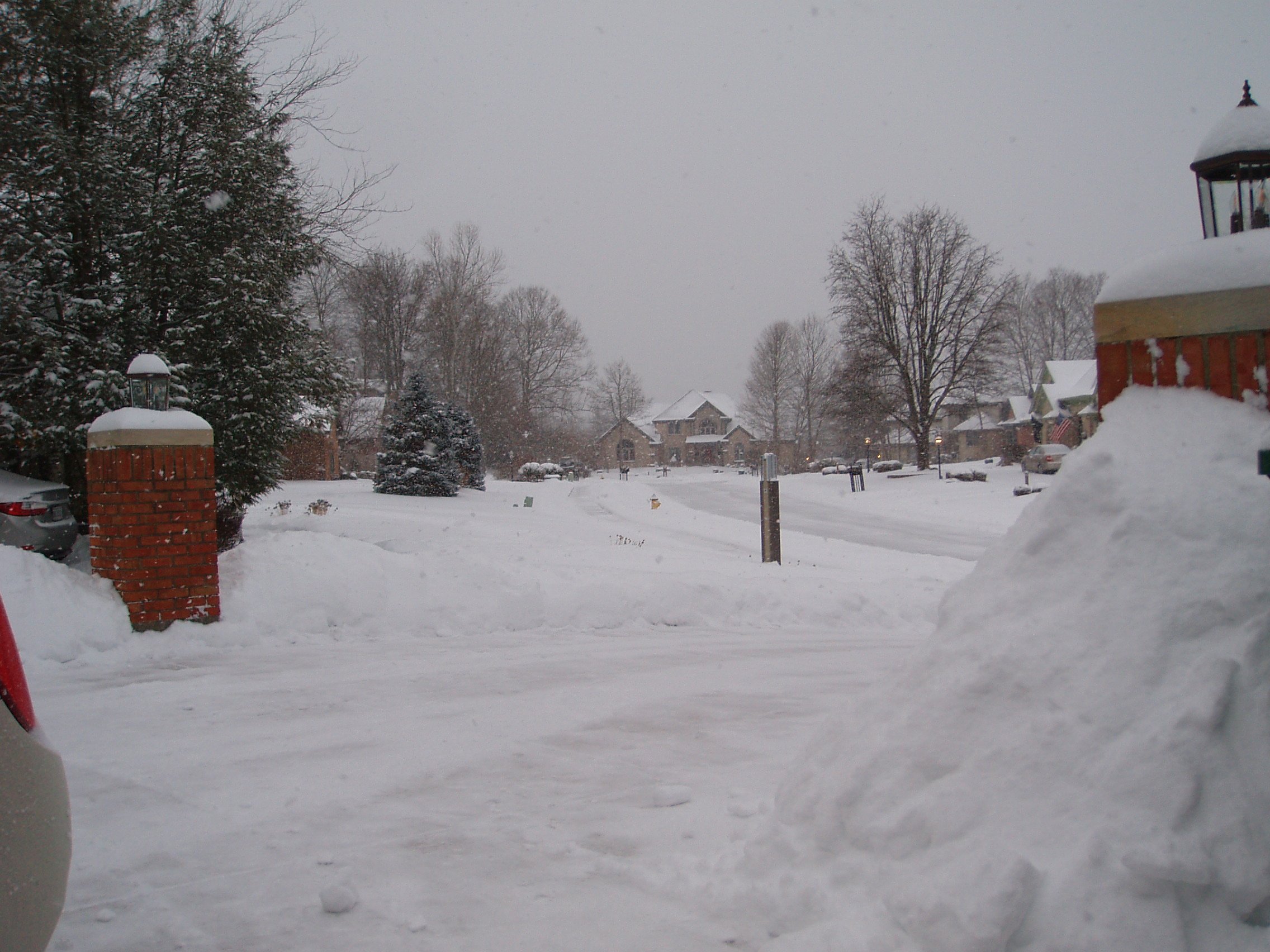
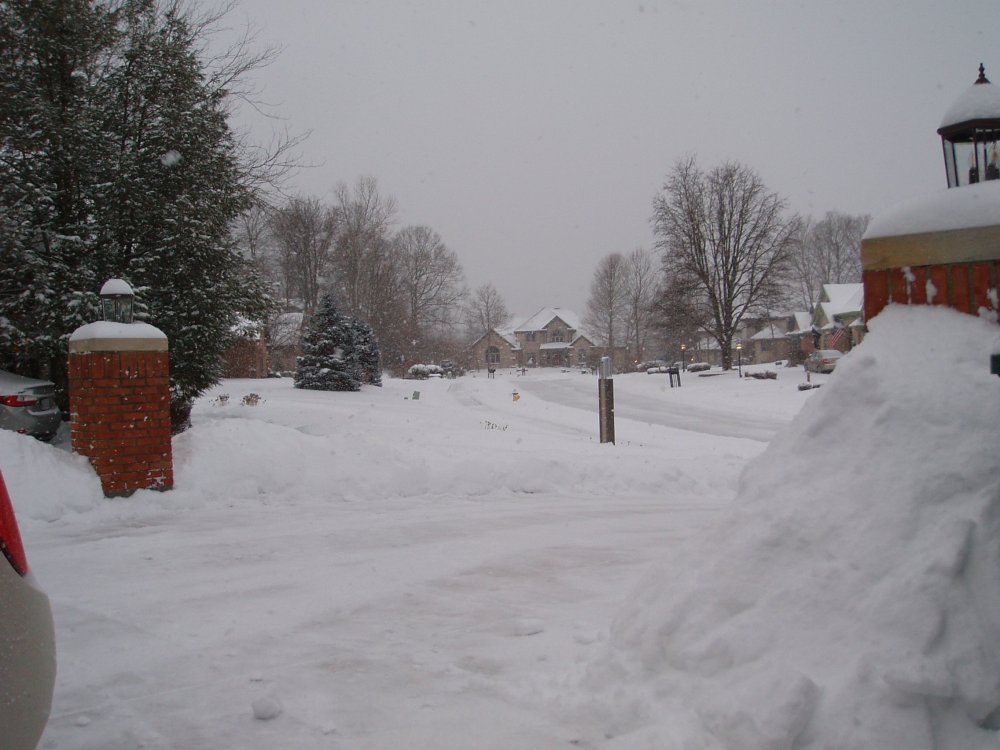
Out my backdoor in Bellbrook, OH....near Dayton.

-
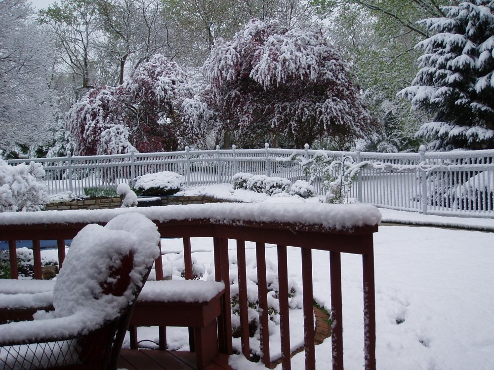
Pretty frustrating to have one of the best snows of the winter happen on April 21st. Hard to measure due to such variance of measurements. Some surfaces shaded by trees and others acting as mini-heat islands. Where sloped ground is away from prevailing sun angle....about 4 inches or so. Maybe some more than that. Didn't spend a lot of time measuring. All will likely be gone by sometime this PM. The good news for snow lovers.....in just two months...the days start getting shorter again.. A look out the back door......
-
And now....just the opposite: https://www.accuweather.com/en/winter-weather/all-time-april-low-could-fall-in-alaskan-city/929260?utm_campaign=breakingweather&utm_medium=social&utm_source=twitter
-
Bing that was my neighbor chewing out her husband for forgetting their anniversary.
-
Beware the Ides of March (and into the 16th)
iluvsnow replied to Hoosier's topic in Lakes/Ohio Valley
I am sure most are aware of the snowstorm in the front range of the Rockies. I found a time lapse from Cheyenne, Wy this morning. Make sure you wait till the very end to see what this morning looks like. https://webcams.windy.com/webcams/public/embed/player/1456851101/lifetime?token=see.cam -
For all the flak Dr. Judah Cohen gets for his long range winter forecasts.....this past winter's was pretty good....especially when compared with other sources.... AER is Cohen's Atmospheric and Environmental Research outfit.
-
-
Larry Cosgrove thinks a brief respite and then winter returns..... https://www.linkedin.com/feed/update/urn:li:share:6768153727691030528/
-
Then you won't like reading this..... https://www.linkedin.com/feed/update/urn:li:share:6768153727691030528/
-
All in all, in Bellbrook, we made the most out of a sad situation. Switched from sleet....and even some freezing rain for a while to snow about 9:00 PM. Then got moderate to heavy snow for 4 or 5 hours. Ended up with about 5 inches. We are the last holdouts...still using the shovel method to clean off the drive and walkways Still snow globes and 15....and totally exhausted. One of the toughest shovels I can remember. Maybe finally time for the blower. Of course if I do....it will no doubt curse things and we will go years before its needed.
-
Definitely pound town snow in Bellbrook going on 10 PM on Monday night. I will tell you this....after letting the dog out for a final squirt.....it will be no fun cleaning up the concrete on the walks and drive. Looks like a few hours of good snows on top of the glacierfied ground. Much rather shovel just snow.
-
Here is a hard lesson I have learned in watching these models leading up to show time....if you truly want to count on snow....you need a 100 mile pad to feel safe.....especially at go time.
-
In Bellbrook we got about a half hour of pounding snow....but that was an hour ago....since....nothing but heavy sleet.
-
Yep.....EE....OH weather knows his stuff. Hats off to him.....pounding snow now in Bellbrook. Can we keep it though?
-
A mix of sleet and parachute sized flakes in Southeast Dayton now. Virtually no wind.
-
WTOD is the warm tongue of death. We weenies ascribe that term to the intolerable upper warm air layers in the atmosphere that seem to always screw Ohioans out of their snow storms. I don't believe the storm actually is going further northwest....its just that a river of warm air aloft appears to be deeper and more entrenched than the models suggested earlier.
-
Pretty sad to have a ground temp of right around 20 and a forecast of up to almost a foot of snow....and we end up with sleet/freezing rain.
-
The heavy radar returns are here now and its all sleet in Southeast Dayton. Bust city!
-
The 18z High res says "Hey NWS ILN.....better update your forecast"....Not just sleet instead of snow....freezing rain is now what to expect. Never....never underestimate the WTOD.