

Superstorm93
-
Posts
8,230 -
Joined
-
Last visited
Content Type
Profiles
Blogs
Forums
American Weather
Media Demo
Store
Gallery
Posts posted by Superstorm93
-
-
-
-
953 NOUS42 KNHC 201850 REPRPD WEATHER RECONNAISSANCE FLIGHTS CARCAH, NATIONAL HURRICANE CENTER, MIAMI, FL. 0250 PM EDT TUE 20 SEPTEMBER 2022 SUBJECT: TROPICAL CYCLONE PLAN OF THE DAY (TCPOD) VALID 21/1100Z TO 22/1100Z SEPTEMBER 2022 TCPOD NUMBER.....22-117 CORRECTION I. ATLANTIC REQUIREMENTS 1. HURRICANE FIONA FLIGHT ONE - NOAA 43 FLIGHT TWO - TEAL 71 A. 21/2330Z A. 22/1130Z,1730Z B. NOAA3 2307A FIONA B. AFXXX 2407A FIONA C. 21/2100Z C. 22/0830Z D. 26.1N 71.2W D. 28.3N 70.2W E. 21/2300Z TO 22/0230Z E. 22/1100Z TO 22/1730Z F. SFC TO 10,000 FT F. SFC TO 10,000 FT G. FIX G. FIX 2. SUSPECT AREA (APPROACHING LESSER ANTILLES) FLIGHT ONE - TEAL 72 FLIGHT TWO - TEAL 73 A. 22/0000Z A. 22/1130Z B. AFXXX 01GGA SURV B. AFXXX 0209A CYCLONE (CORRECTED) C. 21/2230Z C. 22/1000Z D. 11.5N 61.5W D. 12.5N 64.5W E. 21/2330Z TO 22/0330Z E. 22/1100Z TO 22/1430Z F. SFC TO 10,000 FT F. SFC TO 10,000 FT G. SYSTEM SURVEY G. FIX 3. SUCCEEDING DAY OUTLOOK: A. CONTINUE 6-HRLY FIXES ON FIONA WHILE IT REMAINS A THREAT. B. CONTINUE 12-HRLY FIXES ON SUSPECT SYSTEM IF IT DEVELOPS. II. PACIFIC REQUIREMENTS 1. NEGATIVE RECONNAISSANCE REQUIREMENTS. 2. OUTLOOK FOR SUCCEEDING DAY.....NEGATIVE.-
 1
1
-
-
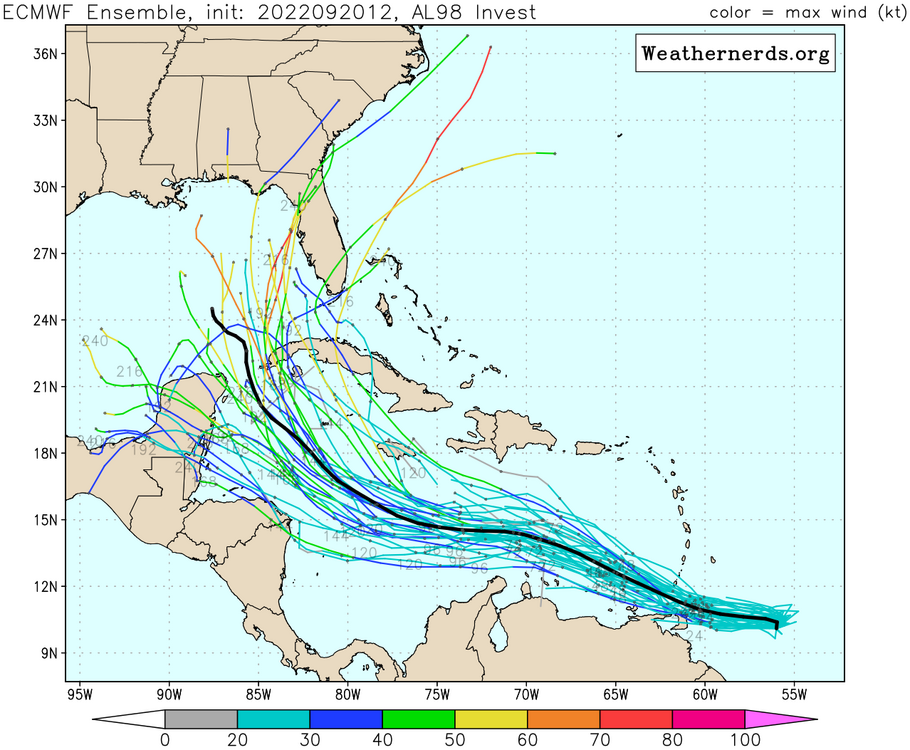
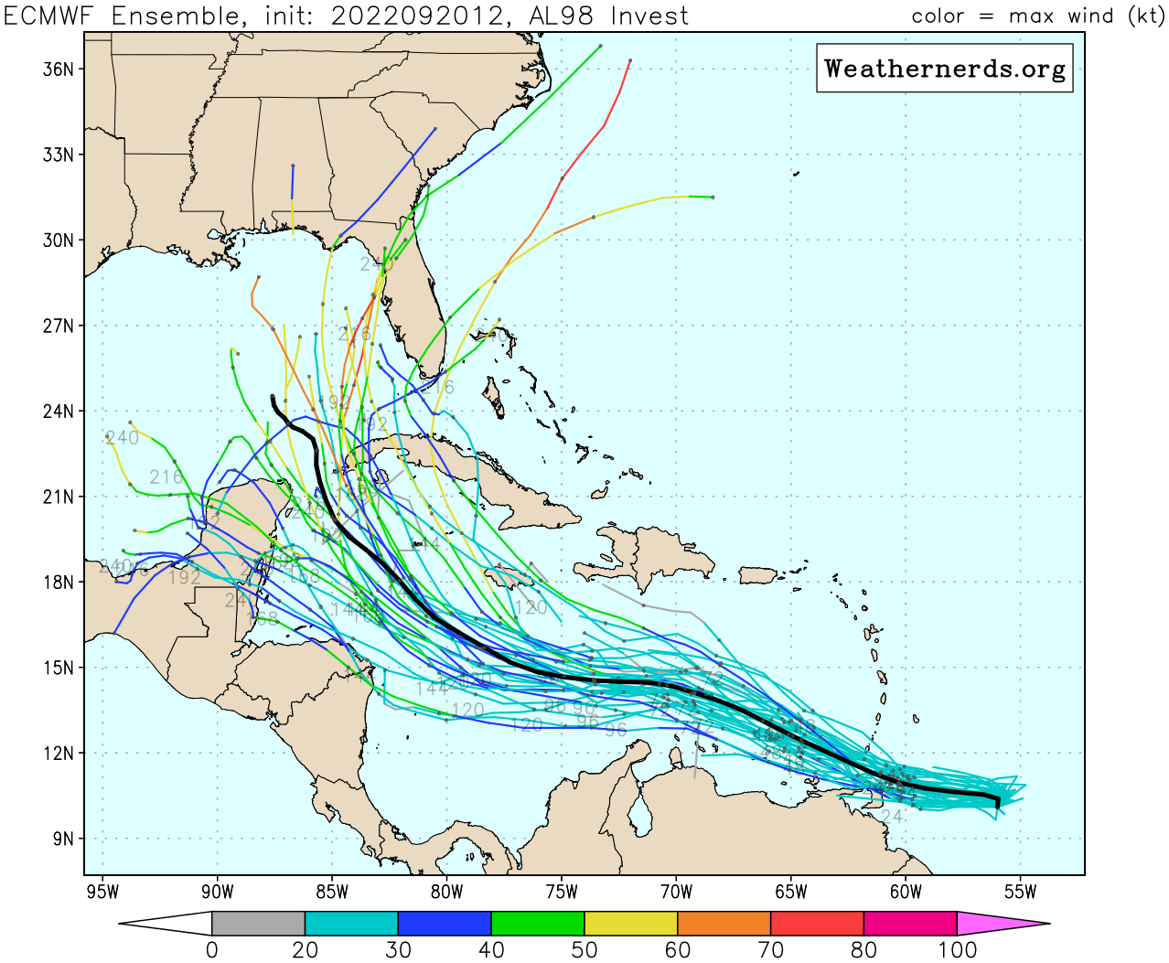
Massive spread remains massive. We should start to see this decrease once the system actually gets into the Caribbean.
-
 6
6
-
-
Bit faster on this run.
-
1
-
-
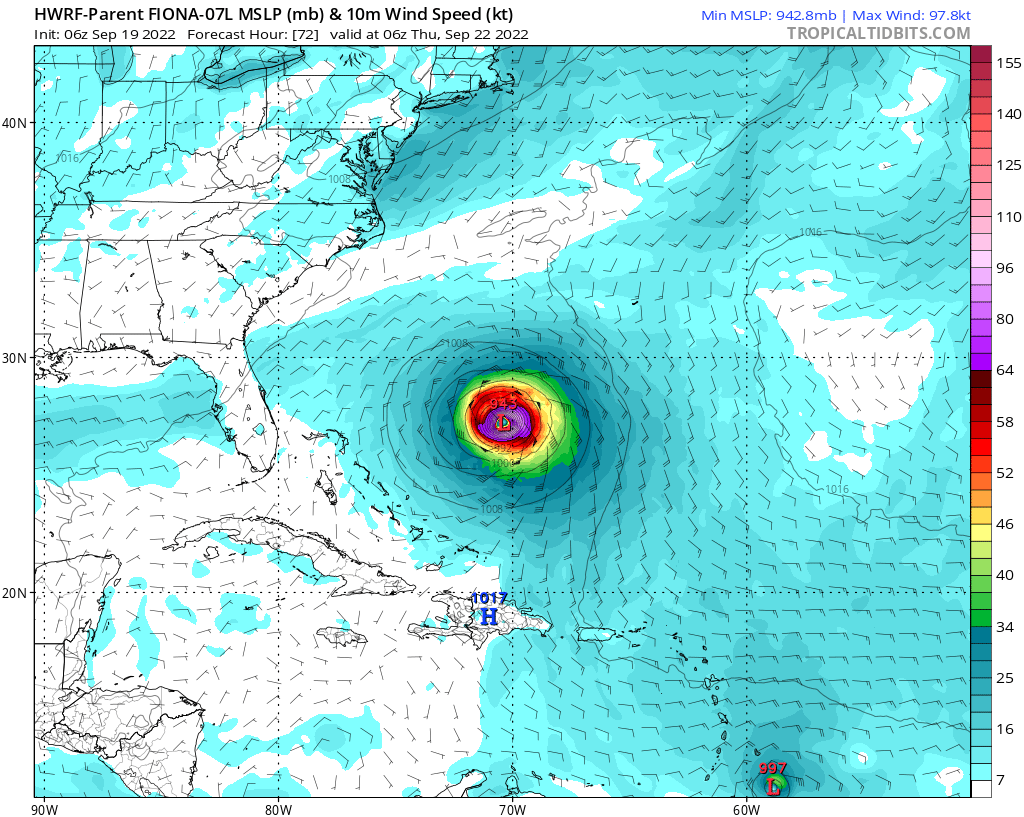
12z HWRF and HMON keep this weak through 126 hours. Not too shocked considering we don't have a well-defined circulation to work with here.
-
Over here using StormVista like its 2007 for the Euro
-
5
-
-
-
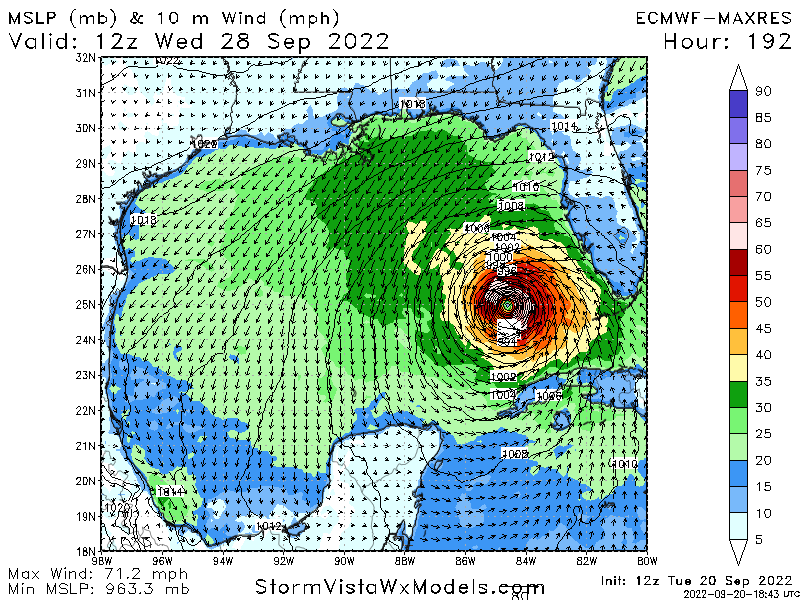
Off to the races today.
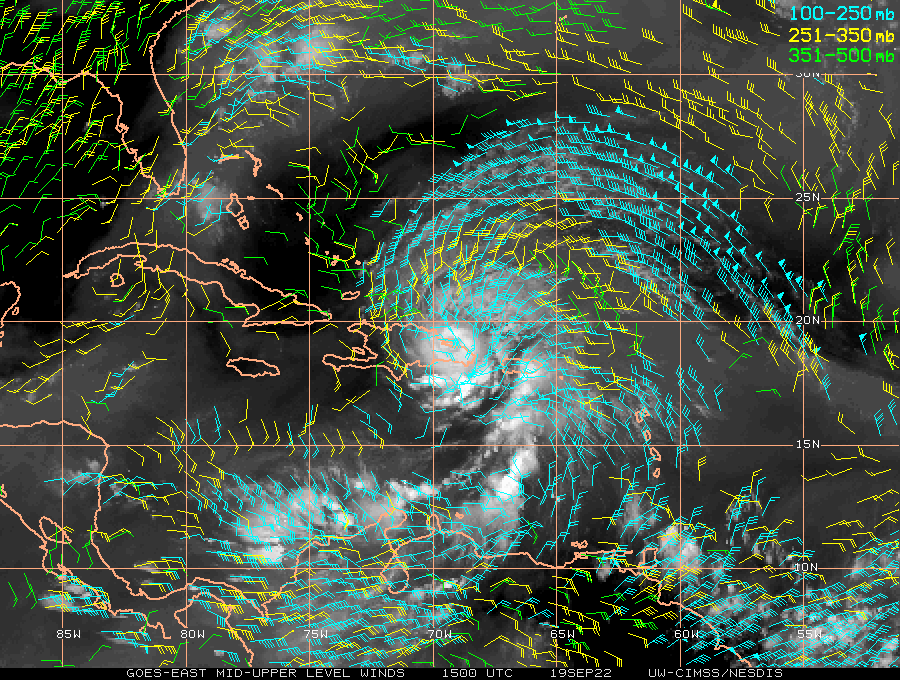
000
ABNT20 KNHC 201453
TWOAT

Special Tropical Weather Outlook
NWS National Hurricane Center Miami FL
1055 AM EDT Tue Sep 20 2022

For the North Atlantic...Caribbean Sea and the Gulf of Mexico:

Active Systems:
The National Hurricane Center is issuing advisories on Hurricane
Fiona, located near the Turks and Caicos islands, and on newly
formed Tropical Depression Eight, located over the north-central
Atlantic Ocean.

Central Tropical Atlantic:
Updated: Satellite data indicate that the tropical wave located
several hundred miles east of the Windward Islands has become better
organized this morning.  Additional development is expected, and a
tropical depression is likely to form within the next few days as
the system moves westward to west-northwestward at 15 to 20 mph
across the eastern and central Caribbean Sea. Interests in the
Windward Islands should closely monitor the progress of this system
as heavy rainfall and gusty winds could affect these islands
beginning on Wednesday.
* Formation chance through 48 hours...medium...40 percent.
* Formation chance through 5 days...high...70 percent.
-
1
-
-
End of the EPS run...
-
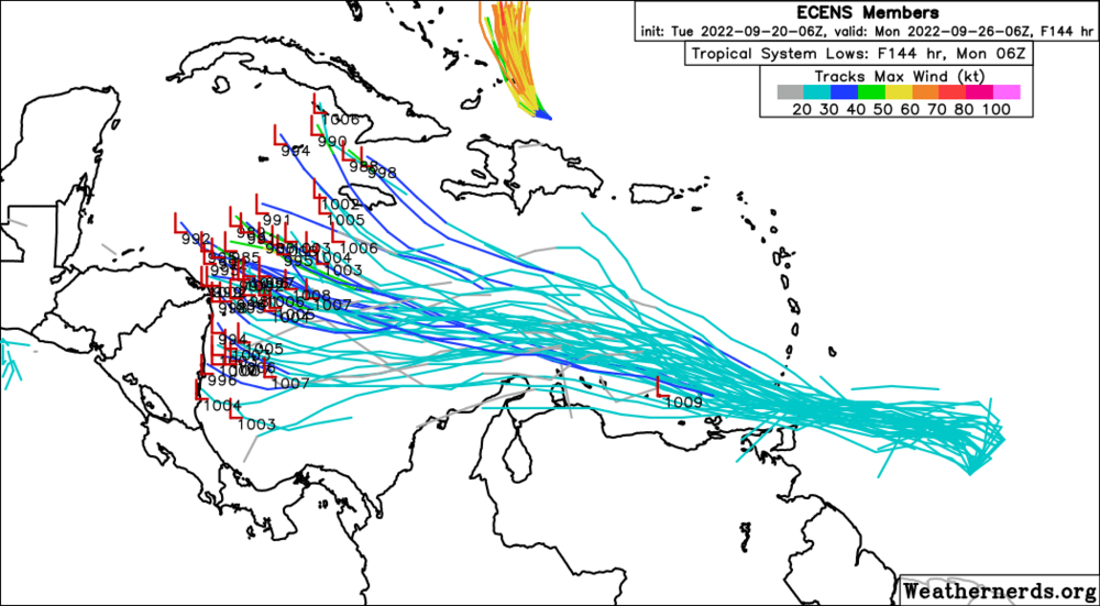
Massive spread on the 6z EPS.
May come down to just how quickly this can organize over the next 72 hours.
-
4
-
-
-
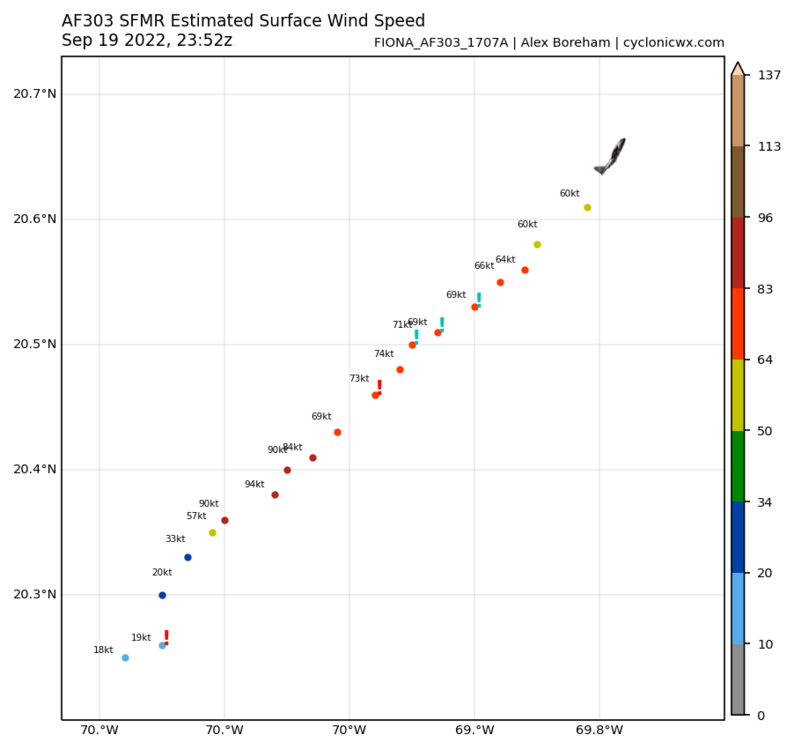
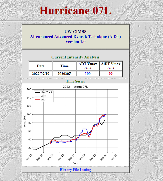
Both planes would support a new intensity around 95 knots.
Wouldn't be shocked to see a major tonight.
-
Uncontaminated 94 knot SFMR reading
-
8 minutes ago, Tatamy said:
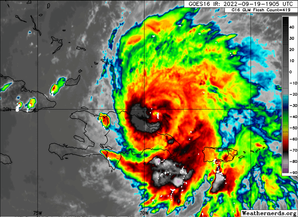
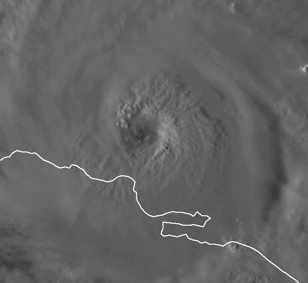
I have been tracking hurricanes since 1971. In that time period I have never seen a storm cross the full length of the DR and look like this only a few short hours later after emerging into the Atlantic. This is quite spectacular to watch unfold.
I was thinking about this earlier today. It really may have just come down to how the center just found itself over the lowest portion of the entire country.
The rebound is absolutely astonishing.
-
3
-
-
Best guess on the first pass would be around 95 knots
-
ADT and AiDT are now around AOA 100 knots
We'll see what recon finds in a little while.

-
Spicy talk has begun.
-
3
-
-
12z EPS definitely looks spooky with a ton of member developing the wave once it reaches the WCARB.
Ton of time to watch this one.
-
5
-
-
Up to 85 knots without recon
AL, 07, 2022091918, , BEST, 0, 196N, 695W, 85, 972, HU -
9 minutes ago, WxWatcher007 said:
It's not the GFS, but the 12z Euro does have more development of that wave in just a few days time.
Honestly, not that far from what the 12z UKIE showed as well. I'd side with slower development over the next several days. This really could be one to watch since we're in that time of year when anything with some spin can absolutely take off in the WCARB.

-
1
-
-
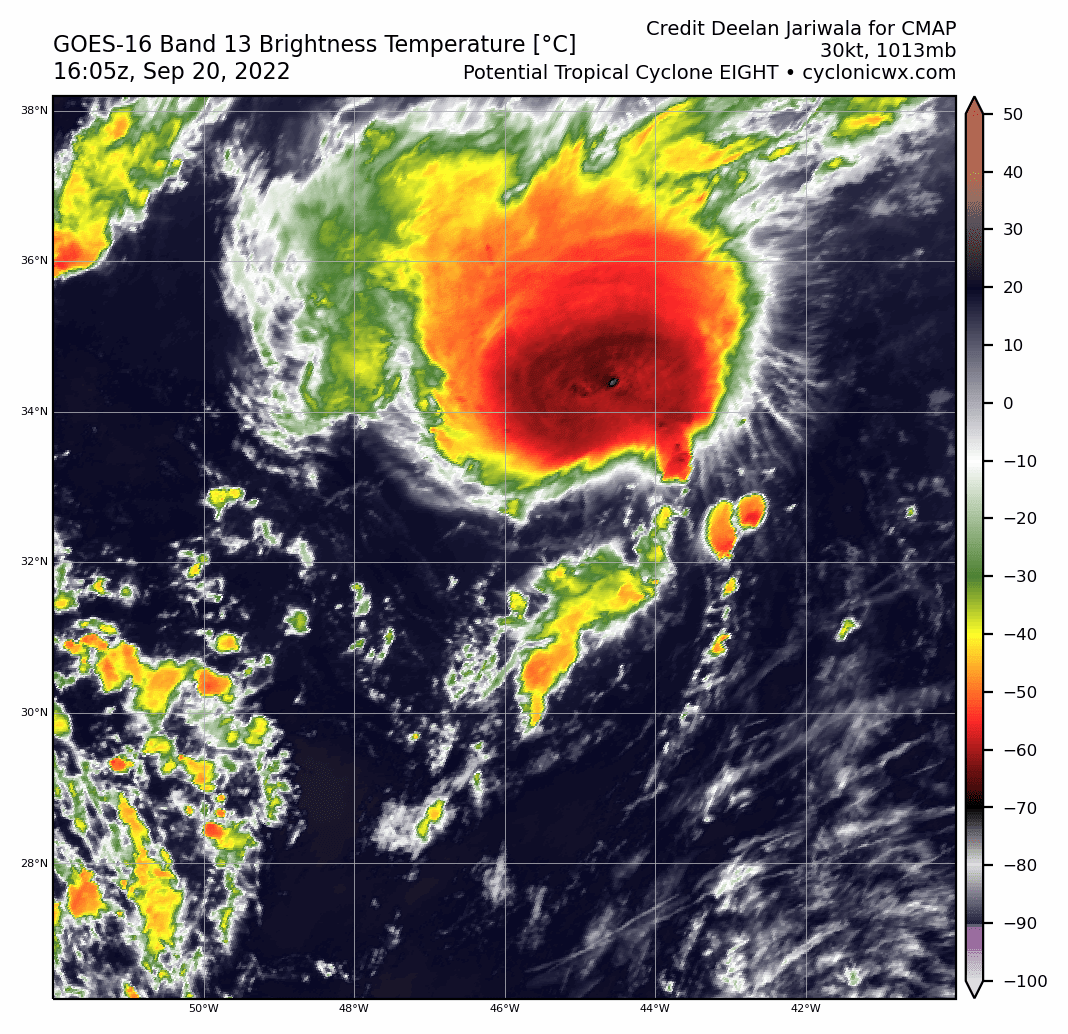
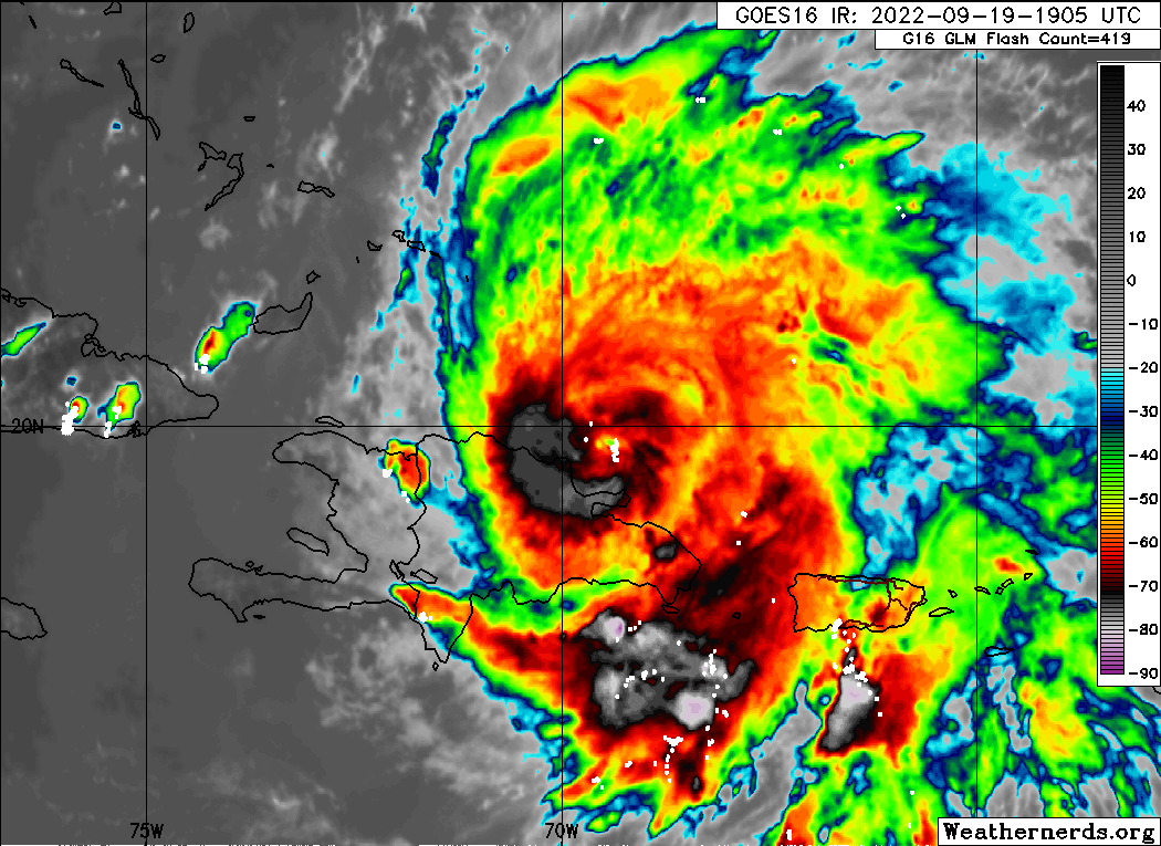
GLM activity is already way up in the eyewall of Fiona. Recon should be pretty interesting later on today as the storm tries to rebuild a tight core with a pretty darn impressive UL environment.
-
2
-
-
Just for sh*ts and gigs really, but the parent domain of the HWRF for Fiona develops the wave as well.

-
3
-
-
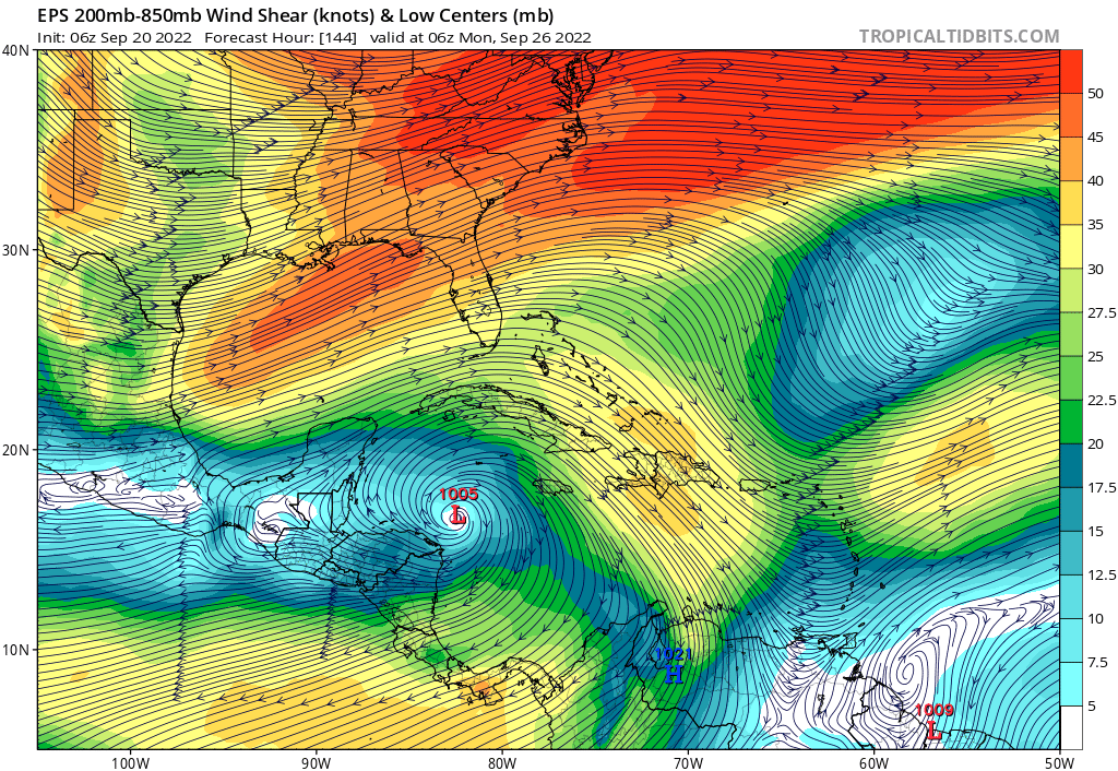
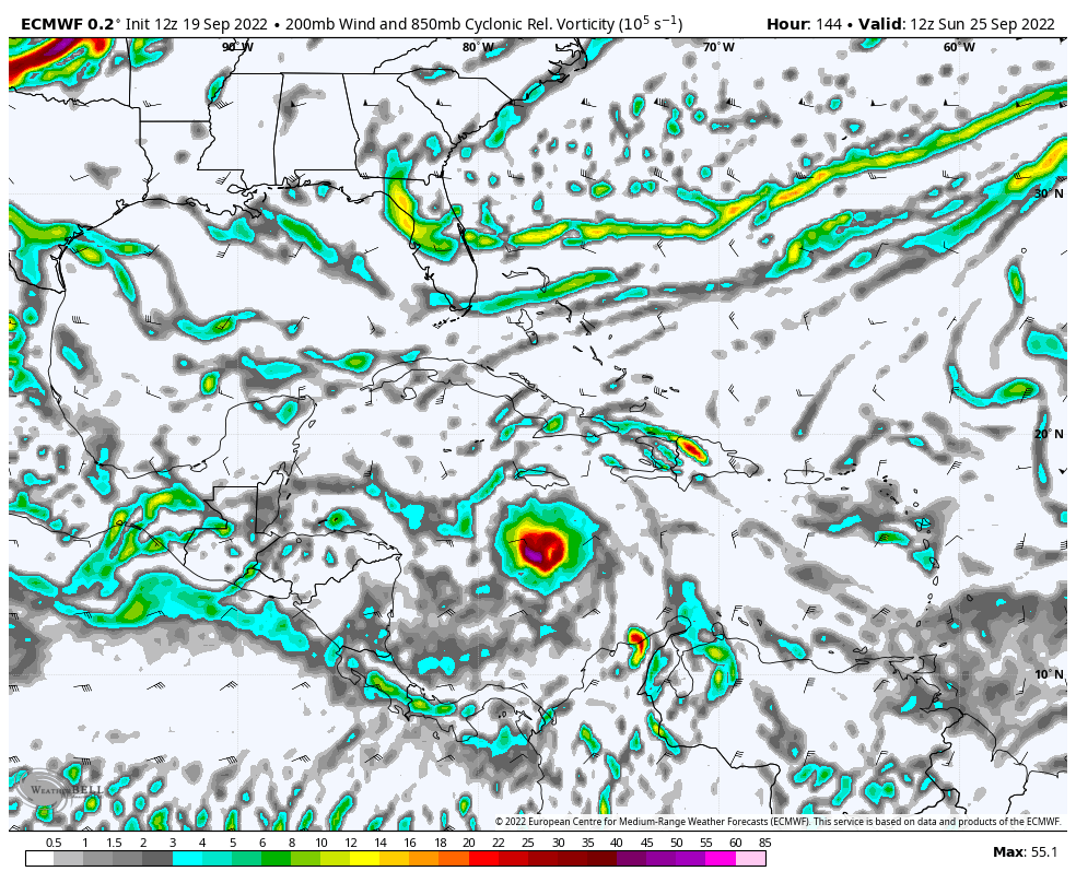
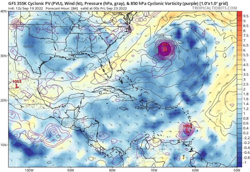
Outflow / PV streamer with Fiona will play a massive role with this wave. Little worried that the GFS is still too fast lifting Fiona out, which may result in quicker genesis than reality.

-
3
-
.gif.80108e267a818585077b0c5387132cf4.gif)


Hurricane Ian
in Tropical Headquarters
Posted
Seriously, which system would you peg for the greatest threat to the CONUS within the next 10 days?
Don't lie.