

Superstorm93
-
Posts
8,230 -
Joined
-
Last visited
Content Type
Profiles
Blogs
Forums
American Weather
Media Demo
Store
Gallery
Posts posted by Superstorm93
-
-
-
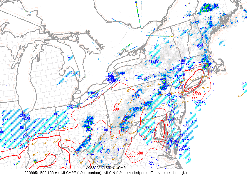
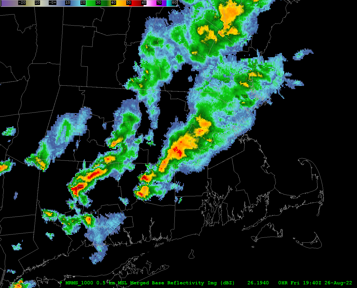
Sneaky destabilization over CT?
-
-
Not sure why the 6z HREF is so cracked out...
https://emc.ncep.noaa.gov/mmb/mpyle/hrefv3/06_exp/main_conus.php
-
 1
1
-
-
6 hours ago, ineedsnow said:
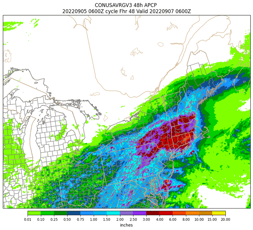
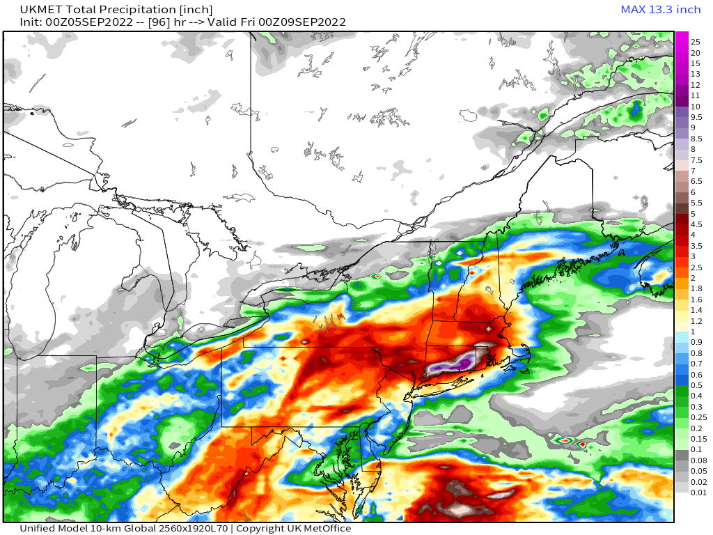
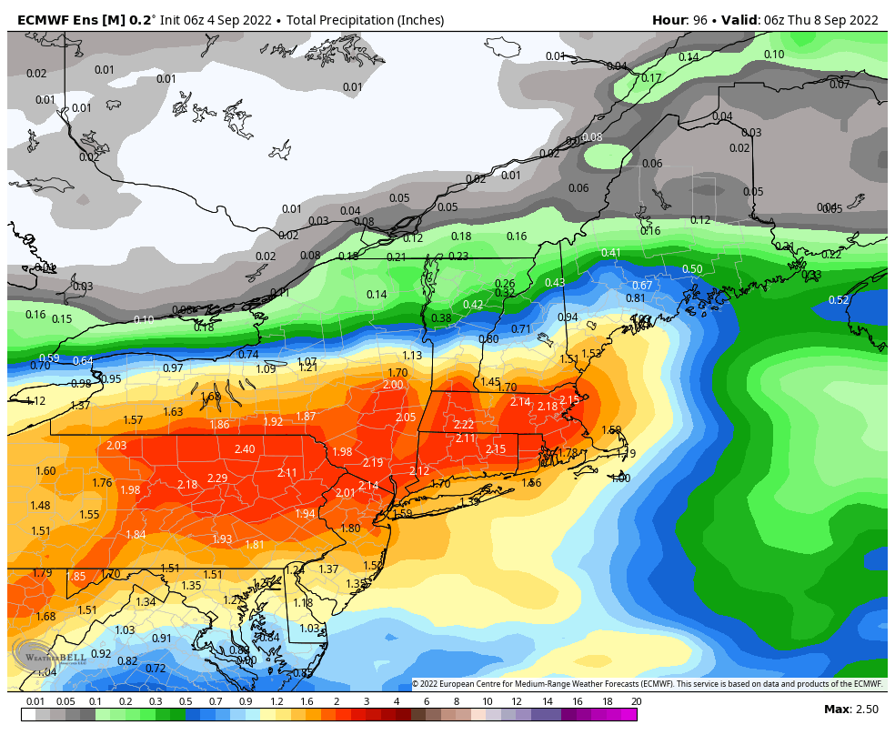
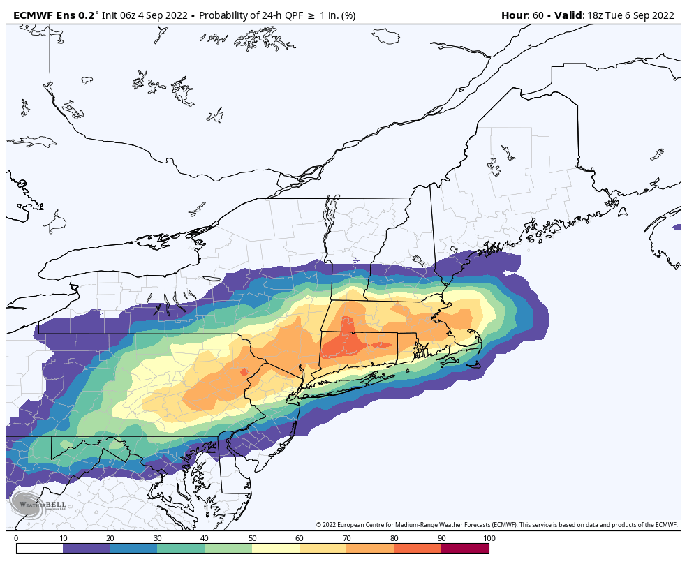
UKIE is 6 to 10 plus for most of southern CT woah.. someone is going to get some serious flooding looking at the 0z models qpf getting beefed up
From Stein to submerged

-
1
-
 1
1
-
-
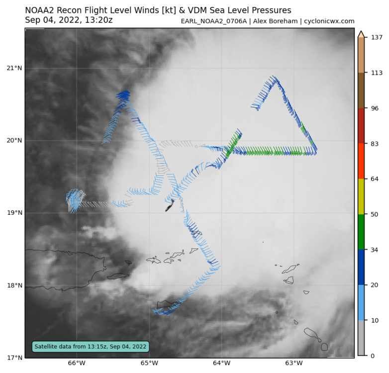
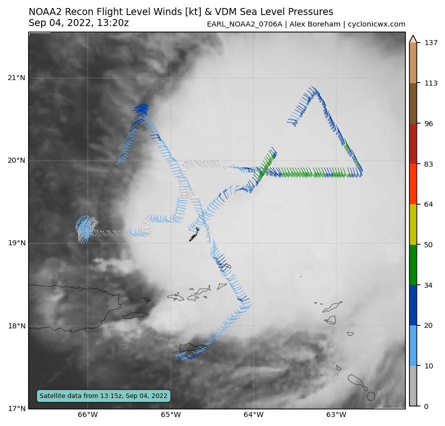
Just now, WxWatcher007 said:
Looks like recon is having communication issues.
Data is starting to backfill now. Center has reformed under the deep convection.
-
 1
1
-
-
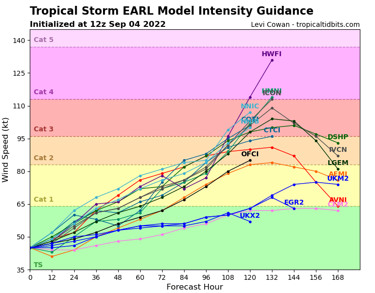
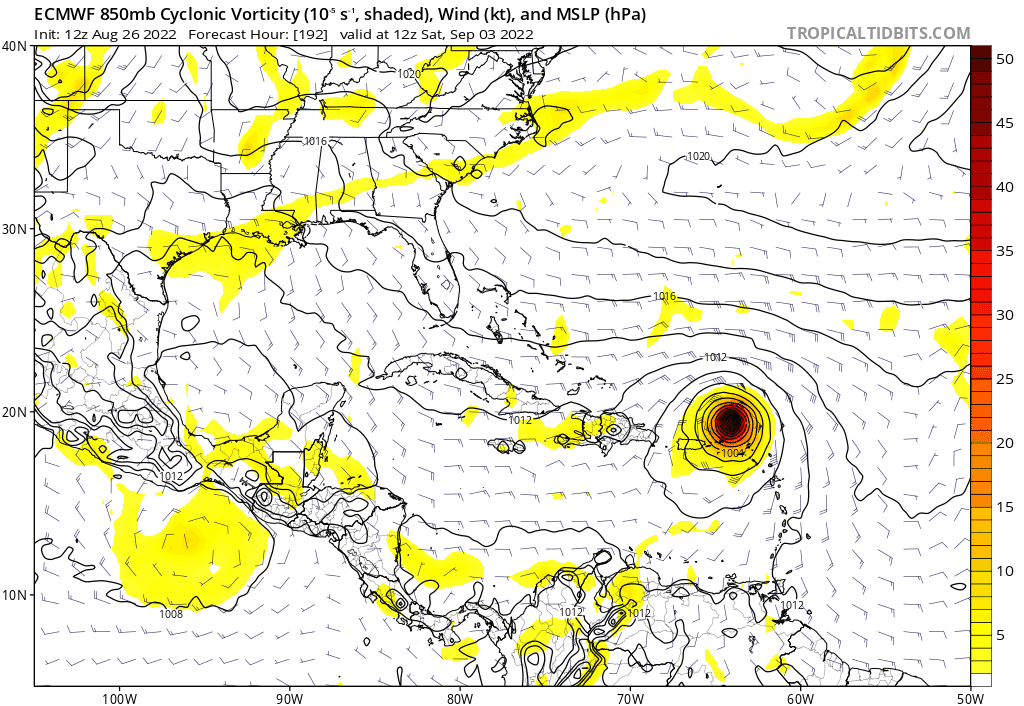
Early is looking increasingly likely to become a strong hurricane over the next several days. Should help rack up some ACE as it heads OTS.
-
1
-
-
-
We take. Still dumping on the North Shore
-
1
-
-
5 minutes ago, shaggy said:
In all honesty we need a quiet season after the last several years.
I'd love to break some records on the quiet side for once. It's been an exhausting six years.
-
8
-
-
-
1 hour ago, Rhino16 said:
If it were to stay a sheared mess for a longer period, does that make it less likely to recurve out to sea?
I'd be inclined to say that this has a low risk of impacting the CONUS over the next week or so.
Significant development of this wave has become increasingly unlikely over the past few runs.
-
1
-
-
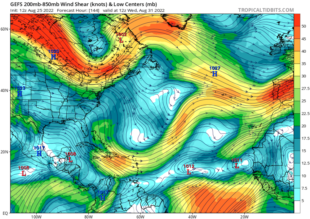
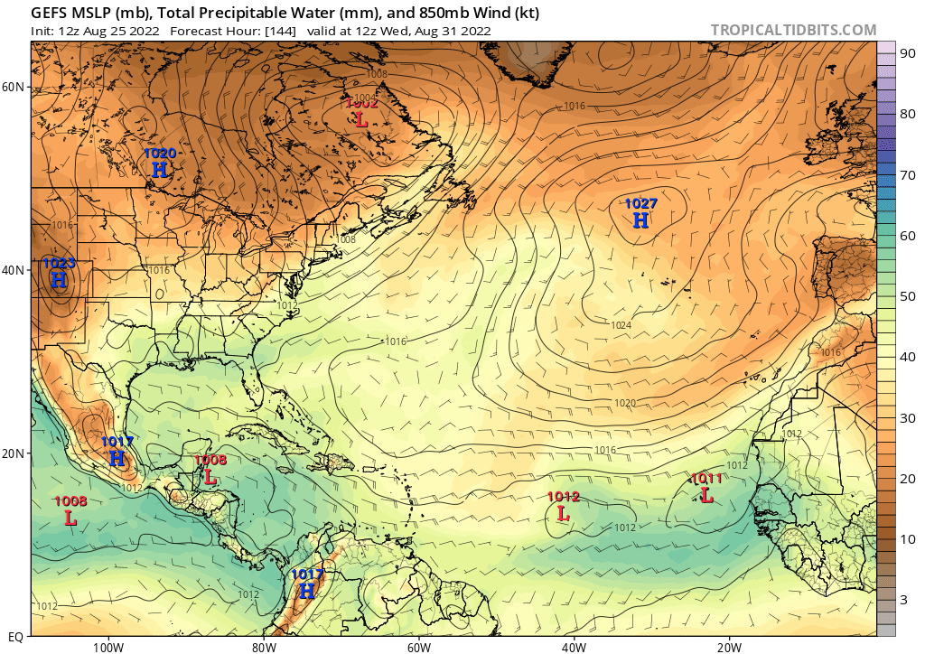
Another interesting development
We could be tracking sheared trash into September
-
-
Best case for this one is very slow development over the next five days. Environment north of the Greater Antilles looks pretty favorable, if it survives.
-
1
-
-
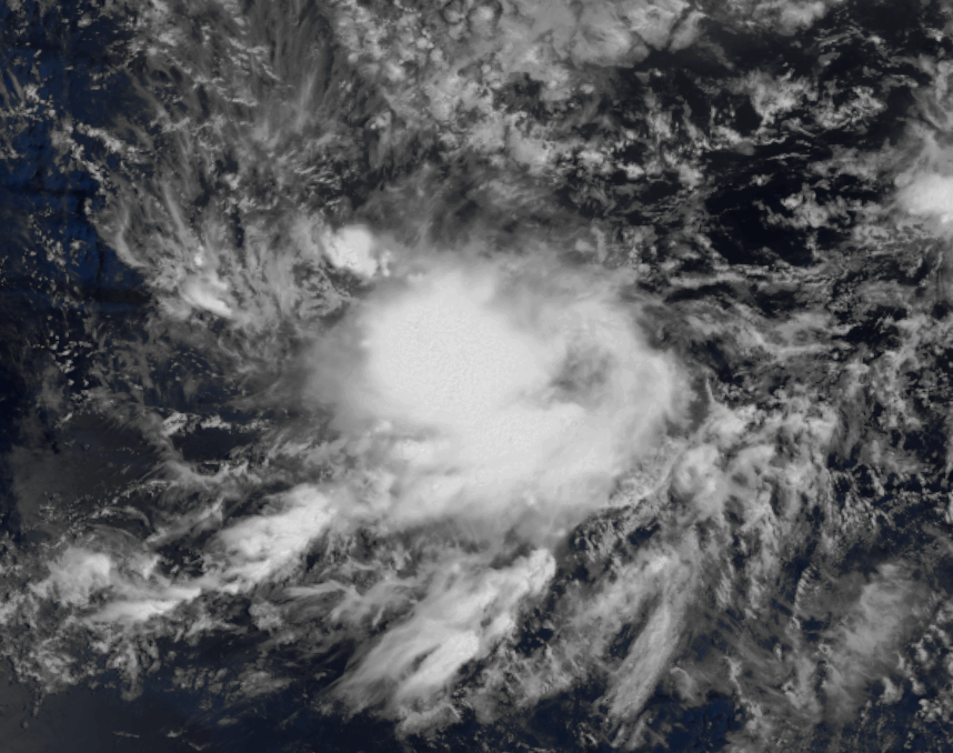
ASCAT pass was certainly more impressive than I would have guessed. Not too far from becoming a depression, but dry air may prolong this process for at least 48 hours.

-
3
-
-
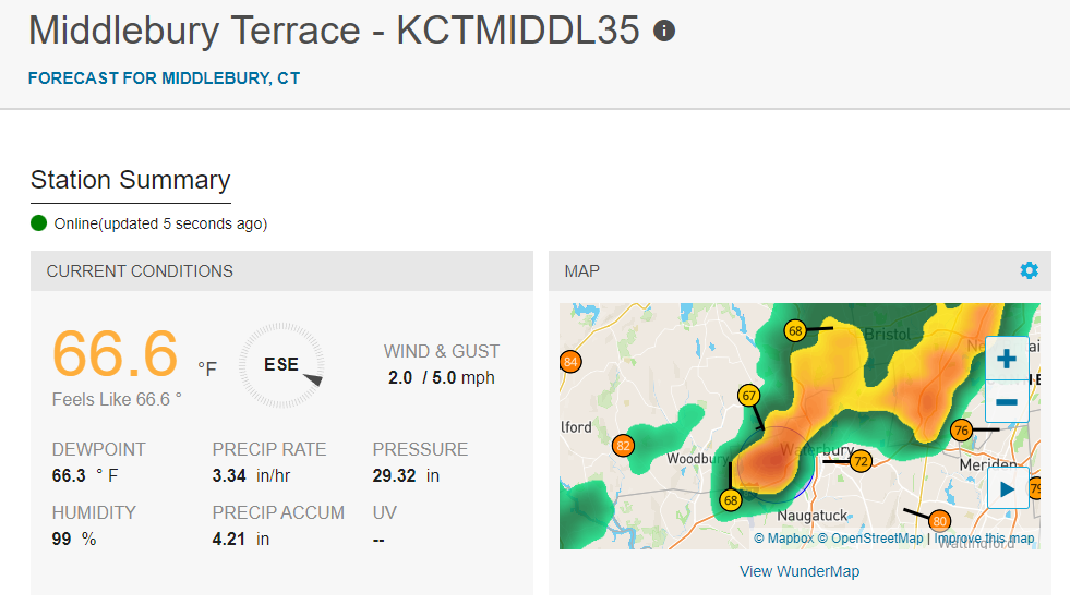
1 minute ago, kdxken said:
Almost an Inch and a quarter.
Congrats!
-
1
-
-
Glad to see a decent drink moving in for some folks.
Nothin too severe, but we'll take that

-
Certainly looks interesting, but this thing has a pretty long journey ahead of it to become a TC. Basically a monsoon depression at this point and an earlier ASCAT did not reveal any signs of a coherent LLC.
I'm pretty confident we make it out of August without a single NS. Pretty remarkable and I'll certainly take it after the last 6 years of insanity.
-
5
-
-
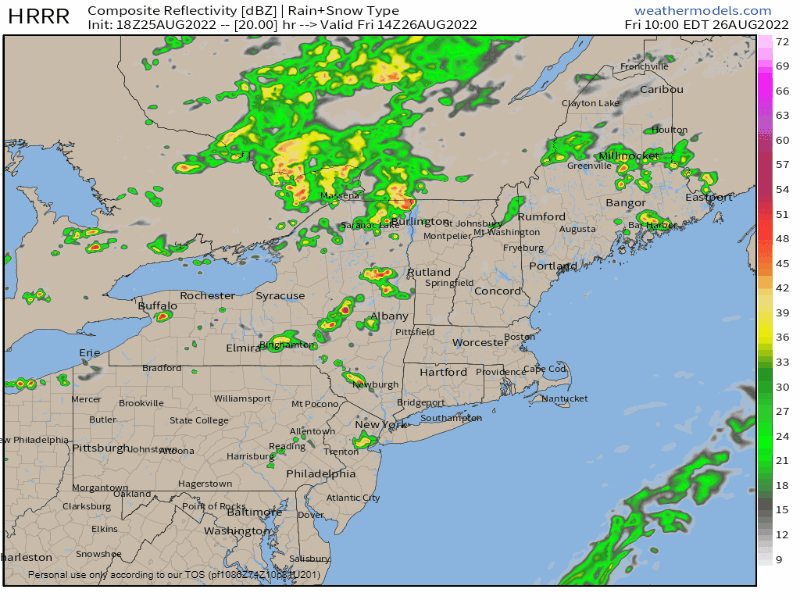
18z HRRR delivers the goods for tomorrow
-
5
-
-
Nothing screams "flipping the switch" like a TUTT on roids and dry air from the subtropics getting injected into the MDR.

-
2
-
1
-
-
Just a bit off...
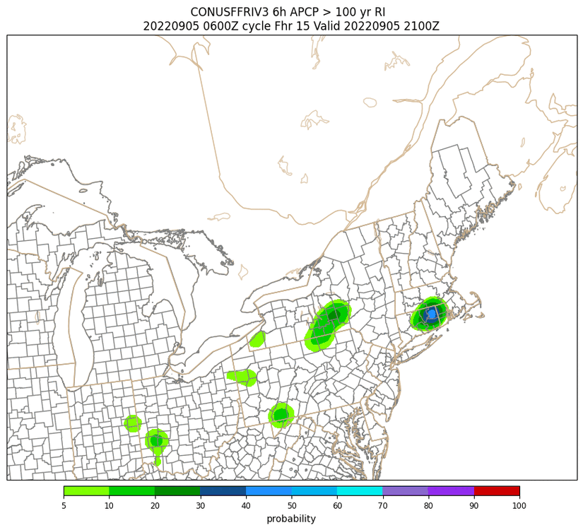
* At 457 PM EDT, Doppler radar indicated thunderstorms producing heavy rain across the warned area. Between 1 and 2 inches of rain have fallen. The expected rainfall rate is 0.5 to 1.5 inches in 1 hour. Flash flooding is ongoing or expected to begin shortly.
-
9 minutes ago, CoastalWx said:
There is a 6z HREF?
-
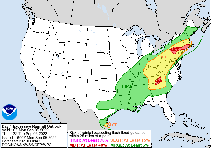
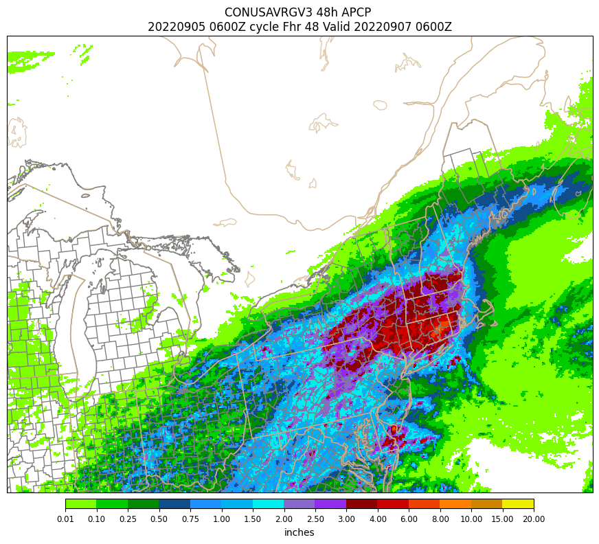


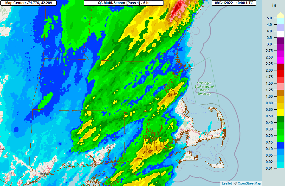
New England heavy rain event Sept 5/6 2022. Does this end the summer drought?
in New England
Posted
This is a perfect example of what I'd want to wash away the
Just a steady rate with almost 3" on the day
https://www.wunderground.com/dashboard/pws/KMAHOPKI38