

Superstorm93
-
Posts
8,230 -
Joined
-
Last visited
Content Type
Profiles
Blogs
Forums
American Weather
Media Demo
Store
Gallery
Posts posted by Superstorm93
-
-
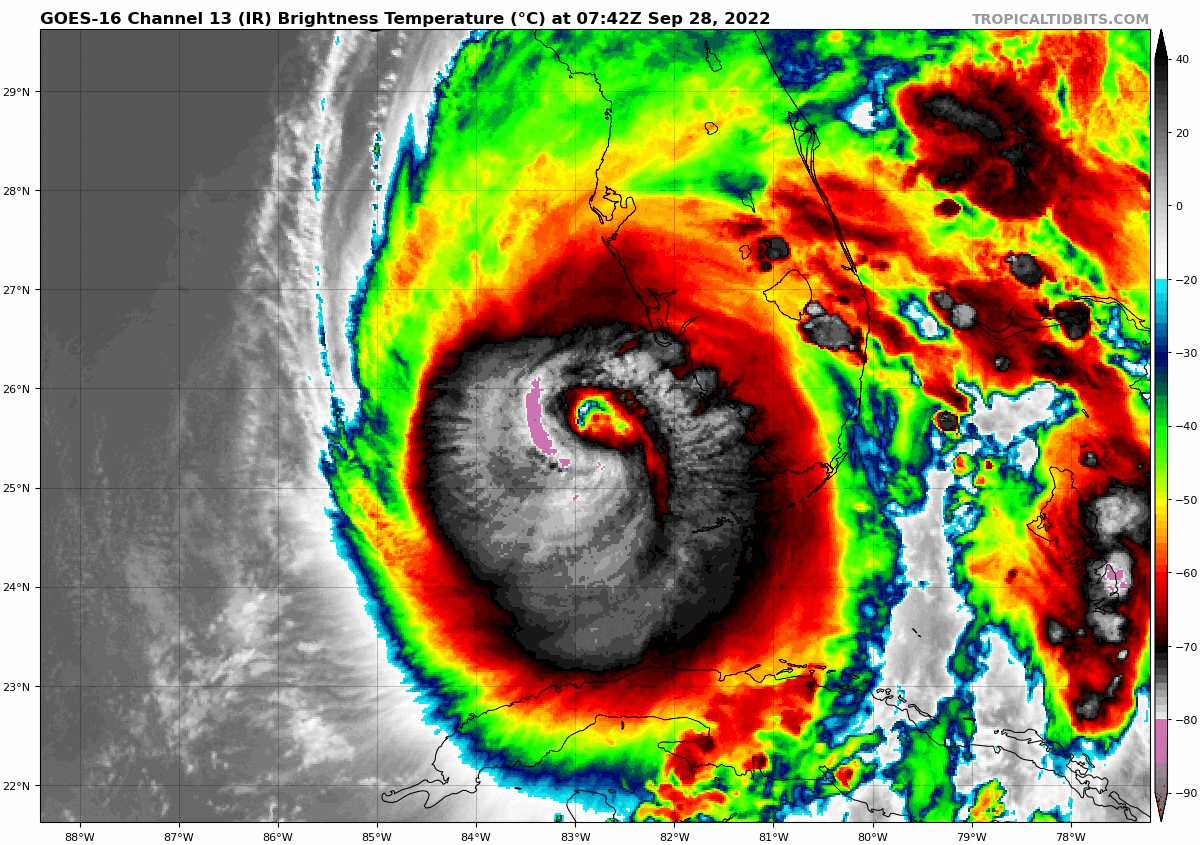
617
WTNT64 KNHC 281036
TCUAT4

Hurricane Ian Tropical Cyclone Update
NWS National Hurricane Center Miami FL       AL092022
635 AM EDT Wed Sep 28 2022

...IAN RAPIDLY INTENSIFYING...
...CONDITIONS RAPIDLY DETERIORATING ALONG THE SOUTHWEST FLORIDA
COAST...

Recent data from a NOAA Hurricane Hunter aircraft indicate
that maximum sustained winds have increased to near 155 mph (250
km/h). A special advisory will be issued by 7 AM EDT (1100 UTC) to
reflect this change and update the forecast.


SUMMARY OF 635 AM EDT...1035 UTC...INFORMATION
----------------------------------------------
LOCATION...25.9N 82.8W
ABOUT 65 MI...105 KM WSW OF NAPLES FLORIDA
ABOUT 80 MI...130 KM SSW OF PUNTA GORDA FLORIDA
MAXIMUM SUSTAINED WINDS...155 MPH...250 KM/H
PRESENT MOVEMENT...NNE OR 15 DEGREES AT 10 MPH...17 KM/H
MINIMUM CENTRAL PRESSURE...936 MB...27.73 INCHES

$$
Forecaster Papin/Blake
-
 3
3
-
 1
1
-
-
At a loss for words.
101130 2551N 08312W 7509 02191 9665 +146 +137 013124 129 120 052 00
101200 2551N 08310W 7516 02153 9628 +144 +138 015135 139 126 044 00
101230 2551N 08309W 7521 02107 9592 +147 +142 016136 140 133 046 00
101300 2551N 08307W 7518 02082 9557 +151 +145 022148 160 137 042 00
101330 2551N 08306W 7558 02024 9534 +155 +149 022150 158 137 042 00
101400 2551N 08304W 7573 01993 9516 +160 +155 026143 149 134 037 00
101430 2550N 08303W 7553 02000 9493 +166 +153 027133 143 134 031 00
101500 2550N 08301W 7516 01999 9461 +175 +156 028111 130 131 027 00
-
15
-
-
-
-
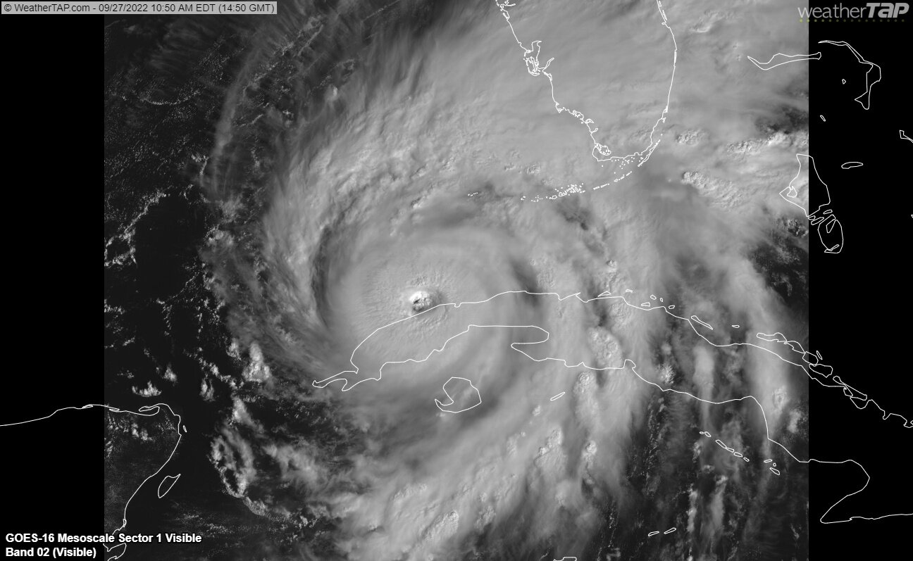
I'd hedge a guess that the window for significant intensification is closing for Ian. The EWRC will likely continue through tonight and shear will likely be on a sharp increase by that time.
Obviously, the surge and rainfall threats remain rather high.
-
4
-
-
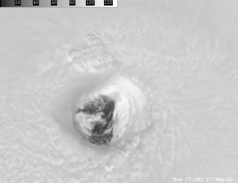
That's going to be a rather large eye IF it's able to successfully complete the cycle.
-
4
-
-
7 minutes ago, Crocodile23 said:
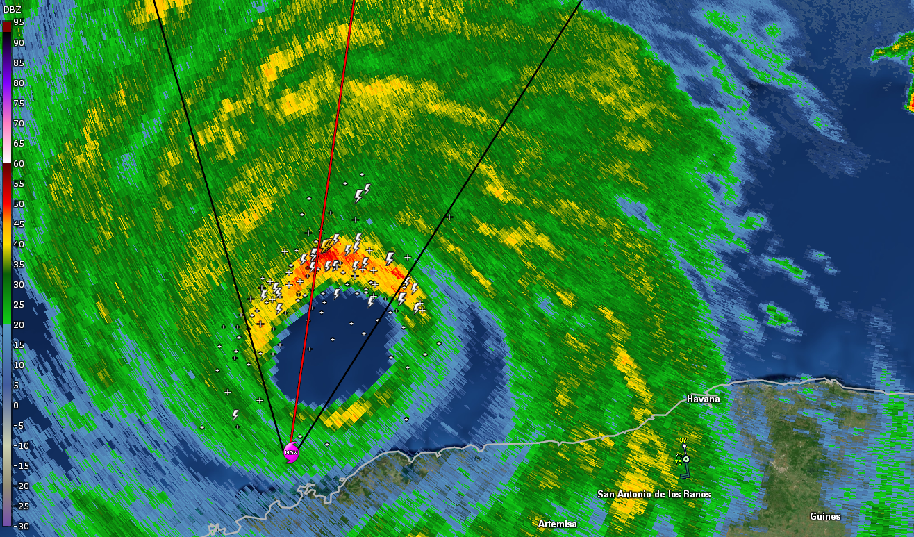
Which radar is this(site or app)? Thanks.
GRLevel2. The lightning is from a placefile.
-
1
-
-
14 minutes ago, jpeters3 said:
This makes me think we are starting to see the effects of increasing southerly shear, which is arguably visibly evident in the visible loop to the south of the storm. Shear will make the inner eyewall lopsided and can "supercharge" the eyewall convection on the downshear flank a bit.
Agreed. I think we may also be witnessesing the first stages of an attempted EWRC.
-
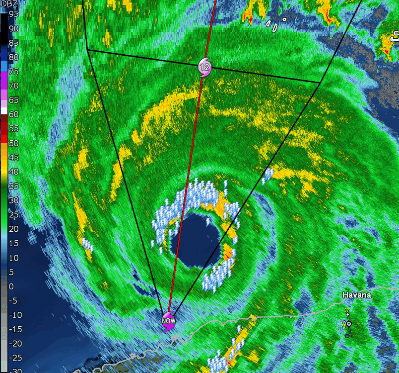
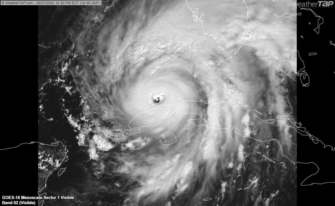
Stupid amount of lightning in the northern eyewall
-
12
-
 1
1
-
 2
2
-
 2
2
-
-
Pressure down to 955 and winds up to 120 as of 2 PM
-
14
-
-
Not great to see the eye already on the right side of the track

-
1 minute ago, Modfan2 said:
Could be just the radar, but does it look like dry air is getting wrapped into the back side?
Could be winds from coming down from the mountains on the backside.
-
1
-
-
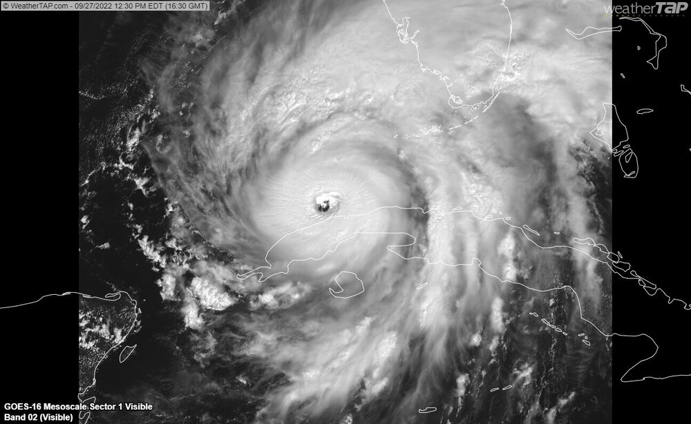
The overall presentation remains rather incredible.
-
7
-
-
-
1 minute ago, ATDoel said:
How is this a 963mb storm?? I hate to disagree with the NHC on anything, but this makes no sense to me, there's just no way? ADT has this in the 930s, and that looks about right based on presentation.
ADT is an algorithm. We literally have recon in the storm right now.
Stop.
-
5
-
1
-
6
-
-
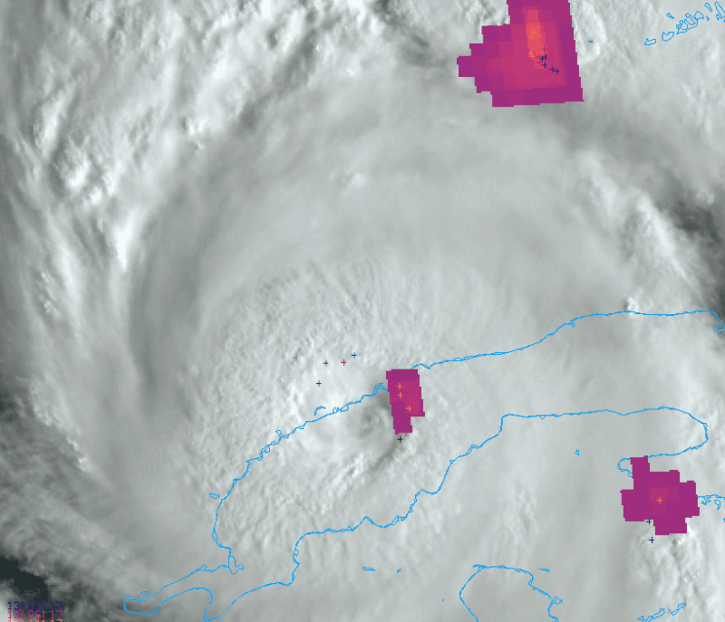
Pretty substantial amount of lightning continues within the core of the storm.
-
5
-
-
Last 4 cycles of the GFS
-
6
-
1
-
-
(Just in case anyone else is reading this)
Please, do NOT consult this thread (or any) to make decisions whether or not to evacuate.
I'm begging you guys to listen to your county/local emergency management officials for all storm related information.
-
25
-
2
-
1
-
2
-
-
Just now, Sportybx said:
What are we looking at for the impacts for Cape Coral Florida .
I have my mother and father down there . Father is in oxygen and both are thick headed and won’t listen to me when I told them to head over to the east coast .
.Find their location for when the latest surge inundation map comes out
https://www.nhc.noaa.gov/refresh/graphics_at4+shtml/100939.shtml?inundation#contents
-
1
-
-
1 minute ago, ATDoel said:
This last dropsonde doesn't make any sense to me. ADT readings and T numbers show significant strengthening of Ian since it made landfall in Cuba, the storm looks tighter and more organized on satellite as well, how in the world did it weaken so much? ADT is estimate 937 mb, that's a 30 mb difference from the drop.
Wasn't exactly the lowest point on the island, but it should recover during the afternoon.
-
Is it a wobble if it's been doing it for six hours lol
-
1
-
-
-
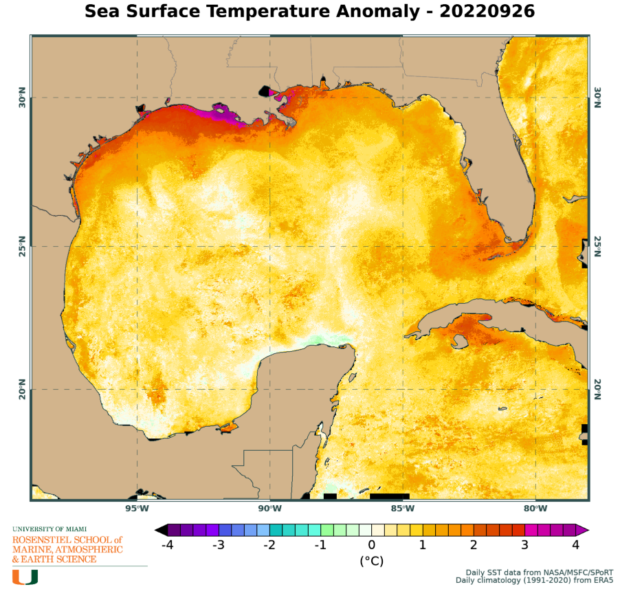
SSTs along the track are running a bit above normal as well

-
ADT is running again
Suggesting 122 knots, but we're likely running lower given the land interaction.
Might be able to see that tonight.

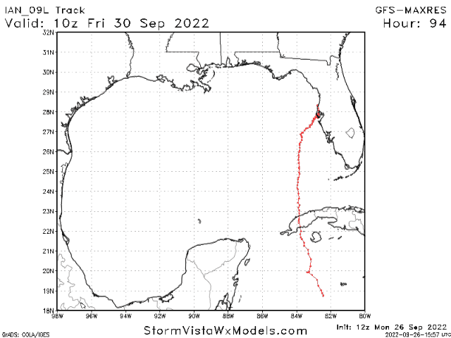
Hurricane Ian
in Tropical Headquarters
Posted
Three things.
1. Not at the surface
2. Those are considered gusts in almost all instances now
3. "Only" 132 knots in the lowest 150m