

Superstorm93
-
Posts
8,230 -
Joined
-
Last visited
Content Type
Profiles
Blogs
Forums
American Weather
Media Demo
Store
Gallery
Posts posted by Superstorm93
-
-
Still have a good 18 hours before shear starts to degrade the core

-
Good amount of lightning now as well

-
 1
1
-
-
My biggest fear is that land interaction will induce an EWRC.
We don't need to expand the winds.
-
1
-
 1
1
-
-
-
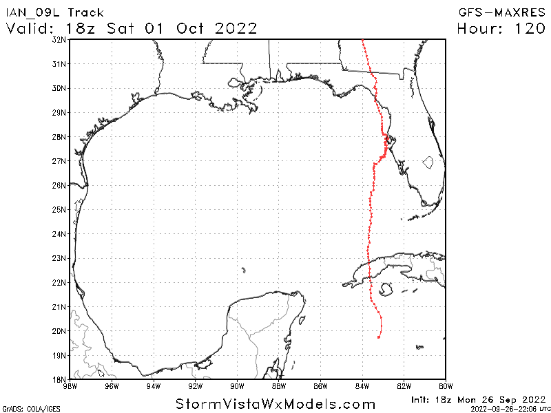
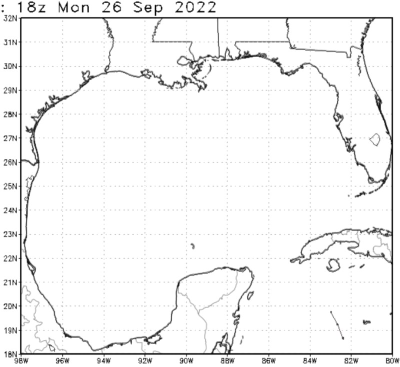
Full GFS track. I really hope we see this shift west tomorrow.
-
1
-
-
Really, really weird call raising the intensity to 85 knots right before you have two recon planes in the storm.
Oh well. We'll see how that works out I suppose.
-
2
-
-
-
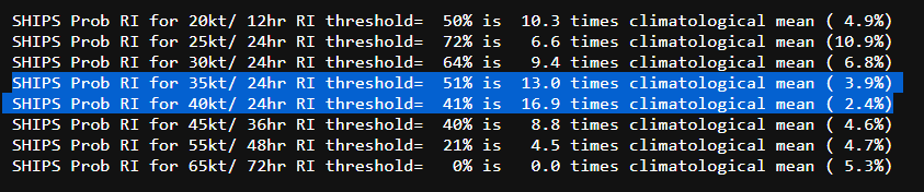
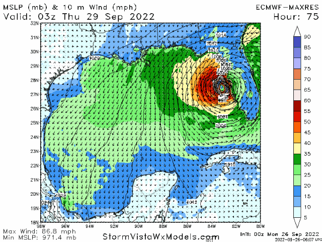
18z SHIPS continues to insist that Ian will become a Category 4 hurricane by tomorrow.
-
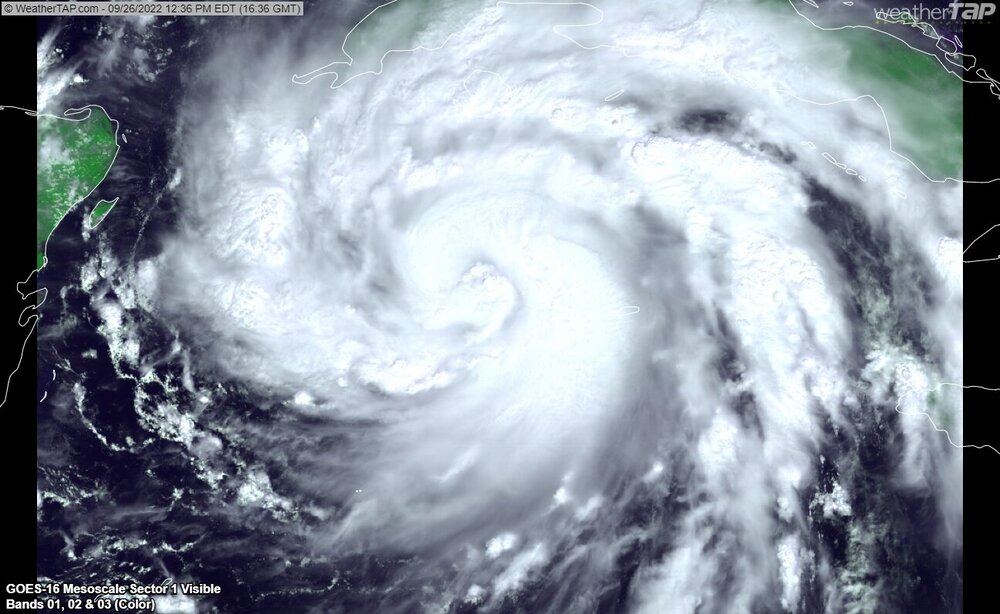
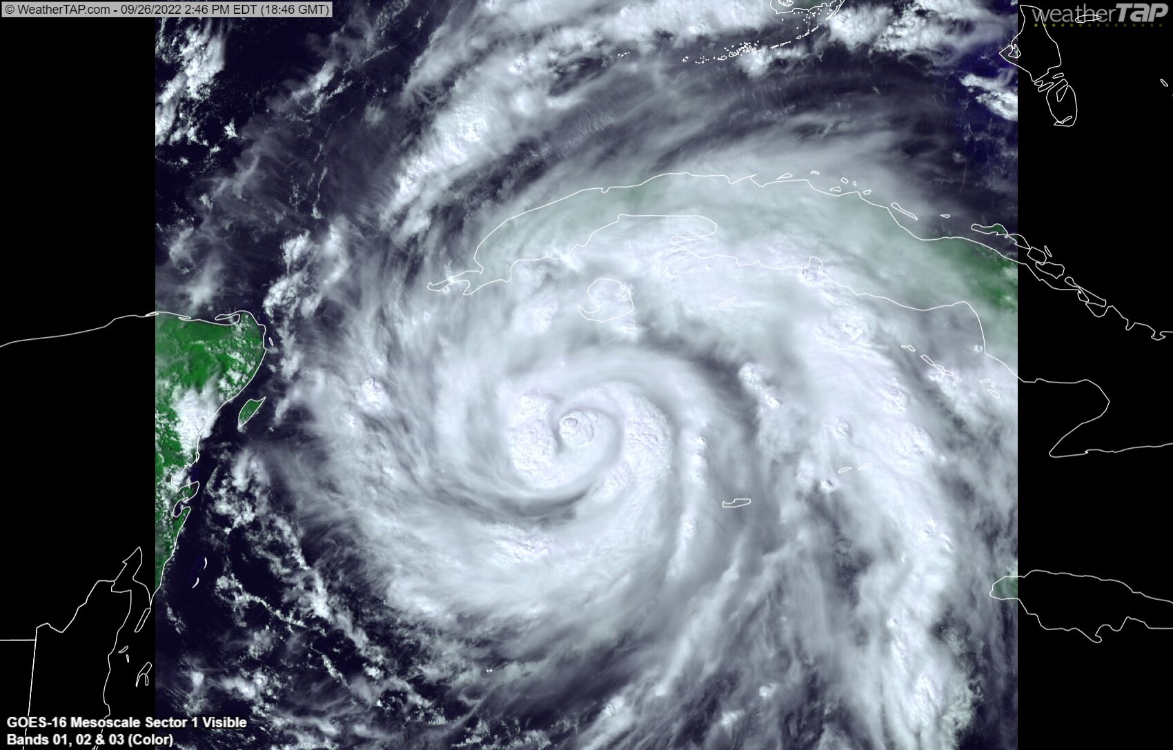
The banding structure is incredible with Ian this afternoon.
While the storm has ingested some dry air, I would guess that the bursts near the core have at least dropped the central pressure a few millibars since the last fix.
I would expect the storm to resume a rather quick pace of intensification overnight as it nears the Cuban coast.

-
7
-
-
9 minutes ago, eyewall said:
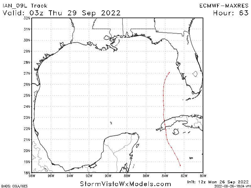
I think what is most notable about the GFS/Euro runs is the stall/crawl off Tampa before resuming the trip north.
I mean, it kind of makes sense.
Steering breaks down due to the high, but the UL jet wants to keep the system moving to the east.
-
2
-
-
-
So far, not good.
-
Just now, NJwx85 said:
Hearing unconfirmed rumors that they have started issuing evacuation orders for portions of Tampa area.
-
For the maximum doom crowd
-
Looks like it took a shot of dry air before.
Latest burst should take care of that
-
2
-
-
-
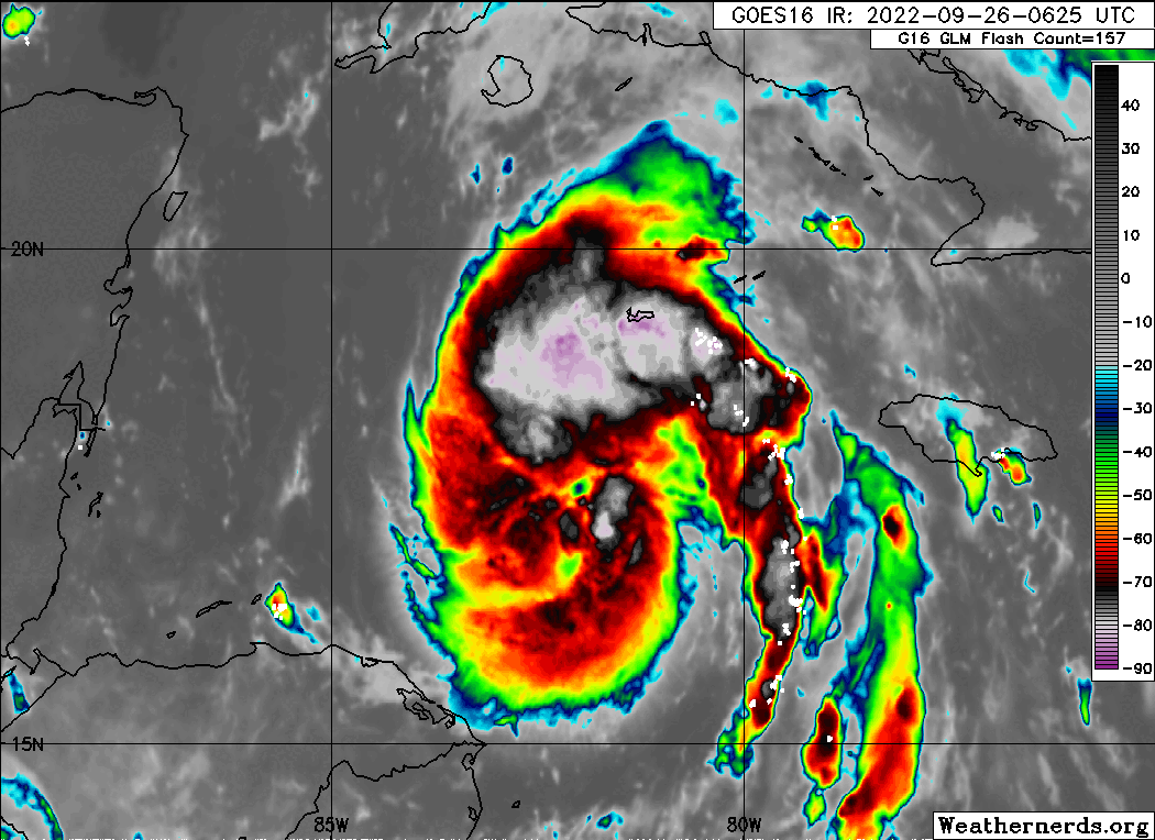
IR continues to dramatically improve. Should be a big day.
-
7
-
-
1 minute ago, WxSynopsisDavid said:
NAM landfalls south of Tampa Bay and the FV3 Hi-Res seems to be following the same track. Interesting to see the CAM start to lean towards a Tampa or points south landfall......very similar to some of the EURO op runs and the ensemble runs we seen the last few days
CAMS are not able to handle tropical systems. They should never be used for track or intensity.
-
3
-
 1
1
-
-
Hell of a time to have two recon planes in a rapidly intensifying hurricane

-
1
-
2
-
-
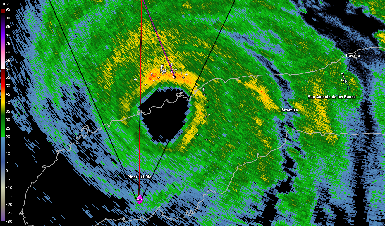
There's the eye...
.png.3a89958d471e17b81897bfc6e5254d72.png)
-
1
-
-
IR isn't spectacular with the heaviest convection once again located outside of the RMW
-
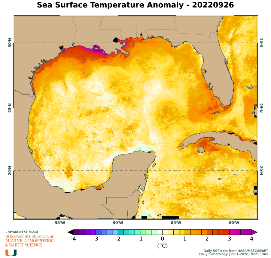
Same deal as 5 AM this morning. All it will take is a few towers in the core. Then, it's just a matter of how much this piles up surge during the next several days.
-
2
-
-
5 minutes ago, Ed, snow and hurricane fan said:
I checked with NHC site to confirm TT, there is indeed a HH flying the Northeast while there is no plane in Ian.
Mission inbound from Florida now. Should hopefully give us some better insight as to how this system has faired throughout the course of the day.
-
10 minutes ago, Amped said:

GFS intensity forecast was not great.
Model that has been historically poor in the Caribbean continues to perform poorly in the Caribbean.
-
2
-

Hurricane Ian
in Tropical Headquarters
Posted
Portion of the eye now completely out of the 5 AM track