

Superstorm93
-
Posts
8,230 -
Joined
-
Last visited
Content Type
Profiles
Blogs
Forums
American Weather
Media Demo
Store
Gallery
Posts posted by Superstorm93
-
-
2 minutes ago, ORH_wxman said:
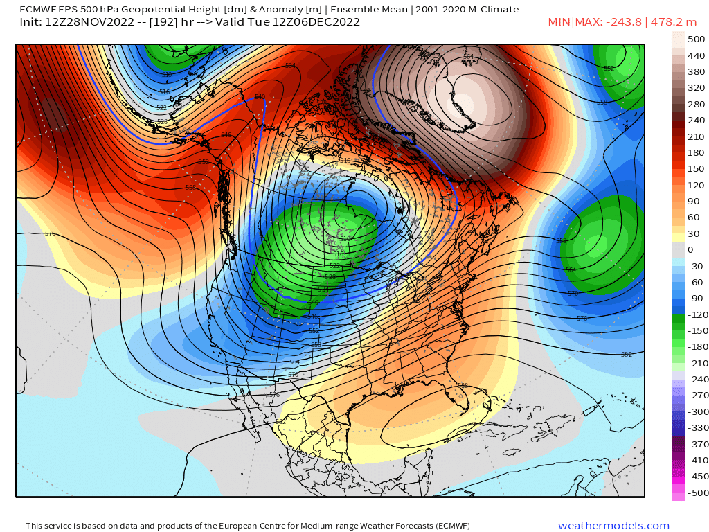
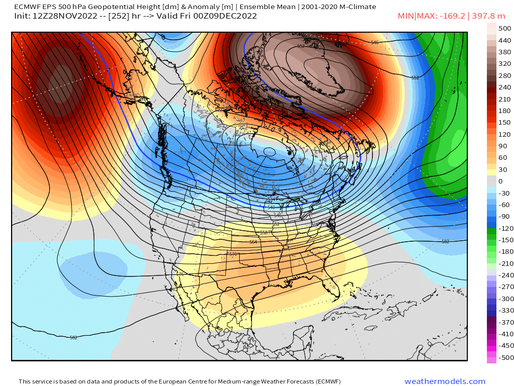
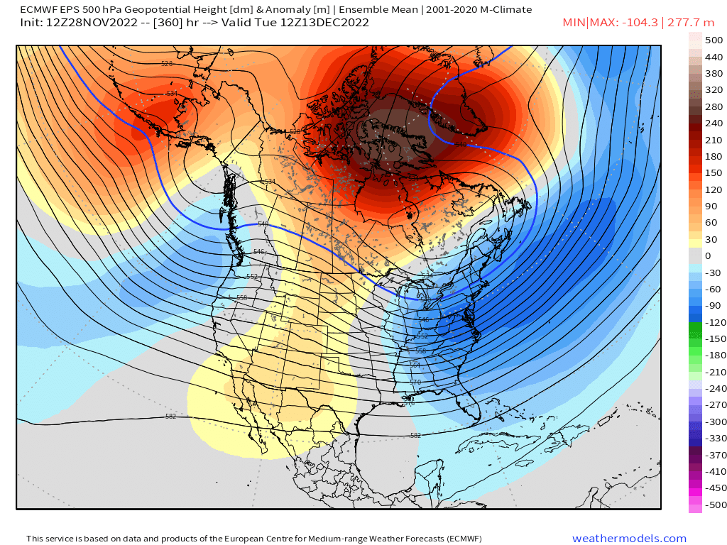
Here is the progression in 3 charts....first one is Dec 6, 2nd is Dec 9, and last one is Dec 13


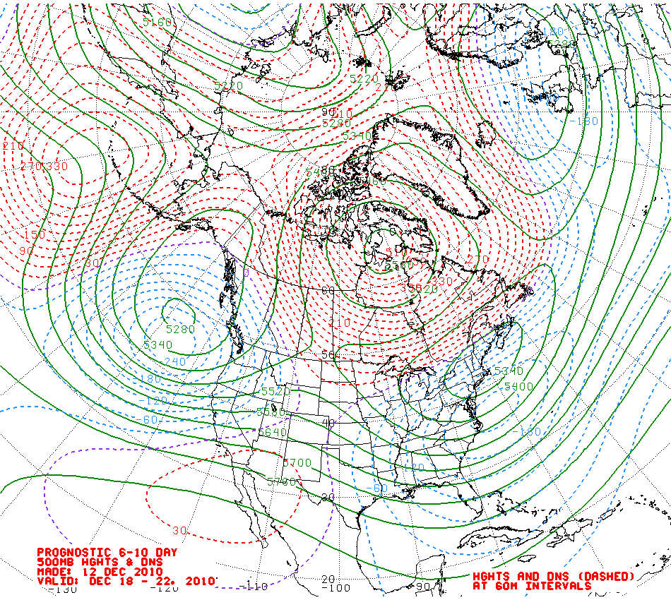
I feel like we've seen this before...
-
 2
2
-
-
Pope on dope.
Ya hate to see it.
-
 1
1
-
-
5 minutes ago, jbenedet said:
You could just post the GEFS at 144 vs the EPS, and tell everyone why you're hugging the GEFS.
PS the pacific is going to shit next week.
Sir, are you okay?

-
2
-
-
Some nice weenie fuel for Sunday
-
Already some 40 mph gusts at PBI
-
27 minutes ago, Ed, snow and hurricane fan said:
An eye starting to form?

Yeah, I'm pretty curious what recon finds later today. The high-altitude mission has winds around 50 - 55 knots well to the north of the center, so I'd imagine 60 knots wouldn't be too crazy for inside the RMW.
-
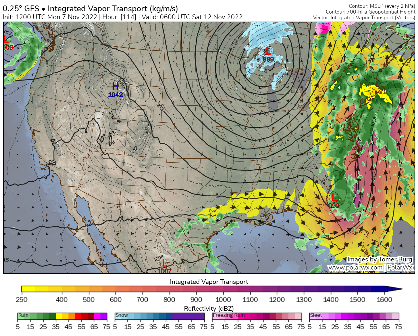
Not a bad PRE setup for Fri/Sat. Could be a depressing soaker with some poor drainage flooding.
-
5
-
-
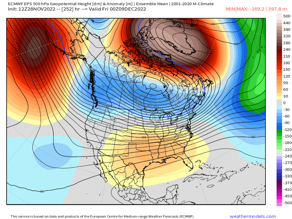
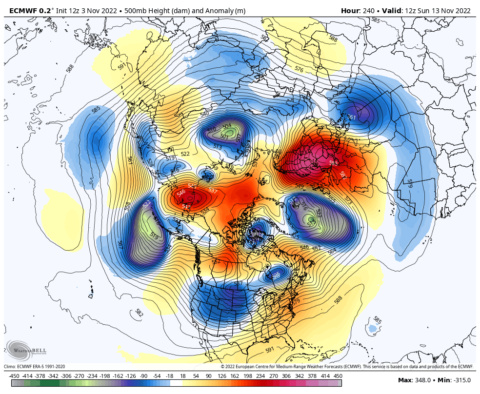
Still seeing signs of increased heights across the Arctic and a retrograding Scandinavian ridge during the middle of the month.
Ensembles are slowly grasping on to this idea as well.

-
1
-
-
Center now exposed on the northern edge of the convection
-
2
-
-
Been poking around all other regions, but did any of you guys hear or see any non-coastal flooding (street/stream/creek) over the last several days?
-
3 minutes ago, BxEngine said:
Nothing of note in Rockland. The usual streams and lakes that tend to overflow were pretty low going in.
Yeah, that's the general answer I'm getting across the entire region. Appreciate it.
-
Anyone actually see/hear of any non-coastal flooding reports?
-
Did anyone actually see any poor drainage flooding with the recent rains? I feel like the duration of this was too drawn out for anything of note to occur...
-
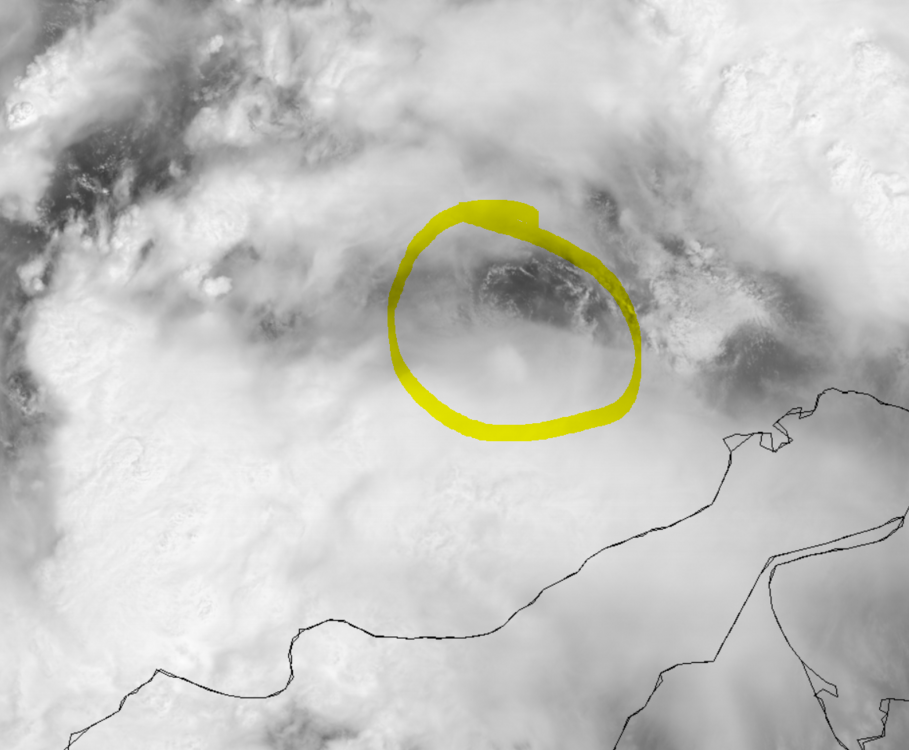
This one has a pretty decent shot at going ballistic once it nears 75 W
I haven't seen a system look this good while over South America in a long time.
-
-
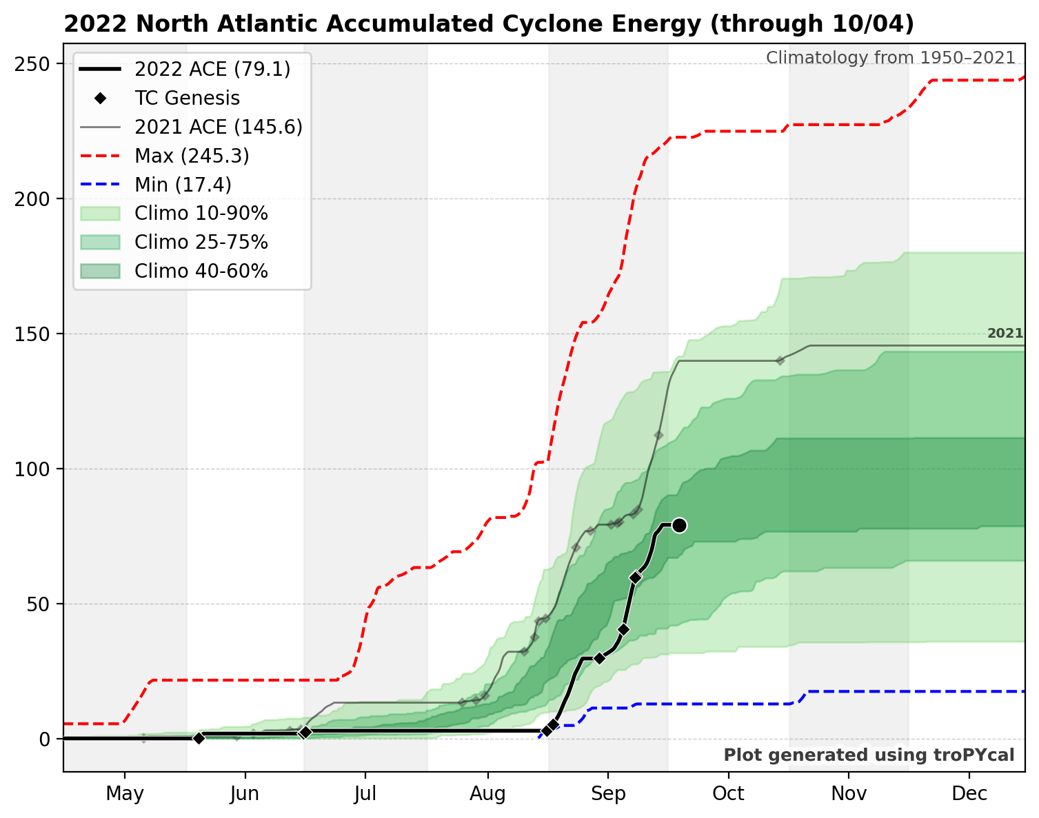
Current ACE plot

-
3
-
 1
1
-
-
1 minute ago, CoastalWx said:
Not always. I will say the data can be intermittent though.
Sorry, I meant the actual radar itself.
-
Isn't TBOS unusually older than the rest of the terminals?
And they're available on GRLevel2/3
-
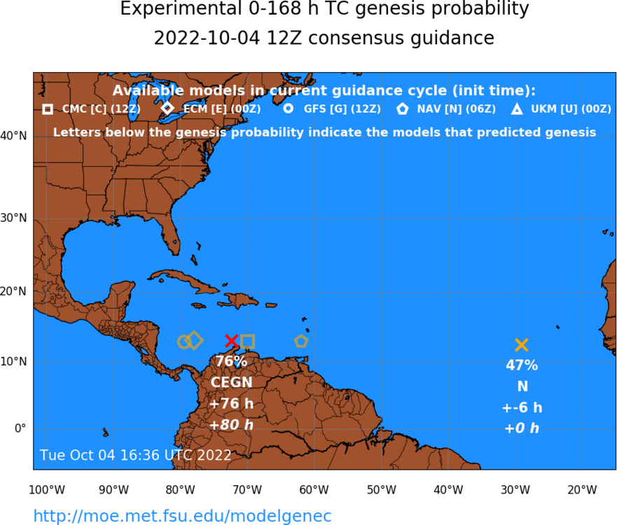
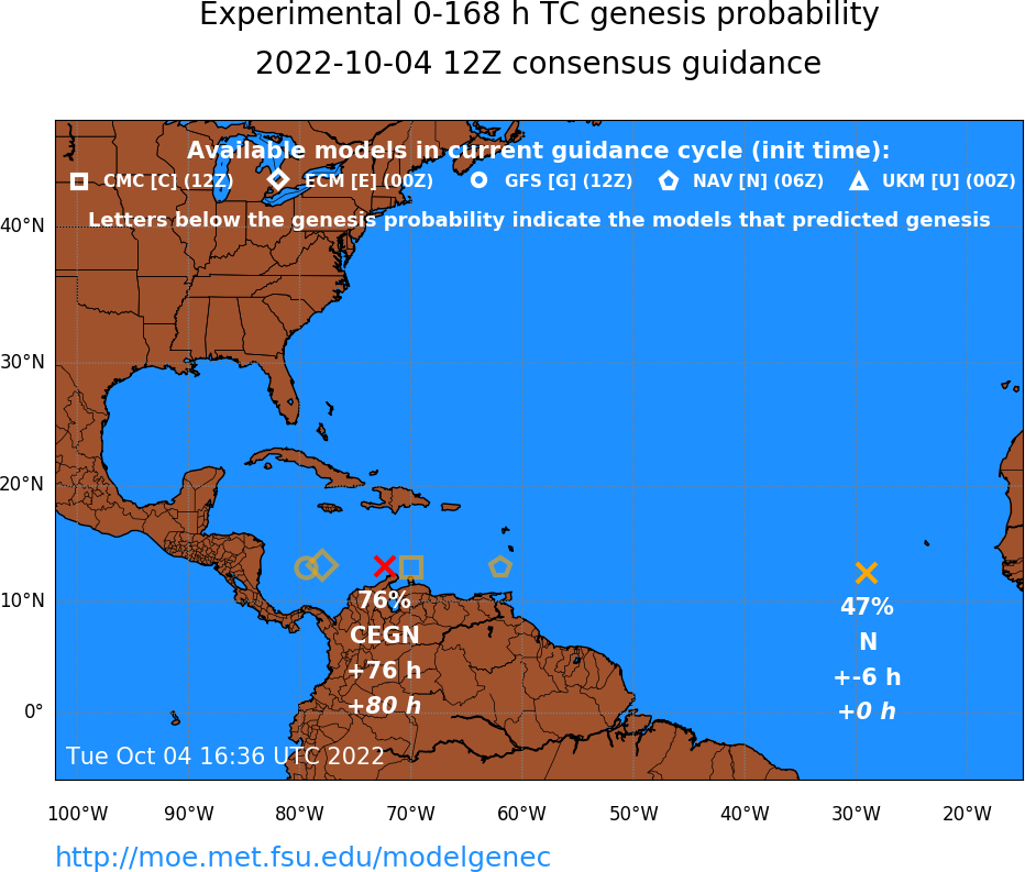
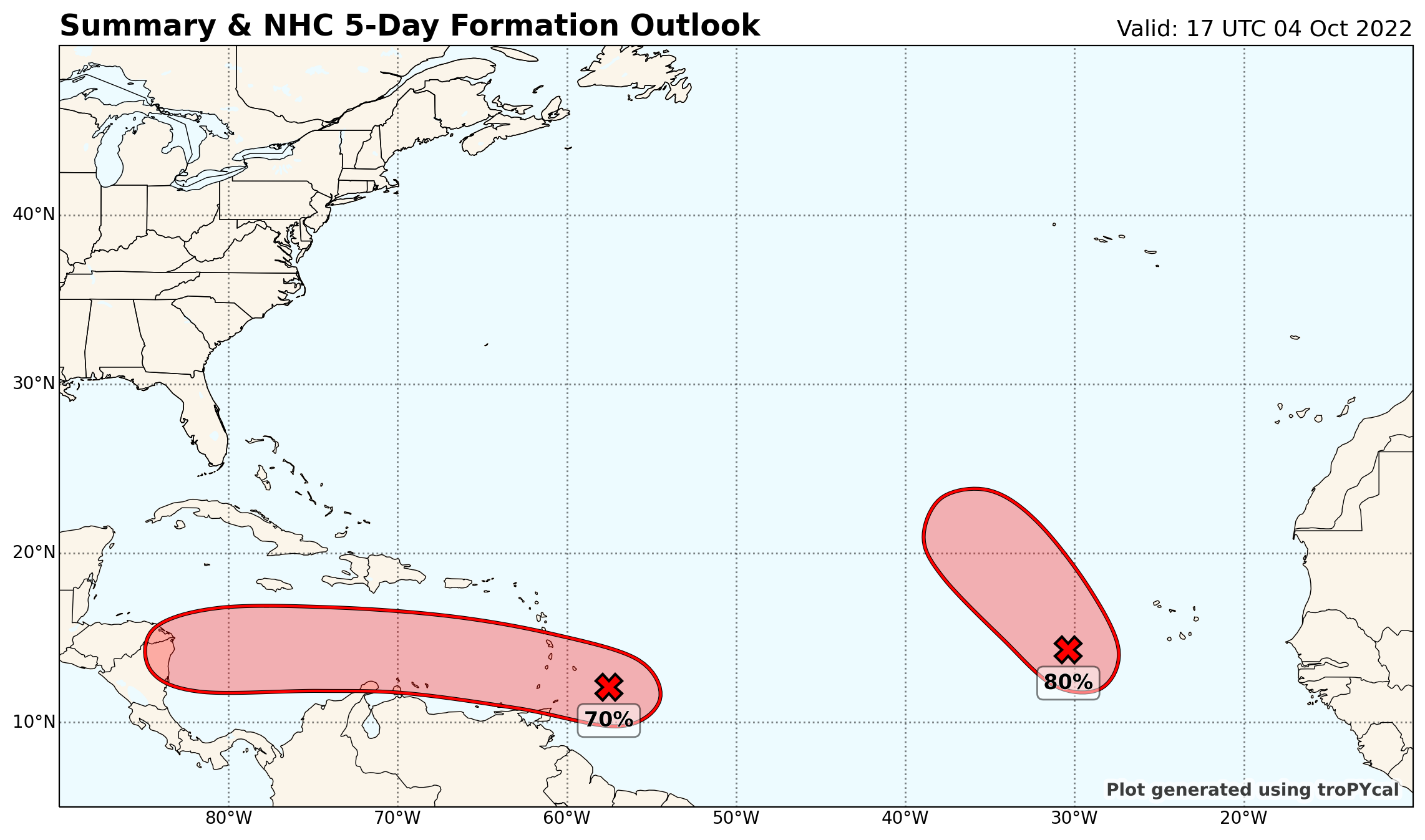
Basically all the 12z runs now show something developing in the WCARB
-
1
-
-
Now 40/70
MLC looks like it wants to work down to the surface.
East of the Windward Islands:
A broad area of low pressure located a couple of hundred miles east
of the southern Windward Islands is producing an area of showers
and thunderstorms to the southeast of an ill-defined center.
Upper-level winds are likely to become more conducive for
development, and a tropical depression could form during the next
couple of days, if the system stays far enough away from land while
moving westward at about 15 mph across the Windward Islands and
southeastern Caribbean Sea.  Conditions appear to become more
conducive for development later this week when the system reaches
the central and western Caribbean Sea.  Regardless of development,
locally heavy rainfall and gusty winds are expected over portions
of the Windward Islands tonight and Wednesday.  Interests in the
Windward Islands, the ABC Islands, and the northern coast of
Venezuela should monitor the progress of this system.  An Air Force
Reserve Hurricane Hunter aircraft is currently investigating this
system.
* Formation chance through 48 hours...medium...40 percent.
* Formation chance through 5 days...high...70 percent.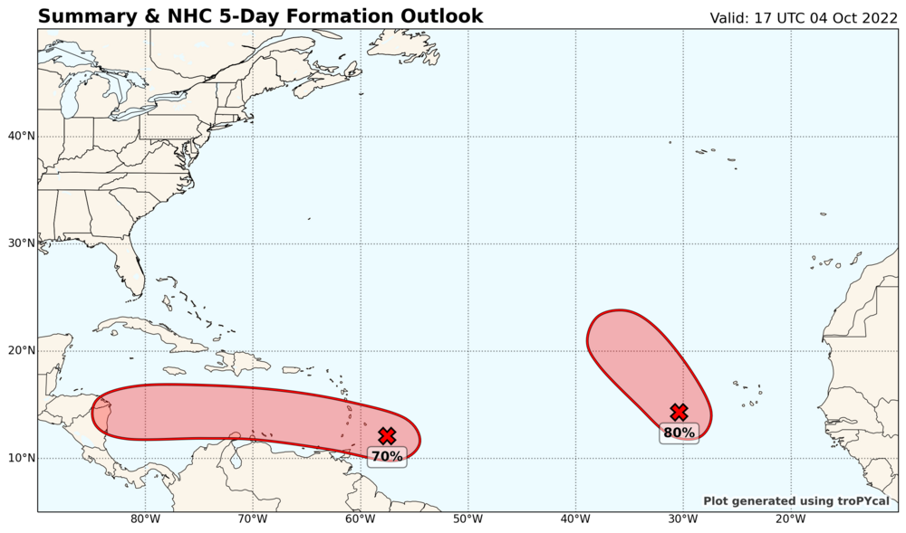
-
1
-
-
-
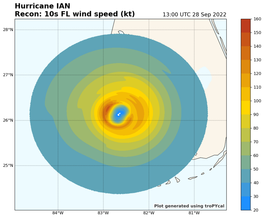
Just remember that the strongest winds were on the W side of the eyewall
-
1
-
-
-
Recon is inbound and will likely catch the western eyewall. I was dead wrong about intensity last night, so I'll sit this one out.
-
2
-


December 2022 Obs/Disc
in New England
Posted
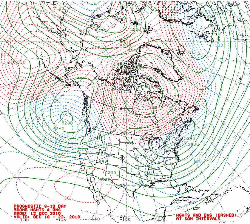
Hate to beat the 2010 comparison into the ground, but even the NAM looks to behave quite similarly (if you believe the GFS)