Tatamy
-
Posts
2,581 -
Joined
-
Last visited
Content Type
Profiles
Blogs
Forums
American Weather
Media Demo
Store
Gallery
Everything posted by Tatamy
-

December 22nd - 23rd Cutter Discussion and Observations
Tatamy replied to NJwx85's topic in New York City Metro
0z HRRR shows the cold front reaching the Delaware River around 10:30 - 11AM. It makes it to NYC about noon. -
December 22nd - 23rd Cutter Discussion and Observations
Tatamy replied to NJwx85's topic in New York City Metro
Freezing rain 31• -
December 22nd - 23rd Cutter Discussion and Observations
Tatamy replied to NJwx85's topic in New York City Metro
Cloudy and 31• -
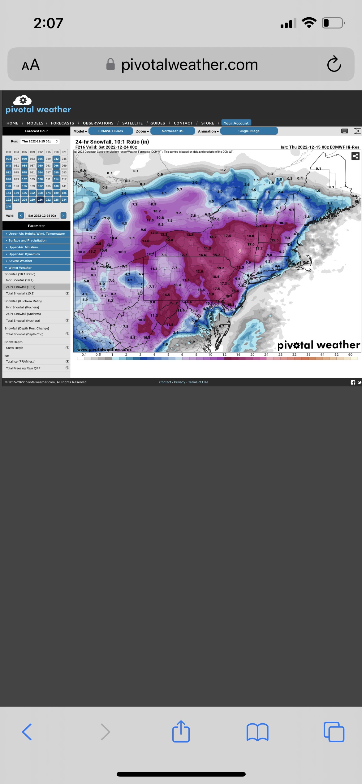
This burst of snow for Friday has been showing up for days now in the GEFS and continues to do so.
-
Would the same be said for the 0z GEFS mean? Some interesting outputs on some of the members.
-
This is a great post. As someone who came of age in the 70s and 80s it amazes me how people and weenies in particular have come to expect major winter events each year. As you stated during the period from 69-93 there only three storms that produced over a foot in NYC. Back in those days storms that were forecast to produce 4-8” were a big deal and if you had one of those in a winter that was a lot. This region has a long term climate history and it is not one where big events (MECS/SECS/HECS) are common. White Christmases are the exception, not the rule here. We have had a good run in recent years with these big events however long term climatology dictates that this not likely to continue.
-
That was the one. It was close to 60 at midnight where I was before the transition.
-
What you just described did actually happen in the area on 2/2/76. SLP bombed out on an arctic front just east of ACY that morning. There are few here that are old enough to remember that one however it was quite spectacular while it lasted. The pressure at my location on the north shore fell to 966 mb with heavy rain going to freezing rain, sleet, and ultimately blizzard conditions for a time with continuous lightning and thunder.
-
12/15 - 12/16 Coastal/Winter Storm & Observations
Tatamy replied to Northof78's topic in New York City Metro
Drive up 115 from Wilkes Barre to the PA Tpke interchange. You go from about 400’ to 2000’ above MSL where the interchange is. Weather conditions will be a different world at the top of that mountain in the winter. -
12/15 - 12/16 Coastal/Winter Storm & Observations
Tatamy replied to Northof78's topic in New York City Metro
Rain 35• -
12/15 - 12/16 Coastal/Winter Storm & Observations
Tatamy replied to Northof78's topic in New York City Metro
Light flurries 33• 1.5” new OTG -
My bad- it was the 0z.
-
Next Friday on the Euro
-
12/15 - 12/16 Coastal/Winter Storm & Observations
Tatamy replied to Northof78's topic in New York City Metro
Steady fall of parachutes. 32•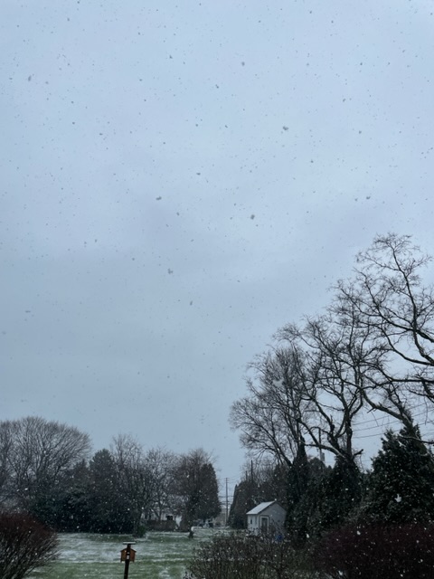
-
E PA/NJ/DE Winter 2022-2023 OBS Thread
Tatamy replied to Ralph Wiggum's topic in Philadelphia Region
Getting a steady fall of parachutes.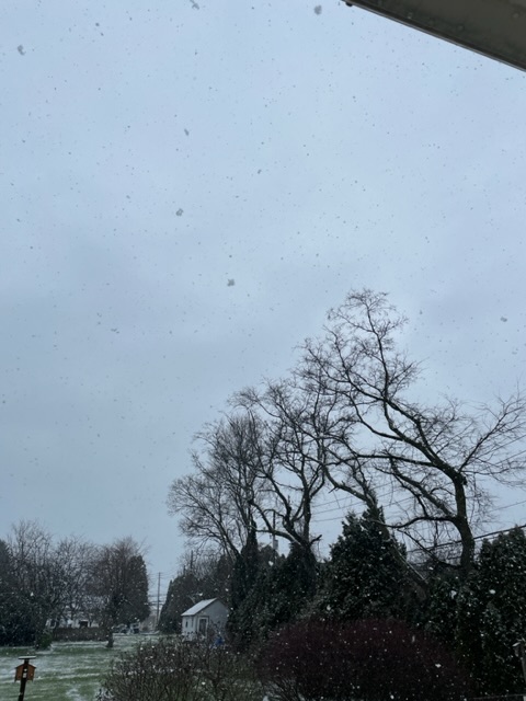
-
Steady snow falling here. 32•
-
12/15 - 12/16 Coastal/Winter Storm & Observations
Tatamy replied to Northof78's topic in New York City Metro
Steady snow falling here. 32• -
12/15 - 12/16 Coastal/Winter Storm & Observations
Tatamy replied to Northof78's topic in New York City Metro
As of now I would agree that forecasted snow amounts are going to bust in a lot of places. -
Mix of snow/sleet here in Bethlehem Twp.
-
12/15 - 12/16 Coastal/Winter Storm & Observations
Tatamy replied to Northof78's topic in New York City Metro
Mixed snow/sleet 31/25 -
12/15 - 12/16 Coastal/Winter Storm & Observations
Tatamy replied to Northof78's topic in New York City Metro
Depends on your location. If you are in the NYC area you will only see rain that develops this afternoon. -
12/15 - 12/16 Coastal/Winter Storm & Observations
Tatamy replied to Northof78's topic in New York City Metro
It did tick cooler. Expected snowfall amounts in your area increased some. -
12/15 - 12/16 Coastal/Winter Storm & Observations
Tatamy replied to Northof78's topic in New York City Metro
It’s to be determined. -
I give you guys a lot of credit with these long range progs. I am dealing with an event out here today and the models literally cannot tell me if I am going to be throwing ice melt on my driveway or dragging the snow blower out of the shed just 6 hours from now.
-
12/15 - 12/16 Coastal/Winter Storm & Observations
Tatamy replied to Northof78's topic in New York City Metro
Snow is breaking out on the west side of Allentown currently. Looks to be coming down moderately as shown on radar / webcams to the west of there.