Tatamy
-
Posts
2,583 -
Joined
-
Last visited
Content Type
Profiles
Blogs
Forums
American Weather
Media Demo
Store
Gallery
Everything posted by Tatamy
-
Currently 12F here
-
I was going to ask what you did to that model… lol
-
 Storm total for this event 1.80”. Cold air arriving here with the temp down to 38.
 -
Winds are starting to crank here as the cold front slowly approaches. Recent wind gust to 29 mph and I am well inland. Winds will really start to crank along the coast soon.
-
After I married I moved from E Northport to Brentwood and then Sayville. There is definitely a big difference year round between the center and south shore of the island and the north shore. Now I am in eastern PA and that is even more different. Good luck with your move.
-
Just recorded a wind gust to 35 mph as this squall arrives.
-
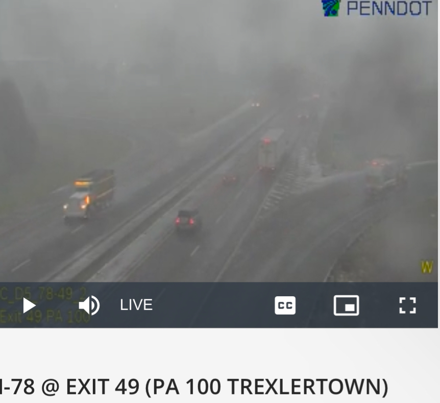
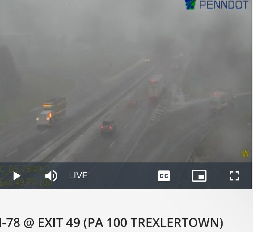
This is what it looks like on the west side of Allentown right now.
-
Round #3 is on its way. Heavy snow showers/squalls are just west of Allentown. This activity looks to be low topped as it is just coming into view on the Mt. Holly radar. Visibility out in that area has really dropped in association with this activity as seen on I78 traffic cams.
-
The line of echoes across western and NW NJ and eastern PS contains heavier snow showers. The rates are like a squall but the winds do not meet the criteria. In any case we have a fresh half inch here. 33/32
-
A couple members on the GEFS biting on it however the mean is still well north and west.
-
Very light snow and flurries here. 36/23
-
Snow squalls that sometimes affect eastern PA and parts of northern and western NJ are typically the ends of lake effect streamers that have some channelized vorticity with them to keep them going. Without that vorticity they do die out in the Poconos and Catskills and the downsloping finishes the process.
-
Very narrow snow swath from the snow squall yesterday evening. Most of the Lehigh Valley just got flurries except for my area with 0.5”
-
Low here of 23. Combination of snow, frost, and black ice didn’t seem to have much impact on temperatures even with calm winds most of the night.
-
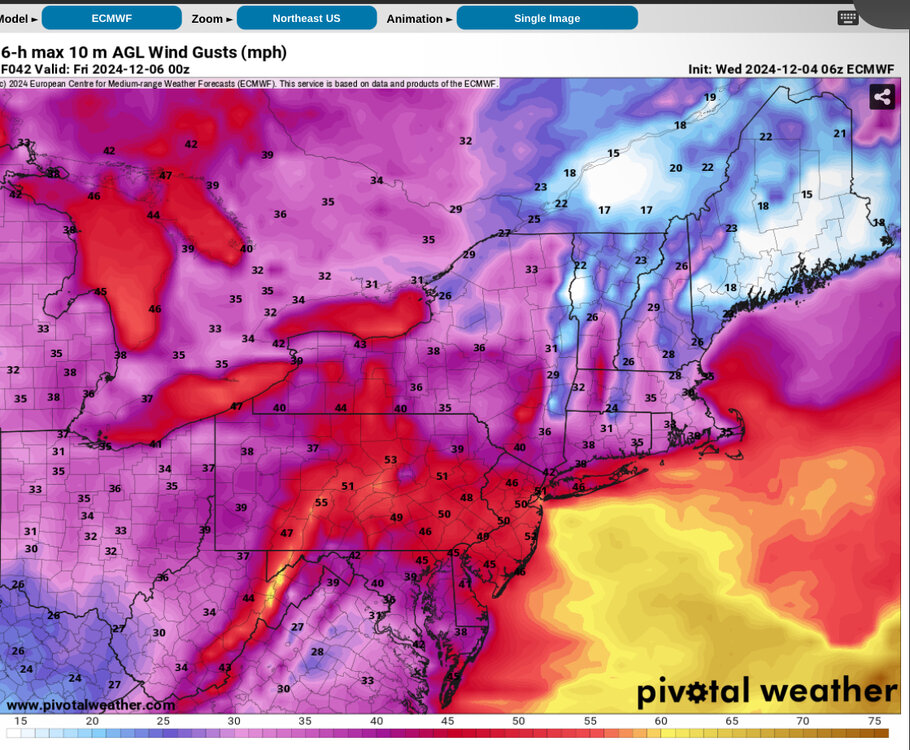
Six hour maximum wind gusts from the 06z Euro for tomorrow as of 7 pm.
-
The Mesos missed the snow squall we had earlier tonight. To their credit Mt. Holly did outlook it in their AFD. I would agree on the idea of the best chances being Thursday morning especially north of the city.
-
Mt. Holly’s Snow Squall warning verified (minus the wind). We have 0.5” new. That’s probably more than what we will see tomorrow night and Thursday.

-
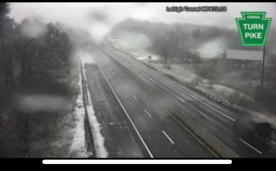
I saw that and there is some really heavy snow coming down along the Tpke at tunnel near Lehighton. Waiting to see how much of that makes it down here or into western/NW NJ
-
HRRR has been showing snow showers and squalls across eastern PA and into parts of northern NJ for a few runs for tomorrow afternoon. Something to watch for.
-
Snowman is correct. Arctic stream involvement is a must for snow for this event in this area.
-
Euro/CMC are both going for snow for places in the Poconos/Catskills/Berks and north with the late week event. Euro has been going for this for a few runs now.
-
Looks like the center of SLP is crossing LI now. My station on Fire Island has recently seen an abrupt change in wind direction from NE to W with a temperature drop of 4 degrees in the past half hour.
-
It’s there now!
-
.95 overnight
-
The Thanksgiving Snowstorm in ‘89 was preceded by a powerful cold front on the Tuesday prior. This front was accompanied by widespread violent severe thunderstorms across Long Island and other parts of the region with many reports of damaging wind gusts of 40-60 mph.