Cheeznado
-
Posts
2,155 -
Joined
-
Last visited
Content Type
Profiles
Blogs
Forums
American Weather
Media Demo
Store
Gallery
Everything posted by Cheeznado
-
I was getting a bit discouraged with the GFS refusing to budge and the 00Z Euro not that great either for Atlanta but the 06Z Euro and the new NAM has made me feel better for now. Now we'll see if the GFS comes around or at least trends in this direction.
-
Lousy run for Atlanta but I have a place to stay in the GA mountains so a road trip may be in order. Let's see what the Euro does.
-
It is so lame that my former employer (TWC) is putting totals on that map. I hated that when I was there and still do.
-
The trend is the only thing worth looking at on the ICON and it is good. All else is noise. Lets not clog up the thread with every panel of the models quite yet, especially the lesser poorer performing ones.
-
Only .03" here since Tuesday noon- all models had a big time fail in the Atlanta area, one of the biggest busts in a long time. Flash flood watch -yeah right.
-
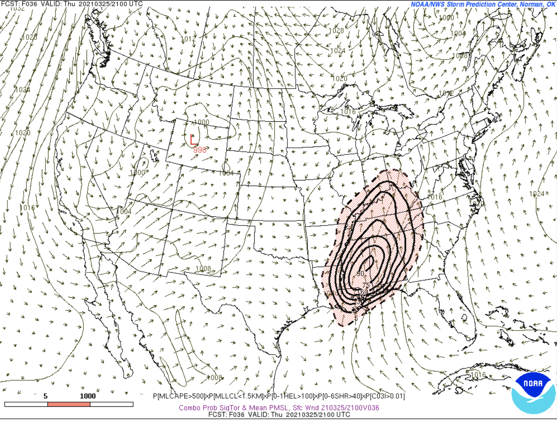
3KM NAM obviously the odd CAM out. What impresses me are the forecast incredibly high 0-1KM SRH values of AOA 500. That is at the level of the 2011 superoutbreak. Not saying this will be as bad, but still impressive.
-
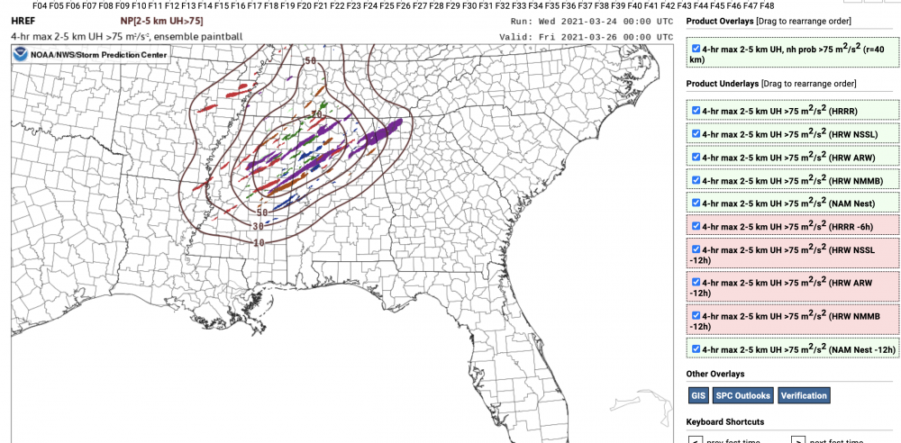
By the time the event was 24-36 hours out the parameters were much less ominous than the ones for tomorrow.
-
Speechless. Hope not too many people die tomorrow.
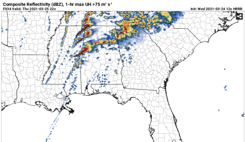
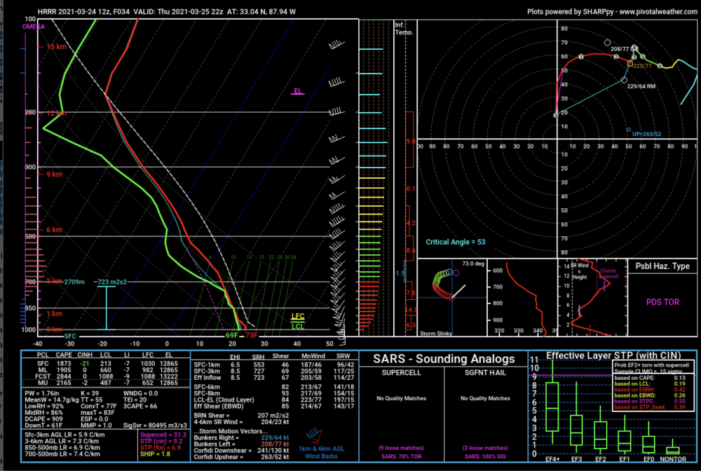
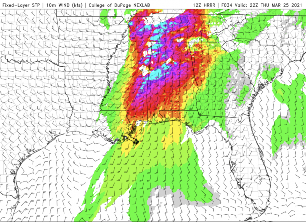
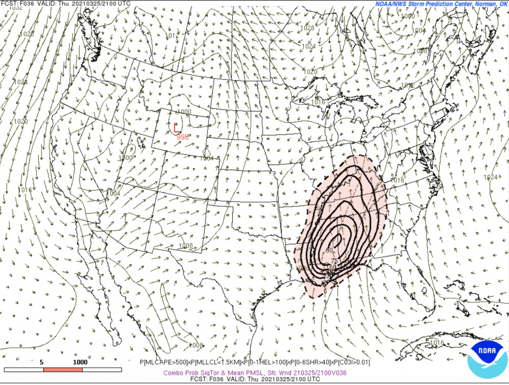
-
I think there is not one shred of a doubt that this this two day event was a colossal bust. (A good thing) This is NOT dissing SPC by any means, although at the time I was somewhat skeptical of the high risk upgrade. On Wednesday from what I can see of the damage reports, there was not one long track or violent tornado, and those were specifically mentioned in the watches and outlooks. Severe forecasting is hard, even for the experts at SPC.
-
I chased a really great supercell in Central Alabama yesterday west and SW of Selma. Best SE storm structure I have seen in my 41 years here. Go to https://www.facebook.com/cheeznadophoto
-
I agree also, UH tracks with relatively low-topped supercells can be misleading, Leaving shortly for my target of Meridian, MS to Tuscaloosa.
-
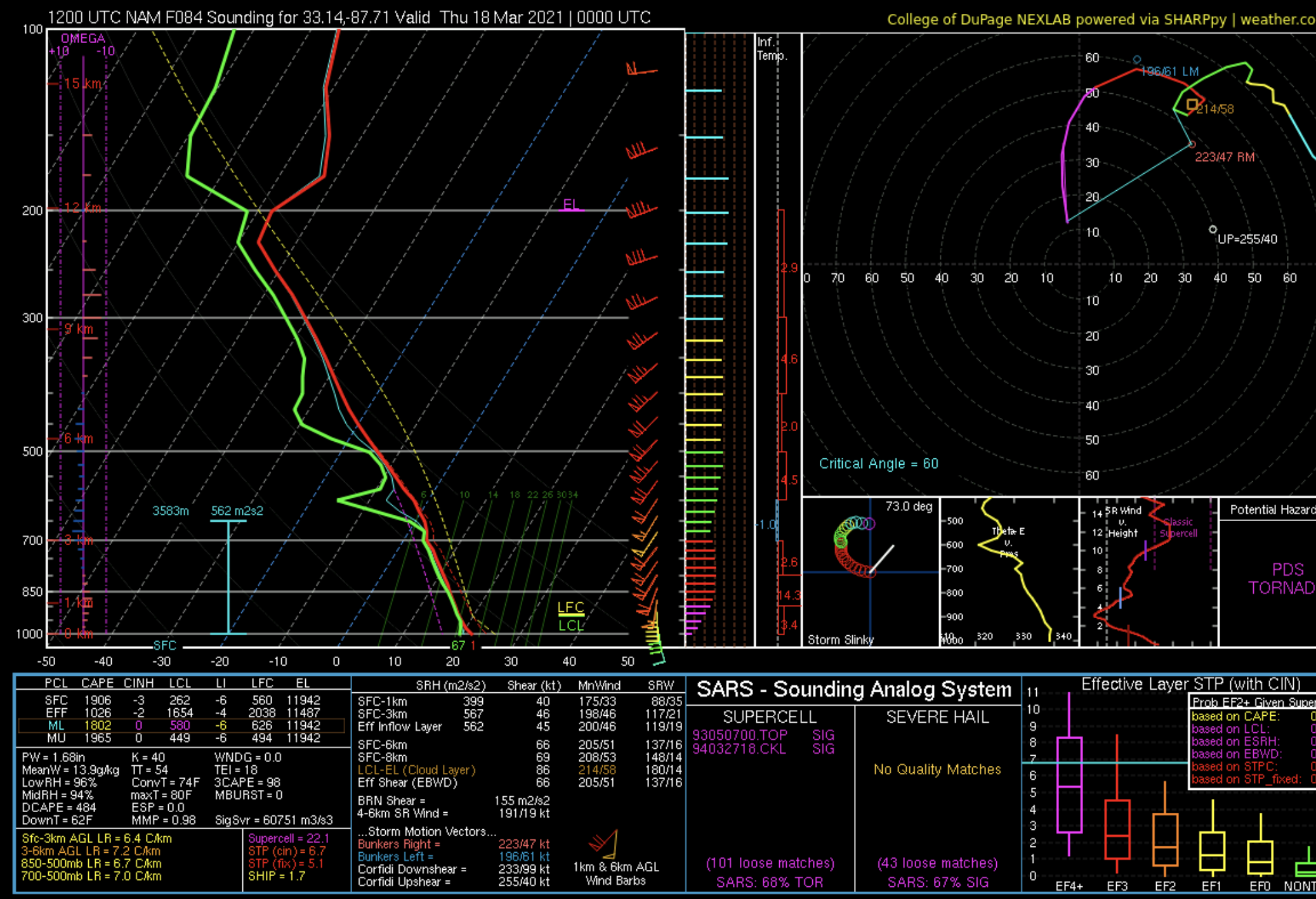
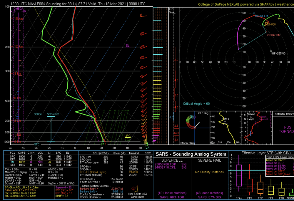
This NAM sounding from the KTCL area is about as textbook for tornadoes as you can get.
-
I have been looking at this for a few days now, will probably be my first storm chase in over a year.
-
Sleeting here.
-
I realize that, but there have been some recent issues with planes turning around etc so keeping my fingers crossed.
-
Too bad the current recon plane left, hopefully another one will get in there before landfall.
-
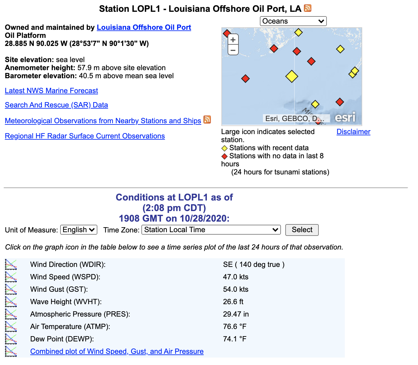
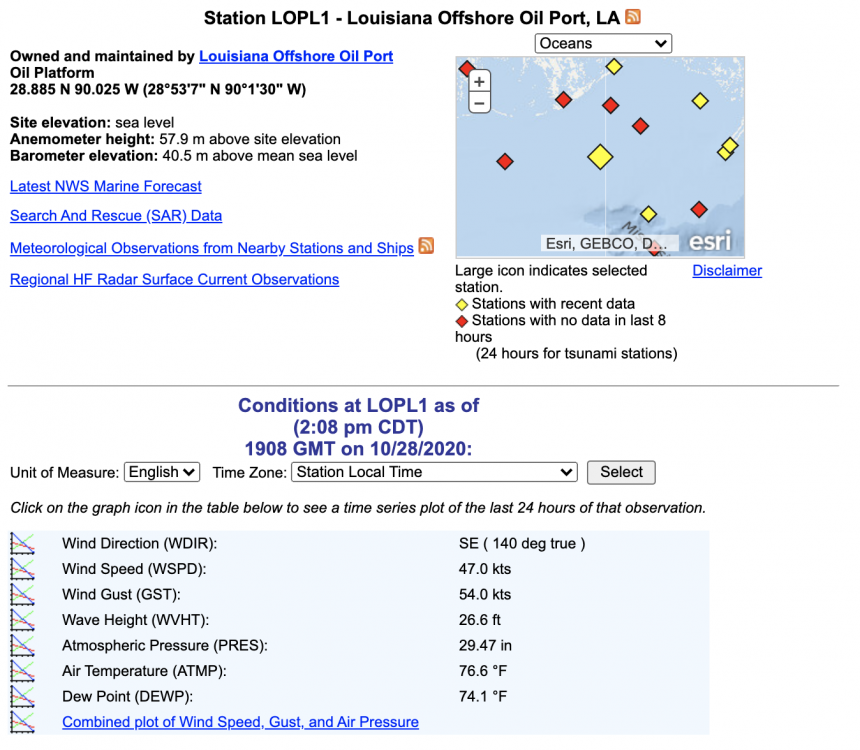
Wow, 26 ft seas just south of the mouth of the MS...
-
Big question is how much strength it loses as it will spend a fair amount over the Yucatan, both the HWRF and HMON have it back down to a TS and never really bring it back to a hurricane.
-
Last recon center reformed farther to the south closer to being underneath the deep convection. Also the Euro track is weaker and farther west than most of the other models.
-
My take: something develops in the central Caribbean in about 5-7 days, strength unknown, with a very good chance it goes east of FL and the rest of the US coast.
-
Both the HWRF and HMON have it too strong by 15-20 mb by 00Z. Do not see any signs of RI right now so by later tonight that discrepancy may get larger.
-
I agree this does not look anything like a borderline cat 5 on the sat pic. Odd storm.
-
I think think the RI has paused for at least a little while based on the last few fixes and the fact the eye has not gotten any clearer. This is a very small storm compared to Gilbert and Wilma which may be a factor for now.
-
984 now, HWRF does not have it that strong until 06Z Wed, Hmmmm.
-
Way too weak for any real eye to be present. Regarding landfall intensity I think that fairly rapid weakening right at the coast is likely due to cooler water and shear, it all depends on how strong it gets in the central Gulf. I noticed that the HWRF backed off of the intensity quite a bit with the 06Z run.