powderfreak
-
Posts
77,198 -
Joined
-
Last visited
Content Type
Profiles
Blogs
Forums
American Weather
Media Demo
Store
Gallery
Everything posted by powderfreak
-
Touche... the quoted post lined up with the quoted AFD... mic drop lol.
-
There's zero chance that type of full evacuation takes place in the U.S. No way a geologist is convincing a town to get out entirely.
-
All meant in good fun, though hard to believe that's the post you take offense to, ha. You know you start the warm season, summer, A/C install, full court press earlier and earlier each year, even at Morch. It drives conversation, keeps things lively. It now feels like we have more posts these days arguing summer weather than we get in the winter.
-
That’s exactly what this forum feels like sometimes lol. Great analogy. By the time climo catches up, we are already moving onto the next season.
-
On this forum, we know DIT/Kev does not like shoulder seasons. So a concerted marketing effort takes place to either get past them as fast as possible, or at least create the illusion that we are moving past it. Once winter wraps up with the “Morch” comments, it’s time to start hyping summer immediately. So by the time we hit June, we’ve literally been hearing/talking about warmth, installing A/Cs, etc for like 6+ weeks now. Its the same in the winter… talk about upcoming cold and troughs and whatever starting in October, by the time December rolls around everyone is expecting mid-winter. Theres no doubt the collective discussion in here alters our idea of what normal is… because we love to rush seasons and the narrative is guided by a salesman.
-
Remember when the forum had the excitement and gung-ho feeling about winter weather? Haha. Now we all high-fiving high pressure in the warm season.
-
In 2020 we'd already hit 95F up here, ha. Looks like 2022 had 10 days already of 80+ up this way too. We've had some warm Mays in the past 5 years that I think people have come to expect. This May has BTV at an exact 0.0 departure so far. Exactly normal.
-
39F morning, 82F afternoon, currently 54F as it drops. Some high diurnal ranges the past few days.
-
39F for the low again and ready to launch another 40+ degrees.
-
Just awesome late light… that post-sunset glow this time of year that just seems to linger on and on… can’t get enough of it. Warm enough for all windows and doors open, watering the freshly planted garden, mosquitoes trying to carry my arm back to the river… it’s a vibe.
-
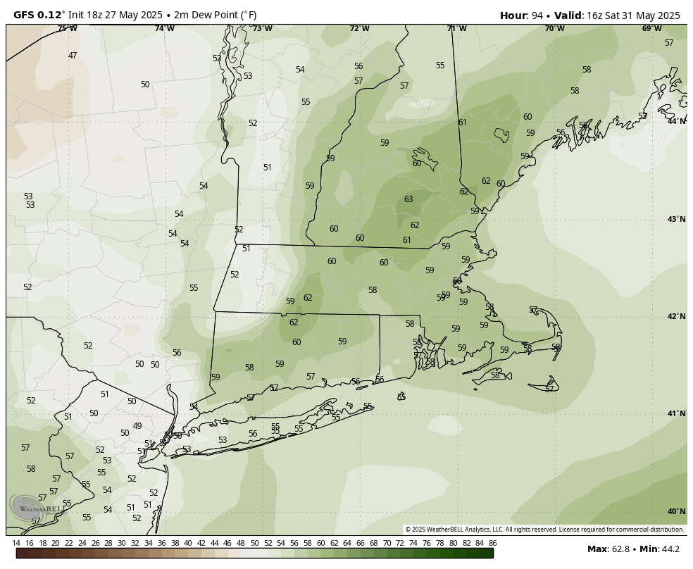
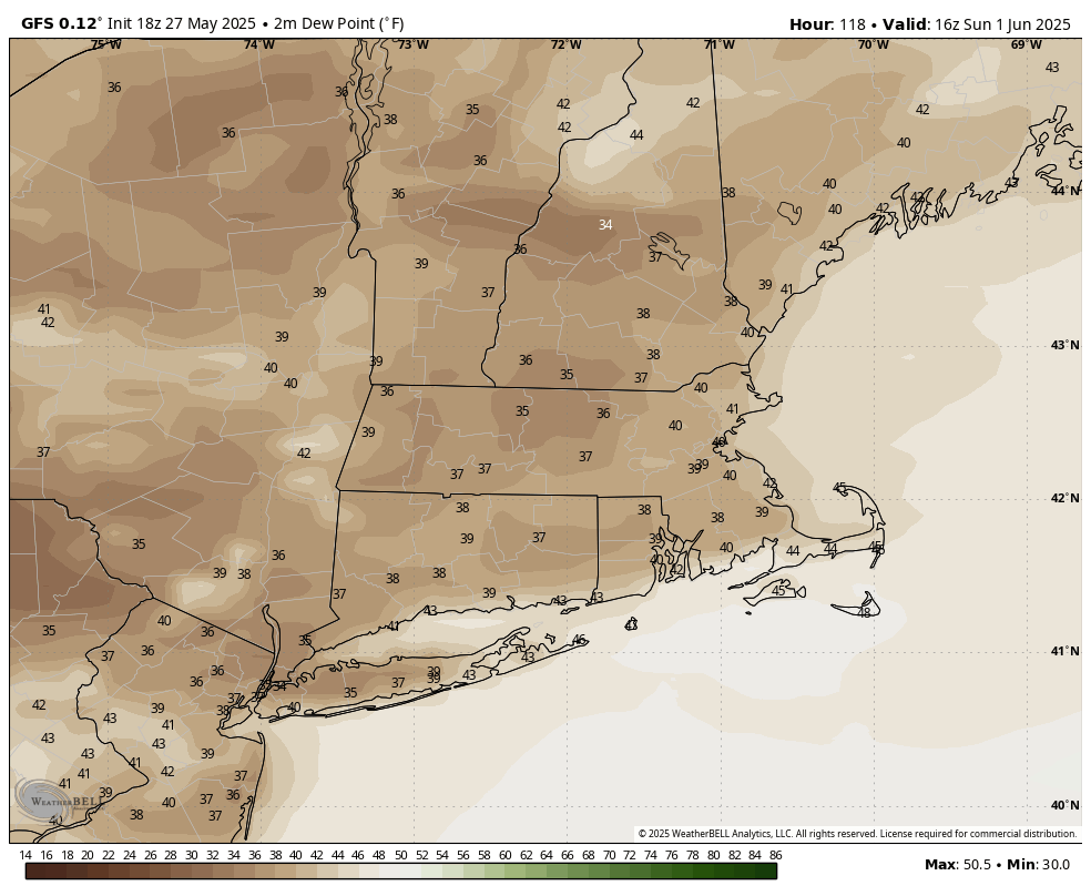
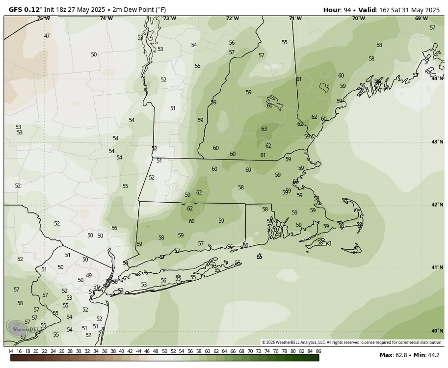
Best of both worlds. You get your humid and showers on Saturday... then others get their nice dry low dew day on Sunday. Sat 12pm dews: Sun 12pm dews:

-
Ahhh only 6 more months of debating temperatures and trying to convince each other it's either the most glorious summer of all time or nothing special.
-
79/34 might be one of the best T/Td spreads for humans to exist outside, ha. It’s amazing out there. 41 diurnal range today so far.
-
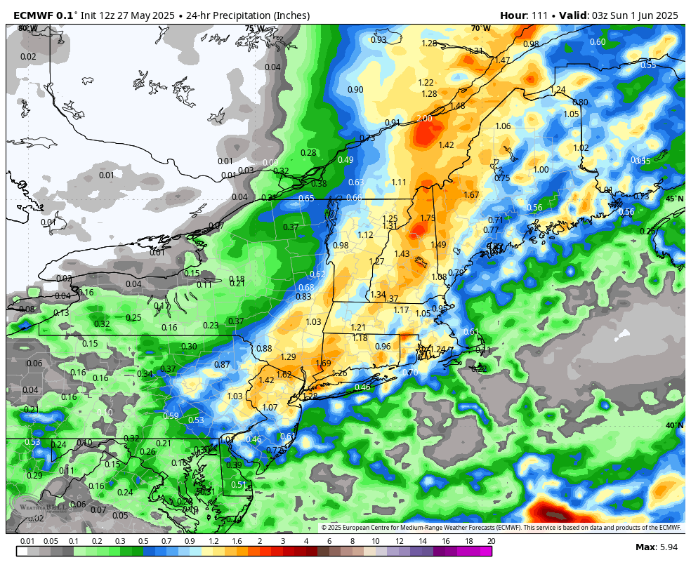
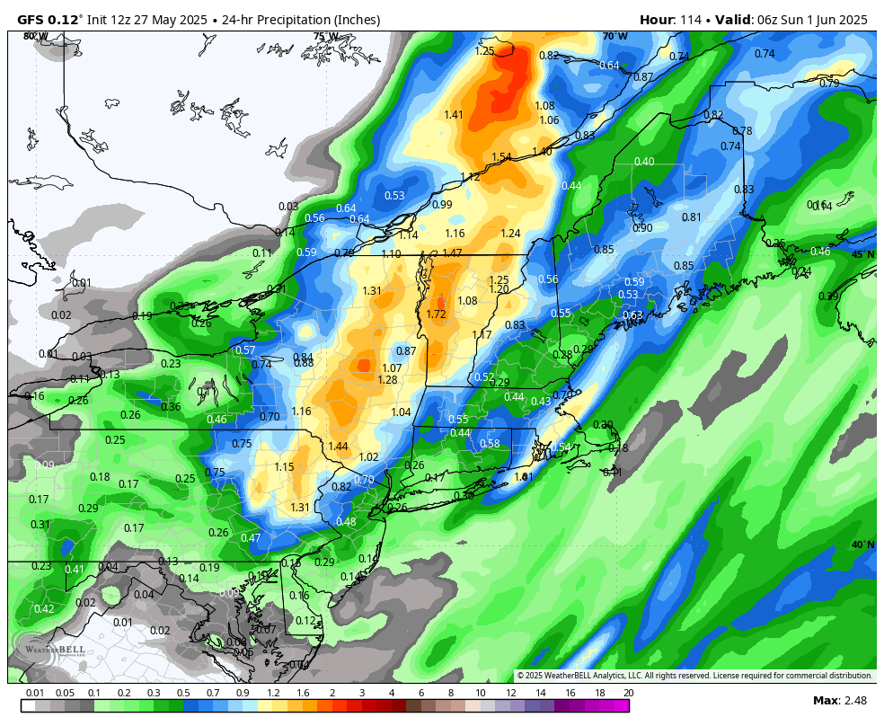
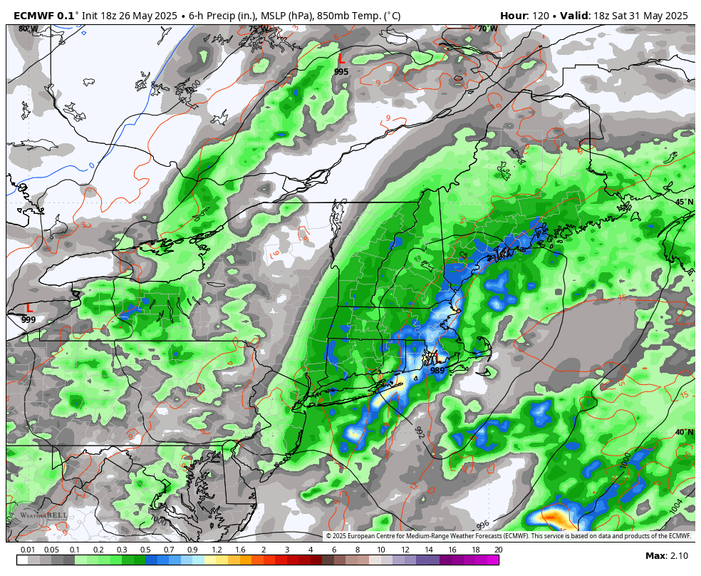
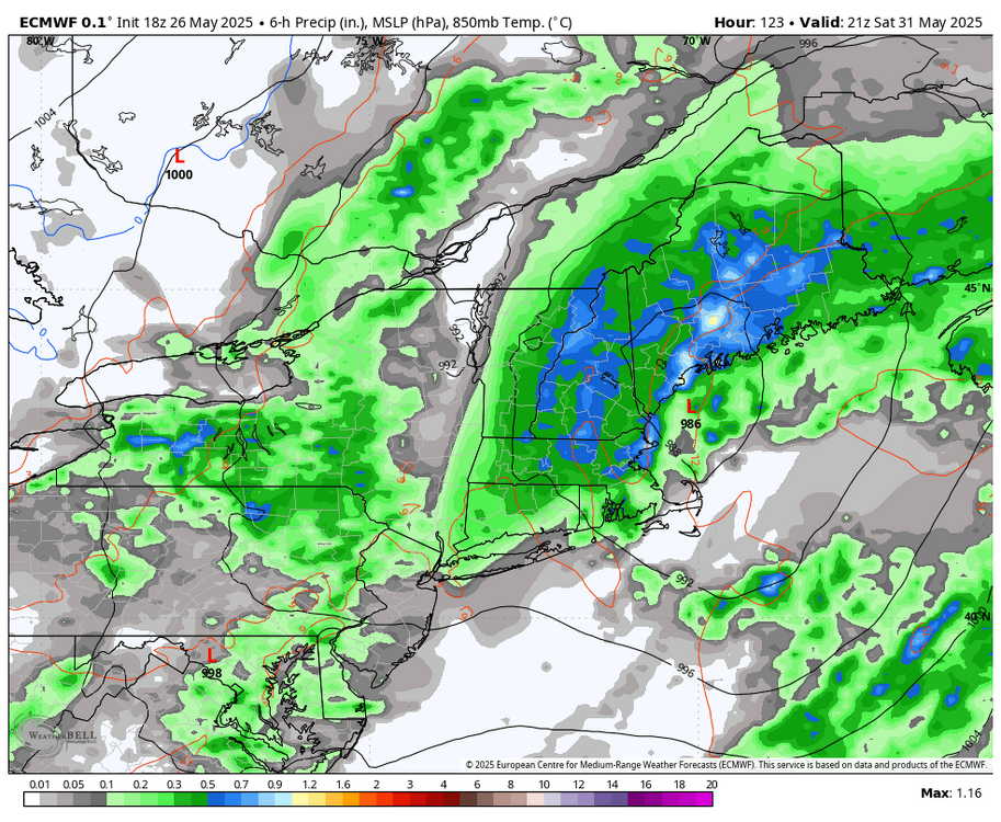
Saturday system looks to be trending a bit towards a cutter/inland track. Probably a bunch of p-type issues pretty far inland with those tracks. 6z Sat to 6z Sun.

-
76/38 What a day.
-
39F for the low and up to 70F already.
-
The forum would be losing its collective shit if the Euro pumped this out Dec-Mar… Even if it was a 5-day 18z run run. Regardless of unlikeliness, it’s a hilarious model outcome of another Saturday.

-
That’s awesome.
-
We’ve heard that phrase several times lately… “not terrible, could be worse.” That’s a telling indication of where our baseline standard is right now, ha. Not terrible. Today was better than not terrible though.
-
Did anyone mention temperatures? Where’s this idea of 40s coming from when folks mentioned models showed rain next Saturday?
-
God bless you man. In a span of like 20 minutes went from "it has no support" to the one model that doesn't show it (GGEM) is "much more realistic." I'm not saying one is better than the other, but I always enjoy your mental gymnastics through this stuff, .
-
Well the Euro looks even worse. So I’d say the GFS has at least some support lol.
-
Selling weekend nonsense has worked well the past two months. But one of these weekends has to work out, so maybe.
-
I think I saw we've had measurable rainfall at some point during daylight hours on 9 straight Saturday's at BTV. Will next Saturday be number 10?
-
70/46 Now this is more like it.