powderfreak
-
Posts
83,833 -
Joined
-
Last visited
Content Type
Profiles
Blogs
Forums
American Weather
Media Demo
Store
Gallery
Everything posted by powderfreak
-

Augdewst 2026: Summer's Last Stand
powderfreak replied to Prismshine Productions's topic in New England
I dunno, tree didn’t look that healthy. Some bare branches mixed in where those colored leaves are. -
Augdewst 2026: Summer's Last Stand
powderfreak replied to Prismshine Productions's topic in New England
Yeah nothing abnormal. We’ve seen a few up here.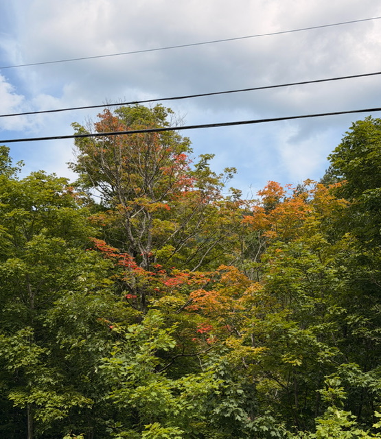
-
Augdewst 2026: Summer's Last Stand
powderfreak replied to Prismshine Productions's topic in New England
Our standards seem to be getting high if 1.5” of rain is the barometer of worthy rain. A half inch will soak in nicely. -
Augdewst 2026: Summer's Last Stand
powderfreak replied to Prismshine Productions's topic in New England
The only trees that fall are ones near power lines in CT. -
Cold season with warm season daylight would be ideal, ha.
-
At this point I almost have to check myself that you aren’t running some AI prompt “Remove radar echoes on this image when they get near the chicken.”
-
I’m with ya today. Would’ve swallowed an uzi in January lol.
-
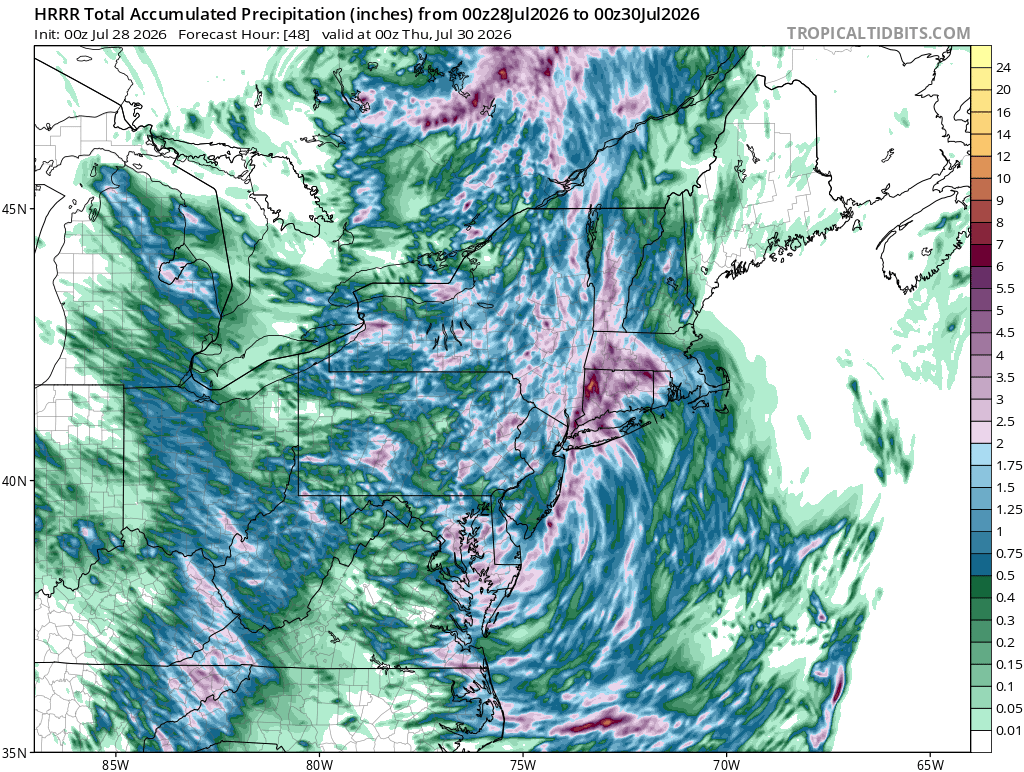
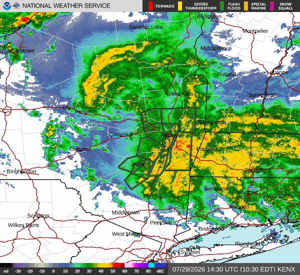
Does not look to be stopping anytime soon. 12z HRRR has it ripping through 00z/8pm tonight at least with another 2-3".
-
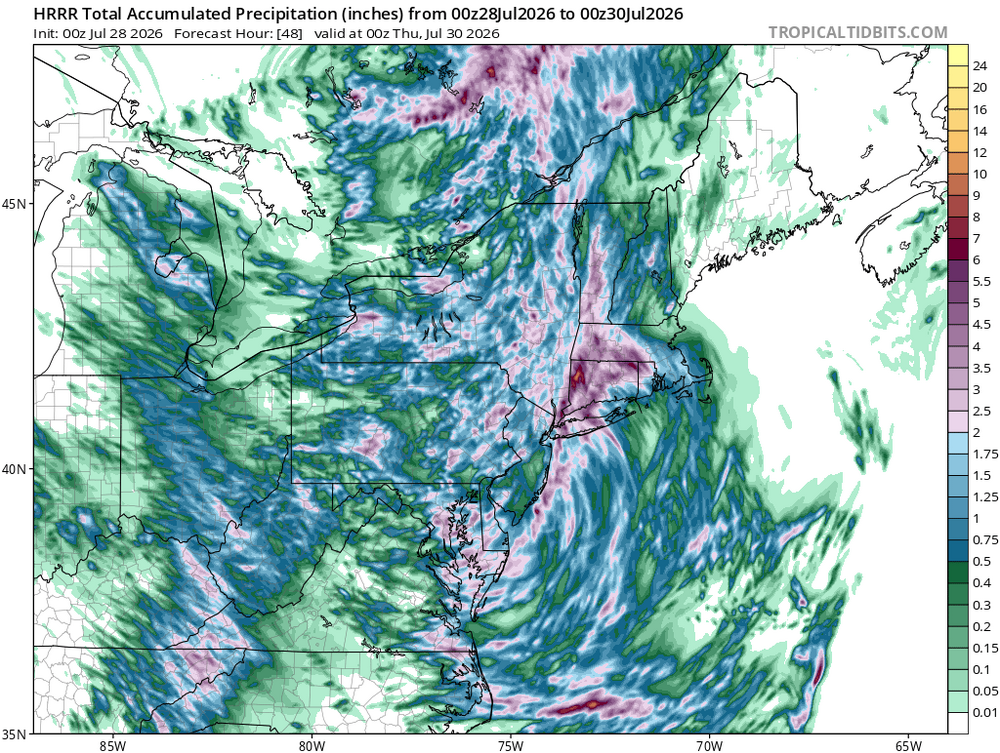
Some 7-8” amounts on CoCoRAHS just south of Albany in the Hudson Valley. That’s decent water for 24-hr period.
-
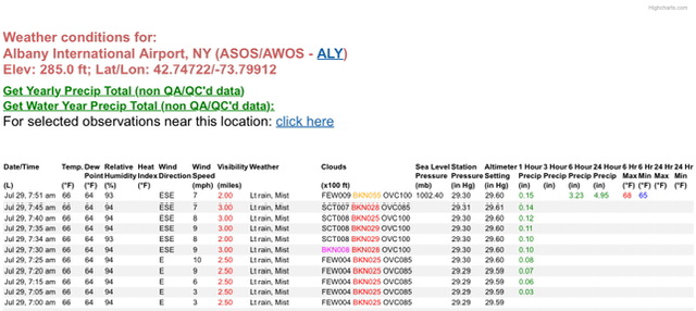
ALB with 4.95” so far.
-
Peels all the soil off Mt Tolland…
-
Another convective round to go in eastern areas. Healthy run.
-
What happens after that? No way there’s zero rain further east. Edit: Whoops, should’ve read the next few posts, ha. Folks have it covered.
-
The good news with that set up is you pump humid air out ahead of it with good pwats and it won’t take much to tally up some quick appreciable rainfall in New England as the front lifts NEward. Though I haven’t looked close enough to see if it’s occluded by that point.
-
Stick with the 6z Euro in the paper bag.
-
Yeah looks like another good soaker on the way down there.
-
Maybe it’ll be like usual where the weather does the opposite of your worries?
-
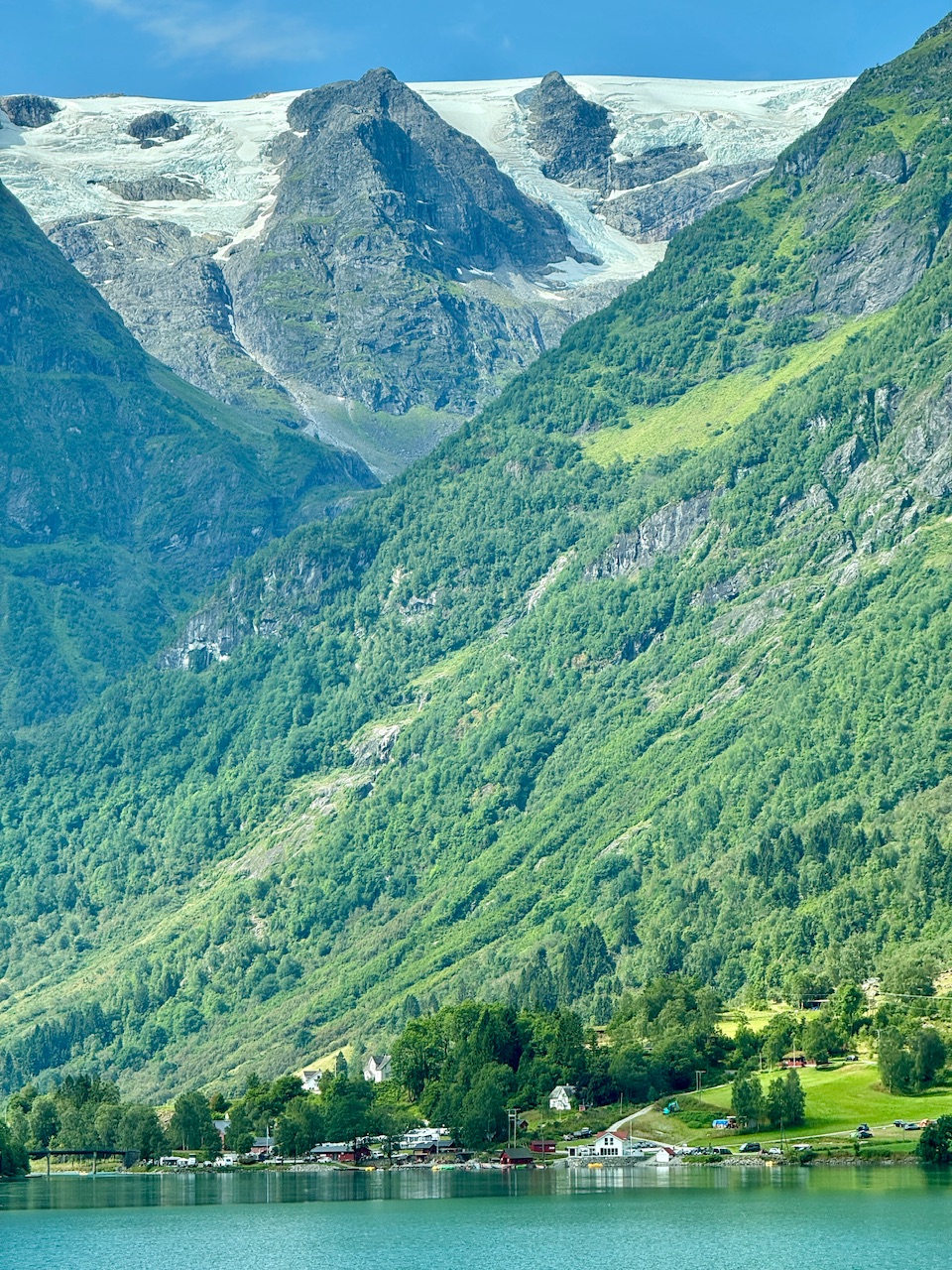
Another nice day in Vermont, under that Mount Mansfield glacier… the fabled Picnic Table Icesheet.

-
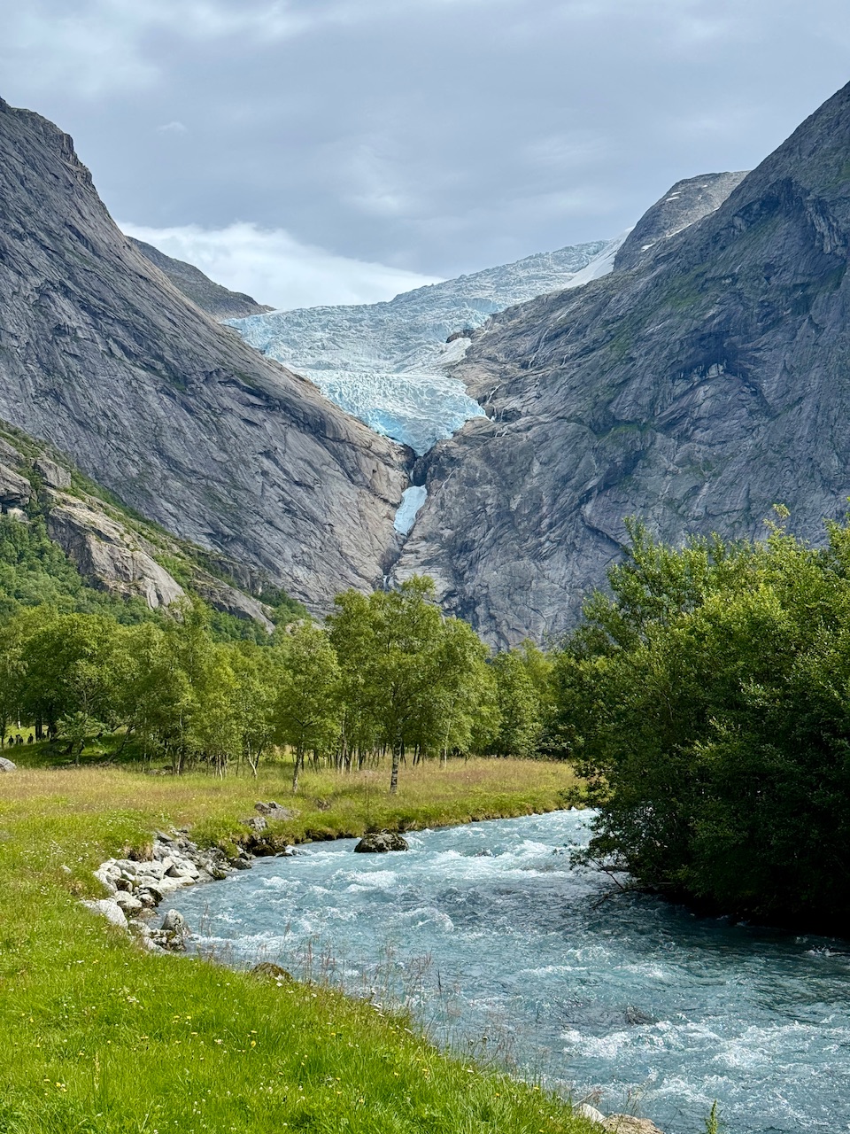
It’s nice now, sunset at 11pm last night and sunrise 4am. Winter must be a toaster bath of darkness though. Everything goes straight up from the ocean… and it’s wild the hanging snowfields above treeline (low treeline, like 2,000ft) up at 4-6,000ft still hang on through summer in areas. One local was joking that the natural snow up high that isn’t glaciated usually melts by mid-August and then two weeks later it starts snowing up there again to build the new snowpack.
-
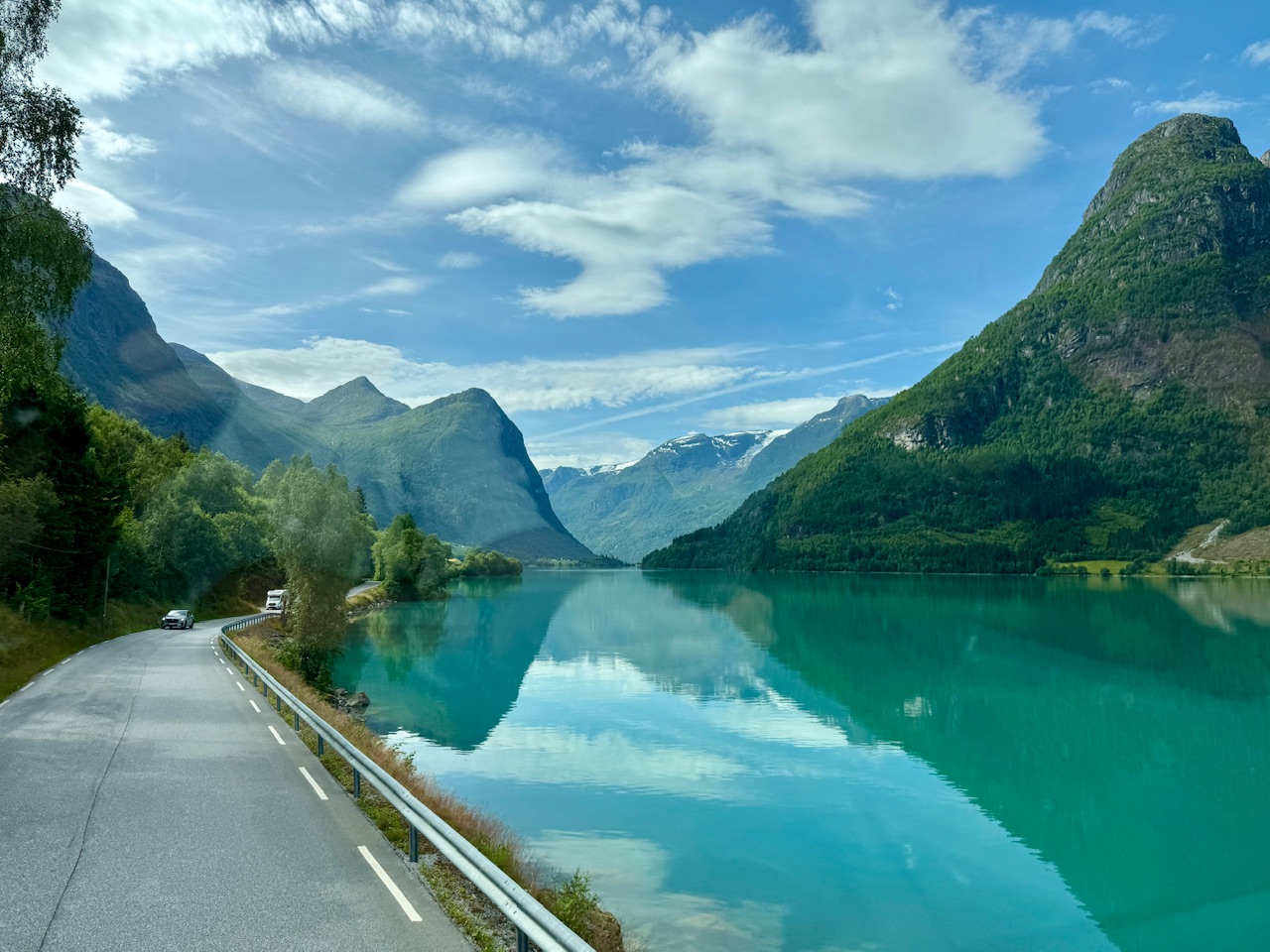
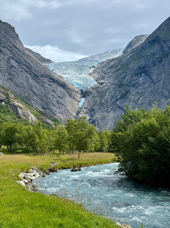
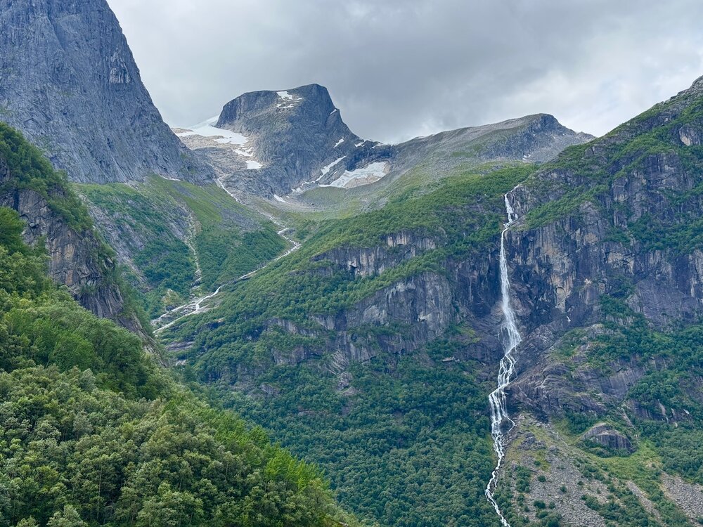
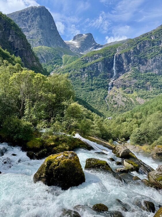
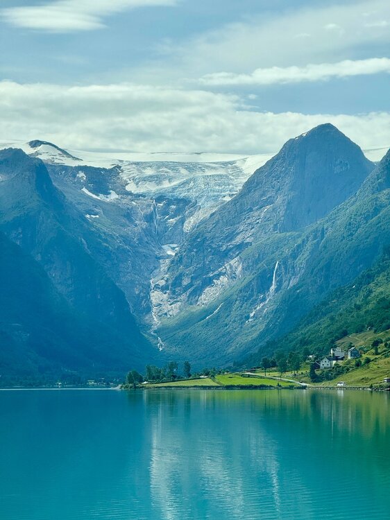
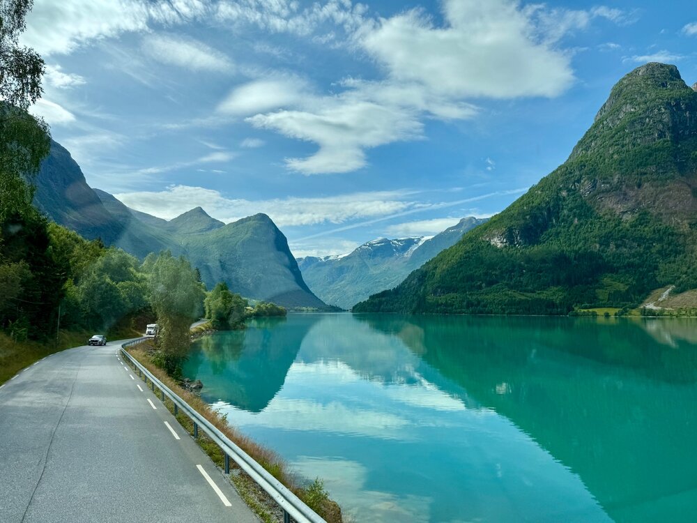
Made it to my grandparents’ homeland… Norwegian family here. Second time over in Norway, but man, this place is absolute sensory overload. Fun watching the Red Sox win 14 from various airports too, ha. Hard to drive with this going on around you..
-
You should hear our chairlift chats, ha. Guy is a ton of fun to be around on the mountain, but we do get into it on some of that stuff. A lot of it is just not wanting to “the good ol’ days” to be done… but we get that vibe on here sometimes. That by admitting it’s warming means you think it’ll never get cold or snowy again. It’s a “holding out hope” type vibe I get.
-
True, I just don’t like Fenway in HHH. You are sitting very tight with a bunch of equally sweaty fans ha. But it’s also nostalgic to be there when it’s hot. Childhood memories of humid evenings. Wrong weather for summer and the beach, but the ballpark is nice with a hoodie.
-
So if the streak ends, we know who to blame … perfect weather for the tight Fenway experience. Though if they win, you can’t miss another game this season.
-
Oh no, it definitely isn’t pedantic. I know “pedantic” posters but you certainly aren’t one… always respectful with measured views. Always appreciate the nuances and your expert opinion. Sometimes I just lean towards devils advocate comments, ha.
-
I was on a Lufthansa regional flight once from London to Munich… There had been a body-building competition and there were like a dozen absolutely massive human beings on the flight (all eating their Tupperware's of chicken and rice). They actually had to walk up and down the plane and redistribute the body builders throughout the plane before we could leave the gate. My buddy was like, dude, if we are so close to a limit that this airline official is walking the rows with a calculator and getting 300+ pound dudes to swap seats with petite women to even out the plane’s weight… like if that dude sits in 3A, this plane won’t get off the ground but if he’s in 36D we take flight… WTF, lol.