-
Posts
3,687 -
Joined
-
Last visited
Content Type
Profiles
Blogs
Forums
American Weather
Media Demo
Store
Gallery
Everything posted by RitualOfTheTrout
-
Fall 2022 Pittsburgh/Western PA Discussion
RitualOfTheTrout replied to Ahoff's topic in Upstate New York/Pennsylvania
Probably a bit of wet bulbing going on here, dew points were generally 29-30 degrees when the heavier rates moved in. Nice .25 - .5 inch of wet snow, even started accumulating on shaded pavement briefly. Enough my son had to go outside and play in. First snowball fight of the season under my belt now. -

Fall 2022 Pittsburgh/Western PA Discussion
RitualOfTheTrout replied to Ahoff's topic in Upstate New York/Pennsylvania
Nice burst of fatties coming down right now. Radar looks like a heavier burst is possible, not sure if that is some sort of mix though. -

Fall 2022 Pittsburgh/Western PA Discussion
RitualOfTheTrout replied to Ahoff's topic in Upstate New York/Pennsylvania
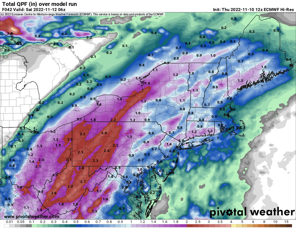
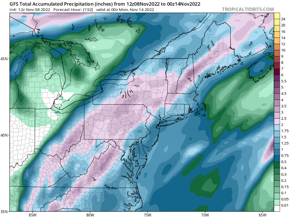
Looks like the global models have shifted back east a bit. Short range still seems to have the heaviest access into eastern OH but either way 1.5 - 2.5 inches looks like a good bet. Euro for reference: -

Fall 2022 Pittsburgh/Western PA Discussion
RitualOfTheTrout replied to Ahoff's topic in Upstate New York/Pennsylvania
Yeah, I'm enjoying the great fall weather, but totally ready to shift gears once mother nature decides to flip the switch. Looks like maybe a good soaking for the area with tropical remnants. Why can't we get a storm like this as all snow in winter? -

Fall 2022 Pittsburgh/Western PA Discussion
RitualOfTheTrout replied to Ahoff's topic in Upstate New York/Pennsylvania
This has been one of the most enjoyable Fall seasons I can remember, pleasantly warm during the days with sunshine, fairly dry, and cool to cold evenings and overnights to keep it feeling like Fall. I've gotten several little outdoor projects completed I thought would be a next Spring tasks, spent lots of time outdoors, and saved a decent chunk of change on heating with minimal furnace usage. Our neighborhood Trick-or-Treat was Saturday evening, and it was probably the best since I've had kids (10+ years). Pretty Hollywood-esque scene with just past peak color contrasted on clear blue evening sky that fades to a cool crisp night. No concerns with umbrellas or trying to fit costumes over three layers to keep warm. My personal preference, but if you are going to have above average temperatures mid October - Thanksgiving-ish time frame gives the most bang for the buck. Unseasonable cold this time of year is largely useless for snow and it gives the hope the pattern needs to flip at some point. If things still look warm in another 2-3 weeks I'll start to get worried about potential wasted winter opportunities but until then I'll take this warmer weather. -

Fall 2022 Pittsburgh/Western PA Discussion
RitualOfTheTrout replied to Ahoff's topic in Upstate New York/Pennsylvania
Yeah, 12z Euro looks like some rain of consequence, especially SE of the city. GFS not so much. -

Fall 2022 Pittsburgh/Western PA Discussion
RitualOfTheTrout replied to Ahoff's topic in Upstate New York/Pennsylvania
Wonder if we manage and decent storms this evening, seems to have already gotten overcast which will probably limit instability. I'm looking forward to the cool weather for sure. Will probably close the pool for the season. Meanwhile way out in fantasy land GFS has remnants from whatever develops in the gulf taking aim at us with another shot of cold air on the backside. -

Pittsburgh/Western PA Summer 2022 Discussion
RitualOfTheTrout replied to Ahoff's topic in Upstate New York/Pennsylvania
How did everyone fair with the storms yesterday? I was in Wexford and it was pretty mild, but at home I got blasted. Tree limbs everywhere, power outage, fence was crushed by a tree in one section, garbage cans with trash bags in them blown over and the bags blown out. I’m not far from that BP that had the gas pump blown over. Must have been a microburst or something. -

Pittsburgh/Western PA Summer 2022 Discussion
RitualOfTheTrout replied to Ahoff's topic in Upstate New York/Pennsylvania
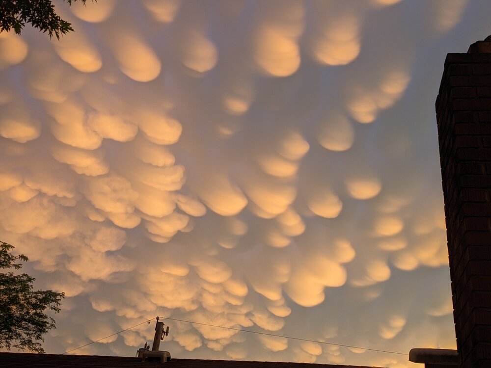
Anyone else noticing the yellow sky? Crazy how comfortable it is out there. Very odd looking sky with sunset reflecting off these clouds. -

Pittsburgh/Western PA Summer 2022 Discussion
RitualOfTheTrout replied to Ahoff's topic in Upstate New York/Pennsylvania
Surprised not even a drop of rain. Glad I watered the garden yesterday. Central / SW OH getting blasted again. -

Pittsburgh/Western PA Summer 2022 Discussion
RitualOfTheTrout replied to Ahoff's topic in Upstate New York/Pennsylvania
Yeah whether we actually hit 90, those dewpoint numbers will make it pretty unbearable to be outside other than immersed in the swimming pool. I'll be interested to see how the severe threat sets up tomorrow afternoon / evening. Still some uncertainty per NWS which trigger is most likely to set things off. Looks like a pretty pleasant weekend on tap. -

Western PA/Pittsburgh Winter 2021/22 Discussion
RitualOfTheTrout replied to meatwad's topic in Upstate New York/Pennsylvania
Going to need elevation and some intense rates to overcome time of year during the day for much more than a coating on the grass that melts pretty quickly after. It’s going to be a raw miserable day for most I think. -

Western PA/Pittsburgh Winter 2021/22 Discussion
RitualOfTheTrout replied to meatwad's topic in Upstate New York/Pennsylvania
It has been an odd winter, by the numbers it looks good but lots of dead periods and near misses, crazy to think about. -

Western PA/Pittsburgh Winter 2021/22 Discussion
RitualOfTheTrout replied to meatwad's topic in Upstate New York/Pennsylvania
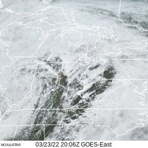
Crazy squal ripping through here right now, heavy snow probably top 5 in snow rates of the winter. -

Western PA/Pittsburgh Winter 2021/22 Discussion
RitualOfTheTrout replied to meatwad's topic in Upstate New York/Pennsylvania
Looks like a mid January morning out there rather than late March. -

Western PA/Pittsburgh Winter 2021/22 Discussion
RitualOfTheTrout replied to meatwad's topic in Upstate New York/Pennsylvania
Pretty much me this weekend: Special Weather Statement National Weather Service Pittsburgh PA 1020 PM EST Sat Mar 12 2022 PAZ013-014-020>022-073-130415- Armstrong-Butler-Lawrence-Westmoreland-Beaver-Allegheny- 1020 PM EST Sat Mar 12 2022 ...A HEAVY SNOW BAND WILL AFFECT NORTHEASTERN BEAVER...SOUTHERN LAWRENCE...SOUTHERN BUTLER...NORTHEASTERN ALLEGHENY...NORTHWESTERN WESTMORELAND AND SOUTHWESTERN ARMSTRONG COUNTIES... At 1015 PM EST, a snow band was located north of Pittsburgh and mostly stationary; 1-2 inches snowfall could occur within this band. Winds in excess of 30 mph are possible with this snow band. Locations impacted include... Cranberry, New Castle, Vandergrift, Apollo, New Kensington, Lower Burrell, Harrison Township, Ellwood City, Arnold, Tarentum, Natrona Heights, and Meridian. This includes the following highways... Pennsylvania Turnpike between mile markers 1 and 19. Interstate 79 in Pennsylvania between mile markers 81 and 96. Interstate 376 in Pennsylvania near mile marker 14. LAT...LON 4076 7971 4053 7952 4057 7982 4090 8052 4105 8052 TIME...MOT...LOC 0317Z 299DEG 45KT 4090 8036 Lol, we got snow here and it was fun sitting in the hot tub during a snow squall but totally feeling jealous missing the best snow of the season back home. -

Western PA/Pittsburgh Winter 2021/22 Discussion
RitualOfTheTrout replied to meatwad's topic in Upstate New York/Pennsylvania
No doubt it will start melting Sunday but should look pretty wintry Saturday. It is March, snow pack retention is unrealistic. That's why I say go big or go home in March, bring it hot and heavy over a short period of time and enjoy the rates because you know it probably starts melting shortly after. -

Western PA/Pittsburgh Winter 2021/22 Discussion
RitualOfTheTrout replied to meatwad's topic in Upstate New York/Pennsylvania
I'll be in deep creek for this, looks to be in the bullseye so to speak. Forecast there is 4-8 with 45-55mph winds then possibly localized blizzard conditions in NW flow after the synoptic portion. I didn't plan the trip with the intention to chase but looks like its going to work out. This may ruin my expectation for winter weather in my own yard lol Given the dynamics of this storm and time of year I'd think it has a better chance of over performing even though the track is a bit further SE and more progressive than it looked a few days ago. Keep your expectation in check and enjoy what happens, I think there will still be a period of heavy snow and post frontal passage the wind gusts should be impressive with embedded snow. Most likely our last snow even to track until next season. -

Western PA/Pittsburgh Winter 2021/22 Discussion
RitualOfTheTrout replied to meatwad's topic in Upstate New York/Pennsylvania
I fully expect a bullseye for our area on this one. Taking a weekend trip to deep creek so I'll probably miss NW again but only this time NW will be my yard back at home lol. Its a pretty fast moving system, but I'd expect a period of pretty heavy snow out of it and our area is in the game to get in on that at least as of how things look right now. Meanwhile the scene outside is still. -

Western PA/Pittsburgh Winter 2021/22 Discussion
RitualOfTheTrout replied to meatwad's topic in Upstate New York/Pennsylvania
Yeah total paste job out there right now. Early morning in March Sun angle not a big influence either especially with heavy rates. I put the snow shovel / sleds away. Kids boots / gloves literally Monday. Ma Nature calling my bluff. -

Western PA/Pittsburgh Winter 2021/22 Discussion
RitualOfTheTrout replied to meatwad's topic in Upstate New York/Pennsylvania
When I left for work this morning it was raining... Forecast called for mainly rain. It was like 32-33 at the surface and I figured great another cold rain event. Paid no attention to the outside until I overheard people at work talking about all the snow and I wasn't expecting this today talk so I run over to the window like a little kid to see the snow coming down. lol This is why you can't ever sleep on March for a surprise snowfall or two. -

Western PA/Pittsburgh Winter 2021/22 Discussion
RitualOfTheTrout replied to meatwad's topic in Upstate New York/Pennsylvania
If by over you mean an end to any chance if sustained cold / snow cover / all snow events then I'd agree, but also state by this time of year that's probably true a majority of srasons. Definitely still reasonable to expect some overnight coatings or a well timed storm though for the next 6 weeks so not over by that metric. -

Western PA/Pittsburgh Winter 2021/22 Discussion
RitualOfTheTrout replied to meatwad's topic in Upstate New York/Pennsylvania
No doubt wasting cold is a disappointment. Getting 5 inches of rain but hitting average or below average temperatures for any winter month could easily be considered frustrating. They are just saying that scenario does not constitute a torch in terms of temperatures. The winter overall to hit average snowfall is needing a more and more extreme storm to make up the difference but nothing we can do about it. Not saying this to you directly but just in general we all need to just enjoy what snow we do get. We all know our climo here and keeping expectations in check goes a long way towards finding the silver linings. We did have that solid stretch in January with sustained snow cover and several snow globe type days. This hobby really is a what have you done for me lately thing, but you need to roll with the punches, not compare your yard to somewhere that averages double and just make an effort to take a step back and enjoy when things are going well and get outside with the kids / dogs / yourself and take it all in because we all know it won't last. Bickering and arguing over it only makes the atmosphere in the thread childish and miserable.


